close
-
Layers w
- Weather Layers
- Pro
- Pro
- Pro
- Pro
- Pro
- Pro
- More Layers
- Pro
- Pro
- Pro
- Pro
-
Upgrade to

3D
Trail Conditions
- Unknown
- Snow Groomed
- Snow Packed
- Snow Covered
- Snow Cover Partial
- Freeze/thaw Cycle
- Icy
- Prevalent Mud
- Wet
- Variable
- Ideal
- Dry
- Very Dry
Trail Flow (Ridden Direction)
Trailforks scans users ridelogs to determine the most popular direction each trail is ridden. A good flowing trail network will have most trails flowing in a single direction according to their intension.
The colour categories are based on what percentage of riders are riding a trail in its intended direction.
The colour categories are based on what percentage of riders are riding a trail in its intended direction.
- > 96%
- > 90%
- > 80%
- > 70%
- > 50%
- < 50%
- bi-directional trail
- no data
Trail Last Ridden
Trailforks scans ridelogs to determine the last time a trail was ridden.
- < 2 days
- < 1 week
- < 2 weeks
- < 1 month
- < 6 months
- > 6 months
Trail Ridden Direction
The intended direction a trail should be ridden.
- Downhill Only
- Downhill Primary
- Both Directions
- Uphill Primary
- Uphill Only
- One Direction
Contribute Details
Colors indicate trail is missing specified detail.
- Description
- Photos
- Description & Photos
- Videos
Trail Popularity ?
Trailforks scans ridelogs to determine which trails are ridden the most in the last 9 months.
Trails are compared with nearby trails in the same city region with a possible 25 colour shades.
Think of this as a heatmap, more rides = more kinetic energy = warmer colors.
- most popular
- popular
- less popular
- not popular
ATV/ORV/OHV Filter
Max Vehicle Width
inches
US Cell Coverage
Legend

Radar Time
Activity Recordings
Trailforks uses anonymized public activity data.
?
Activity Recordings
Trailforks uses anonymized public activity data.
?
Personal Heatmap
▶
Activity Types
all
/
none
▶
Options
2
Date range
month
–
Winter Trails
Warning
A routing network for winter maps does not exist. Selecting trails using the winter trails layer has been disabled.
Missing Trails
Most Popular
Least Popular
Trails are colored based on popularity. The more popular a trail is, the more red. Less popular trails trend towards green.
Jump Magnitude Heatmap
Heatmap of where riders jump on trails. Zoom in to see individual jumps, click circles to view jump details.
BC Backroad Status
![map legend]()
Service Road Atlas is a free to use, community-driven service for viewing and creating reports on the numerous back-country service roads around B.C. and Alberta.

Slope Aspect
Direction the slope faces
Trails Deemphasized
Trails are shown in grey.
Only show trails with no bike usage.
Suggested Layers
Based on selected activity type
Save the current map location and zoom level as your default home location whenever this page is loaded.
Save
No description for Graeagle has been added yet!
Login or register to submit one.
Activities Click to view
- Mountain Bike
95 trails
- E-Bike
48 trails
- Gravel Bike
0 trails
- Adaptive Bike
0 trails
- Horse
80 trails
- Hike
98 trails
- Trail Running
98 trails
- Dirtbike/Moto
36 trails
- ATV/ORV/OHV
37 trails
Region Details
- 43
- 1
- 5
- 20
- 20
- 4
Region Status
Caution as of 1 dayStats
- Avg Trail Rating
- Trails (view details)
- 94
- Trails Mountain Bike
- 95
- Trails E-Bike
- 48
- Trails Horse
- 80
- Trails Hike
- 98
- Trails Trail Running
- 98
- Trails Dirtbike/Moto
- 36
- Trails ATV/ORV/OHV
- 37
- Trails Snowmobile
- 2
- Trails Snowshoe
- 1
- Total Distance
- 160 miles
- Total Descent Distance
- 67 miles
- Total Descent
- 22,026 ft
- Total Vertical
- 3,989 ft
- Highest Trailhead
- 8,091 ft
- Reports
- 900
- Photos
- 143
- Ridden Counter
- 12,696
Sub Regions
-
Lakes Basin
- 10
- 19
- 4
-
Madora Lake
- 2
-
Mills Peak
- 2
- 7
-
Plumas Eureka State Park
- 1
- 2
- 1
Popular Graeagle Mountain Biking Trails
• 100 ★ 4.3 • 7 miles • 192 ft • 1,183 •
This is a bidirectional trail, maintained by the Sierra Buttes Trail Stewardship. For mountain-biking, and downhill orientation, it is a fast and fun high mountain singletrack that rips down the mountain between close trees and large...
• 100 ★ 3.2 • 1 mile • 0 ft • 1,018 •
Lower section of Mill Creek, not so chunky or fast, but a good trail with a few intermediate sections
• 85 ★ 4.2 • 4 miles • 720 ft • 320 •
Highly difficult trail, hard to get out to, but highly rewarding. Most common start spot is .
• 95 ★ 3.0 • 4,462 ft • 431 ft • 303 •
Singletrack access trail from Navajo trail into Lakes Basin. Provides access from the small neighborhood and the mobile home park.
• 90 ★ 3.7 • 3 miles • 51 ft • 228 •
Popular blue difficulty singletrack. This mountain bike primary trail and has a moderate overall physical rating with a 51 ft blue climb. Trail visibility is always easy to follow. On average it takes 26 minutes to complete this trail.
• 100 ★ 0.0 • 5,049 ft • 248 ft • 209 •
Bidirectional, multi-use trail. Maintained by Sierra Buttes Trail Stewardship.
• 80 ★ 0.0 • 3,182 ft • 0 ft • 181 •
Popular blue difficulty alpine singletrack. This multi-use trail can be used downhill primary and has a easy overall physical rating with a 0 ft blue climb. Trail visibility is always easy to follow. On average it takes 7 minutes to complete this trail.
Graeagle Mountain Bike Routes
★ 4.0 • 20 miles • 3,252 ft • 6 • Loop •
This is the preferred pedal powered loop to drop . is very low traffic. You can also pedal up the trail...
11 miles • 344 ft • 2 • Shuttled •
Construction on this trail started in 2007 and finished in 2018. Built and maintained by the Sierra Buttes...
19 miles • 4,345 ft • 7 •
Start at the of Pack Saddle and ride Pauley Creek then loop back to the start - no shuttle needed. Can add...
17 miles • 2,319 ft • 10 • Point to Point •
This epic ride starts at the Downieville shuttle drop at Packer Saddle and takes riders on an adventurous...
14 miles • 2,105 ft • 7 • Point to Point •
Starting at , ride out to Oakland Pond, over MT. Elwell and down to Greaegle.
14 miles • 2,081 ft • 9 • Shuttled •
When you ask people about Mt. Elwell, all they remember is the endless hike a bike. I remember the awesome...
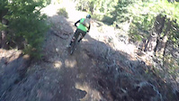
Photos of Graeagle Mountain Bike
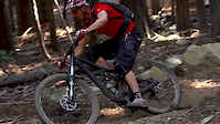
Videos of Graeagle Mountain Bike

trail: Mount Washington Trail
3:27 |
60 |
Sep 22, 2021
trail: Mills Peak Trail
0:56 |
104 |
Dec 17, 2018
trail: Mills Peak Trail
3:10 |
382 |
Oct 22, 2015

trail: Mills Peak Trail
5:05 |
4094 |
Dec 16, 2014
trail: Mills Peak Trail
0:16 |
1488 |
Nov 21, 2014
youtuber
![Jamison / Graeagle, CA / MTB]()
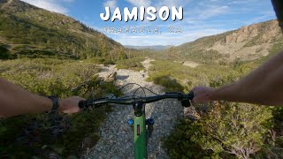
7:30 |
72 |
Nov 5, 2025 , Graeagle
youtuber
![Jamison / Graeagle, CA / MTB]()

7:30 |
48 |
Nov 5, 2025 , Graeagle
youtuber
![Jamison / Graeagle, CA / MTB]()

7:30 |
87 |
Nov 5, 2025 , Graeagle
Recent Trail Reports
Activity Feed
| username | action | type | title | date |
|---|---|---|---|---|
| Tool4life44 | add | report | activity #97454944 | Jun 20, 2026 @ 9:42pm 1 day |
| PRMulligan | comment | trail | activity #97429058 | Jun 20, 2026 @ 1:38pm 1 day |
| brita1 | comment | report | activity #97414905 | Jun 20, 2026 @ 11:08am 2 days |
| matthewsking | add | report | activity #97344621 | Jun 19, 2026 @ 2:22pm 2 days |
| stumpjumperihardlyknower | ridden | trail | activity #97061080 | Jun 15, 2026 @ 1:00pm Jun 15, 2026 |
Recent Comments
| username | type | title | comment | date |
|---|---|---|---|---|
| trail | This trail is amazing in the downhill... | Jun 20, 2026 @ 1:38pm 1 day | ||
| report | !D::;3rjxxxhxjxxxhxxjxdx idepends.huhx... | Jun 20, 2026 @ 11:08am 2 days | ||
| trail | This is a historic trail alignment, so it... | Oct 31, 2025 @ 9:56am Oct 31, 2025 | ||
| trail | This is Phil's Loop. | Sep 20, 2025 @ 8:44am Sep 20, 2025 | ||
| trail | Excellent connector route between Frazier... | Aug 14, 2025 @ 8:41pm Aug 14, 2025 |
Local Badges
-

Completionist0 awarded -

10 Blue Trails33 awarded -

10 Black Trails25 awarded -

Epic Mountain Bike Climb 2k49 awarded -

Climbing 10k Badge11 awarded -

Mountain Biking 100k Badge0 awarded
Activity Type Stats
| activitytype | trails | distance | descent | descent distance | total vertical | rating | global rank | state rank | photos | reports | routes | ridelogs |
|---|---|---|---|---|---|---|---|---|---|---|---|---|
| Mountain Bike | 95 | 159 miles | 21,972 ft | 66 miles | 3,990 ft | #1,418 | #538 | 138 | 898 | 17 | 4,428 | |
| E-Bike | 48 | 103 miles | 7,497 ft | 35 miles | 3,734 ft | #1,737 | #894 | 480 | 2 | 596 | ||
| Horse | 80 | 142 miles | 18,379 ft | 60 miles | 3,734 ft | #246 | #434 | 670 | 1 | |||
| Hike | 98 | 160 miles | 22,024 ft | 67 miles | 3,990 ft | #1,353 | #619 | 3 | 898 | 984 | ||
| Trail Running | 98 | 160 miles | 22,024 ft | 67 miles | 3,990 ft | #1,091 | #399 | 896 | 213 | |||
| Dirtbike/Moto | 36 | 87 miles | 5,994 ft | 30 miles | 3,734 ft | #519 | #170 | 264 | 14 | |||
| ATV/ORV/OHV | 37 | 89 miles | 6,119 ft | 31 miles | 3,734 ft | #338 | #99 | 357 | 3 | |||
| Snowmobile | 2 | 176 | ||||||||||
| Snowshoe | 1 | 94 | 34 |
Frequently Asked Questions About Graeagle
▼
What are the best places to ride in Graeagle?
Graeagle has 5 areas to explore for mountain biking. The top rated areas are:
▼
What are the highest rated mountain biking trails in Graeagle?
The highest rated mountain biking trails in Graeagle are:
- Jamison Creek Trail (Rock Garden) (4.2/5)
- Mills Peak Trail (4.2/5)
- Long Lake Tie Trail (4.1/5)
- Bear Lake Loop Trail (South) (4.1/5)
- Long Lake Trail (Grassy to Gray Eagle) (4.1/5)
▼
What is the best time of the year to ride in Graeagle?
Based on ride log data, the most popular months to ride in Graeagle are:
- July (61 activities)
- October (49 activities)
- June (37 activities)
▼
Where can I park to ride in Graeagle?
There are 10 parking locations listed in Graeagle. The most popular parking spots are: View all parking and trailhead locations on the map to plan your visit.
Activities
Trails
- By j4m356 & contributors
- Admins: TheAngryTomato, SBTS
- #21059 - 16,368 views
- graeagle activity log | embed map of Graeagle mountain bike trails | graeagle mountain biking points of interest
Downloading of trail gps tracks in kml & gpx formats is enabled for Graeagle.
You must login to download files.