close
-
Layers w
- Weather Layers
- Pro
- Pro
- Pro
- Pro
- Pro
- Pro
- More Layers
- Pro
- Pro
- Pro
- Pro
-
Upgrade to

3D
Trail Conditions
- Unknown
- Snow Groomed
- Snow Packed
- Snow Covered
- Snow Cover Partial
- Freeze/thaw Cycle
- Icy
- Prevalent Mud
- Wet
- Variable
- Ideal
- Dry
- Very Dry
Trail Flow (Ridden Direction)
Trailforks scans users ridelogs to determine the most popular direction each trail is ridden. A good flowing trail network will have most trails flowing in a single direction according to their intension.
The colour categories are based on what percentage of riders are riding a trail in its intended direction.
The colour categories are based on what percentage of riders are riding a trail in its intended direction.
- > 96%
- > 90%
- > 80%
- > 70%
- > 50%
- < 50%
- bi-directional trail
- no data
Trail Last Ridden
Trailforks scans ridelogs to determine the last time a trail was ridden.
- < 2 days
- < 1 week
- < 2 weeks
- < 1 month
- < 6 months
- > 6 months
Trail Ridden Direction
The intended direction a trail should be ridden.
- Downhill Only
- Downhill Primary
- Both Directions
- Uphill Primary
- Uphill Only
- One Direction
Contribute Details
Colors indicate trail is missing specified detail.
- Description
- Photos
- Description & Photos
- Videos
Trail Popularity ?
Trailforks scans ridelogs to determine which trails are ridden the most in the last 9 months.
Trails are compared with nearby trails in the same city region with a possible 25 colour shades.
Think of this as a heatmap, more rides = more kinetic energy = warmer colors.
- most popular
- popular
- less popular
- not popular
ATV/ORV/OHV Filter
Max Vehicle Width
inches
US Cell Coverage
Legend

Radar Time
Activity Recordings
Trailforks uses anonymized public activity data.
?
Activity Recordings
Trailforks uses anonymized public activity data.
?
Personal Heatmap
▶
Activity Types
all
/
none
▶
Options
2
Date range
month
–
Winter Trails
Warning
A routing network for winter maps does not exist. Selecting trails using the winter trails layer has been disabled.
Missing Trails
Most Popular
Least Popular
Trails are colored based on popularity. The more popular a trail is, the more red. Less popular trails trend towards green.
Jump Magnitude Heatmap
Heatmap of where riders jump on trails. Zoom in to see individual jumps, click circles to view jump details.
BC Backroad Status
![map legend]()
Service Road Atlas is a free to use, community-driven service for viewing and creating reports on the numerous back-country service roads around B.C. and Alberta.

Slope Aspect
Direction the slope faces
Trails Deemphasized
Trails are shown in grey.
Only show trails with no bike usage.
Suggested Layers
Based on selected activity type
Save the current map location and zoom level as your default home location whenever this page is loaded.
Save
No description for Granada has been added yet!
Login or register to submit one.
This region uses the Uk/Euro style trail grading system.
Activities Click to view
- Mountain Bike
230 trails
- E-Bike
234 trails
- Adaptive Bike
0 trails
- Horse
11 trails
- Hike
236 trails
- Trail Running
238 trails
- Downhill Ski
125 trails
Region Details
- 109
- 6
- 77
- 28
- 6
Region Status
Open as of Apr 5, 2026Stats
- Avg Trail Rating
- Trails (view details)
- 360
- Trails Mountain Bike
- 230
- Trails E-Bike
- 234
- Trails Horse
- 11
- Trails Hike
- 236
- Trails Trail Running
- 238
- Trails Dirtbike/Moto
- 1
- Trails Downhill Ski
- 125
- Total Distance
- 263 miles
- Total Descent
- 87,848 ft
- Total Vertical
- 9,645 ft
- Highest Trailhead
- 11,366 ft
- Reports
- 65
- Photos
- 33
- Ridden Counter
- 8,590
Sub Regions
-
Alpujarra
- 32
- 10
-
Dehesa del Generalife
- 3
- 9
- 6
- 1
-
Dílar
- 9
- 2
-
La Zubia
- 1
-
Sierra de Huetor
- 21
- 7
- 1
-
Sierra Elvira
- 5
- 2
- 1
-
Sierra Nevada
- 10
- 3
Popular Granada Mountain Biking Trails
• 100 ★ 4.0 • 1 mile • 7 ft • 115 •
Popular blue difficulty singletrack. This multi-use trail can be used downhill only. It features berm, drop, rock face and rock garden. On average it takes 14 minutes to complete this trail.
• 85 ★ 4.6 • 3 miles • 0 ft • 97 •
Popular blue difficulty singletrack. This multi-use trail can be used downhill primary. It features berm, drop and jump. On average it takes 51 minutes to complete this trail.
• 100 ★ 0.0 • 3,038 ft • 0 ft • 92 •
Popular red difficulty singletrack. This multi-use trail can be used downhill primary and has a hard overall physical rating with a 0 ft black diamond climb. It features jump, rock face and roller coaster. Trail visibility is always easy to follow.
• 95 ★ 0.0 • 3,474 ft • 0 ft • 84 •
Popular blue difficulty singletrack. This multi-use trail can be used downhill primary and has a moderate overall physical rating with a 0 ft blue climb. Trail visibility is always easy to follow.
• 100 ★ 5.0 • 1,132 ft • 154 ft • 73 • • hike
Popular red difficulty alpine singletrack. This hike primary trail can be used both directions and has a moderate overall physical rating with a 154 ft blue climb. It features rock garden. Trail visibility is sometimes hard to follow. On average it takes 15 minutes to complete this trail.
• 95 ★ 0.0 • 3,862 ft • 2 ft • 58 •
Popular blue difficulty singletrack. This multi-use trail can be used downhill primary and has a moderate overall physical rating with a 2 ft blue climb. It features drop. Trail visibility is always easy to follow.
• 55 ★ 4.7 • 1 mile • 19 ft • 58 •
Moderately popular blue difficulty singletrack. This multi-use trail can be used downhill only and has a moderate overall physical rating. It features berm, rock face and rock garden. On average it takes 17 minutes to complete this trail.
• 100 ★ 0.0 • 2,585 ft • 0 ft • 47 •
Popular blue difficulty singletrack. This multi-use trail can be used downhill primary and has a moderate overall physical rating with a 0 ft blue climb. Trail visibility is always easy to follow.
Granada Mountain Bike Routes
25 miles • 5,846 ft • 12 • Loop •
Ruta endurera por las Alpujarras. Es una ruta que puede dejarte la batería seca si tienes 625 W/h si no...
16 miles • 3,526 ft • 9 • Loop •
Segunda variante en la Sierra de Huétor, donde se realiza una trazada intentando no repetir las bajadas...
21 miles • 4,171 ft • 9 • Loop •
Ruta muy completa en la sierra de Huétor, donde se prioriza el trazado en la dirección de las bajadas...
16 miles • 3,648 ft • 9 • Loop •
RUTA SIERRA DE HUETOR EN LA QUE SE INTENTA OPTIMIZAR LAS BAJADAS MINIMIZANDO SUBIDAS DEMASIADO COMPLICADAS.
19 miles • 4,043 ft • 14 • Loop •
Ruta endurera por la Sierra de Huetor, con sendas de nivel medio, medio alto y alto enlazando las sendas...
★ 5.0 • 24 miles • 6,256 ft • 4 • Loop • Race •
Race course for the 2nd edition of the Sierra Nevada Enduro race held in 2017.
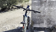
Photos of Granada Mountain Bike
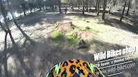
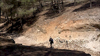
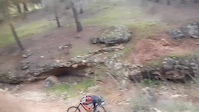
Videos of Granada Mountain Bike
trail: Vertice Cerro Gordo
2:34 |
|
Jan 29, 2023
trail: Panduro
3:19 |
386 |
Mar 12, 2019

trail: Panduro
0:40 |
6291 |
Aug 21, 2018
trail: Panduro
0:06 |
307 |
Apr 24, 2018
trail: Panduro
0:40 |
2096 |
Feb 12, 2017
3:20 |
66607 |
Jul 12, 2016
youtuber
![♂️ Mala Mujer | Dílar (Granada) |...]()
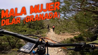
trail: Mala Mujer
5:08 |
53 |
Jul 17, 2025 , Granada
youtuber
![♂️⛰ Albatrales - Barranco del...]()
trail: Albatrales
11:40 |
66 |
Jul 8, 2025 , Granada
Recent Trail Reports
| status | trail | date | condition | info | user |
|---|---|---|---|---|---|
| Barranco de los Castillejos | Apr 5, 2026 @ 9:59am (Europe/Gibraltar) Apr 5, 2026 | Dry | TRUSTwfZQWW | ||
| Barranco de Malacabí | Feb 16, 2026 @ 2:35pm (Europe/Madrid) Feb 16, 2026 | Unknown | thormikel | ||
| Pitres | Dec 13, 2025 @ 5:42pm (Europe/Madrid) Dec 13, 2025 | Unknown | josillescas | ||
| Peñon-Fuente de las Alberquillas | Dec 13, 2025 @ 5:41pm (Europe/Madrid) Dec 13, 2025 | Unknown | josillescas | ||
| Derecha Genil Rio Beiro Clinica | Dec 10, 2025 @ 7:43pm (Europe/Madrid) Dec 10, 2025 | Dry | rmoreno14 | ||
| Acequia del Fardes | Nov 24, 2025 @ 8:34am (Europe/Madrid) Nov 23, 2025 | Ideal | SukyBiker | ||
| Acceso La Perdiz | Oct 30, 2025 @ 8:59am (Europe/Gibraltar) Oct 30, 2025 | Dry | ThomasJ59swe | ||
| Peña San Juan | Oct 18, 2025 @ 12:07pm (Europe/Madrid) Oct 18, 2025 | Wet | frandelasierra | ||
| Altabéitar | Dec 15, 2024 @ 1:07pm Dec 15, 2024 | Variable | SergioMarin | ||
| Jabalí | Dec 15, 2024 @ 1:07pm Dec 15, 2024 | Variable | SergioMarin |
Activity Feed
| username | action | type | title | date |
|---|---|---|---|---|
| EnduroMalagamtb | comment | trail | activity #95760277 and 2 more | May 29, 2026 @ 12:14am May 29, 2026 |
| Stumpjumper74 | ridden | trail | activity #95425964 | May 24, 2026 @ 10:46am May 24, 2026 |
| GrgoirekUUDfO | ridden | trail | activity #95159723 | May 21, 2026 @ 12:27am May 21, 2026 |
| Bastiaan13 | ridden | trail | activity #94811333 and 1 more | May 16, 2026 @ 7:02am May 16, 2026 |
| Canilopezcediel | wishlist | region | activity #94403879 | May 10, 2026 @ 1:08am May 10, 2026 |
Recent Comments
| username | type | title | comment | date |
|---|---|---|---|---|
| trail | One of the moste enjoyable trails around ,... | May 29, 2026 @ 12:18am May 29, 2026 | ||
| trail | Last part of Secret Garden, aka Keep it... | May 29, 2026 @ 12:16am May 29, 2026 | ||
| trail | One of the most flowy trails around the area,... | May 29, 2026 @ 12:14am May 29, 2026 | ||
| trail | Sendero hecho polvo regeros grandísimos y... | Nov 21, 2025 @ 3:48am Nov 21, 2025 | ||
| trail | I would currently not recommend going there as... | Oct 31, 2025 @ 10:22am Oct 31, 2025 |
Local Badges
-

10 Blue Trails26 awarded -

Epic Ride Climb 2k635 awarded -

Climbing 10k Badge84 awarded -

Climbing 100k Badge13 awarded -

Epic Ride Descent 2k950 awarded -

Descent 10k Badge124 awarded
Activity Type Stats
| activitytype | trails | distance | descent | descent distance | total vertical | rating | global rank | state rank | photos | reports | routes | ridelogs |
|---|---|---|---|---|---|---|---|---|---|---|---|---|
| Mountain Bike | 230 | 181 miles | 35,623 ft | 93 miles | 9,347 ft | #919 | #100 | 24 | 65 | 5 | 12,501 | |
| E-Bike | 234 | 183 miles | 38,091 ft | 95 miles | 9,347 ft | #384 | #128 | 57 | 5 | 2,064 | ||
| Horse | 11 | 15 miles | 1,083 ft | 6 miles | 1,079 ft | #726 | #35 | 1 | ||||
| Hike | 236 | 197 miles | 39,318 ft | 99 miles | 9,646 ft | #626 | #97 | 7 | 61 | 25 | 1,405 | |
| Trail Running | 238 | 197 miles | 39,318 ft | 99 miles | 9,646 ft | #457 | #93 | 61 | 13 | 397 | ||
| Dirtbike/Moto | 1 | 1 | 1 | |||||||||
| Downhill Ski | 125 | 65 miles | 47,680 ft | 57 miles | 3,822 ft | #134 | #3 | 581 |
Frequently Asked Questions About Granada
▼
What are the best places to ride in Granada?
Granada has 5 areas to explore for mountain biking. The top rated areas are:
▼
What are the highest rated mountain biking trails in Granada?
The highest rated mountain biking trails in Granada are:
- Panduro (4.3/5)
- La Chaparra (4.2/5)
- Veleta Freeride (4.1/5)
- Cruz De Viznar (4.1/5)
- Cañada Del Sereno (4.1/5)
▼
What is the best time of the year to ride in Granada?
Based on ride log data, the most popular months to ride in Granada are:
- October (44 activities)
- April (39 activities)
- September (22 activities)
▼
Where can I park to ride in Granada?
Check the Granada trail map for trailhead and parking information. Community members regularly update access and parking details for trails in the area.
Activities
Trails
Points of Interest
- By lightlives
 & contributors
 - Admins: AMG, juanx
- #9276 - 14,981 views
- granada activity log | embed map of Granada mountain bike trails | granada mountain biking points of interest
Downloading of trail gps tracks in kml & gpx formats is enabled for Granada.
You must login to download files.