close
-
Layers w
- Weather Layers
- Pro
- Pro
- Pro
- Pro
- Pro
- Pro
- More Layers
- Pro
- Pro
- Pro
- Pro
-
Upgrade to

3D
Trail Conditions
- Unknown
- Snow Groomed
- Snow Packed
- Snow Covered
- Snow Cover Partial
- Freeze/thaw Cycle
- Icy
- Prevalent Mud
- Wet
- Variable
- Ideal
- Dry
- Very Dry
Trail Flow (Ridden Direction)
Trailforks scans users ridelogs to determine the most popular direction each trail is ridden. A good flowing trail network will have most trails flowing in a single direction according to their intension.
The colour categories are based on what percentage of riders are riding a trail in its intended direction.
The colour categories are based on what percentage of riders are riding a trail in its intended direction.
- > 96%
- > 90%
- > 80%
- > 70%
- > 50%
- < 50%
- bi-directional trail
- no data
Trail Last Ridden
Trailforks scans ridelogs to determine the last time a trail was ridden.
- < 2 days
- < 1 week
- < 2 weeks
- < 1 month
- < 6 months
- > 6 months
Trail Ridden Direction
The intended direction a trail should be ridden.
- Downhill Only
- Downhill Primary
- Both Directions
- Uphill Primary
- Uphill Only
- One Direction
Contribute Details
Colors indicate trail is missing specified detail.
- Description
- Photos
- Description & Photos
- Videos
Trail Popularity ?
Trailforks scans ridelogs to determine which trails are ridden the most in the last 9 months.
Trails are compared with nearby trails in the same city region with a possible 25 colour shades.
Think of this as a heatmap, more rides = more kinetic energy = warmer colors.
- most popular
- popular
- less popular
- not popular
ATV/ORV/OHV Filter
Max Vehicle Width
inches
US Cell Coverage
Legend

Radar Time
Activity Recordings
Trailforks uses anonymized public activity data.
?
Activity Recordings
Trailforks uses anonymized public activity data.
?
Personal Heatmap
▶
Activity Types
all
/
none
▶
Options
2
Date range
month
–
Winter Trails
Warning
A routing network for winter maps does not exist. Selecting trails using the winter trails layer has been disabled.
Missing Trails
Most Popular
Least Popular
Trails are colored based on popularity. The more popular a trail is, the more red. Less popular trails trend towards green.
Jump Magnitude Heatmap
Heatmap of where riders jump on trails. Zoom in to see individual jumps, click circles to view jump details.
BC Backroad Status
![map legend]()
Service Road Atlas is a free to use, community-driven service for viewing and creating reports on the numerous back-country service roads around B.C. and Alberta.

Slope Aspect
Direction the slope faces
Trails Deemphasized
Trails are shown in grey.
Only show trails with no bike usage.
Suggested Layers
Based on selected activity type
Save the current map location and zoom level as your default home location whenever this page is loaded.
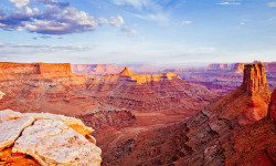
SaveThe southeast area of Utah includes the most famous mountain biking area in the world, Moab. This area also plays host the famous Whole Enchilada which starts on the high benches of the La Sal Mountains, and works its way down to the iconic Sand Flats Recreation Area, AKA Slickrock Trail and LPS (Lower Porcupine Singletrack).
A bit further south in the Monticello and Blanding area there are fun high altitude trails like Robertson Pasture which hosts an annual Enduro Race.
A bit further south in the Monticello and Blanding area there are fun high altitude trails like Robertson Pasture which hosts an annual Enduro Race.
Stats
- Avg Trail Rating
- Trails (view details)
- 580
- Trails Mountain Bike
- 547
- Trails E-Bike
- 228
- Trails Gravel Bike
- 8
- Trails Adaptive Bike
- 18
- Trails Winter Fat Bike
- 9
- Trails Horse
- 52
- Trails Hike
- 686
- Trails Trail Running
- 673
- Trails Dirtbike/Moto
- 151
- Trails Observed Trials
- 8
- Trails ATV/ORV/OHV
- 113
- Trails Snowshoe
- 1
- Trails Backcountry Ski
- 1
- Trails Nordic Ski
- 1
- Total Distance
- 1,178 miles
- Total Descent
- 169,506 ft
- Total Vertical
- 8,692 ft
- Highest Trailhead
- 12,607 ft
- Reports
- 11,207
- Photos
- 5,111
- Ridden Counter
- 545,819
Articles
Why Moab Is Even Better Than You’ve Heard
Sep 10, 2025 from outsideonline.com
Visiting Moab is an adventurer’s rite of passage. Here’s how to make the most of a trip to Utah’s adventure wonderland
7 of the Best Bikepacking Trips Across the U.S.
Jul 11, 2025 from outsideonline.com
Load up your bike and disappear into America's wildest places on these incredible multi-day rides
The 8 Best National Park Drives
Mar 7, 2025 from outsideonline.com
Discover America's most scenic roads with the top national park drives. Our guide features eight stunning scenic routes with must-see stops.

18 Romantic Getaways That Are Far Better than Roses or Chocolate
Feb 5, 2024 from outsideonline.com
We asked our editors for the most romantic trips they’d ever taken. From fire towers to Southwest camping to mountaintop lodges, these...
Popular Trail Networks
view all areas »Sub Regions
- Moab (525)
- Amasa Back (30)
- Arches National Park (6)
- Canyonlands National Park - Island in the Sky (8)
- Dead Horse Point (17)
- Horsethief (28)
- Klondike Bluffs (59)
- Klonzo (33)
- La Sal Mountains (110)
- Mag 7 (41)
- Moab Brand Trails (35)
- Mud Springs (4)
- Navajo Rocks (9)
- Sand Flats Recreation Area (41)
- Sovereign Trail System (33)
Popular Grand County Mountain Biking Trails
• 100 ★ 4.6 • 11 miles • 202 ft • 11,811 •
bike trail is one of the must ride biking trails of Moab, Utah. Long pedal up form town but best when shuttled to the top. On the bike map it is often combined as the with , , and . The main bike trail is about 18KM long with a gentle...
• 100 ★ 4.6 • 1,411 ft • 5 ft • 10,963 •
connects to the world-famous . Together these two trails make up the lower section of the Whole Enchilada Trail System. provides a Slickrock playground, progressing into brief patches of flow trail sections coupled with ledges, sharp...
• 100 ★ 4.6 • 4,465 ft • 35 ft • 10,254 •
4th ride of the . Singletrack starts at a right fork off of the . Watch for the map sign. The double track, which is the , continues to the left and intersects the Sand Flats Road. Challenging singletrack over rock, roots, ledges, and...
• 100 ★ 4.6 • 4,488 ft • 0 ft • 10,102 •
Highly rated popular black diamond difficulty singletrack. This mountain bike primary trail can be used downhill primary. On average it takes 8 minutes to complete this trail.
• 100 ★ 4.3 • 1,906 ft • 24 ft • 9,741 •
This is an alternate to the crazy-hard "notch" that has a few super-tight switchbacks but less steep sections.
• 100 ★ 4.9 • 4,514 ft • 3 ft • 9,678 •
This trail is the cherry on top when riding ! Amazing views of Castle valley are afforded after 50 meters of riding. The trail has good flow with some spicy sections. There is some pedalling but no uphill sections. The exposed rock...
• 100 ★ 4.8 • 2 miles • 145 ft • 8,347 •
Jewel of the area, relatively new to the other trails. Fun transitions and some great little rock drops. is a bit easier, so if you are unsure of your skill, start there, and then climb back up to do .
• 100 ★ 4.6 • 3,010 ft • 116 ft • 7,756 •
Upper section of , connecting the Ahab midpoint to the top.
Grand County Mountain Bike Routes
Brand to Klonzo Ultimate Featured
★ 1.5 • 20 miles • 1,636 ft • 21 • Loop •
Klonzo is a fun place to ride, but access isn't the best. To get there you have to drive out on this long...
Moab Double Down Featured
★ 3.0 • 14 miles • 2,239 ft • 9 • Loop •
This is a double loop that serves up 2 of the best expert downhill trails in Moab. The first leg of the...
★ 3.9 • 27 miles • 1,269 ft • 8 • Shuttled •
The Whole Enchilada! A truly iconic Moab ride. From tight alpine switchbacks to steep sandstone rollers...
★ 4.8 • 18 miles • 1,410 ft • 10 • Loop •
Loop some of the most scenic sections of Mag 7 in a way that limits how much climbing one has to endure....
★ 4.3 • 17 miles • 1,571 ft • 0 • Loop •
Nice trail for intermediate riders. Plenty of tech and punchy climbs, also a good fair share of flow and...
Photos of Grand County Mountain Bike
Videos of Grand County Mountain Bike
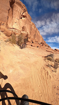
trail: Ramblin
2:15 |
11 |
Apr 17, 2026
trail: Big Mesa
4:41 |
6 |
Apr 17, 2026
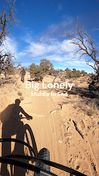
trail: Big Lonely
0:32 |
4 |
Apr 17, 2026
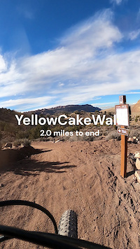
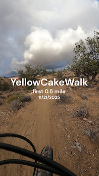
trail: YellowCakeWalk
3:16 |
22 |
Apr 17, 2026
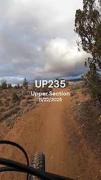
trail: Up235
0:36 |
22 |
Apr 17, 2026
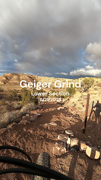
trail: Geiger Grind
0:03 |
8 |
Apr 17, 2026
trail: YellowCakeWalk
0:37 |
9 |
Apr 16, 2026
trail: YellowCakeWalk
0:41 |
11 |
Apr 16, 2026
Current Trail Warnings
| status | trail | date | condition | user | info |
|---|---|---|---|---|---|
| Hazard Trail La Sal Mountains | May 22, 2026 @ 9:32am (America/Denver) May 22, 2026 | Snow Covered | digitalbias | ||
| Burro Shortcut La Sal Mountains | May 22, 2026 @ 9:32am (America/Denver) May 22, 2026 | Snow Covered | digitalbias | ||
| TWE Beginning La Sal Mountains | May 22, 2026 @ 9:32am (America/Denver) May 22, 2026 | Snow Covered | digitalbias |
Recent Trail Reports
| status | trail | date | condition | info | user |
|---|---|---|---|---|---|
| Alaska Klondike Bluffs | Jun 19, 2026 @ 8:19am (America/Denver) 1 hours | Ideal | Reggimann | ||
| EKG Klondike Bluffs | Jun 14, 2026 @ 8:59am (America/Denver) Jun 14, 2026 | Unknown | JustinBath | ||
| EKG (N) Klondike Bluffs | Jun 14, 2026 @ 8:59am (America/Denver) Jun 14, 2026 | Ideal | JustinBath | ||
| UFO Klondike Bluffs | Jun 14, 2026 @ 8:59am (America/Denver) Jun 14, 2026 | Variable | JustinBath | ||
| Baby Steps Road Klondike Bluffs | Jun 14, 2026 @ 8:59am (America/Denver) Jun 14, 2026 | Ideal | JustinBath | ||
| Baby Steps Road Klondike Bluffs | Jun 14, 2026 @ 8:59am (America/Denver) Jun 14, 2026 | Ideal | JustinBath | ||
| Azurite Klondike Bluffs | Jun 14, 2026 @ 8:59am (America/Denver) Jun 14, 2026 | Ideal | JustinBath | ||
| Miners Loop Klondike Bluffs | Jun 14, 2026 @ 8:59am (America/Denver) Jun 14, 2026 | Dry | JustinBath | ||
| EKG Klondike Bluffs | Jun 14, 2026 @ 8:59am (America/Denver) Jun 14, 2026 | Ideal | JustinBath | ||
| Roller Coaster Klonzo | Jun 15, 2026 @ 7:27am (America/Denver) Jun 15, 2026 | Dry | extrapulp |
Activity Feed
| username | action | type | title | date |
|---|---|---|---|---|
| Reggimann | add | report | activity #97315336 | Jun 19, 2026 @ 7:19am 1 hours |
| Reggimann | add | photo | activity #97315263 and 3 more | Jun 19, 2026 @ 7:17am 1 hours |
| Reggimann | comment | trail | activity #97315193 | Jun 19, 2026 @ 7:16am 1 hours |
| Reggimann | vote | trail | activity #97314934 | Jun 19, 2026 @ 7:12am 1 hours |
| Reggimann | ridden | trail | activity #97314831 and 2 more | Jun 19, 2026 @ 7:10am 1 hours |
Recent Comments
| username | type | title | comment | date |
|---|---|---|---|---|
| trail | Rode this in reverse on e-bike and made it a... | Jun 19, 2026 @ 7:16am 1 hours | ||
| trail | Trail is currently well maintained. The most... | Jun 14, 2026 @ 3:11pm Jun 14, 2026 | ||
| trail | The trail sign at the bottom currently says no... | Jun 14, 2026 @ 3:04pm Jun 14, 2026 | ||
| trail | Hiked this NW to SE exiting at Pole Canyon.... | Jun 14, 2026 @ 3:00pm Jun 14, 2026 | ||
| trail | South side of the trail connecting to... | Jun 14, 2026 @ 2:40pm Jun 14, 2026 |
Local Badges
-

Completionist1 awarded -
Completionist0 awarded -
Completionist3 awarded -
Completionist6 awarded -
Completionist0 awarded -

Top 10 Trails1,446 awarded
Bike & Skill Parks
| name | type | city | rating |
|---|---|---|---|
| Moab BMX Park | skill park | Moab | |
| O.K. Corral (Skills Park) | skill park | Moab |
Activity Type Stats
| activitytype | trails | distance | descent | descent distance | total vertical | rating | global rank | state rank | photos | reports | routes | ridelogs |
|---|---|---|---|---|---|---|---|---|---|---|---|---|
| Mountain Bike | 544 | 1,018 miles | 136,119 ft | 462 miles | 7,251 ft | 4,813 | 11,236 | 141 | 178,737 | |||
| E-Bike | 228 | 505 miles | 51,043 ft | 213 miles | 6,755 ft | 40 | 9,495 | 9 | 5,641 | |||
| Gravel Bike | 8 | 13 | 263 | |||||||||
| Adaptive Bike | 18 | 4 | 13 | 23 | ||||||||
| Winter Fat Bike | 9 | 4 | 8 | |||||||||
| Horse | 52 | 154 miles | 15,492 ft | 58 miles | 8,629 ft | 3,373 | 3 | 39 | ||||
| Hike | 685 | 1,177 miles | 169,469 ft | 527 miles | 8,691 ft | 301 | 11,279 | 87 | 27,471 | |||
| Trail Running | 673 | 1,166 miles | 167,375 ft | 522 miles | 8,691 ft | 17 | 11,276 | 106 | 4,642 | |||
| Dirtbike/Moto | 150 | 479 miles | 48,451 ft | 193 miles | 6,755 ft | 19 | 3,533 | 5 | 769 | |||
| Observed Trials | 8 | 16 miles | 928 ft | 3 miles | 5,390 ft | 12 | 60 | |||||
| ATV/ORV/OHV | 113 | 439 miles | 42,569 ft | 179 miles | 6,755 ft | 13 | 3,518 | 270 | ||||
| Snowshoe | 1 | 4 miles | 755 ft | 2 miles | 3,294 ft | 665 | 49 | |||||
| Backcountry Ski | 1 | 4 miles | 446 ft | 2 miles | 3,294 ft | 665 | 241 | |||||
| Nordic Ski | 1 | 512 | 148 |
Activities
- Grand County Mountain Biking Trails
- Grand County E-Biking Trails
- Grand County Gravel Biking Trails
- Grand County Adaptive Biking Trails
- Grand County Winter Fat Biking Trails
- Grand County Horseback Trails
- Grand County Hiking Trails
- Grand County Trail Running Trails
- Grand County Dirtbiking Trails
- Grand County Observed Trials Trails
- Grand County ATVing/Offroading Trails
Trails
Points of Interest
- Potato Bottom Campground A Camping
- Gooseberry Campground A Camping
- Gooseberry Campground B Camping
- Murphy Hogback Campground A Camping
- Murphy Hogback Campground B Camping
- Murphy Hogback Campground C Camping
- Candlestick Campground Camping
- Potato Bottom Campground B Camping
- Airport Campground D Camping
- Airport Campground B Camping
- Mount Peale (12,720 ft)
- Mount Tukuhnikivatz (12,500 ft)
- Mount Waas (12,339 ft)
- By brenthillier
 NSMBA TRAILFORKS & contributors
 - Admins: jkwilliamz, UtahJohn, jpmcghee, jasonmalczyk
- #18347 - 12,245 views
- grand county activity log | embed map of Grand County mountain bike trails | grand county mountain biking points of interest polygons
Downloading of trail gps tracks in kml & gpx formats is enabled for Grand County.
You must login to download files.