close
-
Layers w
- Weather Layers
- Pro
- Pro
- Pro
- Pro
- Pro
- Pro
- More Layers
- Pro
- Pro
- Pro
- Pro
-
Upgrade to

3D
Trail Conditions
- Unknown
- Snow Groomed
- Snow Packed
- Snow Covered
- Snow Cover Partial
- Freeze/thaw Cycle
- Icy
- Prevalent Mud
- Wet
- Variable
- Ideal
- Dry
- Very Dry
Trail Flow (Ridden Direction)
Trailforks scans users ridelogs to determine the most popular direction each trail is ridden. A good flowing trail network will have most trails flowing in a single direction according to their intension.
The colour categories are based on what percentage of riders are riding a trail in its intended direction.
The colour categories are based on what percentage of riders are riding a trail in its intended direction.
- > 96%
- > 90%
- > 80%
- > 70%
- > 50%
- < 50%
- bi-directional trail
- no data
Trail Last Ridden
Trailforks scans ridelogs to determine the last time a trail was ridden.
- < 2 days
- < 1 week
- < 2 weeks
- < 1 month
- < 6 months
- > 6 months
Trail Ridden Direction
The intended direction a trail should be ridden.
- Downhill Only
- Downhill Primary
- Both Directions
- Uphill Primary
- Uphill Only
- One Direction
Contribute Details
Colors indicate trail is missing specified detail.
- Description
- Photos
- Description & Photos
- Videos
Trail Popularity ?
Trailforks scans ridelogs to determine which trails are ridden the most in the last 9 months.
Trails are compared with nearby trails in the same city region with a possible 25 colour shades.
Think of this as a heatmap, more rides = more kinetic energy = warmer colors.
- most popular
- popular
- less popular
- not popular
ATV/ORV/OHV Filter
Max Vehicle Width
inches
US Cell Coverage
Legend

Radar Time
Activity Recordings
Trailforks uses anonymized public activity data.
?
Activity Recordings
Trailforks uses anonymized public activity data.
?
Personal Heatmap
▶
Activity Types
all
/
none
▶
Options
2
Date range
month
–
Winter Trails
Warning
A routing network for winter maps does not exist. Selecting trails using the winter trails layer has been disabled.
Missing Trails
Most Popular
Least Popular
Trails are colored based on popularity. The more popular a trail is, the more red. Less popular trails trend towards green.
Jump Magnitude Heatmap
Heatmap of where riders jump on trails. Zoom in to see individual jumps, click circles to view jump details.
BC Backroad Status
![map legend]()
Service Road Atlas is a free to use, community-driven service for viewing and creating reports on the numerous back-country service roads around B.C. and Alberta.

Slope Aspect
Direction the slope faces
Trails Deemphasized
Trails are shown in grey.
Only show trails with no bike usage.
Suggested Layers
Based on selected activity type
Save the current map location and zoom level as your default home location whenever this page is loaded.
Save
No description for Grand Rapids has been added yet!
Login or register to submit one.
Activities Click to view
- Mountain Bike
107 trails
- E-Bike
53 trails
- Gravel Bike
0 trails
- Adaptive Bike
0 trails
- Winter Fat Bike
0 trails
- Horse
0 trails
- Hike
139 trails
- Trail Running
139 trails
- Dirtbike/Moto
0 trails
- Observed Trials
0 trails
- ATV/ORV/OHV
0 trails
- Snowmobile
0 trails
- Snowshoe
19 trails
- Downhill Ski
0 trails
- Backcountry Ski
0 trails
- Nordic Ski
18 trails
Region Details
- 31
- 52
- 13
- 1
Region Status
Open as of Jun 3, 2026Stats
- Avg Trail Rating
- Trails (view details)
- 106
- Trails Mountain Bike
- 107
- Trails E-Bike
- 53
- Trails Hike
- 139
- Trails Trail Running
- 139
- Trails Snowshoe
- 19
- Trails Nordic Ski
- 18
- Total Distance
- 113 miles
- Total Descent
- 4,313 ft
- Total Vertical
- 278 ft
- Highest Trailhead
- 865 ft
- Reports
- 765
- Photos
- 164
- Ridden Counter
- 6,838
Sub Regions
-
Ball Perkins Park
- 3
- 2
-
Calvin University Trails
- 4
-
Crahen Valley Park
- 10
-
Donald J. Lamoreaux Park
-
Grand Rapids Bike Park
- 3
- 1
-
Indian Trails Golf Course
- 1
-
Ken-O-Sha Park
- 1
- 4
- 5
-
Millenium Park
- 19
- 7
-
Paris Park
- 1
-
Richmond Park
- 2
- 1
-
Robinette's Apple Haus
- 2
- 2
-
Rogue River Park
- 5
-
The Highlands
- 10
- 1
-
The Underground
- 1
Popular Grand Rapids Mountain Biking Trails
• 85 ★ 0.0 • 11 miles • 72 ft • 216 •
Popular white difficulty family friendly paved path. This multi-use trail can be used both directions and has a easy overall physical rating with a 72 ft green climb. Trail visibility is always easy to follow. On average it takes 56 minutes to complete this trail.
• 75 ★ 4.6 • 3,478 ft • 24 ft • 177 •
A nice easy/moderate single-track trail within the GR city limits! Great for beginners.. and more experienced riders too! The North loops are sandy and usually very rideable even after a rain. The South loop (on other side of the paved...
• 100 ★ 0.0 • 3,698 ft • 15 ft • 169 •
Popular white difficulty paved path. This multi-use trail can be used both directions. On average it takes 2 minutes to complete this trail.
• 95 ★ 0.0 • 2,736 ft • 22 ft • 166 •
Popular white difficulty paved path. This multi-use trail can be used both directions. On average it takes 2 minutes to complete this trail.
• 85 ★ 0.0 • 4,708 ft • 9 ft • 165 •
Popular white difficulty paved path. This multi-use trail can be used both directions. On average it takes 3 minutes to complete this trail.
• 90 ★ 0.0 • 1 mile • 0 ft • 162 •
Popular white difficulty paved path. This multi-use trail can be used both directions. On average it takes 4 minutes to complete this trail.
• 80 ★ 0.0 • 863 ft • 16 ft • 160 •
Popular white difficulty paved path. This multi-use trail can be used both directions. On average it takes minutes to complete this trail.
• 70 ★ 4.0 • 860 ft • 3 ft • 159 •
Popular blue difficulty singletrack. This mountain bike primary trail. On average it takes 1 minutes to complete this trail.
Grand Rapids Mountain Bike Routes
★ 2.0 • 3 miles • 68 ft • 0 •
A great local trail tucked into the urban center of Grand Rapids. The trail optimizes space available and...
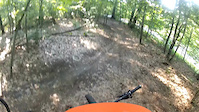
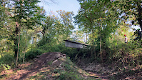
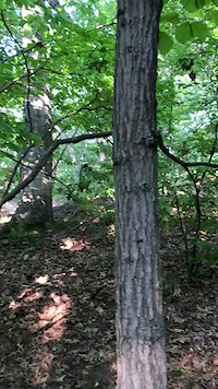
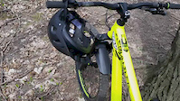
Photos of Grand Rapids Mountain Bike
Videos of Grand Rapids Mountain Bike
trail: Underground Loop
0:50 |
84 |
Jul 9, 2024

trail: GRBP Loop
0:16 |
94 |
Nov 7, 2023
trail: GRBP Loop
0:16 |
|
Oct 18, 2023
trail: Richmond Flow
0:10 |
450 |
Jul 29, 2019
trail: Richmond Flow
0:32 |
578 |
Apr 18, 2017

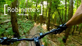
trail: Robinette's Loop 2
3:23 |
534 |
Jun 7, 2021 , Grand Rapids
trail: Robinette's Loop 1
3:23 |
586 |
Jun 7, 2021 , Grand Rapids
youtuber
![Robinette's Mountain Bike Trail - Grand Rapids...]()

3:23 |
367 |
Jun 7, 2021
Recent Trail Reports
| status | trail | date | condition | info | user |
|---|---|---|---|---|---|
| Wanderlust | Jun 3, 2026 @ 2:34pm (America/Detroit) Jun 3, 2026 | Ideal | surlypaul | ||
| Underground Loop | May 29, 2026 @ 11:28am (America/Detroit) May 29, 2026 | Dry | GaryPEXIiT | ||
| Johnson connector | May 5, 2026 @ 3:45am (America/Los_Angeles) May 5, 2026 | Unknown | dfrayer WMMBA | ||
| scenic loop | May 5, 2026 @ 3:45am (America/Los_Angeles) May 5, 2026 | Unknown | dfrayer WMMBA | ||
| Richmond Flow | Mar 15, 2026 @ 2:10pm (America/Detroit) Mar 15, 2026 | Wet | PatEllis4130 | ||
| Richmond Return Trail | Mar 15, 2026 @ 2:07pm (America/Detroit) Mar 15, 2026 | Unknown | PatEllis4130 | ||
| Richmond Flow Connector | Oct 26, 2025 @ 9:59am (America/Detroit) Oct 26, 2025 | Ideal | PatEllis4130 | ||
| Robinette's Loop 1 | Aug 17, 2025 @ 5:19am Aug 17, 2025 | Dry | ABhardtail | ||
| Robinette's Loop 2 | Aug 17, 2025 @ 5:16am Aug 17, 2025 | Dry | ABhardtail | ||
| Ken-O-Sha North Loop | Jun 29, 2025 @ 5:23pm Jun 29, 2025 | Ideal | Smasheroni |
Activity Feed
| username | action | type | title | date |
|---|---|---|---|---|
| m3GSqH | wishlist | region | activity #97049413 | Jun 15, 2026 @ 10:04am Jun 15, 2026 |
| surlypaul | add | report | activity #96170327 | Jun 3, 2026 @ 11:34am Jun 3, 2026 |
| GaryPEXIiT | add | report | activity #95779302 | May 29, 2026 @ 8:28am May 29, 2026 |
| flyinghighk9s | wishlist | region | activity #95372203 | May 23, 2026 @ 6:37pm May 23, 2026 |
| flyinghighk9s | like | directory | activity #95371766 | May 23, 2026 @ 6:28pm May 23, 2026 |
Recent Comments
| username | type | title | comment | date |
|---|---|---|---|---|
| trail | Not worth it. | Jun 19, 2025 @ 6:39pm Jun 19, 2025 | ||
| trail | Not worth it. | Jun 19, 2025 @ 6:39pm Jun 19, 2025 | ||
| trail | Nice paved trail. | Jun 19, 2025 @ 6:37pm Jun 19, 2025 | ||
| trail | I’d call it more of a black with the gap... | Apr 27, 2025 @ 8:27pm Apr 27, 2025 | ||
| trail | Rode the Flow Trail today. It is an exciting... | Jul 25, 2024 @ 11:10am Jul 25, 2024 |
Local Badges
-

Epic Ride Climb 2k14 awarded -

Climbing 10k Badge61 awarded -

Climbing 100k Badge5 awarded -

Epic Ride Descent 2k12 awarded -

Descent 10k Badge60 awarded -

Descent 100k Badge5 awarded
Bike & Skill Parks
| name | type | city | rating |
|---|---|---|---|
| Grand Rapids Urban Bike Park | skill park | Grand Rapids |
Activity Type Stats
| activitytype | trails | distance | descent | descent distance | total vertical | rating | global rank | state rank | photos | reports | routes | ridelogs |
|---|---|---|---|---|---|---|---|---|---|---|---|---|
| Mountain Bike | 107 | 109 miles | 4,157 ft | 41 miles | 279 ft | #1,624 | #612 | 161 | 764 | 1 | 31,934 | |
| E-Bike | 53 | 63 miles | 1,804 ft | 27 miles | 230 ft | #2,527 | #1,015 | 310 | 312 | |||
| Hike | 139 | 109 miles | 4,009 ft | 40 miles | 279 ft | #1,616 | #716 | 2 | 760 | 907 | ||
| Trail Running | 139 | 109 miles | 4,009 ft | 40 miles | 279 ft | #1,421 | #510 | 2 | 760 | 1,323 | ||
| Snowshoe | 19 | 27 miles | 571 ft | 12 miles | 177 ft | #631 | #254 | 10 | 30 | |||
| Nordic Ski | 18 | 27 miles | 571 ft | 12 miles | 177 ft | #705 | #256 | 8 | 55 |
Frequently Asked Questions About Grand Rapids
▼
What are the best places to ride in Grand Rapids?
Grand Rapids has 15 areas to explore for mountain biking. The top rated areas are:
▼
What are the highest rated mountain biking trails in Grand Rapids?
The highest rated mountain biking trails in Grand Rapids are:
- Ken-O-Sha North Loop (4.3/5)
- Richmond Flow (4.2/5)
- GRBP Dirt Pump Track (4.2/5)
- GRBP Loop (4.2/5)
- Richmond Flow Connector (4.1/5)
▼
What is the best time of the year to ride in Grand Rapids?
Based on ride log data, the most popular months to ride in Grand Rapids are:
- June (40 activities)
- July (37 activities)
- September (22 activities)
▼
Where can I park to ride in Grand Rapids?
There are 21 parking locations listed in Grand Rapids. The most popular parking spots are: View all parking and trailhead locations on the map to plan your visit.
Activities
Trails
Points of Interest
- By guce & contributors
- Admins: apply
- #8293 - 17,946 views
- grand rapids activity log | embed map of Grand Rapids mountain bike trails | grand rapids mountain biking points of interest
Downloading of trail gps tracks in kml & gpx formats is enabled for Grand Rapids.
You must login to download files.