close
-
Layers w
- Weather Layers
- Pro
- Pro
- Pro
- Pro
- Pro
- Pro
- More Layers
- Pro
- Pro
- Pro
- Pro
-
Upgrade to

3D
Trail Conditions
- Unknown
- Snow Groomed
- Snow Packed
- Snow Covered
- Snow Cover Partial
- Freeze/thaw Cycle
- Icy
- Prevalent Mud
- Wet
- Variable
- Ideal
- Dry
- Very Dry
Trail Flow (Ridden Direction)
Trailforks scans users ridelogs to determine the most popular direction each trail is ridden. A good flowing trail network will have most trails flowing in a single direction according to their intension.
The colour categories are based on what percentage of riders are riding a trail in its intended direction.
The colour categories are based on what percentage of riders are riding a trail in its intended direction.
- > 96%
- > 90%
- > 80%
- > 70%
- > 50%
- < 50%
- bi-directional trail
- no data
Trail Last Ridden
Trailforks scans ridelogs to determine the last time a trail was ridden.
- < 2 days
- < 1 week
- < 2 weeks
- < 1 month
- < 6 months
- > 6 months
Trail Ridden Direction
The intended direction a trail should be ridden.
- Downhill Only
- Downhill Primary
- Both Directions
- Uphill Primary
- Uphill Only
- One Direction
Contribute Details
Colors indicate trail is missing specified detail.
- Description
- Photos
- Description & Photos
- Videos
Trail Popularity ?
Trailforks scans ridelogs to determine which trails are ridden the most in the last 9 months.
Trails are compared with nearby trails in the same city region with a possible 25 colour shades.
Think of this as a heatmap, more rides = more kinetic energy = warmer colors.
- most popular
- popular
- less popular
- not popular
ATV/ORV/OHV Filter
Max Vehicle Width
inches
US Cell Coverage
Legend

Radar Time
Activity Recordings
Trailforks uses anonymized public activity data.
?
Activity Recordings
Trailforks uses anonymized public activity data.
?
Personal Heatmap
▶
Activity Types
all
/
none
▶
Options
2
Date range
month
–
Winter Trails
Warning
A routing network for winter maps does not exist. Selecting trails using the winter trails layer has been disabled.
Missing Trails
Most Popular
Least Popular
Trails are colored based on popularity. The more popular a trail is, the more red. Less popular trails trend towards green.
Jump Magnitude Heatmap
Heatmap of where riders jump on trails. Zoom in to see individual jumps, click circles to view jump details.
BC Backroad Status
![map legend]()
Service Road Atlas is a free to use, community-driven service for viewing and creating reports on the numerous back-country service roads around B.C. and Alberta.

Slope Aspect
Direction the slope faces
Trails Deemphasized
Trails are shown in grey.
Only show trails with no bike usage.
Suggested Layers
Based on selected activity type
Save the current map location and zoom level as your default home location whenever this page is loaded.
SaveNestled among pines and boulders of Prescott’s iconic Granite Mountain, Granite Basin offers a variety of beginner through expert trails. Easy singletrack to steep off-camber and technical rock gardens. Many of the trails originate from Granite Basin Lake.
Primary Trail Type: Cross-Country
Land Status: National Forest
 google parking directions
 Activities Click to view
- Mountain Bike
38 trails
- Horse
14 trails
- Hike
41 trails
- Trail Running
39 trails
Region Details
- 4
- 8
- 22
- 3
Region Status
Caution as of May 3, 2026Stats
- Avg Trail Rating
- Trails (view details)
- 40
- Trails Mountain Bike
- 38
- Trails E-Bike
- 2
- Trails Horse
- 14
- Trails Hike
- 41
- Trails Trail Running
- 39
- Trails Dirtbike/Moto
- 1
- Trails ATV/ORV/OHV
- 1
- Total Distance
- 81 miles
- Total Descent
- 11,997 ft
- Total Vertical
- 2,320 ft
- Highest Trailhead
- 7,108 ft
- Reports
- 229
- Photos
- 162
- Ridden Counter
- 4,131
Popular Granite Basin Mountain Biking Trails
• 70 ★ 3.4 • 3,013 ft • 143 ft • 458 •
Popular blue difficulty singletrack. This multi-use trail can be used both directions. On average it takes 6 minutes to complete this trail.
• 70 ★ 3.6 • 3,295 ft • 85 ft • 426 •
Popular blue difficulty singletrack. This multi-use trail can be used downhill primary and has a easy overall physical rating with a 85 ft green climb. On average it takes 6 minutes to complete this trail.
• 70 ★ 2.6 • 2,191 ft • 2 ft • 417 •
Trail is a nice gradual climb up an old dirt road. This is a great way to start out from Cayuse parking area to create a loop down trail and back around.
• 65 ★ 3.0 • 1 mile • 20 ft • 333 •
Moderately popular green difficulty singletrack. This multi-use trail can be used both directions and has a easy overall physical rating with a 20 ft green climb. On average it takes 8 minutes to complete this trail.
• 75 ★ 4.0 • 3 miles • 370 ft • 322 •
Popular blue difficulty singletrack. This mountain bike primary trail can be used both directions. On average it takes 30 minutes to complete this trail.
• 55 ★ 3.0 • 1 mile • 93 ft • 282 •
Hokaygon Trail # traverses the rolling terrain southeast of Granite Mountain. The trail stays primarily in pinyon-juniper woodland and is carved out from the dense understory of classic chaparral shrubs such as scrub oak, apache plume,...
• 55 ★ 3.5 • 3 miles • 297 ft • 234 •
Balancing Rock Trail # begins at the Cayuse Equestrian Trailhead within the Granite Recreation Area. The trail weaves up and down through shaded pine forest studded with granite boulders. Wildflowers add color to the landscape...
• 60 ★ 4.5 • 1 mile • 28 ft • 231 •
Surprise Spring Trail # offers a ride within the Granite Recreation Area. While the first portion of the trail passes through shady stands of ponderosa pine, this trail soon enters rocky, exposed country where large boulders tower over...
Granite Basin Mountain Bike Routes
16 miles • 1,681 ft • 3 • Loop •
Riding Trail route is physically demanding due to rough, overgrown trail conditions in several segments....
Photos of Granite Basin Mountain Bike
Videos of Granite Basin Mountain Bike
trail: 351 - West Lake
2:43 |
81 |
Oct 15, 2017

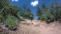
trail: Javelina
3:47:18 |
44 |
Sep 4, 2025 , Prescott
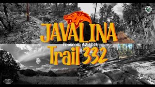
trail: Javelina
15:54 |
59 |
Sep 4, 2025 , Prescott

trail: 346 - Willow Connector
3:47:18 |
36 |
Sep 4, 2025 , Prescott

trail: 350 - Surprise Springs
3:47:18 |
36 |
Sep 4, 2025 , Prescott

trail: 348 - Chimbley Water
3:47:18 |
37 |
Sep 4, 2025 , Prescott

trail: 352 - Mint Wash Connector
3:47:18 |
41 |
Sep 4, 2025 , Prescott

trail: 345 - Mint Wash
3:47:18 |
32 |
Sep 4, 2025 , Prescott
Recent Trail Reports
| status | trail | date | condition | info | user |
|---|---|---|---|---|---|
| Upper Pasture Trail | Mar 26, 2026 @ 6:13pm (America/Phoenix) Mar 26, 2026 | Very Dry | Saltysucc04 | ||
| 347 (Lower) | May 3, 2026 @ 7:31am (America/Phoenix) May 3, 2026 | Very Dry | mej16489 | ||
| 347 (Lower) | May 3, 2026 @ 7:31am (America/Phoenix) May 3, 2026 | Very Dry | mej16489 | ||
| 348 - Chimbley Water | Apr 18, 2026 @ 7:47am (America/Phoenix) Apr 18, 2026 | Very Dry | mej16489 | ||
| Little Granite Mountain | Apr 7, 2026 @ 8:19pm (America/Phoenix) Apr 7, 2026 | Dry | Saltysucc04 | ||
| Javelina | Apr 5, 2026 @ 5:40pm (America/Phoenix) Apr 5, 2026 | Dry | noahmaz06 | ||
| 40 - Clark Spring | Mar 14, 2026 @ 8:20am (America/Phoenix) Mar 14, 2026 | Ideal | mej16489 | ||
| Balancing Rock | Sep 7, 2025 @ 1:07pm Sep 7, 2025 | Ideal | Sheepdog590 | ||
| 350 - Surprise Springs | Sep 7, 2025 @ 1:06pm Sep 7, 2025 | Variable | Sheepdog590 | ||
| Trail 353 | Jun 6, 2025 @ 8:43am Jun 6, 2025 | Ideal | Avester |
Activity Feed
| username | action | type | title | date |
|---|---|---|---|---|
| MTBHammer | ridden | trail | activity #96651144 | Jun 9, 2026 @ 8:32pm Jun 9, 2026 |
| dalep63 | wishlist | trail | activity #96158885 | Jun 3, 2026 @ 8:50am Jun 3, 2026 |
| 3ePAjcAX | add | photo | activity #95060307 and 1 more | May 19, 2026 @ 12:40pm May 19, 2026 |
| 3ePAjcAX | wishlist | trail | activity #94915985 | May 17, 2026 @ 9:59am May 17, 2026 |
| mej16489 | add | report | activity #93961017 and 1 more | May 3, 2026 @ 10:22am May 3, 2026 |
Recent Comments
| username | type | title | comment | date |
|---|---|---|---|---|
| trail | Not a very fun ride, especially going West.... | Apr 5, 2026 @ 5:40pm Apr 5, 2026 | ||
| trail | Surprisingly tough climb from Katahn Dr.... | Apr 5, 2026 @ 5:38pm Apr 5, 2026 | ||
| trail | Overall a BLUE trail, not green! Even though... | Mar 14, 2026 @ 4:58am Mar 14, 2026 | ||
| trail | Fair warning. You do not want to attempt to... | Nov 20, 2024 @ 8:49pm Nov 20, 2024 | ||
| trail | Short loop, good for littles | Mar 11, 2024 @ 3:45pm Mar 11, 2024 |
Nearby Areas
| name | distance | ||||
|---|---|---|---|---|---|
| Spence Basin | 8 | 13 | 6 | 2.6 km | |
| Alto Pit | 1 | 4 | 3.1 km | ||
| Brownlow / Pioneer Park | 15 | 15 | 3.7 km | ||
| Thumb Butte | 1 | 39 | 6 | 4.3 km | |
| Constellation trails | 3 | 10 | 6.5 km |
Local Badges
-

Completionist0 awarded
Local Mountain Biking Directory
-
Prescott Mountain Bike Alliance
![Prescott Mountain Bike Alliance]()
-
Soul Ride
![Soul Ride]()
-
Chain Events
![Chain Events]()
-
Bikesmith Cycle & FitnessBike Shop
-
Ironclad BicyclesBike Shop
![Ironclad Bicycles]()
-
High Gear Bike ShopBike Shop
![High Gear Bike Shop]()
Local Products
Activity Type Stats
| activitytype | trails | distance | descent | descent distance | total vertical | rating | global rank | state rank | photos | reports | routes | ridelogs |
|---|---|---|---|---|---|---|---|---|---|---|---|---|
| Mountain Bike | 38 | 71 miles | 9,711 ft | 33 miles | 1,772 ft | #3,434 | #1,198 | 139 | 229 | 4 | 2,868 | |
| E-Bike | 2 | 3 miles | 541 ft | 1 mile | 1,568 ft | 189 | 1 | 115 | ||||
| Horse | 14 | 40 miles | 4,747 ft | 18 miles | 1,168 ft | #849 | #446 | 46 | 1 | 17 | ||
| Hike | 41 | 81 miles | 11,998 ft | 38 miles | 2,320 ft | #1,282 | #617 | 24 | 225 | 1 | 1,292 | |
| Trail Running | 39 | 77 miles | 11,696 ft | 38 miles | 2,320 ft | #2,580 | #633 | 225 | 1 | 210 | ||
| Dirtbike/Moto | 1 | 2 miles | 492 ft | 1 mile | 433 ft | 42 | 9 | |||||
| ATV/ORV/OHV | 1 | 2 miles | 492 ft | 1 mile | 433 ft | 38 | 1 |
Frequently Asked Questions About Granite Basin
▼
What are the highest rated mountain biking trails in Granite Basin?
The highest rated mountain biking trails in Granite Basin are:
- Almosta (4.1/5)
- 350 - Surprise Springs (4.1/5)
- 347 - Willow (4/5)
- Javelina (4/5)
- Granite Connector (4/5)
▼
What is the best time of the year to ride in Granite Basin?
Based on ride log data, the most popular months to ride in Granite Basin are:
- July (42 activities)
- June (30 activities)
- May (28 activities)
▼
Where can I park to ride in Granite Basin?
There are 3 parking locations listed in Granite Basin. The most popular parking spots are: View all parking and trailhead locations on the map to plan your visit.
▼
What is the longest trail in Granite Basin?
The longest trail in Granite Basin is Almosta at 6.9 miles. View all trails sorted by distance.
Activities
- By rwinkster
 PMBA & contributors
 - Admins: PMBA, UMC-s, rowbearto-Prescott, PMBA
- #10914 - 7,394 views
- granite basin activity log | embed map of Granite Basin mountain bike trails | granite basin mountain biking points of interest
Downloading of trail gps tracks in kml & gpx formats is enabled for Granite Basin.
You must login to download files.