close
-
Layers w
- Weather Layers
- Pro
- Pro
- Pro
- Pro
- Pro
- Pro
- More Layers
- Pro
- Pro
- Pro
- Pro
-
Upgrade to

3D
Trail Conditions
- Unknown
- Snow Groomed
- Snow Packed
- Snow Covered
- Snow Cover Partial
- Freeze/thaw Cycle
- Icy
- Prevalent Mud
- Wet
- Variable
- Ideal
- Dry
- Very Dry
Trail Flow (Ridden Direction)
Trailforks scans users ridelogs to determine the most popular direction each trail is ridden. A good flowing trail network will have most trails flowing in a single direction according to their intension.
The colour categories are based on what percentage of riders are riding a trail in its intended direction.
The colour categories are based on what percentage of riders are riding a trail in its intended direction.
- > 96%
- > 90%
- > 80%
- > 70%
- > 50%
- < 50%
- bi-directional trail
- no data
Trail Last Ridden
Trailforks scans ridelogs to determine the last time a trail was ridden.
- < 2 days
- < 1 week
- < 2 weeks
- < 1 month
- < 6 months
- > 6 months
Trail Ridden Direction
The intended direction a trail should be ridden.
- Downhill Only
- Downhill Primary
- Both Directions
- Uphill Primary
- Uphill Only
- One Direction
Contribute Details
Colors indicate trail is missing specified detail.
- Description
- Photos
- Description & Photos
- Videos
Trail Popularity ?
Trailforks scans ridelogs to determine which trails are ridden the most in the last 9 months.
Trails are compared with nearby trails in the same city region with a possible 25 colour shades.
Think of this as a heatmap, more rides = more kinetic energy = warmer colors.
- most popular
- popular
- less popular
- not popular
ATV/ORV/OHV Filter
Max Vehicle Width
inches
US Cell Coverage
Legend

Radar Time
Activity Recordings
Trailforks uses anonymized public activity data.
?
Activity Recordings
Trailforks uses anonymized public activity data.
?
Personal Heatmap
▶
Activity Types
all
/
none
▶
Options
2
Date range
month
–
Winter Trails
Warning
A routing network for winter maps does not exist. Selecting trails using the winter trails layer has been disabled.
Missing Trails
Most Popular
Least Popular
Trails are colored based on popularity. The more popular a trail is, the more red. Less popular trails trend towards green.
Jump Magnitude Heatmap
Heatmap of where riders jump on trails. Zoom in to see individual jumps, click circles to view jump details.
BC Backroad Status
![map legend]()
Service Road Atlas is a free to use, community-driven service for viewing and creating reports on the numerous back-country service roads around B.C. and Alberta.

Slope Aspect
Direction the slope faces
Trails Deemphasized
Trails are shown in grey.
Only show trails with no bike usage.
Suggested Layers
Based on selected activity type
Save the current map location and zoom level as your default home location whenever this page is loaded.
Save
No description for Granville has been added yet!
Login or register to submit one.
This region uses the Uk/Euro style trail grading system.
Activities Click to view
- Mountain Bike
24 trails
- E-Bike
7 trails
- Gravel Bike
0 trails
- Adaptive Bike
0 trails
- Winter Fat Bike
0 trails
- Hike
23 trails
- Trail Running
23 trails
Region Details
- 2
- 12
- 8
- 1
- 1
Region Status
Open as of Jun 21, 2025Stats
- Avg Trail Rating
- Trails (view details)
- 24
- Trails Mountain Bike
- 24
- Trails E-Bike
- 7
- Trails Horse
- 3
- Trails Hike
- 23
- Trails Trail Running
- 23
- Total Distance
- 16 miles
- Total Descent
- 2,269 ft
- Total Vertical
- 376 ft
- Highest Trailhead
- 406 ft
- Reports
- 64
- Photos
- 29
- Ridden Counter
- 113
Sub Regions
-
Forêt de la Lucerne
- 6
- 3
Popular Granville Mountain Biking Trails
• 5 ★ 4.0 • 3,772 ft • 7 ft • 8 •
Less popular blue difficulty singletrack. This mountain bike primary trail can be used downhill primary and has a easy overall physical rating. On average it takes 5 minutes to complete this trail.
• 5 ★ 1.0 • 3,701 ft • 7 ft • 8 •
Less popular blue difficulty singletrack. This mountain bike primary trail can be used downhill primary and has a moderate overall physical rating with a 7 ft blue climb. On average it takes 4 minutes to complete this trail.
• 5 ★ 0.0 • 1,004 ft • 64 ft • 7 •
Less popular green difficulty singletrack. This mountain bike primary trail can be used uphill primary and has a easy overall physical rating with a 64 ft green climb. On average it takes 1 minutes to complete this trail.
• 90 ★ 4.0 • 2,405 ft • 0 ft • 6 •
Popular green difficulty singletrack. This mountain bike primary trail can be used downhill only and has a moderate overall physical rating. On average it takes 1 minutes to complete this trail.
• 100 ★ 4.0 • 2,569 ft • 1 ft • 6 •
Popular blue difficulty singletrack. This mountain bike primary trail can be used downhill only and has a moderate overall physical rating. On average it takes 1 minutes to complete this trail.
• 85 ★ 2.5 • 2,372 ft • 17 ft • 5 •
Popular green difficulty singletrack. This mountain bike primary trail can be used downhill primary and has a easy overall physical rating. On average it takes 1 minutes to complete this trail.
• 5 ★ 5.0 • 1 mile • 41 ft • 5 •
Less popular green difficulty singletrack. This mountain bike primary trail can be used both directions and has a easy overall physical rating with a 41 ft green climb. On average it takes 5 minutes to complete this trail.
• 95 ★ 3.0 • 1 mile • 21 ft • 5 •
Popular green difficulty mixed. This mountain bike primary trail can be used both directions and has a easy overall physical rating with a 21 ft green climb. On average it takes 5 minutes to complete this trail.
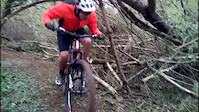
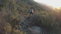
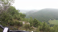
Photos of Granville Mountain Bike
Videos of Granville Mountain Bike
trail: Le "Chemin Aménagé"
0:31 |
120 |
Apr 20, 2016
trail: La Spéciale
4:24 |
770 |
Feb 19, 2015
trail: Descente "du GR"
2:46 |
238 |
Jul 27, 2014

trail: La Spéciale
14:08 |
223 |
Apr 27, 2014
Recent Trail Reports
| status | trail | date | condition | info | user |
|---|---|---|---|---|---|
| Lovely Wood | Jun 21, 2025 @ 2:45am Jun 21, 2025 | Dry | downhillstuart28 | ||
| La Croix Liron | May 30, 2017 @ 4:17am May 30, 2017 | Dry | Chessssssssssss | ||
| Le "Chemin Aménagé" | Apr 2, 2017 @ 10:47am Apr 2, 2017 | Dry | SiMSJdC | ||
| Le "chemin de la croix" | Apr 2, 2017 @ 10:47am Apr 2, 2017 | Variable | SiMSJdC | ||
| Descente Abbaye Sud | Apr 2, 2017 @ 10:47am Apr 2, 2017 | Dry | SiMSJdC | ||
| La Spéciale | Apr 2, 2017 @ 10:47am Apr 2, 2017 | Dry | SiMSJdC | ||
| Accès Lovely Wood | Apr 2, 2017 @ 10:47am Apr 2, 2017 | Dry | SiMSJdC | ||
| Au Long du Thar | Dec 25, 2016 @ 1:25am Dec 25, 2016 | Variable | ugolegentil | ||
| Le colibri | Dec 25, 2016 @ 1:22am Dec 25, 2016 | Variable | ugolegentil | ||
| Descente "du GR" | Nov 21, 2016 @ 1:34am Nov 21, 2016 | Variable | ugolegentil |
Activity Feed
| username | action | type | title | date |
|---|---|---|---|---|
| downhillstuart28 | add | report | activity #74227473 | Jun 21, 2025 @ 2:45am Jun 21, 2025 |
| Huard | wishlist | region | activity #66212559 | Feb 15, 2025 @ 1:41am Feb 15, 2025 |
| jeromd | wishlist | region | activity #56676581 | Aug 4, 2024 @ 2:45am Aug 4, 2024 |
| thierryjanel | wishlist | region | activity #56572276 | Aug 2, 2024 @ 1:57am Aug 2, 2024 |
| fabioborghi | add | photo | activity #41758604 | Jul 14, 2023 @ 12:59am Jul 14, 2023 |
Recent Comments
| username | type | title | comment | date |
|---|---|---|---|---|
| trail | No challenges but mud and leaves. | Nov 6, 2021 @ 12:17pm Nov 6, 2021 | ||
| trail | Mwah. | Nov 6, 2021 @ 12:16pm Nov 6, 2021 | ||
| trail | Trails are closed. Lots of trees have been put... | Nov 6, 2021 @ 12:15pm Nov 6, 2021 |
Local Badges
-

Epic Ride Climb 2k1 awarded -

Climbing 10k Badge2 awarded -

Climbing 100k Badge0 awarded -

Epic Ride Descent 2k1 awarded -

Descent 10k Badge2 awarded -

Descent 100k Badge0 awarded
Bike & Skill Parks
| name | type | city | rating |
|---|---|---|---|
| Forêt de la Lucerne - Partie Nord | skill park | Granville |
Activity Type Stats
| activitytype | trails | distance | descent | descent distance | total vertical | rating | global rank | state rank | photos | reports | routes | ridelogs |
|---|---|---|---|---|---|---|---|---|---|---|---|---|
| Mountain Bike | 24 | 16 miles | 2,267 ft | 8 miles | 377 ft | #5,850 | #236 | 29 | 64 | 815 | ||
| E-Bike | 7 | 5 miles | 801 ft | 3 miles | 299 ft | #5,863 | #405 | 63 | 258 | |||
| Horse | 3 | 2 miles | 213 ft | 3,976 ft | 135 ft | 63 | ||||||
| Hike | 23 | 15 miles | 2,090 ft | 8 miles | 377 ft | #7,131 | #265 | 63 | 67 | |||
| Trail Running | 23 | 15 miles | 2,090 ft | 8 miles | 377 ft | #6,544 | #246 | 63 | 23 |
Frequently Asked Questions About Granville
▼
What are the best places to ride in Granville?
Granville has 1 areas to explore for mountain biking. The top rated areas are:
▼
What are the highest rated mountain biking trails in Granville?
The highest rated mountain biking trails in Granville are:
- Au Long du Thar (4.2/5)
- LHP's Trail (4.1/5)
- Stair's Trail (4/5)
- Lovely Wood (4/5)
- Descente "du GR" (4/5)
▼
What is the best time of the year to ride in Granville?
Based on ride log data, the most popular months to ride in Granville are:
- August (12 activities)
- September (7 activities)
- October (7 activities)
▼
Where can I park to ride in Granville?
There are 1 parking locations listed in Granville. The most popular parking spots are:
- By SiMSJdC & contributors
- Admins: apply
- #8284 - 2,776 views
- granville activity log | embed map of Granville mountain bike trails | granville mountain biking points of interest
Downloading of trail gps tracks in kml & gpx formats is enabled for Granville.
You must login to download files.