close
-
Layers w
- Weather Layers
- Pro
- Pro
- Pro
- Pro
- Pro
- Pro
- More Layers
- Pro
- Pro
- Pro
- Pro
-
Upgrade to

3D
Trail Conditions
- Unknown
- Snow Groomed
- Snow Packed
- Snow Covered
- Snow Cover Partial
- Freeze/thaw Cycle
- Icy
- Prevalent Mud
- Wet
- Variable
- Ideal
- Dry
- Very Dry
Trail Flow (Ridden Direction)
Trailforks scans users ridelogs to determine the most popular direction each trail is ridden. A good flowing trail network will have most trails flowing in a single direction according to their intension.
The colour categories are based on what percentage of riders are riding a trail in its intended direction.
The colour categories are based on what percentage of riders are riding a trail in its intended direction.
- > 96%
- > 90%
- > 80%
- > 70%
- > 50%
- < 50%
- bi-directional trail
- no data
Trail Last Ridden
Trailforks scans ridelogs to determine the last time a trail was ridden.
- < 2 days
- < 1 week
- < 2 weeks
- < 1 month
- < 6 months
- > 6 months
Trail Ridden Direction
The intended direction a trail should be ridden.
- Downhill Only
- Downhill Primary
- Both Directions
- Uphill Primary
- Uphill Only
- One Direction
Contribute Details
Colors indicate trail is missing specified detail.
- Description
- Photos
- Description & Photos
- Videos
Trail Popularity ?
Trailforks scans ridelogs to determine which trails are ridden the most in the last 9 months.
Trails are compared with nearby trails in the same city region with a possible 25 colour shades.
Think of this as a heatmap, more rides = more kinetic energy = warmer colors.
- most popular
- popular
- less popular
- not popular
ATV/ORV/OHV Filter
Max Vehicle Width
inches
US Cell Coverage
Legend

Radar Time
Activity Recordings
Trailforks uses anonymized public activity data.
?
Activity Recordings
Trailforks uses anonymized public activity data.
?
Personal Heatmap
▶
Activity Types
all
/
none
▶
Options
2
Date range
month
–
Winter Trails
Warning
A routing network for winter maps does not exist. Selecting trails using the winter trails layer has been disabled.
Missing Trails
Most Popular
Least Popular
Trails are colored based on popularity. The more popular a trail is, the more red. Less popular trails trend towards green.
Jump Magnitude Heatmap
Heatmap of where riders jump on trails. Zoom in to see individual jumps, click circles to view jump details.
BC Backroad Status
![map legend]()
Service Road Atlas is a free to use, community-driven service for viewing and creating reports on the numerous back-country service roads around B.C. and Alberta.

Slope Aspect
Direction the slope faces
Trails Deemphasized
Trails are shown in grey.
Only show trails with no bike usage.
Suggested Layers
Based on selected activity type
Save the current map location and zoom level as your default home location whenever this page is loaded.
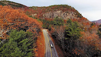
SaveThe Grater Woods system of trails is yet another fantastic little gem of New England riding that holds within it some really great singletrack, along with wider trails/access roads that just about anyone can try to tackle. However, even on the wider trails/roads, you will find some steep sections that will provide a decent challenge.
But for you singletrack lovers, warm up on Salamander and Millipede, before heading over to Centipede for something a little more challenging. Make sure you get down to Silverfish for a longer trail with some challenges, and absolutely do not miss Skyline for one of the longest, best singletrack trails in the area. Ridge Line provides a fun little downhill, or a challenging short climb from the other direction.
If you're feeling more mellow, follow Red Maple up north, and grab Drilled Rock and Eagle for some easy fun, or pop across the road and jump on Caterpillar.
Remember these trails are frequented by walkers/hikers and hunters during season, so be on the lookout. But the more intermediate singletrack trails are mostly populated by bikers. Class 1 eMTB use is permitted. Have a great time at Grater
Primary Trail Type: Cross-Country
eBikes Allowed:
Yes
Land Status: City Managed
Land Manager: Merrimack Conservation Commission
 google parking directions
Links
Activities Click to view
- Mountain Bike
43 trails
- E-Bike
41 trails
- Hike
42 trails
- Trail Running
42 trails
- Snowshoe
1 trails
- Nordic Ski
1 trails
Region Details
- 5
- 13
- 24
- 1
Region Status
Open as of May 20, 2026Stats
- Avg Trail Rating
- Trails (view details)
- 43
- Trails Mountain Bike
- 43
- Trails E-Bike
- 41
- Trails Hike
- 42
- Trails Trail Running
- 42
- Trails Snowshoe
- 1
- Trails Nordic Ski
- 1
- Total Distance
- 18 miles
- Total Descent
- 2,631 ft
- Total Vertical
- 264 ft
- Highest Trailhead
- 499 ft
- Reports
- 238
- Photos
- 36
- Ridden Counter
- 7,654
Popular Grater Woods Mountain Biking Trails
• 90 ★ 4.5 • 1 mile • 37 ft • 542 •
Like most of the trails out at Grater, is full of twists and turns. Definitely one of the easiest trails out here though, with not much as far as climbs or technical features.
• 75 ★ 4.8 • 2 miles • 279 ft • 473 •
Yet another fun, twisty trail out at Grater! Capped at both ends with windy singletrack through a tight brushy forest with a lot of punchy ups and downs, and a good amount of tech. The middle of the trail opens up to wider switchbacks...
• 75 ★ 3.0 • 1,683 ft • 38 ft • 432 •
is a short connecting trail that gets you to and (it is the only way to , as connects at both ends). runs off of and connects back to .
• 80 ★ 4.5 • 1 mile • 91 ft • 397 •
Super fun twisty track with a few technical spots and some super short punchy climbs. One of the better trails at Grater.
• 70 ★ 3.5 • 2,260 ft • 36 ft • 374 •
Shorter singletrack with some off-camber stuff that makes it a little more interesting. Not really a blue, but not the greenest green either.
• 60 ★ 3.0 • 2,244 ft • 10 ft • 356 •
Hill pops south off of , over a large wooden bridge, just before a steep, rocky climb that will take you to intersections with and . It then mellows out and there is a green-grade downhill to .
Grater Woods Mountain Bike Routes
10 miles • 1,322 ft • 8 •
Skip the doubletrack trails and get right to it. Climb to via , , Milipede, , and then descend via ,
6 miles • 461 ft • 5 • Point to Point •
This route is meant to be a rather quick one that focuses on the twists and turns while working through...
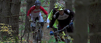
Photos of Grater Woods Mountain Bike
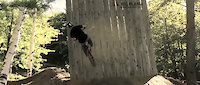
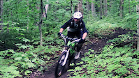
Videos of Grater Woods Mountain Bike
trail: Grater Woods Trail
2:02 |
10827 |
Nov 12, 2016
trail: Skyline
6:35 |
67947 |
Nov 7, 2013

trail: Skyline
2:34 |
21596 |
Feb 20, 2013

trail: Skyline
4:13 |
33207 |
Oct 24, 2012

trail: Skyline
2:26 |
2323 |
May 11, 2012

trail: Skyline
2:35 |
3908 |
Nov 11, 2011
trail: Skyline
2:05 |
5903 |
Sep 16, 2011
trail: Skyline
0:45 |
345 |
Sep 1, 2011
Recent Trail Reports
| status | trail | date | condition | info | user |
|---|---|---|---|---|---|
| School Loop Trail | May 20, 2026 @ 5:53pm (America/New_York) May 20, 2026 | Dry | SCoves12 | ||
| Eagle | May 20, 2026 @ 5:53pm (America/New_York) May 20, 2026 | Dry | SCoves12 | ||
| Castor | May 20, 2026 @ 5:53pm (America/New_York) May 20, 2026 | Dry | SCoves12 | ||
| Salamander | May 19, 2026 @ 8:49am (America/New_York) May 19, 2026 | Dry | mappermook TRAILFORKS | ||
| Centipede | May 19, 2026 @ 8:49am (America/New_York) May 19, 2026 | Ideal | mappermook TRAILFORKS | ||
| Silverfish | May 19, 2026 @ 8:49am (America/New_York) May 19, 2026 | Variable | mappermook TRAILFORKS | ||
| Grater Loop | May 19, 2026 @ 8:49am (America/New_York) May 19, 2026 | Variable | mappermook TRAILFORKS | ||
| Lesser Loop | May 19, 2026 @ 8:49am (America/New_York) May 19, 2026 | Ideal | mappermook TRAILFORKS | ||
| Grater Forest | May 19, 2026 @ 8:49am (America/New_York) May 19, 2026 | Dry | mappermook TRAILFORKS | ||
| Millipede | May 16, 2026 @ 12:24pm (America/New_York) May 16, 2026 | Ideal | Oldbikersam |
Activity Feed
| username | action | type | title | date |
|---|---|---|---|---|
| JustinNbZWeP | wishlist | trail | activity #96768752 and 2 more | Jun 11, 2026 @ 4:38pm Jun 11, 2026 |
| timothyfrench | wishlist | region | activity #95881635 | May 30, 2026 @ 1:13pm May 30, 2026 |
| SCoves12 | add | report | activity #95143871 and 2 more | May 20, 2026 @ 5:27pm May 20, 2026 |
| mappermook | add | trail | activity #95099401 | May 20, 2026 @ 4:50am May 20, 2026 |
| mappermook | comment | trail | activity #95042922 | May 19, 2026 @ 8:29am May 19, 2026 |
Recent Comments
| username | type | title | comment | date |
|---|---|---|---|---|
| trail | Mellow fun flowy riding, except for a bridge... | May 19, 2026 @ 8:29am May 19, 2026 | ||
| report | Downed tree on Centipede, shortly after... | May 4, 2025 @ 9:42am May 4, 2025 | ||
| trail | Outstanding all natural non-neutured New... | Jun 10, 2024 @ 1:41pm Jun 10, 2024 | ||
| trail | This is a textbook example of a mid-to-upper... | Jun 10, 2024 @ 1:38pm Jun 10, 2024 | ||
| trail | Rode it Sept 18 2021... You can take it all... | Sep 20, 2021 @ 8:15pm Sep 20, 2021 |
Nearby Areas
| name | distance | ||||
|---|---|---|---|---|---|
| Pond Parish Town Forest | 10 | 1 | 1.4 km | ||
| Horse Hill Nature Preserve | 5 | 15 | 3 | 1.9 km | |
| Bicentennial South | 3 | 3 | 2.8 km | ||
| Wildcat Falls Conservation Area | 4 | 1 | 2.9 km | ||
| Haseltine | 4 | 5 | 2 | 3.4 km |
Local Badges
-

Completionist0 awarded
Activity Type Stats
| activitytype | trails | distance | descent | descent distance | total vertical | rating | global rank | state rank | photos | reports | routes | ridelogs |
|---|---|---|---|---|---|---|---|---|---|---|---|---|
| Mountain Bike | 43 | 18 miles | 2,631 ft | 7 miles | 266 ft | #4,332 | #1,526 | 37 | 238 | 4 | 4,754 | |
| E-Bike | 41 | 18 miles | 2,631 ft | 7 miles | 266 ft | #4,565 | #1,259 | 203 | 1 | 154 | ||
| Hike | 42 | 18 miles | 2,592 ft | 7 miles | 266 ft | #7,544 | #2,774 | 238 | 482 | |||
| Trail Running | 42 | 18 miles | 2,592 ft | 7 miles | 266 ft | #7,295 | #2,420 | 238 | 72 | |||
| Snowshoe | 1 | #982 | #479 | 41 | ||||||||
| Nordic Ski | 1 | #2,084 | #1,089 | 2 |
Frequently Asked Questions About Grater Woods
▼
What are the highest rated mountain biking trails in Grater Woods?
The highest rated mountain biking trails in Grater Woods are:
- Skyline (4.3/5)
- Silverfish (4.1/5)
- Salamander (4.1/5)
- Millipede (4/5)
- Centipede (4/5)
▼
What is the best time of the year to ride in Grater Woods?
Based on ride log data, the most popular months to ride in Grater Woods are:
- May (107 activities)
- June (107 activities)
- August (101 activities)
▼
Where can I park to ride in Grater Woods?
There are 4 parking locations listed in Grater Woods. The most popular parking spots are: View all parking and trailhead locations on the map to plan your visit.
▼
What is the longest trail in Grater Woods?
The longest trail in Grater Woods is Skyline at 2.7 km. View all trails sorted by distance.
Activities
- By zdwagner & contributors
- Admins: SNH NEMBA
- #16633 - 11,911 views
- grater woods activity log | embed map of Grater Woods mountain bike trails | grater woods mountain biking points of interest
Downloading of trail gps tracks in kml & gpx formats is enabled for Grater Woods.
You must login to download files.