close
-
Layers w
- Weather Layers
- Pro
- Pro
- Pro
- Pro
- Pro
- Pro
- More Layers
- Pro
- Pro
- Pro
- Pro
-
Upgrade to

3D
Trail Conditions
- Unknown
- Snow Groomed
- Snow Packed
- Snow Covered
- Snow Cover Partial
- Freeze/thaw Cycle
- Icy
- Prevalent Mud
- Wet
- Variable
- Ideal
- Dry
- Very Dry
Trail Flow (Ridden Direction)
Trailforks scans users ridelogs to determine the most popular direction each trail is ridden. A good flowing trail network will have most trails flowing in a single direction according to their intension.
The colour categories are based on what percentage of riders are riding a trail in its intended direction.
The colour categories are based on what percentage of riders are riding a trail in its intended direction.
- > 96%
- > 90%
- > 80%
- > 70%
- > 50%
- < 50%
- bi-directional trail
- no data
Trail Last Ridden
Trailforks scans ridelogs to determine the last time a trail was ridden.
- < 2 days
- < 1 week
- < 2 weeks
- < 1 month
- < 6 months
- > 6 months
Trail Ridden Direction
The intended direction a trail should be ridden.
- Downhill Only
- Downhill Primary
- Both Directions
- Uphill Primary
- Uphill Only
- One Direction
Contribute Details
Colors indicate trail is missing specified detail.
- Description
- Photos
- Description & Photos
- Videos
Trail Popularity ?
Trailforks scans ridelogs to determine which trails are ridden the most in the last 9 months.
Trails are compared with nearby trails in the same city region with a possible 25 colour shades.
Think of this as a heatmap, more rides = more kinetic energy = warmer colors.
- most popular
- popular
- less popular
- not popular
ATV/ORV/OHV Filter
Max Vehicle Width
inches
US Cell Coverage
Legend

Radar Time
Activity Recordings
Trailforks uses anonymized public activity data.
?
Activity Recordings
Trailforks uses anonymized public activity data.
?
Personal Heatmap
▶
Activity Types
all
/
none
▶
Options
2
Date range
month
–
Winter Trails
Warning
A routing network for winter maps does not exist. Selecting trails using the winter trails layer has been disabled.
Missing Trails
Most Popular
Least Popular
Trails are colored based on popularity. The more popular a trail is, the more red. Less popular trails trend towards green.
Jump Magnitude Heatmap
Heatmap of where riders jump on trails. Zoom in to see individual jumps, click circles to view jump details.
BC Backroad Status
![map legend]()
Service Road Atlas is a free to use, community-driven service for viewing and creating reports on the numerous back-country service roads around B.C. and Alberta.

Slope Aspect
Direction the slope faces
Trails Deemphasized
Trails are shown in grey.
Only show trails with no bike usage.
Suggested Layers
Based on selected activity type
Save the current map location and zoom level as your default home location whenever this page is loaded.
Save
No description for Gravenhurst has been added yet!
Login or register to submit one.
Activities Click to view
- Mountain Bike
63 trails
- Gravel Bike
0 trails
- Adaptive Bike
0 trails
- Winter Fat Bike
0 trails
- Hike
30 trails
- Trail Running
30 trails
- Snowmobile
8 trails
- Snowshoe
28 trails
- Backcountry Ski
0 trails
- Nordic Ski
12 trails
Region Details
- 13
- 6
- 22
- 11
- 8
- 3
Region Status
Caution as of Aug 9, 2023Stats
- Avg Trail Rating
- Trails (view details)
- 70
- Trails Mountain Bike
- 63
- Trails Hike
- 30
- Trails Trail Running
- 30
- Trails Snowmobile
- 8
- Trails Snowshoe
- 28
- Trails Nordic Ski
- 12
- Total Distance
- 64 miles
- Total Descent
- 2,160 ft
- Total Vertical
- 253 ft
- Highest Trailhead
- 948 ft
- Reports
- 399
- Photos
- 58
- Ridden Counter
- 11,556
Sub Regions
-
Buckwallow Cycling Centre [[PERMANENTLY CLOSED]]
- 5
- 8
- 8
- 3
-
Kahshe Lake Barrens Conservation Reserve
- 2
-
Muskoka Tourism Information Center
- 4
-
Ungerman Gateway Park
- 2
Popular Gravenhurst Mountain Biking Trails
Stumpy Permanently Closed
• 5 ★ 5.0 • 541 ft • 2 ft • 422 •
Less popular green difficulty closed singletrack. This mountain bike primary trail can be used both directions and has a easy overall physical rating with a 2 ft green climb. It features bridge, drop and skinny. On average it takes minutes to complete this trail.
Pine Pitch Permanently Closed
• 5 ★ 3.0 • 742 ft • 3 ft • 421 •
Less popular green difficulty closed singletrack. This mountain bike primary trail can be used both directions and has a easy overall physical rating with a 3 ft green climb. It features rock face. On average it takes minutes to complete this trail.
Border Run Permanently Closed
• 5 ★ 3.0 • 1,122 ft • 2 ft • 410 •
Less popular green difficulty closed singletrack. This mountain bike primary trail can be used both directions and has a easy overall physical rating with a 2 ft green climb. It features rock face. On average it takes 4 minutes to complete this trail.
Loam Rider Permanently Closed
• 5 ★ 3.8 • 3,699 ft • 59 ft • 392 •
Less popular black diamond difficulty closed singletrack. This mountain bike primary trail can be used both directions and has a moderate overall physical rating with a 59 ft black diamond climb. It features bridge, drop, rock face and skinny. On average it takes 7 minutes to complete this trail.
I'll Be Buck Permanently Closed
• 5 ★ 4.7 • 967 ft • 16 ft • 389 •
It’s a fairly short loop of 412m of technical fun. The trail is classified as “4 Hooves” (out of 5) difficulty level, and for a good reason. As soon as you enter the trail, you must ride up a somewhat steep, granite rock that is...
Eager Beaver Permanently Closed
• 5 ★ 3.5 • 638 ft • 5 ft • 381 •
Less popular blue difficulty closed singletrack. This mountain bike primary trail can be used both directions and has a easy overall physical rating with a 5 ft green climb. It features rock face and skinny. On average it takes minutes to complete this trail.
Hoof Hearted Permanently Closed
• 5 ★ 3.5 • 1,160 ft • 10 ft • 372 •
Less popular green difficulty closed singletrack. This mountain bike primary trail can be used both directions and has a easy overall physical rating with a 10 ft green climb. It features jump. On average it takes 1 minutes to complete this trail.
Still Here Permanently Closed
• 5 ★ 3.5 • 2,359 ft • 46 ft • 364 •
Less popular green difficulty closed singletrack. This mountain bike primary trail can be used both directions and has a easy overall physical rating with a 46 ft green climb. It features rock face. On average it takes 3 minutes to complete this trail.
Gravenhurst Mountain Bike Routes
★ 4.0 • 5 miles • 262 ft • 19 • Loop •
Buckwallow features easy to very difficult trails with large granite rocks and roots. This loop is very...
16 miles • 736 ft • 165 •
Complete Route thru every Trail in Buckwallow with minimum overlap of sections.
Photos of Gravenhurst Mountain Bike
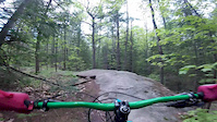
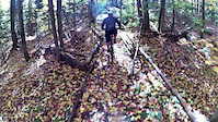
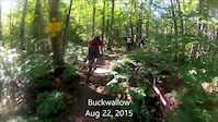
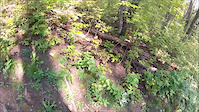
Videos of Gravenhurst Mountain Bike
trail: Pass Thru 3
10:20 |
199 |
May 28, 2017

trail: Bear Bluff
7:03 |
758 |
May 24, 2016
trail: Pass Thru 3
0:43 |
60 |
Oct 18, 2015
trail: Pass Thru 3
5:33 |
39 |
Oct 2, 2015
trail: Pass Thru 3
2:14 |
50 |
Sep 25, 2015

trail: Why
0:15 |
789 |
Aug 31, 2015

trail: Pass Thru 3
3:57 |
330 |
May 21, 2012

trail: Pass Thru 3
4:57 |
153 |
Nov 23, 2011
Recent Trail Reports
| status | trail | date | condition | info | user |
|---|---|---|---|---|---|
| Trail | Jul 17, 2023 @ 11:58am Jul 17, 2023 | Wet | mcassellmtb | ||
| Reflector Loop Access | Aug 29, 2020 @ 7:42am Aug 29, 2020 | Dry | provin1327 |
Activity Feed
| username | action | type | title | date |
|---|---|---|---|---|
| o04aFs | wishlist | region | activity #95243845 | May 22, 2026 @ 8:18am May 22, 2026 |
| Canadmos | add | poi | activity #95041384 | May 19, 2026 @ 8:02am May 19, 2026 |
| Canadmos | update | region | activity #93207576 | Apr 23, 2026 @ 5:50am Apr 23, 2026 |
| trailforks | add | video | activity #85484611 | Dec 13, 2025 @ 3:00pm Dec 13, 2025 |
| Canadmos | add | poi | activity #83178249 and 4 more | Oct 28, 2025 @ 12:58pm Oct 28, 2025 |
Recent Comments
| username | type | title | comment | date |
|---|---|---|---|---|
| trail | Mike has retired and it is his property.... | Aug 30, 2024 @ 12:32pm Aug 30, 2024 | ||
| trail | Its on private property | Aug 30, 2024 @ 10:39am Aug 30, 2024 | ||
| trail | do people still ride here or is this private... | Aug 30, 2024 @ 7:47am Aug 30, 2024 | ||
| trail | damn that sucks :( | May 13, 2021 @ 12:25pm May 13, 2021 | ||
| trail | Wasn't sure where to put this, but I saw a... | May 13, 2021 @ 12:09pm May 13, 2021 |
Local Badges
-

10 Blue Trails65 awarded -

Epic Ride Climb 2k1 awarded -

Climbing 10k Badge6 awarded -

Climbing 100k Badge0 awarded -

Epic Ride Descent 2k1 awarded -

Descent 10k Badge6 awarded
Activity Type Stats
| activitytype | trails | distance | descent | descent distance | total vertical | rating | global rank | state rank | photos | reports | routes | ridelogs |
|---|---|---|---|---|---|---|---|---|---|---|---|---|
| Mountain Bike | 63 | 27 miles | 1,447 ft | 9 miles | 171 ft | #2,315 | #46 | 58 | 399 | 2 | 2,786 | |
| Hike | 30 | 20 miles | 702 ft | 8 miles | 167 ft | #6,999 | #129 | 395 | 220 | |||
| Trail Running | 30 | 20 miles | 702 ft | 8 miles | 167 ft | #7,319 | #127 | 395 | 41 | |||
| Snowmobile | 8 | 39 miles | 804 ft | 13 miles | 253 ft | #237 | #18 | |||||
| Snowshoe | 28 | 14 miles | 518 ft | 6 miles | 154 ft | #985 | #100 | 28 | ||||
| Nordic Ski | 12 | 3 miles | 131 ft | 1 mile | 89 ft | #1,522 | #113 | 24 |
Frequently Asked Questions About Gravenhurst
▼
What are the best places to ride in Gravenhurst?
Gravenhurst has 5 areas to explore for mountain biking. The top rated areas are:
▼
What are the highest rated mountain biking trails in Gravenhurst?
The highest rated mountain biking trails in Gravenhurst are:
- Trail (0/5)
- Old Stone Road Trail (0/5)
- Cooper's Falls (0/5)
- Leo Heritage Recreational Trail (0/5)
- Trans Canada Trail - Gravenhurst (0/5)
▼
What is the best time of the year to ride in Gravenhurst?
Based on ride log data, the most popular months to ride in Gravenhurst are:
- August (125 activities)
- July (94 activities)
- June (77 activities)
▼
Where can I park to ride in Gravenhurst?
Activities
Trails
Points of Interest
- By hipposauce
 & contributors
 - Admins: MORCA, MORRA, HMBA
- #6042 - 7,920 views
- gravenhurst activity log | embed map of Gravenhurst mountain bike trails | gravenhurst mountain biking points of interest polygons
Downloading of trail gps tracks in kml & gpx formats is enabled for Gravenhurst.
You must login to download files.