close
-
Layers w
- Weather Layers
- Pro
- Pro
- Pro
- Pro
- Pro
- Pro
- More Layers
- Pro
- Pro
- Pro
- Pro
-
Upgrade to

3D
Trail Conditions
- Unknown
- Snow Groomed
- Snow Packed
- Snow Covered
- Snow Cover Partial
- Freeze/thaw Cycle
- Icy
- Prevalent Mud
- Wet
- Variable
- Ideal
- Dry
- Very Dry
Trail Flow (Ridden Direction)
Trailforks scans users ridelogs to determine the most popular direction each trail is ridden. A good flowing trail network will have most trails flowing in a single direction according to their intension.
The colour categories are based on what percentage of riders are riding a trail in its intended direction.
The colour categories are based on what percentage of riders are riding a trail in its intended direction.
- > 96%
- > 90%
- > 80%
- > 70%
- > 50%
- < 50%
- bi-directional trail
- no data
Trail Last Ridden
Trailforks scans ridelogs to determine the last time a trail was ridden.
- < 2 days
- < 1 week
- < 2 weeks
- < 1 month
- < 6 months
- > 6 months
Trail Ridden Direction
The intended direction a trail should be ridden.
- Downhill Only
- Downhill Primary
- Both Directions
- Uphill Primary
- Uphill Only
- One Direction
Contribute Details
Colors indicate trail is missing specified detail.
- Description
- Photos
- Description & Photos
- Videos
Trail Popularity ?
Trailforks scans ridelogs to determine which trails are ridden the most in the last 9 months.
Trails are compared with nearby trails in the same city region with a possible 25 colour shades.
Think of this as a heatmap, more rides = more kinetic energy = warmer colors.
- most popular
- popular
- less popular
- not popular
ATV/ORV/OHV Filter
Max Vehicle Width
inches
US Cell Coverage
Legend

Radar Time
Activity Recordings
Trailforks uses anonymized public activity data.
?
Activity Recordings
Trailforks uses anonymized public activity data.
?
Personal Heatmap
▶
Activity Types
all
/
none
▶
Options
2
Date range
month
–
Winter Trails
Warning
A routing network for winter maps does not exist. Selecting trails using the winter trails layer has been disabled.
Missing Trails
Most Popular
Least Popular
Trails are colored based on popularity. The more popular a trail is, the more red. Less popular trails trend towards green.
Jump Magnitude Heatmap
Heatmap of where riders jump on trails. Zoom in to see individual jumps, click circles to view jump details.
BC Backroad Status
![map legend]()
Service Road Atlas is a free to use, community-driven service for viewing and creating reports on the numerous back-country service roads around B.C. and Alberta.

Slope Aspect
Direction the slope faces
Trails Deemphasized
Trails are shown in grey.
Only show trails with no bike usage.
Suggested Layers
Based on selected activity type
Save the current map location and zoom level as your default home location whenever this page is loaded.
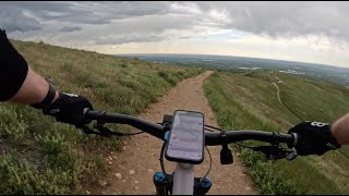
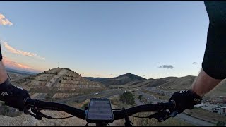
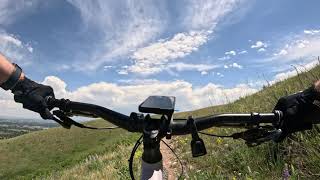
SaveGreen Mountain is a medium-sized trail network in the Western suburbs of Denver. Most trails are Green/Blue with a few Blue sections. Great place to bring advanced beginners to work on skills and stamina. Often very busy on weekends and one of the few close places you can ride somewhat reliably most of the year. Despite the proximity to Jefferson County trails, this park (known as William F. Hayden Park) is actually administered by Lakewood and open till 10PM every day. It's a popular choice for after-dark rides as most other trails are only open till "sunset".
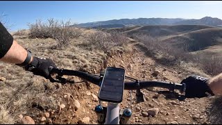
Probably most known for trails "Rooney Valley" and "Box-o-Rox.
Probably most known for trails "Rooney Valley" and "Box-o-Rox.
source: ...
 google parking directions
 Activities Click to view
- Mountain Bike
31 trails
- E-Bike
31 trails
- Horse
27 trails
- Hike
32 trails
- Trail Running
32 trails
Region Details
- 2
- 4
- 23
- 2
Region Status
Open as of Jun 2, 2026Stats
- Avg Trail Rating
- Trails (view details)
- 31
- Trails Mountain Bike
- 31
- Trails E-Bike
- 31
- Trails Horse
- 27
- Trails Hike
- 32
- Trails Trail Running
- 32
- Total Distance
- 25 miles
- Total Descent
- 4,959 ft
- Total Vertical
- 945 ft
- Highest Trailhead
- 6,857 ft
- Reports
- 808
- Photos
- 64
- Ridden Counter
- 24,978
Popular Green Mountain Mountain Biking Trails
• 100 ★ 3.0 • 3,267 ft • 91 ft • 2,317 •
This has been rerouted to be a little easier and cause less erosion.
• 100 ★ 4.2 • 2,795 ft • 4 ft • 1,726 •
This trail is designed more with the downhiller in mind, but can be climbed as well. At the high point where you come on from the original Box o' Rox trail you start with some fast berms and smaller doubles and then moves onto a slide...
• 100 ★ 0.0 • 226 ft • 10 ft • 1,620 •
A short connector where the top of Rooney got the short bypass. This is a part of the old before the reroute around the old loose ridge.
• 95 ★ 4.0 • 207 ft • 0 ft • 1,436 •
Popular black diamond difficulty singletrack. This multi-use trail can be used both directions and has a moderate overall physical rating with a 0 ft double black diamond climb. It features drop, gap jump and rock garden. On average it takes 1 minutes to complete this trail.
• 95 ★ 3.0 • 1 mile • 559 ft • 1,410 •
Popular blue difficulty singletrack. This multi-use trail can be used both directions and has a moderate overall physical rating with a 559 ft blue climb. On average it takes 16 minutes to complete this trail.
• 95 ★ 4.2 • 3 miles • 352 ft • 1,404 •
Highly rated popular green difficulty singletrack. This multi-use trail can be used both directions and has a easy overall physical rating with a 352 ft green climb. On average it takes 20 minutes to complete this trail.
• 100 ★ 3.5 • 2 miles • 255 ft • 1,272 •
Popular blue difficulty singletrack. This mountain bike primary trail can be used downhill primary. On average it takes 11 minutes to complete this trail.
Green Mountain Mountain Bike Routes
9 miles • 1,253 ft • 4 •
One of many loops available on Green Mountain. It has a section of that is missed in other routes. You can...
9 miles • 1,183 ft • 4 • Loop •
Start from the Florida parking lot on Alameda Parkway. Take to the access road on top, and then Box O...
★ 2.8 • 11 miles • 1,211 ft • 12 • Out & Back •
A great beginner to intermediate out, loop and back ride for Demoing directly from the Yeti HQ. Riders...
6 miles • 921 ft • 2 •
Climb Green Mountain from the underpass, then descend the flow trail, .
★ 3.0 • 1 mile • 498 ft • 1 •
Green Mountain North Side access trail From Exposition Dr up to Junction
★ 1.7 • 11 miles • 1,617 ft • 27 • Loop •
Green Mountain 10.8 mile loop starting from the Florida Parking Lot that hits the peak along the way.
Photos of Green Mountain Mountain Bike
Videos of Green Mountain Mountain Bike

trail: Green Mountain (Perimeter)
0:40 |
355 |
Nov 27, 2018
trail: Green Mountain Loop
6:18 |
125 |
May 30, 2025 , Lakewood
trail: Hayden
10:00 |
187 |
Mar 9, 2025 , Lakewood
trail: Wrigley's
14:11 |
155 |
Sep 19, 2024 , Lakewood
trail: Summit Loop
13:03 |
207 |
Jun 12, 2024 , Lakewood
trail: Rooney Valley
9:44 |
272 |
Jun 9, 2024 , Lakewood

trail: Box O Rox extension
3:33 |
232 |
Apr 12, 2023 , Lakewood

trail: Box-O-Rox
3:33 |
278 |
Apr 12, 2023 , Lakewood
Recent Trail Reports
| status | trail | date | condition | info | user |
|---|---|---|---|---|---|
| Green Mountain Loop | Jun 2, 2026 @ 7:30pm (America/Denver) Jun 2, 2026 | Dry | PirateRaceProductions | ||
| Rooney Valley | Apr 16, 2026 @ 7:23am (America/Denver) Apr 16, 2026 | Ideal | JOHNASZTO2 | ||
| Rooney Valley | Apr 10, 2026 @ 2:09pm (America/Denver) Apr 10, 2026 | Ideal | tim-berjack | ||
| Green Mountain Alt | Apr 10, 2026 @ 2:09pm (America/Denver) Apr 10, 2026 | Ideal | tim-berjack | ||
| Box-O-Rox | Apr 10, 2026 @ 2:09pm (America/Denver) Apr 10, 2026 | Dry | tim-berjack | ||
| Green Mountain Dirt Alt | Feb 7, 2026 @ 11:23am (America/Denver) Feb 7, 2026 | Ideal | JoeyDelish | ||
| Rooney Connect | Feb 7, 2026 @ 11:23am (America/Denver) Feb 7, 2026 | Ideal | JoeyDelish | ||
| Box O Rox extension | Feb 7, 2026 @ 11:23am (America/Denver) Feb 7, 2026 | Ideal | JoeyDelish | ||
| Rooney Valley Conn | Jan 6, 2026 @ 12:28pm (America/Denver) Jan 6, 2026 | Ideal | Frcg | ||
| Green Mountain (Perimeter) | Oct 11, 2025 @ 11:07am (America/Denver) Oct 11, 2025 | Ideal | tshralper |
Activity Feed
| username | action | type | title | date |
|---|---|---|---|---|
| 3O5Vgcz9 | wishlist | region | activity #96989861 | Jun 14, 2026 @ 11:27am Jun 14, 2026 |
| dben89x | wishlist | route | activity #96894290 | Jun 13, 2026 @ 10:34am Jun 13, 2026 |
| dmurray810 | wishlist | route | activity #96873498 | Jun 13, 2026 @ 7:15am Jun 13, 2026 |
| calypso423 | wishlist | trail | activity #96712541 and 1 more | Jun 10, 2026 @ 7:13pm Jun 10, 2026 |
| PeterWTWLQj | wishlist | route | activity #96700121 | Jun 10, 2026 @ 3:46pm Jun 10, 2026 |
Recent Comments
| username | type | title | comment | date |
|---|---|---|---|---|
| trail | Jborges91 is right. Nice views from the top... | May 17, 2026 @ 7:57am May 17, 2026 | ||
| trail | Especially when there’s several other ways... | Apr 27, 2026 @ 2:53pm Apr 27, 2026 | ||
| trail | Yup 👍 | Apr 27, 2026 @ 2:52pm Apr 27, 2026 | ||
| trail | Idk if I would call it beginner its probably a... | Apr 27, 2026 @ 2:28pm Apr 27, 2026 | ||
| trail | When do you ride out of curiosity because on... | Apr 27, 2026 @ 2:27pm Apr 27, 2026 |
Nearby Areas
| name | distance | ||||
|---|---|---|---|---|---|
| Matthews Winters Park | 3 | 5 | 5 | 2 km | |
| Red Rock Park | 2.9 km | ||||
| Cottonwood Park | 3 km | ||||
| Apex Park | 2 | 6 | 6 | 3 km | |
| Bear Creek Lake Park | 33 | 5 | 3.2 km |
Local Badges
-

Completionist0 awarded
Local Products
Activity Type Stats
| activitytype | trails | distance | descent | descent distance | total vertical | rating | global rank | state rank | photos | reports | routes | ridelogs |
|---|---|---|---|---|---|---|---|---|---|---|---|---|
| Mountain Bike | 31 | 25 miles | 4,961 ft | 12 miles | 945 ft | #1,502 | #512 | 62 | 802 | 6 | 30,248 | |
| E-Bike | 31 | 25 miles | 4,961 ft | 12 miles | 945 ft | #3,491 | #1,023 | 752 | 4 | 1,016 | ||
| Horse | 27 | 25 miles | 4,961 ft | 12 miles | 945 ft | #1,254 | #640 | 199 | 2 | 1 | ||
| Hike | 32 | 25 miles | 4,961 ft | 12 miles | 945 ft | #6,139 | 1 | 802 | 3 | 1,050 | ||
| Trail Running | 32 | 25 miles | 4,961 ft | 12 miles | 945 ft | #4,445 | #1,281 | 1 | 802 | 3 | 2,284 |
Frequently Asked Questions About Green Mountain
▼
What are the highest rated mountain biking trails in Green Mountain?
The highest rated mountain biking trails in Green Mountain are:
- Wrigley's (4.2/5)
- Rooney Valley (4.1/5)
- Box O Rox extension (4.1/5)
- Green Mountain (Perimeter) (4/5)
- Box O Rox extension Black line (4/5)
▼
What is the best time of the year to ride in Green Mountain?
Based on ride log data, the most popular months to ride in Green Mountain are:
- July (264 activities)
- May (213 activities)
- June (204 activities)
▼
Where can I park to ride in Green Mountain?
There are 1 parking locations listed in Green Mountain. The most popular parking spots are:
▼
What is the longest trail in Green Mountain?
The longest trail in Green Mountain is Green Mountain (Perimeter) at 3.3 miles. View all trails sorted by distance.
Activities
- By brenthillier
 NSMBA TRAILFORKS & contributors
 - Admins: apply
- #8660 - 31,207 views
- green mountain activity log | embed map of Green Mountain mountain bike trails | green mountain mountain biking points of interest
Downloading of trail gps tracks in kml & gpx formats is enabled for Green Mountain.
You must login to download files.