close
-
Layers w
- Weather Layers
- Pro
- Pro
- Pro
- Pro
- Pro
- Pro
- More Layers
- Pro
- Pro
- Pro
- Pro
-
Upgrade to

3D
Trail Conditions
- Unknown
- Snow Groomed
- Snow Packed
- Snow Covered
- Snow Cover Partial
- Freeze/thaw Cycle
- Icy
- Prevalent Mud
- Wet
- Variable
- Ideal
- Dry
- Very Dry
Trail Flow (Ridden Direction)
Trailforks scans users ridelogs to determine the most popular direction each trail is ridden. A good flowing trail network will have most trails flowing in a single direction according to their intension.
The colour categories are based on what percentage of riders are riding a trail in its intended direction.
The colour categories are based on what percentage of riders are riding a trail in its intended direction.
- > 96%
- > 90%
- > 80%
- > 70%
- > 50%
- < 50%
- bi-directional trail
- no data
Trail Last Ridden
Trailforks scans ridelogs to determine the last time a trail was ridden.
- < 2 days
- < 1 week
- < 2 weeks
- < 1 month
- < 6 months
- > 6 months
Trail Ridden Direction
The intended direction a trail should be ridden.
- Downhill Only
- Downhill Primary
- Both Directions
- Uphill Primary
- Uphill Only
- One Direction
Contribute Details
Colors indicate trail is missing specified detail.
- Description
- Photos
- Description & Photos
- Videos
Trail Popularity ?
Trailforks scans ridelogs to determine which trails are ridden the most in the last 9 months.
Trails are compared with nearby trails in the same city region with a possible 25 colour shades.
Think of this as a heatmap, more rides = more kinetic energy = warmer colors.
- most popular
- popular
- less popular
- not popular
ATV/ORV/OHV Filter
Max Vehicle Width
inches
US Cell Coverage
Legend

Radar Time
Activity Recordings
Trailforks uses anonymized public activity data.
?
Activity Recordings
Trailforks uses anonymized public activity data.
?
Personal Heatmap
▶
Activity Types
all
/
none
▶
Options
2
Date range
month
–
Winter Trails
Warning
A routing network for winter maps does not exist. Selecting trails using the winter trails layer has been disabled.
Missing Trails
Most Popular
Least Popular
Trails are colored based on popularity. The more popular a trail is, the more red. Less popular trails trend towards green.
Jump Magnitude Heatmap
Heatmap of where riders jump on trails. Zoom in to see individual jumps, click circles to view jump details.
BC Backroad Status
![map legend]()
Service Road Atlas is a free to use, community-driven service for viewing and creating reports on the numerous back-country service roads around B.C. and Alberta.

Slope Aspect
Direction the slope faces
Trails Deemphasized
Trails are shown in grey.
Only show trails with no bike usage.
Suggested Layers
Based on selected activity type
Save the current map location and zoom level as your default home location whenever this page is loaded.
SavePopular Trail Networks
view all areas »
No description for Grey County has been added yet!
Login or register to submit one.
Activities Click to view
- Mountain Bike
617 trails
- E-Bike
206 trails
- Horse
62 trails
- Hike
868 trails
- Trail Running
853 trails
- ATV/ORV/OHV
7 trails
- Snowmobile
38 trails
- Snowshoe
482 trails
- Downhill Ski
220 trails
- Backcountry Ski
106 trails
- Nordic Ski
309 trails
Stats
- Avg Trail Rating
- Trails (view details)
- 1,144
- Trails Mountain Bike
- 617
- Trails E-Bike
- 206
- Trails Horse
- 62
- Trails Hike
- 868
- Trails Trail Running
- 853
- Trails Dirtbike/Moto
- 3
- Trails ATV/ORV/OHV
- 7
- Trails Snowmobile
- 38
- Trails Snowshoe
- 482
- Trails Downhill Ski
- 220
- Trails Backcountry Ski
- 106
- Trails Nordic Ski
- 309
- Total Distance
- 827 miles
- Total Descent
- 115,637 ft
- Total Vertical
- 1,217 ft
- Highest Trailhead
- 1,794 ft
- Reports
- 6,048
- Photos
- 2,453
- Ridden Counter
- 120,235
Articles
Race Report: Sea Otter Canada EWS Qualifier - Blue Mountain Resort
Jul 11, 2019 from pinkbike.com
Relive all the action from the Sea Otter Canada EWS Qualifier at Blue Mountain Resort.
Race Preview: Canadian Enduro Series EWS Qualifier at Sea Otter Canada
Jul 5, 2019 from pinkbike.com
Norco Canadian Enduro Series is back with round four serving as an EWS Qualifier at the Blue Mountain Resort in Ontario.
Sub Regions
- Blue Mountain Resort (12)
- Blue Mountain DH (1)
- Chatsworth (25)
- Dornoch (0)
- Durham (14)
- Eugenia (0)
- Georgian Bluffs Township (38)
- Cobble Beach (4)
- Grey County Forest - Copper Kettle (2)
- Grey County Forest - Derby Tract (4)
- Grey County Forest - Quarry Tract (4)
- GSCA - Bass Lake Management Area (2)
- GSCA - Kemble Mountain Management Area (2)
- GSCA - Skinner Marsh McNab Lake Management Area (3)
- GSCA - Skinners Bluff Management Area (4)
- GSCA - Slough of Despond Management Area (2)
- GSCA - The Glen Management Area (1)
- Grey Highlands (27)
- Beaver Valley (12)
- Grey County Forest - Harkaway (1)
- Grey County Forest - Osprey Wetland (0)
- Grey County Forest - The Wickens (0)
- GSCA - Epping - John Muir Lookout (0)
- GSCA - Feversham Management Area (4)
- GSCA - Flesherton Management Area (2)
- GSCA - Griersville Management Area (1)
- GSCA - Rocklyn Creek Management Area (3)
- Hanover (3)
- Kimberley (56)
- Meaford (9)
- Owen Sound (45)
- The Blue Mountains (343)
- Thornbury (0)
- West Grey (30)
Popular Grey County Mountain Biking Trails
• 100 ★ 4.2 • 2,772 ft • 27 ft • 1,306 •
Perfect warm up for the rest of your ride. A flowing segment with some moderate climbs and downhill sections. Fairly smooth sailing except for a few roots and rocks. You will encounter traffic in both directions on this trail but the...
• 100 ★ 4.3 • 2,566 ft • 82 ft • 1,135 •
tracks along the edge of the Pretty River Valley. There are a couple of shorty, punchy climbs, but the majority of the trail is winding singletrack with roots and rocks interspersed. There are also some off camber sections with exposed...
• 100 ★ 3.0 • 1,476 ft • 24 ft • 1,118 •
Basically an access type road with aggregate so although it is straight and not very interesting, it has traction to climb when clay based trails don't.
• 100 ★ 4.0 • 896 ft • 0 ft • 1,088 •
Popular blue difficulty singletrack. This mountain bike primary trail can be used both directions and has a easy overall physical rating. On average it takes 2 minutes to complete this trail.
• 100 ★ 4.4 • 2,562 ft • 26 ft • 1,030 •
Rough singletrack with a short, fairly technical climb followed by a steep, rocky and rooty downhill section to help you carry speed back out to the parking lot. The vast majority of traffic on this trail is heading back out to the...
• 100 ★ 4.5 • 3,607 ft • 48 ft • 968 •
Popular blue difficulty singletrack. This mountain bike primary trail can be used both directions and has a easy overall physical rating with a 48 ft green climb. On average it takes 5 minutes to complete this trail.
• 95 ★ 3.9 • 2,300 ft • 27 ft • 927 •
Twisty and technical singletrack without many major changes in elevations or prolonged climbs. The majority of the trail will keep you at a steady pace as you navigate the roots and rocks.
Grey County Mountain Bike Routes
★ 3.8 • 5 miles • 342 ft • 17 • Point to Point •
A good place to start for experienced riders who are new to Three Stage. This route will lead you through...
★ 5.0 • 15 miles • 1,338 ft • 7 •
This big loop hits all the highlights in Kolapore, it can be access from any of the 3 parking spots and...
★ 5.0 • 12 miles • 1,523 ft • 32 •
East Loop, to loop, to loop. S-B-S: Small-Big-Small.
★ 4.8 • 7 miles • 597 ft • 33 • Out & Back •
This route contains some of the more popular three stage trails. It is a relatively flowy route for three...
★ 5.0 • 7 miles • 1,021 ft • 16 • Loop •
Enduro style loop. Single track downhill to bottom. Pretty River Climb back to top.
★ 5.0 • 11 miles • 1,019 ft • 20 • Loop •
This route was designed by Collingwood Offroad Cycling Club (CORC) in summer 2020. It offers three...
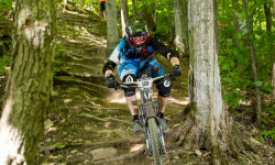
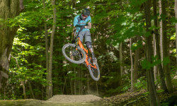
Photos of Grey County Mountain Bike
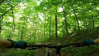
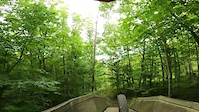
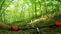
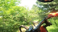
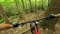
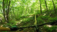
Videos of Grey County Mountain Bike
trail: Fresh
2:33 |
20 |
Aug 16, 2024
trail: Roller Derby
3:14 |
53 |
Aug 15, 2024
trail: Fresh
0:34 |
40 |
Jul 26, 2023
trail: Trail Mix
2:53 |
105 |
Jul 23, 2023
trail: Valley
2:22 |
152 |
Jul 31, 2022
trail: Fresh
2:17 |
45 |
Jul 30, 2022
trail: Happy Valley
0:45 |
29 |
Jul 15, 2022
trail: Trail Mix
0:26 |
61 |
Jul 14, 2022
Recent Trail Reports
Activity Feed
| username | action | type | title | date |
|---|---|---|---|---|
| bikerchick70 | add | report | activity #96954106 | Jun 14, 2026 @ 4:23am Jun 14, 2026 |
| civey | wishlist | route | activity #96864869 and 1 more | Jun 13, 2026 @ 5:16am Jun 13, 2026 |
| Canadmos | update | trail | activity #96798589 | Jun 12, 2026 @ 6:15am Jun 12, 2026 |
| Dpmacdonald | ridden | trail | activity #96566887 | Jun 8, 2026 @ 3:21pm Jun 8, 2026 |
| maryteresa | wishlist | route | activity #96364031 | Jun 6, 2026 @ 6:35am Jun 6, 2026 |
Recent Comments
| username | type | title | comment | date |
|---|---|---|---|---|
| trail | It’s a paved trail running from the... | May 13, 2026 @ 6:42am May 13, 2026 | ||
| report | Chainsaw I think | Apr 27, 2026 @ 5:02am Apr 27, 2026 | ||
| report | Chainsaw or handsaw type job? | Apr 26, 2026 @ 11:41am Apr 26, 2026 | ||
| report | leaf and stick covered needs a clear | Apr 25, 2026 @ 1:53pm Apr 25, 2026 | ||
| trail | Someone has gone through and cleaned it all up. | Jan 21, 2026 @ 11:18am Jan 21, 2026 |
Local Badges
-

10 Green Trails0 awarded -

Top 10 Trails0 awarded -
10 Green Trails0 awarded -
10 Green Trails0 awarded -
10 Green Trails20 awarded -

Epic Ride 50k0 awarded
Bike & Skill Parks
| name | type | city | rating |
|---|---|---|---|
| MotoPark MTB | skill park | Chatsworth | |
| Little Rollers Bicycle Playground | skill park | The Blue Mountains |
Local Products
Local Trail Association
Activity Type Stats
| activitytype | trails | distance | descent | descent distance | total vertical | rating | global rank | state rank | photos | reports | routes | ridelogs |
|---|---|---|---|---|---|---|---|---|---|---|---|---|
| Mountain Bike | 617 | 491 miles | 28,304 ft | 154 miles | 1,217 ft | 2,264 | 5,792 | 56 | 52,013 | |||
| E-Bike | 206 | 201 miles | 11,936 ft | 86 miles | 1,152 ft | 5,322 | 9 | 900 | ||||
| Horse | 62 | 121 miles | 3,586 ft | 50 miles | 1,112 ft | 1,675 | 1 | 14 | ||||
| Hike | 868 | 729 miles | 46,749 ft | 252 miles | 1,217 ft | 172 | 5,742 | 13 | 10,723 | |||
| Trail Running | 853 | 720 miles | 45,614 ft | 248 miles | 1,217 ft | 5,734 | 17 | 4,143 | ||||
| Dirtbike/Moto | 3 | 4,354 ft | 358 ft | 4,094 ft | 561 ft | 1,520 | 45 | |||||
| ATV/ORV/OHV | 7 | 76 miles | 1,483 ft | 36 miles | 955 ft | 1,518 | 20 | |||||
| Snowmobile | 38 | 100 miles | 2,467 ft | 42 miles | 1,152 ft | 179 | 17 | |||||
| Snowshoe | 482 | 389 miles | 29,918 ft | 156 miles | 1,217 ft | 1 | 614 | 9 | 802 | |||
| Downhill Ski | 220 | 68 miles | 65,043 ft | 66 miles | 1,043 ft | 1 | 167 | 12,442 | ||||
| Backcountry Ski | 106 | 62 miles | 10,423 ft | 30 miles | 906 ft | 2 | 895 | 1 | 1,170 | |||
| Nordic Ski | 309 | 278 miles | 12,238 ft | 112 miles | 1,155 ft | 9 | 1,107 | 5 | 2,598 |
Frequently Asked Questions About Grey County
▼
What are the best places to ride in Grey County?
Grey County has 94 areas to explore for mountain biking. The top rated areas are:
▼
What are the highest rated mountain biking trails in Grey County?
The highest rated mountain biking trails in Grey County are:
- Shits & Giggles (Green Trail) (4.4/5)
- Pork Chop (4.4/5)
- Mount Dhaulagiri Loop (4.4/5)
- Paradise Highway Part 3 (4.4/5)
- Cumming Go (4.4/5)
▼
What is the best time of the year to ride in Grey County?
Based on ride log data, the most popular months to ride in Grey County are:
- July (1,652 activities)
- August (1,241 activities)
- June (1,190 activities)
▼
What is the longest trail in Grey County?
The longest trail in Grey County is Georgian Trail, Meaford / Thornbury at 8.3 miles. View all trails sorted by distance.
Activities
- Grey County Mountain Biking Trails
- Grey County E-Biking Trails
- Grey County Horseback Trails
- Grey County Hiking Trails
- Grey County Trail Running Trails
- Grey County ATVing/Offroading Trails
- Grey County Snowmobiling Trails
- Grey County Snowshoeing Trails
- Grey County Skiing Trails
- Grey County Backcountry Skiing Trails
- Grey County Nordic Skiing Trails
Trails
- By markholloway
 Trailforks Map Team & contributors
 - Admins: Canadmos, Grey, jpetznick
- #10055 - 11,933 views
- grey county activity log | embed map of Grey County mountain bike trails | grey county mountain biking points of interest polygons
Downloading of trail gps tracks in kml & gpx formats is enabled for Grey County.
You must login to download files.