close
-
Layers w
- Weather Layers
- Pro
- Pro
- Pro
- Pro
- Pro
- Pro
- More Layers
- Pro
- Pro
- Pro
- Pro
-
Upgrade to

3D
Trail Conditions
- Unknown
- Snow Groomed
- Snow Packed
- Snow Covered
- Snow Cover Partial
- Freeze/thaw Cycle
- Icy
- Prevalent Mud
- Wet
- Variable
- Ideal
- Dry
- Very Dry
Trail Flow (Ridden Direction)
Trailforks scans users ridelogs to determine the most popular direction each trail is ridden. A good flowing trail network will have most trails flowing in a single direction according to their intension.
The colour categories are based on what percentage of riders are riding a trail in its intended direction.
The colour categories are based on what percentage of riders are riding a trail in its intended direction.
- > 96%
- > 90%
- > 80%
- > 70%
- > 50%
- < 50%
- bi-directional trail
- no data
Trail Last Ridden
Trailforks scans ridelogs to determine the last time a trail was ridden.
- < 2 days
- < 1 week
- < 2 weeks
- < 1 month
- < 6 months
- > 6 months
Trail Ridden Direction
The intended direction a trail should be ridden.
- Downhill Only
- Downhill Primary
- Both Directions
- Uphill Primary
- Uphill Only
- One Direction
Contribute Details
Colors indicate trail is missing specified detail.
- Description
- Photos
- Description & Photos
- Videos
Trail Popularity ?
Trailforks scans ridelogs to determine which trails are ridden the most in the last 9 months.
Trails are compared with nearby trails in the same city region with a possible 25 colour shades.
Think of this as a heatmap, more rides = more kinetic energy = warmer colors.
- most popular
- popular
- less popular
- not popular
ATV/ORV/OHV Filter
Max Vehicle Width
inches
US Cell Coverage
Legend

Radar Time
Activity Recordings
Trailforks uses anonymized public activity data.
?
Activity Recordings
Trailforks uses anonymized public activity data.
?
Personal Heatmap
▶
Activity Types
all
/
none
▶
Options
2
Date range
month
–
Winter Trails
Warning
A routing network for winter maps does not exist. Selecting trails using the winter trails layer has been disabled.
Missing Trails
Most Popular
Least Popular
Trails are colored based on popularity. The more popular a trail is, the more red. Less popular trails trend towards green.
Jump Magnitude Heatmap
Heatmap of where riders jump on trails. Zoom in to see individual jumps, click circles to view jump details.
BC Backroad Status
![map legend]()
Service Road Atlas is a free to use, community-driven service for viewing and creating reports on the numerous back-country service roads around B.C. and Alberta.

Slope Aspect
Direction the slope faces
Trails Deemphasized
Trails are shown in grey.
Only show trails with no bike usage.
Suggested Layers
Based on selected activity type
Save the current map location and zoom level as your default home location whenever this page is loaded.
SaveGriffith is a major regional city in the Murrumbidgee Irrigation Area that is located in the north-western part of the Riverina region of New South Wales, known commonly as the food bowl of Australia. It is also the seat of the City of Griffith local government area. Like the Australian capital, Canberra, and the nearby town of Leeton, Griffith was designed by Walter Burley Griffin and Marion Mahony Griffin.[4] Griffith was named after Arthur Hill Griffith, the first New South Wales Minister of Public Works. Griffith was proclaimed a city in 1987, and had a population of 20,251 in June 2018.
It can be accessed by road from Sydney and Canberra via the Hume Highway and the Burley Griffin Way and from Melbourne, Victoria, via the Newell Highway and either by using the Kidman Way or the Irrigation Way. Griffith can be accessed from other places like Adelaide, Orange, and Bathurst through the Mid-Western Highway and the Rankins Springs road from Rankins Springs and the Kidman Way from Goolgowi.
It can be accessed by road from Sydney and Canberra via the Hume Highway and the Burley Griffin Way and from Melbourne, Victoria, via the Newell Highway and either by using the Kidman Way or the Irrigation Way. Griffith can be accessed from other places like Adelaide, Orange, and Bathurst through the Mid-Western Highway and the Rankins Springs road from Rankins Springs and the Kidman Way from Goolgowi.
Links
Activities Click to view
- Mountain Bike
213 trails
- E-Bike
216 trails
- Adaptive Bike
0 trails
- Horse
4 trails
- Hike
209 trails
- Trail Running
209 trails
- Dirtbike/Moto
17 trails
- Observed Trials
8 trails
- ATV/ORV/OHV
8 trails
Region Details
- 43
- 7
- 88
- 43
- 19
- 1
Region Status
Open as of Sep 17, 2025Stats
- Avg Trail Rating
- Trails (view details)
- 201
- Trails Mountain Bike
- 213
- Trails E-Bike
- 216
- Trails Gravel Bike
- 2
- Trails Horse
- 4
- Trails Hike
- 209
- Trails Trail Running
- 209
- Trails Dirtbike/Moto
- 17
- Trails Observed Trials
- 8
- Trails ATV/ORV/OHV
- 8
- Total Distance
- 45 miles
- Total Descent Distance
- 22 miles
- Total Descent
- 4,387 ft
- Total Vertical
- 230 ft
- Highest Trailhead
- 642 ft
- Reports
- 86
- Photos
- 24
- Ridden Counter
- 3,281
Sub Regions
-
Cocoparra National Park
-
Griffith Mountain Bike Park
- 5
- 4
- 2
-
Scenic Hill
- 7
- 75
- 35
- 15
- 1
-
Tharbogang Hill
Popular Griffith Mountain Biking Trails
• 100 ★ 4.0 • 1,247 ft • 32 ft • 84 •
An easy singletrack travelling through grasslands. Gradient is almost level and the trail is free of prominent rocks and hazards.
• 95 ★ 0.0 • 755 ft • 3 ft • 47 •
Trail follows a well worn and reasonably wide path towards the edge of the escarpment. The surface is quite smooth but leads to 3 more challenging trails. The easiest exits from this trail are at the southern end, with running both...
• 90 ★ 0.0 • 722 ft • 14 ft • 42 •
Trail shortcuts a corner of 19. Heading south west, the trail has a significant and somewhat rocky rise that can be challenging to ascend, requiring either an approach with plenty of momentum or very deft riding at low speed. In the...
• 95 ★ 0.0 • 1,086 ft • 0 ft • 40 •
Trail descends with a moderate grade to the north. Trail is showing some signs of erosion from use and now has loose rocks in sections. There are a few small bare rock sections that drop down into gravel. Most turns are bermed through...
• 95 ★ 5.0 • 4,721 ft • 87 ft • 40 •
Trail is generally fast flowing, but does present the occasional rocky outcrop. Mid trail, there is a substantial rock garden (and an alternate line that is also a rock garden of similar difficulty) that may require care when riding...
• 75 ★ 0.0 • 1,736 ft • 0 ft • 40 •
Popular blue difficulty singletrack. This multi-use trail can be used both directions and has a moderate overall physical rating with a 0 ft blue climb. Trail visibility is always easy to follow. On average it takes 1 minutes to complete this trail.
• 70 ★ 0.0 • 627 ft • 0 ft • 40 •
The initial part of the descent (heading east) is somewhat steep and has a few rock steps. The remainder of the trail is more manageable, though still loose from rocks.
• 90 ★ 0.0 • 1,411 ft • 0 ft • 39 •
is a link between and the Apex lookout. The trail has a moderate to easy gradient when climbing to the west. The trail is rocky and occasionally loose, with a few sections that are moderately challenging when taken at speed, typically...
Griffith Mountain Bike Routes
3 miles • 162 ft • 3 • Loop • Race •
Feral Joggers Be Social 4.1km Route 2. Used during summer social series, shorter route used on warmer days.
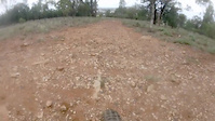
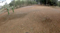
Photos of Griffith Mountain Bike
Videos of Griffith Mountain Bike
trail: Cranky Monkey
5:43 |
157 |
May 31, 2020
0:52 |
58 |
May 30, 2020
trail: Mallinson Descent - Top Half
0:52 |
43 |
May 30, 2020

trail: Blue Monday
0:53 |
55 |
May 25, 2020
trail: Don't Look Down
0:54 |
148 |
May 25, 2020
trail: Blue Monday
0:21 |
57 |
Apr 6, 2020
trail: Brown Undies
0:50 |
158 |
Feb 26, 2020
trail: Feral Fellas
0:06 |
48 |
Jan 20, 2020
Recent Trail Reports
| status | trail | date | condition | info | user |
|---|---|---|---|---|---|
| BC Drop | Sep 18, 2025 @ 4:46pm (Australia/Sydney) Sep 17, 2025 | Unknown | scottydwrx GMBA | ||
| Rodeo 4x4 | Aug 28, 2025 @ 4:25pm Aug 28, 2025 | Unknown | scottydwrx GMBA | ||
| The Cure | May 24, 2025 @ 12:58am May 24, 2025 | Unknown | scottydwrx GMBA | ||
| Cut To Coaster | Apr 4, 2025 @ 5:33pm Apr 4, 2025 | Ideal | scottydwrx GMBA | ||
| Ridgeback | Mar 9, 2025 @ 4:05am Mar 9, 2025 | Dry | scottydwrx GMBA | ||
| Eastern Ridge | Mar 9, 2025 @ 4:01am Mar 9, 2025 | Unknown | scottydwrx GMBA | ||
| Chute The Moon | Feb 14, 2025 @ 7:16pm Feb 14, 2025 | Unknown | scottydwrx GMBA | ||
| Stairway To Hell | Jan 27, 2025 @ 4:30pm Jan 27, 2025 | Unknown | scottydwrx GMBA | ||
| Corkscrew | Jan 24, 2025 @ 4:49pm Jan 24, 2025 | Unknown | scottydwrx GMBA | ||
| Trident Left | Jan 1, 2025 @ 9:12am Jan 1, 2025 | Dry | scottydwrx GMBA |
Activity Feed
| username | action | type | title | date |
|---|---|---|---|---|
| scottydwrx | add | trail | activity #96594273 | Jun 9, 2026 @ 3:39am Jun 9, 2026 |
| scottydwrx | update | trail | activity #96594095 | Jun 9, 2026 @ 3:33am Jun 9, 2026 |
| scottydwrx | add | poi | activity #93327831 and 1 more | Apr 24, 2026 @ 10:00pm Apr 24, 2026 |
| scottydwrx | add | trail | activity #93327494 and 1 more | Apr 24, 2026 @ 9:41pm Apr 24, 2026 |
| scottydwrx | update | trail | activity #92633566 and 1 more | Apr 14, 2026 @ 5:56pm Apr 14, 2026 |
Recent Comments
| username | type | title | comment | date |
|---|---|---|---|---|
| trail | Not really rideable, there is a narrow section... | Dec 31, 2024 @ 11:39pm Dec 31, 2024 | ||
| trail | Nice little tabletop jump loop with a wall... | Oct 16, 2024 @ 10:34pm Oct 16, 2024 | ||
| trail | Need | Jun 19, 2024 @ 11:24pm Jun 19, 2024 | ||
| report | The ?????? Should have meant "Thumbs Up" | Mar 18, 2020 @ 11:45am Mar 18, 2020 |
Local Badges
-

Completionist0 awarded -

Epic Mountain Bike Climb 2k0 awarded -

Climbing 10k Badge6 awarded -

Mountain Biking 100k Badge1 awarded -

Epic Ride Descent 2k0 awarded -

Descent 10k Badge6 awarded
Bike & Skill Parks
| name | type | city | rating |
|---|---|---|---|
| Griffith Pump Track | skill park | Griffith |
Activity Type Stats
| activitytype | trails | distance | descent | descent distance | total vertical | rating | global rank | state rank | photos | reports | routes | ridelogs |
|---|---|---|---|---|---|---|---|---|---|---|---|---|
| Mountain Bike | 213 | 45 miles | 4,386 ft | 22 miles | 230 ft | #1,822 | #90 | 24 | 85 | 1 | 4,524 | |
| E-Bike | 216 | 10 miles | 656 ft | 4 miles | 223 ft | #2,304 | #112 | 55 | 1 | 137 | ||
| Gravel Bike | 2 | #5,449 | #175 | |||||||||
| Horse | 4 | 9 miles | 574 ft | 3 miles | 217 ft | #1,306 | #57 | 2 | 1 | |||
| Hike | 209 | 40 miles | 3,740 ft | 20 miles | 230 ft | #2,899 | #84 | 79 | 1 | 61 | ||
| Trail Running | 209 | 40 miles | 3,740 ft | 20 miles | 230 ft | #2,412 | #67 | 78 | 15 | 182 | ||
| Dirtbike/Moto | 17 | 9 miles | 640 ft | 4 miles | 217 ft | #634 | #32 | 4 | 1 | 3 | ||
| Observed Trials | 8 | 5 miles | 197 ft | 1 mile | 190 ft | #97 | #3 | 1 | ||||
| ATV/ORV/OHV | 8 | 7 miles | 328 ft | 2 miles | 217 ft | #363 | #19 | 2 |
Frequently Asked Questions About Griffith
▼
What are the best places to ride in Griffith?
Griffith has 4 areas to explore for mountain biking. The top rated areas are:
▼
What are the highest rated mountain biking trails in Griffith?
The highest rated mountain biking trails in Griffith are:
- Eagle (4.1/5)
- Duck (4.1/5)
- Secret Passage (4.1/5)
- The Landing Strip (4.1/5)
- Over The Hill (4.1/5)
▼
What is the best time of the year to ride in Griffith?
Based on ride log data, the most popular months to ride in Griffith are:
- April (34 activities)
- September (33 activities)
- July (31 activities)
▼
Where can I park to ride in Griffith?
There are 6 parking locations listed in Griffith. The most popular parking spots are:
- Hermits Cave Carpark
- Pioneer Park Carpark
- Griffith MTB Track Parking
- Water Tower Parking
- Lawford Lookout Parking
Activities
Trails
Points of Interest
- By Edgecrusher13 & contributors
- Admins: stuartrichardson, GMBA
- #32968 - 8,373 views
- griffith activity log | embed map of Griffith mountain bike trails | griffith mountain biking points of interest
Downloading of trail gps tracks in kml & gpx formats is enabled for Griffith.
You must login to download files.