close
-
Layers w
- Weather Layers
- Pro
- Pro
- Pro
- Pro
- Pro
- Pro
- More Layers
- Pro
- Pro
- Pro
- Pro
-
Upgrade to

3D
Trail Conditions
- Unknown
- Snow Groomed
- Snow Packed
- Snow Covered
- Snow Cover Partial
- Freeze/thaw Cycle
- Icy
- Prevalent Mud
- Wet
- Variable
- Ideal
- Dry
- Very Dry
Trail Flow (Ridden Direction)
Trailforks scans users ridelogs to determine the most popular direction each trail is ridden. A good flowing trail network will have most trails flowing in a single direction according to their intension.
The colour categories are based on what percentage of riders are riding a trail in its intended direction.
The colour categories are based on what percentage of riders are riding a trail in its intended direction.
- > 96%
- > 90%
- > 80%
- > 70%
- > 50%
- < 50%
- bi-directional trail
- no data
Trail Last Ridden
Trailforks scans ridelogs to determine the last time a trail was ridden.
- < 2 days
- < 1 week
- < 2 weeks
- < 1 month
- < 6 months
- > 6 months
Trail Ridden Direction
The intended direction a trail should be ridden.
- Downhill Only
- Downhill Primary
- Both Directions
- Uphill Primary
- Uphill Only
- One Direction
Contribute Details
Colors indicate trail is missing specified detail.
- Description
- Photos
- Description & Photos
- Videos
Trail Popularity ?
Trailforks scans ridelogs to determine which trails are ridden the most in the last 9 months.
Trails are compared with nearby trails in the same city region with a possible 25 colour shades.
Think of this as a heatmap, more rides = more kinetic energy = warmer colors.
- most popular
- popular
- less popular
- not popular
ATV/ORV/OHV Filter
Max Vehicle Width
inches
US Cell Coverage
Legend

Radar Time
Activity Recordings
Trailforks uses anonymized public activity data.
?
Activity Recordings
Trailforks uses anonymized public activity data.
?
Personal Heatmap
▶
Activity Types
all
/
none
▶
Options
2
Date range
month
–
Winter Trails
Warning
A routing network for winter maps does not exist. Selecting trails using the winter trails layer has been disabled.
Missing Trails
Most Popular
Least Popular
Trails are colored based on popularity. The more popular a trail is, the more red. Less popular trails trend towards green.
Jump Magnitude Heatmap
Heatmap of where riders jump on trails. Zoom in to see individual jumps, click circles to view jump details.
BC Backroad Status
![map legend]()
Service Road Atlas is a free to use, community-driven service for viewing and creating reports on the numerous back-country service roads around B.C. and Alberta.

Slope Aspect
Direction the slope faces
Trails Deemphasized
Trails are shown in grey.
Only show trails with no bike usage.
Suggested Layers
Based on selected activity type
Save the current map location and zoom level as your default home location whenever this page is loaded.
Save
No description for Groningen has been added yet!
Login or register to submit one.
Activities Click to view
- Mountain Bike
14 trails
- E-Bike
11 trails
- Adaptive Bike
0 trails
- Winter Fat Bike
0 trails
- Hike
4 trails
- Trail Running
3 trails
Region Details
- 4
- 3
- 6
- 1
Region Status
Caution as of Mar 24, 2026Stats
- Avg Trail Rating
- Trails (view details)
- 14
- Trails Mountain Bike
- 14
- Trails E-Bike
- 11
- Trails Hike
- 4
- Trails Trail Running
- 3
- Total Distance
- 1 mile
- Total Descent Distance
- 3,369 ft
- Total Descent
- 177 ft
- Total Vertical
- 49 ft
- Highest Trailhead
- 49 ft
- Reports
- 24
- Photos
- 3
- Ridden Counter
- 324
Articles
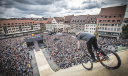
Red Bull District Ride Returns in 2026 with New Location & Expanded Format
Jan 28, 2026 from pinkbike.com
The Diamond-level slopestyle event will make its Dutch debut in Groningen on July 24–25, with a women’s category added for the first time.
Sub Regions
-
Bikepark Groningen
- 1
- 1
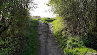
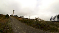
Popular Groningen Mountain Biking Trails
• 95 ★ 5.0 • 942 ft • 0 ft • 32 •
Easy flowy freeride track made on an old fourcross track, all obstacles have a chickenway avaailable.
• 40 ★ 5.0 • 266 ft • 0 ft • 25 •
Difficult enduro trail with roots, artificial whoops and a steep section with a steepness of 115%.
• 25 ★ 5.0 • 394 ft • 0 ft • 15 •
Skinny singletrack through forest with an optional log drop.
• 65 ★ 5.0 • 581 ft • 0 ft • 13 •
Easy Enduro trail, great for all types of mountain bikes. The drop is rollable.
• 60 ★ 0.0 • 486 ft • 0 ft • 12 •
Easy trail with optional jump & drop. Good for XC & Enduro riders.
Groningen Mountain Bike Routes
32 miles • 279 ft • 0 •
Vanaf Grijpskerk richting Zoutkamp naar de zeedijk bij de Waddenzee, om vandaar uit via Leens weer terug...
35 miles • 221 ft • 0 •
Fietstocht gecombineerd Groningerlandschap en noord Drenthe
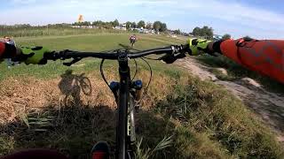
Videos of Groningen Mountain Bike
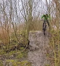
trail: Handyman Trail
0:09 |
64 |
Apr 21, 2020
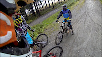
trail: 4X/Freeride
0:09 |
157 |
Oct 28, 2019
trail: Downhill
2:51 |
421 |
Oct 8, 2013
trail: Downhill
0:14 |
145 |
Oct 7, 2013
trail: Jumpline
0:21 |
291 |
Oct 16, 2019 , Groningen
Recent Trail Reports
| status | trail | date | condition | info | user |
|---|---|---|---|---|---|
| Bpg access road #1 | Aug 13, 2025 @ 5:27am Aug 13, 2025 | Dry | GelukMTB | ||
| 4X/Freeride | Aug 13, 2025 @ 5:26am Aug 13, 2025 | Dry | GelukMTB | ||
| Downhill | Mar 31, 2020 @ 1:31pm Mar 31, 2020 | Variable | FilipCernak | ||
| Mosquito trail | Nov 17, 2019 @ 7:47am Nov 17, 2019 | Wet | FilipCernak |
Activity Feed
| username | action | type | title | date |
|---|---|---|---|---|
| RoyRovers | ridden | trail | activity #95475005 | May 25, 2026 @ 3:28am May 25, 2026 |
| trailforks | add | article_links | activity #87972662 | Jan 28, 2026 @ 8:02pm Jan 28, 2026 |
| GelukMTB | checkin | trail | activity #78033510 and 1 more | Aug 13, 2025 @ 5:26am Aug 13, 2025 |
| GelukMTB | ridden | trail | activity #78033509 and 1 more | Aug 13, 2025 @ 5:26am Aug 13, 2025 |
| GelukMTB | add | report | activity #78033508 and 1 more | Aug 13, 2025 @ 5:26am Aug 13, 2025 |
Local Badges
-

Epic Mountain Bike Climb 2k0 awarded -

Climbing 10k Badge12 awarded -

Mountain Biking 100k Badge0 awarded -

Epic Ride Descent 2k0 awarded -

Descent 10k Badge12 awarded -

Descent 100k Badge0 awarded
Bike & Skill Parks
| name | type | city | rating |
|---|---|---|---|
| Bikepark Groningen | skill park | Groningen |
Activity Type Stats
| activitytype | trails | distance | descent | descent distance | total vertical | rating | global rank | state rank | photos | reports | routes | ridelogs |
|---|---|---|---|---|---|---|---|---|---|---|---|---|
| Mountain Bike | 14 | 1 mile | 177 ft | 3,369 ft | 49 ft | #3,231 | #29 | 3 | 23 | 3 | 8,504 | |
| E-Bike | 11 | 1 mile | 161 ft | 3,061 ft | 49 ft | #1,738 | #14 | 21 | 1 | 108 | ||
| Hike | 4 | 2,710 ft | 3 ft | 102 ft | 39 ft | #2,887 | #27 | 17 | 228 | |||
| Trail Running | 3 | 2,602 ft | 59 ft | 39 ft | #2,391 | #28 | 17 | 29 |
Frequently Asked Questions About Groningen
▼
What are the best places to ride in Groningen?
Groningen has 1 areas to explore for mountain biking. The top rated areas are:
▼
What are the highest rated mountain biking trails in Groningen?
The highest rated mountain biking trails in Groningen are:
- Right Enduro Trail (4.1/5)
- 4X/Freeride (4.1/5)
- Handyman Trail (4.1/5)
- Mosquito trail (4.1/5)
- Downhill (0/5)
▼
What is the best time of the year to ride in Groningen?
Based on ride log data, the most popular months to ride in Groningen are:
- October (30 activities)
- September (27 activities)
- November (21 activities)
▼
Where can I park to ride in Groningen?
Check the Groningen trail map for trailhead and parking information. Community members regularly update access and parking details for trails in the area.
- By schralpcc & contributors
- Admins: apply
- #5192 - 3,943 views
- groningen activity log | embed map of Groningen mountain bike trails |
Downloading of trail gps tracks in kml & gpx formats is enabled for Groningen.
You must login to download files.