close
-
Layers w
- Weather Layers
- Pro
- Pro
- Pro
- Pro
- Pro
- Pro
- More Layers
- Pro
- Pro
- Pro
- Pro
-
Upgrade to

3D
Trail Conditions
- Unknown
- Snow Groomed
- Snow Packed
- Snow Covered
- Snow Cover Partial
- Freeze/thaw Cycle
- Icy
- Prevalent Mud
- Wet
- Variable
- Ideal
- Dry
- Very Dry
Trail Flow (Ridden Direction)
Trailforks scans users ridelogs to determine the most popular direction each trail is ridden. A good flowing trail network will have most trails flowing in a single direction according to their intension.
The colour categories are based on what percentage of riders are riding a trail in its intended direction.
The colour categories are based on what percentage of riders are riding a trail in its intended direction.
- > 96%
- > 90%
- > 80%
- > 70%
- > 50%
- < 50%
- bi-directional trail
- no data
Trail Last Ridden
Trailforks scans ridelogs to determine the last time a trail was ridden.
- < 2 days
- < 1 week
- < 2 weeks
- < 1 month
- < 6 months
- > 6 months
Trail Ridden Direction
The intended direction a trail should be ridden.
- Downhill Only
- Downhill Primary
- Both Directions
- Uphill Primary
- Uphill Only
- One Direction
Contribute Details
Colors indicate trail is missing specified detail.
- Description
- Photos
- Description & Photos
- Videos
Trail Popularity ?
Trailforks scans ridelogs to determine which trails are ridden the most in the last 9 months.
Trails are compared with nearby trails in the same city region with a possible 25 colour shades.
Think of this as a heatmap, more rides = more kinetic energy = warmer colors.
- most popular
- popular
- less popular
- not popular
ATV/ORV/OHV Filter
Max Vehicle Width
inches
US Cell Coverage
Legend

Radar Time
Activity Recordings
Trailforks uses anonymized public activity data.
?
Activity Recordings
Trailforks uses anonymized public activity data.
?
Personal Heatmap
▶
Activity Types
all
/
none
▶
Options
2
Date range
month
–
Winter Trails
Warning
A routing network for winter maps does not exist. Selecting trails using the winter trails layer has been disabled.
Missing Trails
Most Popular
Least Popular
Trails are colored based on popularity. The more popular a trail is, the more red. Less popular trails trend towards green.
Jump Magnitude Heatmap
Heatmap of where riders jump on trails. Zoom in to see individual jumps, click circles to view jump details.
BC Backroad Status
![map legend]()
Service Road Atlas is a free to use, community-driven service for viewing and creating reports on the numerous back-country service roads around B.C. and Alberta.

Slope Aspect
Direction the slope faces
Trails Deemphasized
Trails are shown in grey.
Only show trails with no bike usage.
Suggested Layers
Based on selected activity type
Save the current map location and zoom level as your default home location whenever this page is loaded.
Save
No description for Gruyères has been added yet!
Login or register to submit one.
This region uses the Uk/Euro style trail grading system.
Activities Click to view
- Mountain Bike
13 trails
- E-Bike
12 trails
- Hike
10 trails
- Trail Running
10 trails
Region Details
- 5
- 6
- 2
Region Status
Open as of May 31, 2026Stats
- Avg Trail Rating
- Trails (view details)
- 14
- Trails Mountain Bike
- 13
- Trails E-Bike
- 12
- Trails Hike
- 10
- Trails Trail Running
- 10
- Total Distance
- 15 miles
- Total Descent Distance
- 10 miles
- Total Descent
- 7,967 ft
- Total Vertical
- 3,228 ft
- Highest Trailhead
- 5,450 ft
- Reports
- 40
- Photos
- 4
- Ridden Counter
- 515
Sub Regions
-
Moleson Bike Park
- 2
- 2
Popular Gruyères Mountain Biking Trails
• 40 ★ 5.0 • 1,834 ft • 0 ft • 49 •
Moderately popular red difficulty singletrack. This mountain bike primary trail and has a moderate overall physical rating. It features drop, jump and gap jump. Trail visibility is always easy to follow.
• 60 ★ 4.0 • 2,241 ft • 9 ft • 48 •
Moderately popular red difficulty singletrack. This mountain bike primary trail and has a moderate overall physical rating. Trail visibility is always easy to follow.
• 70 ★ 3.8 • 3 miles • 252 ft • 21 •
The first part is veary rocky and loose. Once you enter the forest, it is more wide open but a bit wett.
• 90 ★ 0.0 • 2,169 ft • 5 ft • 18 • • hike
Popular green difficulty singletrack. This hike primary trail.
• 100 ★ 0.0 • 2 miles • 82 ft • 10 • • hike
Popular green difficulty singletrack. This hike primary trail can be used both directions.
• 60 ★ 0.0 • 1,234 ft • 30 ft • 8 • • hike
Moderately popular blue difficulty singletrack. This hike primary trail can be used both directions.
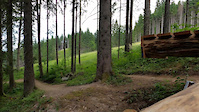
Videos of Gruyères Mountain Bike
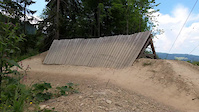
trail: Modzon Flow
0:07 |
70 |
Jun 30, 2025
trail: TchéDon - 2nd part
0:07 |
85 |
Jun 30, 2025

trail: Modzon Flow
7:03 |
217 |
Oct 31, 2024 , Gruyères
Recent Trail Reports
| status | trail | date | condition | info | user |
|---|---|---|---|---|---|
| Poya Flow Trail | May 31, 2026 @ 2:04pm (Europe/Zurich) May 31, 2026 | Very Dry | mouchsi | ||
| Rétour > Moleson Village | May 31, 2026 @ 2:04pm (Europe/Zurich) May 31, 2026 | Very Dry | mouchsi | ||
| TchéDon - 2nd part | May 31, 2026 @ 2:04pm (Europe/Zurich) May 31, 2026 | Very Dry | mouchsi | ||
| Modzon Flow | May 31, 2026 @ 2:04pm (Europe/Zurich) May 31, 2026 | Very Dry | mouchsi | ||
| TchéDon - 1st part | May 31, 2026 @ 2:04pm (Europe/Zurich) May 31, 2026 | Very Dry | mouchsi | ||
| Col des Combes | Apr 6, 2025 @ 3:22am Apr 6, 2025 | Ideal | joe27a | ||
| Energias De Panticosa Superior | Dec 10, 2024 @ 3:01am Dec 10, 2024 | Snow Covered | Limoneras TFSPAIN | ||
| Broc | Jun 16, 2024 @ 3:39am Jun 16, 2024 | Variable | Giuze |
Activity Feed
| username | action | type | title | date |
|---|---|---|---|---|
| KeName | wishlist | trail | activity #97050645 and 1 more | Jun 15, 2026 @ 10:22am Jun 15, 2026 |
| 4000 | ridden | trail | activity #96888588 | Jun 13, 2026 @ 9:39am Jun 13, 2026 |
| mouchsi | add | report | activity #95928028 | May 31, 2026 @ 5:05am May 31, 2026 |
| mouchsi | add | report | activity #95928027 and 4 more | May 31, 2026 @ 5:05am May 31, 2026 |
| RPs7JHI | ridden | trail | activity #94361213 | May 9, 2026 @ 11:12am May 9, 2026 |
Local Badges
-

Epic Mountain Bike Climb 2k0 awarded -

Climbing 10k Badge0 awarded -

Mountain Biking 100k Badge0 awarded -

Epic Ride Descent 2k0 awarded -

Descent 10k Badge0 awarded -

Descent 100k Badge0 awarded
Bike & Skill Parks
| name | type | city | rating |
|---|---|---|---|
| Moleson Bike Park | bike park | Gruyères | |
| Pumptrack Charmey | skill park | Gruyères |
Activity Type Stats
| activitytype | trails | distance | descent | descent distance | total vertical | rating | global rank | state rank | photos | reports | routes | ridelogs |
|---|---|---|---|---|---|---|---|---|---|---|---|---|
| Mountain Bike | 13 | 14 miles | 7,858 ft | 10 miles | 3,228 ft | #7,278 | #208 | 4 | 40 | 849 | ||
| E-Bike | 12 | 12 miles | 7,041 ft | 8 miles | 3,228 ft | #3,841 | #157 | 40 | 110 | |||
| Hike | 10 | 11 miles | 5,994 ft | 6 miles | 3,228 ft | #5,453 | #135 | 34 | 211 | |||
| Trail Running | 10 | 11 miles | 5,994 ft | 6 miles | 3,228 ft | #5,248 | #127 | 34 | 36 |
Frequently Asked Questions About Gruyères
▼
What are the best places to ride in Gruyères?
Gruyères has 1 areas to explore for mountain biking. The top rated areas are:
▼
What are the highest rated mountain biking trails in Gruyères?
The highest rated mountain biking trails in Gruyères are:
- Modzon Flow (4.4/5)
- Poya Flow Trail (4.2/5)
- TchéDon - 2nd part (4.1/5)
- TchéDon - 1st part (4/5)
- Col des Combes (3.9/5)
▼
What is the best time of the year to ride in Gruyères?
Based on ride log data, the most popular months to ride in Gruyères are:
- August (7 activities)
- September (7 activities)
- June (4 activities)
▼
Where can I park to ride in Gruyères?
There are 1 parking locations listed in Gruyères. The most popular parking spots are:
Activities
Trails
Points of Interest
- By inversedotch
 & contributors
 - Admins: apply
- #38754 - 879 views
- gruyères activity log | embed map of Gruyères mountain bike trails | gruyères mountain biking points of interest
Downloading of trail gps tracks in kml & gpx formats is enabled for Gruyères.
You must login to download files.