close
-
Layers w
- Weather Layers
- Pro
- Pro
- Pro
- Pro
- Pro
- Pro
- More Layers
- Pro
- Pro
- Pro
- Pro
-
Upgrade to

3D
Trail Conditions
- Unknown
- Snow Groomed
- Snow Packed
- Snow Covered
- Snow Cover Partial
- Freeze/thaw Cycle
- Icy
- Prevalent Mud
- Wet
- Variable
- Ideal
- Dry
- Very Dry
Trail Flow (Ridden Direction)
Trailforks scans users ridelogs to determine the most popular direction each trail is ridden. A good flowing trail network will have most trails flowing in a single direction according to their intension.
The colour categories are based on what percentage of riders are riding a trail in its intended direction.
The colour categories are based on what percentage of riders are riding a trail in its intended direction.
- > 96%
- > 90%
- > 80%
- > 70%
- > 50%
- < 50%
- bi-directional trail
- no data
Trail Last Ridden
Trailforks scans ridelogs to determine the last time a trail was ridden.
- < 2 days
- < 1 week
- < 2 weeks
- < 1 month
- < 6 months
- > 6 months
Trail Ridden Direction
The intended direction a trail should be ridden.
- Downhill Only
- Downhill Primary
- Both Directions
- Uphill Primary
- Uphill Only
- One Direction
Contribute Details
Colors indicate trail is missing specified detail.
- Description
- Photos
- Description & Photos
- Videos
Trail Popularity ?
Trailforks scans ridelogs to determine which trails are ridden the most in the last 9 months.
Trails are compared with nearby trails in the same city region with a possible 25 colour shades.
Think of this as a heatmap, more rides = more kinetic energy = warmer colors.
- most popular
- popular
- less popular
- not popular
ATV/ORV/OHV Filter
Max Vehicle Width
inches
US Cell Coverage
Legend

Radar Time
Activity Recordings
Trailforks uses anonymized public activity data.
?
Activity Recordings
Trailforks uses anonymized public activity data.
?
Personal Heatmap
▶
Activity Types
all
/
none
▶
Options
2
Date range
month
–
Winter Trails
Warning
A routing network for winter maps does not exist. Selecting trails using the winter trails layer has been disabled.
Missing Trails
Most Popular
Least Popular
Trails are colored based on popularity. The more popular a trail is, the more red. Less popular trails trend towards green.
Jump Magnitude Heatmap
Heatmap of where riders jump on trails. Zoom in to see individual jumps, click circles to view jump details.
BC Backroad Status
![map legend]()
Service Road Atlas is a free to use, community-driven service for viewing and creating reports on the numerous back-country service roads around B.C. and Alberta.

Slope Aspect
Direction the slope faces
Trails Deemphasized
Trails are shown in grey.
Only show trails with no bike usage.
Suggested Layers
Based on selected activity type
Save the current map location and zoom level as your default home location whenever this page is loaded.
SaveGuatemala is a beautiful country, between the Atlantic and the Pacific oceans, many different types of geography and with a weather that makes Guatemala the "Land of the eternal Spring".
Links
Region Details
- 6
- 6
- 15
- 8
- 1
Stats
- Avg Trail Rating
- Trails (view details)
- 37
- Trails Mountain Bike
- 37
- Trails E-Bike
- 7
- Trails Hike
- 110
- Trails Trail Running
- 111
- Total Distance
- 43 miles
- Total Descent
- 27,356 ft
- Total Vertical
- 11,598 ft
- Highest Trailhead
- 12,891 ft
- Reports
- 41
- Photos
- 9
- Ridden Counter
- 1,257
Popular Trail Networks
view all areas »Sub Regions
- Alta Verapaz (0)
- Baja Verapaz (0)
- Chiquimula (0)
- El Progreso (1)
- Morazán (1)
- Morazán (1)
- Escuintla (0)
- Huehuetenango (8)
- Huehuetenango (8)
- Cerro Negro (7)
- Huehuetenango (8)
- Izabal (0)
- Jutiapa (0)
- Petén (0)
- Quetzaltenango (1)
- Quetzaltenango (1)
- Quetzaltenango (1)
- Retalhuleu (0)
- Sacatepequez (1)
- San Marcos (0)
- Santa Rosa (0)
- Sololá (2)
- Panajachel (2)
- Panajachel (2)
- Suchitepéquez (0)
- Totonicapán (0)
- Zacapa (0)
- Antigua (3)
- Guatemala City (21)
- El socorro Bike Park (1)
- El Zur (2)
- Las Nubes (6)
- San Aguistin Bike Park (0)
- San Agustín Bike Park (5)
- Santa Rosalia (2)
- Tecpán (0)
Popular Guatemala Mountain Biking Trails
• 100 ★ 0.0 • 2 miles • 496 ft • 42 •
Start at the Mendez Montenegro Lookout near Godinez and end up in Santa Catarina Palopo. Great trail with scenic vistas of the lake and nice technical sections. Stone steps going through the narrow streets of Santa Catarinal
• 85 ★ 5.0 • 2 miles • 107 ft • 32 •
Flow, as the name states, is a single track that provides a real "state of " ride, many features along the ride such as big table tops, step ups, step downs, rhythm sections make you just want more of it, you will want to ride it over...
• 90 ★ 5.0 • 1,581 ft • 0 ft • 29 •
Short (but not so much) and intense dual slalom track with some doubles, nice curves, challenging berms that challenge you as well to ride by your own at your best, or alongside your riding partner, but watch out for them not to...
• 80 ★ 0.0 • 2 miles • 1,494 ft • 17 •
If you like to go up, this is a trail fro you, just watch out, there are runners in the way (rarely).
• 50 ★ 0.0 • 4,009 ft • 66 ft • 10 •
Vereda de acceso de la finca el Recreo (Rancho Verde) a Fraijanes, Es un camino de aproximadamente 2m de ancho. en Invierno suele formarse sanjas en algunos tramos del recorrido, es común encontrarse peatones caminando, por lo que se...
• 5 ★ 5.0 • 2,852 ft • 20 ft • 10 •
bajada rápida con peraltes, con un pequeño drop con raíces al final
• 5 ★ 0.0 • 630 ft • 0 ft • 8 •
short DH, with some roots, some technical parts, but still flowy and fast
Guatemala Mountain Bike Routes
41 miles • 2,123 ft • 0 • Point to Point •
Travesía Río Dulce a Punta de Palma
16 miles • 2,214 ft • 0 • Loop •
Se sube por un pavimento de 9km mas o menos y luego se toma terraceria para llegar a una vereda
21 miles • 2,214 ft • 0 • Point to Point •
the route of the volcanos, one of the best route of Escuintla, Guatemala for MTB
37 miles • 3,232 ft • 0 • Loop •
Explorando nueva ruta MTB en Escuintla hacia Guanagazapa full montaña
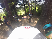
Photos of Guatemala Mountain Bike
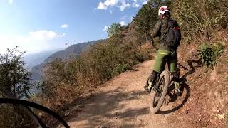
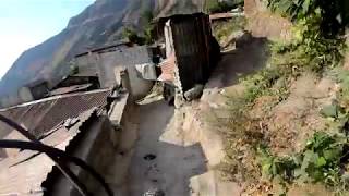
Videos of Guatemala Mountain Bike
trail: La Pinada
5:14 |
179 |
Jun 23, 2015

trail: Anaconda
4:15 |
675 |
Jun 24, 2019 , Guatemala City
trail: Santa Cat
702 |
Apr 1, 2018 , Panajachel
trail: La Culebra
5:01 |
832 |
Apr 1, 2018 , Panajachel
Recent Comments
| username | type | title | comment | date |
|---|---|---|---|---|
| trail | 50q now for entry | Mar 2, 2020 @ 12:26pm Mar 2, 2020 | ||
| trail | Great trail! I did it a few years ago and it... | Nov 22, 2015 @ 12:10pm Nov 22, 2015 |
Bike & Skill Parks
| name | type | city | rating |
|---|---|---|---|
| El socorro Bike Park | bike park | Guatemala City | |
| San Aguistin Bike Park | bike park | Guatemala City |
Activity Type Stats
| activitytype | trails | distance | descent | descent distance | total vertical | rating | global rank | state rank | photos | reports | routes | ridelogs |
|---|---|---|---|---|---|---|---|---|---|---|---|---|
| Mountain Bike | 37 | 43 miles | 27,346 ft | 28 miles | 11,598 ft | #98 | 9 | 41 | 5 | 17,450 | ||
| E-Bike | 7 | 8 miles | 6,972 ft | 6 miles | 8,133 ft | #89 | 37 | 4 | 875 | |||
| Hike | 110 | 40 miles | 24,875 ft | 26 miles | 11,598 ft | #78 | 40 | 1,952 | ||||
| Trail Running | 111 | 40 miles | 24,875 ft | 26 miles | 11,598 ft | #84 | 40 | 1 | 337 |
Activities
Trails
Points of Interest
- Conjunto M Other
- Temple 5C-49 Other
- Templo del Gran Sacerdote Other
- Conjunto N Other
- Sweat House Other
- Templo 38 Other
- Templo del Gran Jaguar Other
- Templo de las Mascaras Viewpoint
- Templo V Other
- Piramide Mundo Perdido Viewpoint
- Cerro Concepción (4,070 m)
- Cumbre el Plato o Cumbre Bonete (Cumbre (3,962 m)
- Cumbre de Yepocapa o Tercera María (Cum (3,835 m)
- By gzepeda & contributors
- Admins: apply
- #5819 - 10,743 views
- guatemala activity log | embed map of Guatemala mountain bike trails | guatemala mountain biking points of interest polygons
Downloading of trail gps tracks in kml & gpx formats is enabled for Guatemala.
You must login to download files.