close
-
Layers w
- Weather Layers
- Pro
- Pro
- Pro
- Pro
- Pro
- Pro
- More Layers
- Pro
- Pro
- Pro
- Pro
-
Upgrade to

3D
Trail Conditions
- Unknown
- Snow Groomed
- Snow Packed
- Snow Covered
- Snow Cover Partial
- Freeze/thaw Cycle
- Icy
- Prevalent Mud
- Wet
- Variable
- Ideal
- Dry
- Very Dry
Trail Flow (Ridden Direction)
Trailforks scans users ridelogs to determine the most popular direction each trail is ridden. A good flowing trail network will have most trails flowing in a single direction according to their intension.
The colour categories are based on what percentage of riders are riding a trail in its intended direction.
The colour categories are based on what percentage of riders are riding a trail in its intended direction.
- > 96%
- > 90%
- > 80%
- > 70%
- > 50%
- < 50%
- bi-directional trail
- no data
Trail Last Ridden
Trailforks scans ridelogs to determine the last time a trail was ridden.
- < 2 days
- < 1 week
- < 2 weeks
- < 1 month
- < 6 months
- > 6 months
Trail Ridden Direction
The intended direction a trail should be ridden.
- Downhill Only
- Downhill Primary
- Both Directions
- Uphill Primary
- Uphill Only
- One Direction
Contribute Details
Colors indicate trail is missing specified detail.
- Description
- Photos
- Description & Photos
- Videos
Trail Popularity ?
Trailforks scans ridelogs to determine which trails are ridden the most in the last 9 months.
Trails are compared with nearby trails in the same city region with a possible 25 colour shades.
Think of this as a heatmap, more rides = more kinetic energy = warmer colors.
- most popular
- popular
- less popular
- not popular
ATV/ORV/OHV Filter
Max Vehicle Width
inches
US Cell Coverage
Legend

Radar Time
Activity Recordings
Trailforks uses anonymized public activity data.
?
Activity Recordings
Trailforks uses anonymized public activity data.
?
Personal Heatmap
▶
Activity Types
all
/
none
▶
Options
2
Date range
month
–
Winter Trails
Warning
A routing network for winter maps does not exist. Selecting trails using the winter trails layer has been disabled.
Missing Trails
Most Popular
Least Popular
Trails are colored based on popularity. The more popular a trail is, the more red. Less popular trails trend towards green.
Jump Magnitude Heatmap
Heatmap of where riders jump on trails. Zoom in to see individual jumps, click circles to view jump details.
BC Backroad Status
![map legend]()
Service Road Atlas is a free to use, community-driven service for viewing and creating reports on the numerous back-country service roads around B.C. and Alberta.

Slope Aspect
Direction the slope faces
Trails Deemphasized
Trails are shown in grey.
Only show trails with no bike usage.
Suggested Layers
Based on selected activity type
Save the current map location and zoom level as your default home location whenever this page is loaded.
Save
No description for Guayama has been added yet!
Login or register to submit one.
Activities Click to view
- Mountain Bike
72 trails
- E-Bike
70 trails
- Gravel Bike
0 trails
- Adaptive Bike
0 trails
- Winter Fat Bike
0 trails
- Hike
68 trails
- Trail Running
68 trails
Region Details
- 5
- 44
- 21
- 2
Region Status
Open as of Jun 14, 2026Stats
- Avg Trail Rating
- Trails (view details)
- 72
- Trails Mountain Bike
- 72
- Trails E-Bike
- 70
- Trails Hike
- 68
- Trails Trail Running
- 68
- Total Distance
- 90 miles
- Total Descent
- 13,079 ft
- Total Vertical
- 2,440 ft
- Highest Trailhead
- 2,441 ft
- Reports
- 371
- Photos
- 90
- Ridden Counter
- 3,894
Sub Regions
-
Caminos Blancos Trail Network
- 21
- 6
-
Carite Trail Network
- 3
- 10
-
Monte Brujo Trail Network
- 19
- 4
- 2
Popular Guayama Mountain Biking Trails
• 100 ★ 5.0 • 1,302 ft • 8 ft • 332 •
Popular green difficulty doubletrack. This mountain bike primary trail can be used downhill primary and has a easy overall physical rating with a 8 ft green climb. On average it takes 2 minutes to complete this trail.
• 100 ★ 4.0 • 659 ft • 2 ft • 314 •
Popular green difficulty singletrack. This mountain bike primary trail can be used uphill primary and has a easy overall physical rating with a 2 ft green climb. On average it takes 1 minutes to complete this trail.
• 100 ★ 4.0 • 4,557 ft • 59 ft • 302 •
Popular green difficulty doubletrack. This multi-use trail can be used downhill primary and has a easy overall physical rating with a 59 ft green climb. Trail visibility is always easy to follow. On average it takes 8 minutes to complete this trail.
• 5 ★ 0.0 • 1,715 ft • 8 ft • 294 •
Less popular green difficulty singletrack. This mountain bike primary trail can be used uphill primary and has a easy overall physical rating with a 8 ft green climb. On average it takes 3 minutes to complete this trail.
• 95 ★ 4.7 • 6 miles • 500 ft • 201 •
is predominantly ridden one-way counterclockwise. It's characterized by having a nice flow dodging trees in fast turns, easy ascents and descents and some bumps to jump. The surface is a hardpack mostly free of obstacles such as roots...
• 100 ★ 3.0 • 702 ft • 6 ft • 156 •
Popular green difficulty doubletrack. This mountain bike primary trail can be used both directions and has a easy overall physical rating with a 6 ft green climb. On average it takes 1 minutes to complete this trail.
• 95 ★ 0.0 • 2 miles • 24 ft • 149 •
Popular green difficulty dirt/gravel road. This mountain bike primary trail can be used both directions and has a easy overall physical rating with a 24 ft green climb. On average it takes 11 minutes to complete this trail.
• 5 ★ 0.0 • 2,904 ft • 37 ft • 147 •
Less popular green difficulty singletrack. This multi-use trail can be used one direction and has a easy overall physical rating with a 37 ft green climb. Trail visibility is always easy to follow. On average it takes 8 minutes to complete this trail.
Guayama Mountain Bike Routes
★ 4.5 • 9 miles • 930 ft • 18 • Loop •
Español: Este ruta sirve de guía para hacer una buena corrida larga de singletracks solamente en ....
• 9 miles • 970 ft • 2 •
• 23 miles • 1,209 ft • 3 •
• 16 miles • 1,440 ft • 6 •
• 31 miles • 3,103 ft • 4 •
• 13 miles • 895 ft • 5 •
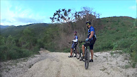
Photos of Guayama Mountain Bike
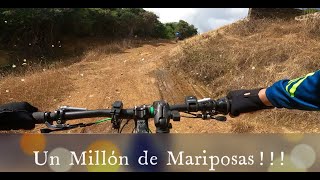
Videos of Guayama Mountain Bike
trail: El Palito
5:23 |
146 |
Oct 5, 2015
14:46 |
167 |
Dec 24, 2021

trail: Pozuelo
19:28 |
174 |
Dec 24, 2021 , Guayama

trail: Monte Brujo
2:39 |
438 |
Jun 21, 2020 , Guayama

trail: La Juana Trail
6:15 |
449 |
Jun 21, 2020 , Guayama

trail: Monte Brujo
26:21 |
440 |
Jun 21, 2020 , Guayama

trail: Monte Brujo
30:25 |
1023 |
Jun 21, 2020 , Guayama

trail: Monte Brujo
6:06 |
524 |
Jun 11, 2020 , Guayama
Recent Trail Reports
| status | trail | date | condition | info | user |
|---|---|---|---|---|---|
| Monte Brujo | Jan 7, 2026 @ 6:59pm (America/Puerto_Rico) Jan 7, 2026 | Ideal | traildefenderspr | ||
| Conector Trail | Mar 10, 2025 @ 5:13pm Mar 10, 2025 | Ideal | Lcollazo | ||
| Las Mareas | Apr 21, 2024 @ 4:44am Apr 21, 2024 | Prevalent Mud | rafyvega | ||
| Zombie Trail | Apr 21, 2024 @ 4:44am Apr 21, 2024 | Ideal | rafyvega | ||
| Atrecho XC 2018 | Apr 21, 2024 @ 4:44am Apr 21, 2024 | Ideal | rafyvega | ||
| La Juana Trail | Apr 21, 2024 @ 4:44am Apr 21, 2024 | Ideal | rafyvega | ||
| Lion Trail | Jan 15, 2024 @ 5:31am Jan 15, 2024 | Ideal | agnellopd | ||
| UpandDown | Nov 23, 2023 @ 4:43pm Nov 23, 2023 | Ideal | sum333 | ||
| Riego Los Cabros | Mar 8, 2023 @ 3:17am Mar 8, 2023 | Prevalent Mud | tDQdYx | ||
| Connector Los Cabros | Mar 8, 2023 @ 11:17am Mar 8, 2023 | Prevalent Mud | tDQdYx |
Activity Feed
| username | action | type | title | date |
|---|---|---|---|---|
| Lcollazo | wishlist | region | activity #97158059 | Jun 16, 2026 @ 7:49pm 1 day |
| MiguelMxfGks | wishlist | region | activity #94538353 | May 11, 2026 @ 9:09pm May 11, 2026 |
| Elfrao | wishlist | region | activity #89868429 | Mar 2, 2026 @ 5:10pm Mar 2, 2026 |
| ouzoglade | comment | trail | activity #89463561 | Feb 24, 2026 @ 7:50am Feb 24, 2026 |
| Nicolasroma | wishlist | region | activity #87453247 | Jan 18, 2026 @ 5:33pm Jan 18, 2026 |
Recent Comments
| username | type | title | comment | date |
|---|---|---|---|---|
| trail | Do not try this trail. It is all bushwacking | Feb 24, 2026 @ 7:50am Feb 24, 2026 | ||
| trail | Esta en buenas condiciones, excepto calle 8... | Feb 10, 2023 @ 5:00am Feb 10, 2023 | ||
| trail | Lleno de abrojos y arbustos. Necesita machete... | Feb 4, 2023 @ 1:02pm Feb 4, 2023 | ||
| trail | El camino está cubierto de vegetación espinosa. | Nov 14, 2021 @ 8:05am Nov 14, 2021 | ||
| trail | Hoy clima bueno! | Oct 14, 2020 @ 2:12pm Oct 14, 2020 |
Local Badges
-

10 Green Trails184 awarded -

Epic Ride Climb 2k18 awarded -

Climbing 10k Badge28 awarded -

Climbing 100k Badge0 awarded -

Epic Ride Descent 2k18 awarded -

Descent 10k Badge28 awarded
Activity Type Stats
| activitytype | trails | distance | descent | descent distance | total vertical | rating | global rank | state rank | photos | reports | routes | ridelogs |
|---|---|---|---|---|---|---|---|---|---|---|---|---|
| Mountain Bike | 72 | 90 miles | 13,081 ft | 34 miles | 2,441 ft | #1,218 | #3 | 89 | 371 | 1 | 5,228 | |
| E-Bike | 70 | 87 miles | 12,733 ft | 32 miles | 2,441 ft | #727 | #3 | 1 | 282 | 655 | ||
| Hike | 68 | 88 miles | 12,710 ft | 33 miles | 2,441 ft | #1,235 | #3 | 370 | 27 | |||
| Trail Running | 68 | 88 miles | 12,710 ft | 33 miles | 2,441 ft | #902 | #2 | 370 | 73 |
Frequently Asked Questions About Guayama
▼
What are the best places to ride in Guayama?
Guayama has 3 areas to explore for mountain biking. The top rated areas are:
▼
What are the highest rated mountain biking trails in Guayama?
The highest rated mountain biking trails in Guayama are:
- Valle Hermosa (4.2/5)
- Monte Brujo (4.2/5)
- Conector Trail (4.1/5)
- Calle 8 (4.1/5)
- Atrecho XC 2018 (4/5)
▼
What is the best time of the year to ride in Guayama?
Based on ride log data, the most popular months to ride in Guayama are:
- February (51 activities)
- September (40 activities)
- March (31 activities)
▼
Where can I park to ride in Guayama?
There are 3 parking locations listed in Guayama. The most popular parking spots are: View all parking and trailhead locations on the map to plan your visit.
Activities
Trails
Points of Interest
- By rampagus
 Monagas & contributors
 - Admins: MTBRC
- #9710 - 5,394 views
- guayama activity log | embed map of Guayama mountain bike trails | guayama mountain biking points of interest
Downloading of trail gps tracks in kml & gpx formats is enabled for Guayama.
You must login to download files.