close
-
Layers w
- Weather Layers
- Pro
- Pro
- Pro
- Pro
- Pro
- Pro
- More Layers
- Pro
- Pro
- Pro
- Pro
-
Upgrade to

3D
Trail Conditions
- Unknown
- Snow Groomed
- Snow Packed
- Snow Covered
- Snow Cover Partial
- Freeze/thaw Cycle
- Icy
- Prevalent Mud
- Wet
- Variable
- Ideal
- Dry
- Very Dry
Trail Flow (Ridden Direction)
Trailforks scans users ridelogs to determine the most popular direction each trail is ridden. A good flowing trail network will have most trails flowing in a single direction according to their intension.
The colour categories are based on what percentage of riders are riding a trail in its intended direction.
The colour categories are based on what percentage of riders are riding a trail in its intended direction.
- > 96%
- > 90%
- > 80%
- > 70%
- > 50%
- < 50%
- bi-directional trail
- no data
Trail Last Ridden
Trailforks scans ridelogs to determine the last time a trail was ridden.
- < 2 days
- < 1 week
- < 2 weeks
- < 1 month
- < 6 months
- > 6 months
Trail Ridden Direction
The intended direction a trail should be ridden.
- Downhill Only
- Downhill Primary
- Both Directions
- Uphill Primary
- Uphill Only
- One Direction
Contribute Details
Colors indicate trail is missing specified detail.
- Description
- Photos
- Description & Photos
- Videos
Trail Popularity ?
Trailforks scans ridelogs to determine which trails are ridden the most in the last 9 months.
Trails are compared with nearby trails in the same city region with a possible 25 colour shades.
Think of this as a heatmap, more rides = more kinetic energy = warmer colors.
- most popular
- popular
- less popular
- not popular
ATV/ORV/OHV Filter
Max Vehicle Width
inches
US Cell Coverage
Legend

Radar Time
Activity Recordings
Trailforks uses anonymized public activity data.
?
Activity Recordings
Trailforks uses anonymized public activity data.
?
Personal Heatmap
▶
Activity Types
all
/
none
▶
Options
2
Date range
month
–
Winter Trails
Warning
A routing network for winter maps does not exist. Selecting trails using the winter trails layer has been disabled.
Missing Trails
Most Popular
Least Popular
Trails are colored based on popularity. The more popular a trail is, the more red. Less popular trails trend towards green.
Jump Magnitude Heatmap
Heatmap of where riders jump on trails. Zoom in to see individual jumps, click circles to view jump details.
BC Backroad Status
![map legend]()
Service Road Atlas is a free to use, community-driven service for viewing and creating reports on the numerous back-country service roads around B.C. and Alberta.

Slope Aspect
Direction the slope faces
Trails Deemphasized
Trails are shown in grey.
Only show trails with no bike usage.
Suggested Layers
Based on selected activity type
Save the current map location and zoom level as your default home location whenever this page is loaded.
SaveThis place we call Guelph has served as traditional lands and a place of refuge for many peoples over time, but more specifically the Attiwonderonk, and the Haudenosaunee. This land is held as the treaty lands and territory with the Mississaugas of the Credit First Nation. Guelph lies directly adjacent to the Haldimand Tract and is part of a long-established traditional hunting ground for the Six Nations of the Grand River. Many First Nations, Inuit, and Métis peoples who have come from across Turtle Island call Guelph home today.
As we hike, run, or cycle, let us take time to reflect on our privilege to live and play in Guelph; a city built over rich Indigenous histories. We are guests here, and we should reflect upon the responsibility to care for this land, the people who live here today, and the generations to come. If our actions today can move us towards reconciliation, we should take pause and make those decisions with intention and gratitude.
As we hike, run, or cycle, let us take time to reflect on our privilege to live and play in Guelph; a city built over rich Indigenous histories. We are guests here, and we should reflect upon the responsibility to care for this land, the people who live here today, and the generations to come. If our actions today can move us towards reconciliation, we should take pause and make those decisions with intention and gratitude.
Activities Click to view
- Mountain Bike
210 trails
- E-Bike
4 trails
- Gravel Bike
0 trails
- Adaptive Bike
0 trails
- Winter Fat Bike
0 trails
- Hike
171 trails
- Trail Running
171 trails
- Snowshoe
93 trails
- Nordic Ski
21 trails
Region Details
- 24
- 12
- 69
- 56
- 21
- 9
Region Status
Open as of 2 daysStats
- Avg Trail Rating
- Trails (view details)
- 196
- Trails Mountain Bike
- 223
- Trails E-Bike
- 4
- Trails Hike
- 171
- Trails Trail Running
- 171
- Trails Snowshoe
- 93
- Trails Nordic Ski
- 21
- Total Distance
- 162 miles
- Total Descent
- 5,410 ft
- Total Vertical
- 406 ft
- Highest Trailhead
- 1,292 ft
- Reports
- 4,037
- Photos
- 294
- Ridden Counter
- 101,728
Sub Regions
-
Guelph Lake
- 8
- 18
- 23
- 9
- 6
-
Hanlon Creek
- 1
- 14
- 10
Popular Guelph Mountain Biking Trails
• 85 ★ 3.7 • 2,720 ft • 54 ft • 2,762 •
Popular blue difficulty singletrack. This mountain bike primary trail can be used one direction and has a easy overall physical rating with a 54 ft blue climb. On average it takes 1 minutes to complete this trail.
• 90 ★ 3.6 • 1,358 ft • 25 ft • 2,189 •
Popular blue difficulty singletrack. This mountain bike primary trail can be used both directions and has a easy overall physical rating with a 25 ft green climb. Trail visibility is always easy to follow. On average it takes minutes to complete this trail.
• 95 ★ 3.7 • 1 mile • 72 ft • 1,788 •
Popular blue difficulty singletrack. This mountain bike primary trail can be used one direction and has a easy overall physical rating with a 72 ft green climb. On average it takes 4 minutes to complete this trail.
• 100 ★ 3.3 • 1,470 ft • 14 ft • 1,528 •
Slightly more interesting than , less technical than roller coaster.
• 100 ★ 3.7 • 722 ft • 3 ft • 1,511 •
A nice trail to warm up on at the beginning of a ride. Quick slightly technical pitch at the beginning and ends with a fun bermed decent
• 95 ★ 4.2 • 1,519 ft • 43 ft • 1,402 •
Highly rated popular blue difficulty singletrack. This mountain bike primary trail can be used one direction and has a easy overall physical rating with a 43 ft green climb. On average it takes 3 minutes to complete this trail.
Guelph Mountain Bike Routes
G2G Rail Trail Featured
90 miles • 640 ft • 3 • Point to Point •
The fully accessible 132 KM Rail Trail Experience that is a multi-use green space from the 401 corridor at...
★ 3.0 • 11 miles • 652 ft • 21 • Loop •
Full Puslinch loop including new additions for 2021
4 miles • 236 ft • 14 • Loop •
GORBA 2026 Yellow Winter Loop 7K Kilometers
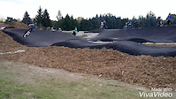
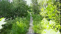
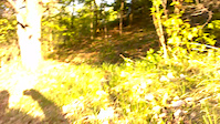
Photos of Guelph Mountain Bike
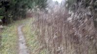
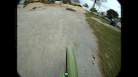
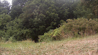
Videos of Guelph Mountain Bike
trail: Lower Picnic
2:06 |
295 |
Oct 29, 2016
trail: Hell's Kitchen
0:12 |
190 |
Nov 26, 2015
trail: Lower Picnic
2:28 |
92 |
Oct 16, 2015
trail: The Link
4:04 |
378 |
Feb 25, 2014
trail: Boardwalk
0:33 |
89 |
Feb 18, 2014
trail: Full Out
0:12 |
487 |
May 17, 2013

trail: Phoenix
0:32 |
762 |
Apr 2, 2013

trail: Lower Picnic
3:34 |
406 |
Mar 13, 2013
Recent Trail Reports
| status | trail | date | condition | info | user |
|---|---|---|---|---|---|
| Hell's Kitchen Connector | Jun 3, 2026 @ 10:45am (America/Toronto) 2 days | Ideal | GoneBiking79 | ||
| Foundation Connector | Jun 3, 2026 @ 10:45am (America/Toronto) 2 days | Ideal | GoneBiking79 | ||
| Fight Club | Jun 3, 2026 @ 10:45am (America/Toronto) 2 days | Ideal | GoneBiking79 | ||
| Snail Trail | Jun 3, 2026 @ 10:45am (America/Toronto) 2 days | Ideal | GoneBiking79 | ||
| Firefly Shortcut | Jun 3, 2026 @ 10:45am (America/Toronto) 2 days | Ideal | GoneBiking79 | ||
| Lower Jurassic | Jun 3, 2026 @ 10:45am (America/Toronto) 2 days | Ideal | GoneBiking79 | ||
| Monkey Bridge | Jun 3, 2026 @ 10:45am (America/Toronto) 2 days | Dry | GoneBiking79 | ||
| Digg'r | May 26, 2026 @ 3:38pm (America/Toronto) May 26, 2026 | Ideal | GoneBiking79 | ||
| Short & Sweet | May 26, 2026 @ 3:38pm (America/Toronto) May 26, 2026 | Ideal | GoneBiking79 | ||
| Petite Trunk | May 26, 2026 @ 3:38pm (America/Toronto) May 26, 2026 | Ideal | GoneBiking79 |
Activity Feed
| username | action | type | title | date |
|---|---|---|---|---|
| GoneBiking79 | add | report | activity #96227327 and 6 more | Jun 4, 2026 @ 7:50am 1 day |
| abD5Oj | ridden | trail | activity #95820581 | May 29, 2026 @ 8:07pm May 29, 2026 |
| GoneBiking79 | add | report | activity #95595486 and 3 more | May 26, 2026 @ 3:55pm May 26, 2026 |
| GoneBiking79 | add | report | activity #95595476 and 26 more | May 26, 2026 @ 3:55pm May 26, 2026 |
| GuelphOffRoadBikeAssoc | update | poi | activity #95242818 | May 22, 2026 @ 8:02am May 22, 2026 |
Recent Comments
| username | type | title | comment | date |
|---|---|---|---|---|
| trail | Has been converted to only one way in the... | Jul 2, 2025 @ 8:03am Jul 2, 2025 | ||
| trail | Seems to be a jump-liney area developing... | Jun 21, 2023 @ 5:39am Jun 21, 2023 | ||
| trail | Awesome | Jun 1, 2023 @ 7:20am Jun 1, 2023 | ||
| trail | You can carry some good speed into it from the... | May 28, 2023 @ 9:14pm May 28, 2023 | ||
| trail | Berms then rooty climb then more berms. Couple... | May 28, 2023 @ 9:03pm May 28, 2023 |
Local Badges
-

Completionist23 awarded -

Big Ride 30k4,684 awarded -

Epic Ride 50k1,734 awarded -

Top 10 Trails236 awarded -
Completionist0 awarded -
Completionist0 awarded
Bike & Skill Parks
| name | type | city | rating |
|---|---|---|---|
| Silvercreek Skatepark | skill park | Guelph |
Activity Type Stats
| activitytype | trails | distance | descent | descent distance | total vertical | rating | global rank | state rank | photos | reports | routes | ridelogs |
|---|---|---|---|---|---|---|---|---|---|---|---|---|
| Mountain Bike | 210 | 157 miles | 5,151 ft | 71 miles | 407 ft | #124 | #7 | 217 | 4,022 | 19 | 39,847 | |
| E-Bike | 4 | 86 miles | 892 ft | 47 miles | 407 ft | #2,162 | #48 | 3,645 | 2 | 743 | ||
| Hike | 171 | 154 miles | 4,774 ft | 70 miles | 407 ft | #459 | #8 | 80 | 3,967 | 1 | 3,081 | |
| Trail Running | 171 | 154 miles | 4,774 ft | 70 miles | 407 ft | #877 | #15 | 3,967 | 1 | 2,234 | ||
| Snowshoe | 93 | 89 miles | 1,037 ft | 48 miles | 407 ft | #111 | #9 | 63 | 12 | 60 | ||
| Nordic Ski | 21 | #545 | #34 | 42 | 3 | 106 |
Frequently Asked Questions About Guelph
▼
What are the best places to ride in Guelph?
Guelph has 3 areas to explore for mountain biking. The top rated areas are:
▼
What are the highest rated mountain biking trails in Guelph?
The highest rated mountain biking trails in Guelph are:
- Fight Club (4.6/5)
- Snail Trail (4.4/5)
- Detour (4.3/5)
- Homestead (4.2/5)
- Monkey Wrench (4.2/5)
▼
What is the best time of the year to ride in Guelph?
Based on ride log data, the most popular months to ride in Guelph are:
- July (627 activities)
- June (517 activities)
- August (492 activities)
▼
Where can I park to ride in Guelph?
There are 21 parking locations listed in Guelph. The most popular parking spots are: View all parking and trailhead locations on the map to plan your visit.
Activities
Trails
- By IsaacBikes & contributors
- Admins: CoG
- #5242 - 28,402 views
- guelph activity log | embed map of Guelph mountain bike trails | guelph mountain biking points of interest
Downloading of trail gps tracks in kml & gpx formats is enabled for Guelph.
You must login to download files.