close
-
Layers w
- Weather Layers
- Pro
- Pro
- Pro
- Pro
- Pro
- Pro
- More Layers
- Pro
- Pro
- Pro
- Pro
-
Upgrade to

3D
Trail Conditions
- Unknown
- Snow Groomed
- Snow Packed
- Snow Covered
- Snow Cover Partial
- Freeze/thaw Cycle
- Icy
- Prevalent Mud
- Wet
- Variable
- Ideal
- Dry
- Very Dry
Trail Flow (Ridden Direction)
Trailforks scans users ridelogs to determine the most popular direction each trail is ridden. A good flowing trail network will have most trails flowing in a single direction according to their intension.
The colour categories are based on what percentage of riders are riding a trail in its intended direction.
The colour categories are based on what percentage of riders are riding a trail in its intended direction.
- > 96%
- > 90%
- > 80%
- > 70%
- > 50%
- < 50%
- bi-directional trail
- no data
Trail Last Ridden
Trailforks scans ridelogs to determine the last time a trail was ridden.
- < 2 days
- < 1 week
- < 2 weeks
- < 1 month
- < 6 months
- > 6 months
Trail Ridden Direction
The intended direction a trail should be ridden.
- Downhill Only
- Downhill Primary
- Both Directions
- Uphill Primary
- Uphill Only
- One Direction
Contribute Details
Colors indicate trail is missing specified detail.
- Description
- Photos
- Description & Photos
- Videos
Trail Popularity ?
Trailforks scans ridelogs to determine which trails are ridden the most in the last 9 months.
Trails are compared with nearby trails in the same city region with a possible 25 colour shades.
Think of this as a heatmap, more rides = more kinetic energy = warmer colors.
- most popular
- popular
- less popular
- not popular
ATV/ORV/OHV Filter
Max Vehicle Width
inches
US Cell Coverage
Legend

Radar Time
Activity Recordings
Trailforks uses anonymized public activity data.
?
Activity Recordings
Trailforks uses anonymized public activity data.
?
Personal Heatmap
▶
Activity Types
all
/
none
▶
Options
2
Date range
month
–
Winter Trails
Warning
A routing network for winter maps does not exist. Selecting trails using the winter trails layer has been disabled.
Missing Trails
Most Popular
Least Popular
Trails are colored based on popularity. The more popular a trail is, the more red. Less popular trails trend towards green.
Jump Magnitude Heatmap
Heatmap of where riders jump on trails. Zoom in to see individual jumps, click circles to view jump details.
BC Backroad Status
![map legend]()
Service Road Atlas is a free to use, community-driven service for viewing and creating reports on the numerous back-country service roads around B.C. and Alberta.

Slope Aspect
Direction the slope faces
Trails Deemphasized
Trails are shown in grey.
Only show trails with no bike usage.
Suggested Layers
Based on selected activity type
Save the current map location and zoom level as your default home location whenever this page is loaded.
SaveMan made and natural trails. Gateway to the North Yorkshire Moor National Park
Primary Trail Type: Cross-Country
Land Status: Community Forest
Access Info:
Pinchinthorpe Visitors Centre (PVC)
This region uses the Uk/Euro style trail grading system.
Activities Click to view
- Mountain Bike
159 trails
- E-Bike
141 trails
- Gravel Bike
20 trails
- Adaptive Bike
29 trails
- Winter Fat Bike
4 trails
- Horse
41 trails
- Hike
99 trails
- Trail Running
98 trails
Region Details
- 72
- 19
- 33
- 33
- 2
Region Status
Open as of Jun 7, 2026Stats
- Avg Trail Rating
- Trails (view details)
- 178
- Trails Mountain Bike
- 159
- Trails E-Bike
- 141
- Trails Gravel Bike
- 20
- Trails Adaptive Bike
- 29
- Trails Winter Fat Bike
- 4
- Trails Horse
- 41
- Trails Hike
- 99
- Trails Trail Running
- 98
- Total Distance
- 65 miles
- Total Descent
- 18,131 ft
- Total Vertical
- 753 ft
- Highest Trailhead
- 1,069 ft
- Reports
- 622
- Photos
- 153
- Ridden Counter
- 9,952
Sub Regions
-
Guisborough Forest
- 18
- 35
- 33
- 2
Popular Guisborough Mountain Biking Trails
• 100 ★ 3.8 • 479 ft • 0 ft • 370 •
Reconditioned and adapted trail a few features added, along with variations and easier lines.
• 100 ★ 4.4 • 873 ft • 3 ft • 311 •
Highly rated popular black difficulty singletrack. This mountain bike primary trail can be used one direction and has a hard overall physical rating. It features berm, drop, jump and rock garden. On average it takes 4 minutes to complete this trail.
• 95 ★ 4.4 • 2,162 ft • 10 ft • 292 •
Popular red difficulty singletrack. This mountain bike primary trail can be used one direction. On average it takes 2 minutes to complete this trail.
• 50 ★ 4.8 • 2,890 ft • 0 ft • 229 •
Singletrack through the woods, then traverses the hillside with some steep chutes. Pedally. Can be overgrown in summer
• 90 ★ 4.7 • 728 ft • 0 ft • 215 •
Popular red difficulty singletrack. This mountain bike primary trail can be used one direction. It features berm and jump. On average it takes minutes to complete this trail.
• 85 ★ 4.5 • 1,033 ft • 0 ft • 211 •
Popular blue difficulty singletrack. This mountain bike primary trail can be used one direction. On average it takes 1 minutes to complete this trail.
• 90 ★ 4.4 • 919 ft • 5 ft • 208 •
Popular red difficulty singletrack. This mountain bike primary trail can be used one direction. It features berm. On average it takes 1 minutes to complete this trail.
Guisborough Mountain Bike Routes
7 miles • 1,208 ft • 14 • Loop •
Nice chilled out route for first time visits at Guisborough forest
• 7 miles • 1,282 ft • 12 •
• 5 miles • 832 ft • 8 •
Photos of Guisborough Mountain Bike
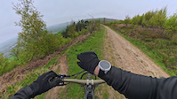
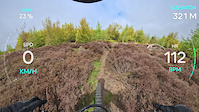
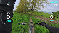
Videos of Guisborough Mountain Bike

trail: Arfur Stone
0:37 |
15 |
Apr 26, 2026
trail: John Storey's Trail
2:19 |
17 |
Apr 26, 2026
trail: The SuperChute
3:13 |
13 |
Apr 26, 2026
trail: Nomad
4:09 |
19 |
Apr 25, 2026
trail: The Chute
2:44 |
16 |
Apr 25, 2026

trail: Point N Chute
2:45 |
14 |
Apr 25, 2026
trail: Stripes
0:40 |
125 |
Aug 7, 2022
trail: Loam Sweet Loam
0:28 |
148 |
Jan 25, 2021
Recent Trail Reports
| status | trail | date | condition | info | user |
|---|---|---|---|---|---|
| chevRonzz>> | Jun 7, 2026 @ 10:34am (Europe/Isle_of_Man) Jun 7, 2026 | Ideal | Ray-Gordon | ||
| Forest Road | Jun 7, 2026 @ 10:34am (Europe/Isle_of_Man) Jun 7, 2026 | Dry | Ray-Gordon | ||
| Les's 1 | Jun 7, 2026 @ 10:34am (Europe/Isle_of_Man) Jun 7, 2026 | Ideal | Ray-Gordon | ||
| Flowrider | Jun 7, 2026 @ 10:34am (Europe/Isle_of_Man) Jun 7, 2026 | Ideal | Ray-Gordon | ||
| The Hippo Way | Jun 7, 2026 @ 10:34am (Europe/Isle_of_Man) Jun 7, 2026 | Ideal | Ray-Gordon | ||
| Jump Trail | Jun 7, 2026 @ 10:34am (Europe/Isle_of_Man) Jun 7, 2026 | Dry | Ray-Gordon | ||
| Les's 3 | Jun 7, 2026 @ 10:34am (Europe/Isle_of_Man) Jun 7, 2026 | Dry | Ray-Gordon | ||
| Amber Gambler | Jun 7, 2026 @ 10:34am (Europe/Isle_of_Man) Jun 7, 2026 | Ideal | Ray-Gordon | ||
| Les's 2 | Jun 7, 2026 @ 10:34am (Europe/Isle_of_Man) Jun 7, 2026 | Dry | Ray-Gordon | ||
| Allo Allo 2 | Jun 7, 2026 @ 10:34am (Europe/Isle_of_Man) Jun 7, 2026 | Ideal | Ray-Gordon |
Activity Feed
| username | action | type | title | date |
|---|---|---|---|---|
| Ray-Gordon | add | report | activity #96455682 and 11 more | Jun 7, 2026 @ 6:49am Jun 7, 2026 |
| trailforks | add | video | activity #96408803 | Jun 6, 2026 @ 3:00pm Jun 6, 2026 |
| L8WXlT | wishlist | region | activity #96348999 | Jun 6, 2026 @ 2:03am Jun 6, 2026 |
| treedocuk | wishlist | route | activity #95632947 | May 27, 2026 @ 7:28am May 27, 2026 |
| trailforks | add | video | activity #94879170 | May 17, 2026 @ 2:00am May 17, 2026 |
Recent Comments
| username | type | title | comment | date |
|---|---|---|---|---|
| trail | Nice and easy. Harder blue or easy red | Oct 19, 2025 @ 8:41am Oct 19, 2025 | ||
| trail | Rode on the 24/9/25, massively overgrown... | Sep 24, 2025 @ 5:58am Sep 24, 2025 | ||
| trail | Really overgrown western end. Centre to east... | Sep 8, 2025 @ 5:03am Sep 8, 2025 | ||
| trail | This trail is overgrown and not easy to ride.... | Aug 22, 2025 @ 6:39am Aug 22, 2025 | ||
| trail | Fallen tree half way but can lift over it and... | May 11, 2025 @ 5:57am May 11, 2025 |
Local Badges
-

Epic Mountain Bike Climb 2k5 awarded -

Climbing 10k Badge44 awarded -

Mountain Biking 100k Badge4 awarded -

Epic Ride Descent 2k5 awarded -

Descent 10k Badge44 awarded -

Descent 100k Badge4 awarded
Bike & Skill Parks
| name | type | city | rating |
|---|---|---|---|
| Great Ayton Quarry Dirt Jumps | skill park | Guisborough | |
| Skelton Green Pumptrack | skill park | Guisborough | |
| Hutton Rudby Pumptrack | skill park | Guisborough | |
| Dormanstown Pumptrack | skill park | Guisborough | |
| Swainby Pumptrack | skill park | Guisborough |
Local Mountain Biking Directory
-
MTB GuisboroughClub
![MTB Guisborough]()
-
Bike SceneBike Shop
Activity Type Stats
| activitytype | trails | distance | descent | descent distance | total vertical | rating | global rank | state rank | photos | reports | routes | ridelogs |
|---|---|---|---|---|---|---|---|---|---|---|---|---|
| Mountain Bike | 159 | 61 miles | 17,375 ft | 31 miles | 751 ft | #761 | #33 | 153 | 622 | 2 | 10,373 | |
| E-Bike | 141 | 51 miles | 15,663 ft | 27 miles | 745 ft | #1,051 | #51 | 497 | 1 | 3,067 | ||
| Gravel Bike | 20 | 15 miles | 2,014 ft | 6 miles | 722 ft | #83 | #134 | 86 | 96 | |||
| Adaptive Bike | 29 | 25 miles | 2,825 ft | 10 miles | 745 ft | #55 | #170 | 98 | ||||
| Winter Fat Bike | 4 | 2 miles | 666 ft | 1 mile | 479 ft | #65 | #169 | 57 | ||||
| Horse | 41 | 26 miles | 2,598 ft | 9 miles | 715 ft | #810 | #34 | 123 | ||||
| Hike | 99 | 48 miles | 6,398 ft | 19 miles | 751 ft | #2,798 | #59 | 454 | 803 | |||
| Trail Running | 98 | 48 miles | 6,398 ft | 19 miles | 751 ft | #2,459 | #48 | 454 | 485 |
Frequently Asked Questions About Guisborough
▼
What are the best places to ride in Guisborough?
Guisborough has 1 areas to explore for mountain biking. The top rated areas are:
▼
What are the highest rated mountain biking trails in Guisborough?
The highest rated mountain biking trails in Guisborough are:
- Skip Off Work (4.4/5)
- Milkman Vs Batman (4.3/5)
- Lovers Ledge (4.3/5)
- Les's 1 (4.3/5)
- Dead Mans Shoe (4.2/5)
▼
What is the best time of the year to ride in Guisborough?
Based on ride log data, the most popular months to ride in Guisborough are:
- April (37 activities)
- June (34 activities)
- August (33 activities)
▼
Where can I park to ride in Guisborough?
There are 5 parking locations listed in Guisborough. The most popular parking spots are:
- Roadside Parking
- Roseberry Topping Public Car Park
- Guisborough Forest & Walkway Visitor Centre
- Parking spot for Vlaardingen skillpark and trail.
- Parking
Activities
Trails
Points of Interest
- By MTBDanP & contributors
- Admins: wisey, MathieuC, cemoorelife, loamcoach
- #5298 - 6,019 views
- guisborough activity log | embed map of Guisborough mountain bike trails | guisborough mountain biking points of interest
Downloading of trail gps tracks in kml & gpx formats is enabled for Guisborough.
You must login to download files.