close
-
Layers w
- Weather Layers
- Pro
- Pro
- Pro
- Pro
- Pro
- Pro
- More Layers
- Pro
- Pro
- Pro
- Pro
-
Upgrade to

3D
Trail Conditions
- Unknown
- Snow Groomed
- Snow Packed
- Snow Covered
- Snow Cover Partial
- Freeze/thaw Cycle
- Icy
- Prevalent Mud
- Wet
- Variable
- Ideal
- Dry
- Very Dry
Trail Flow (Ridden Direction)
Trailforks scans users ridelogs to determine the most popular direction each trail is ridden. A good flowing trail network will have most trails flowing in a single direction according to their intension.
The colour categories are based on what percentage of riders are riding a trail in its intended direction.
The colour categories are based on what percentage of riders are riding a trail in its intended direction.
- > 96%
- > 90%
- > 80%
- > 70%
- > 50%
- < 50%
- bi-directional trail
- no data
Trail Last Ridden
Trailforks scans ridelogs to determine the last time a trail was ridden.
- < 2 days
- < 1 week
- < 2 weeks
- < 1 month
- < 6 months
- > 6 months
Trail Ridden Direction
The intended direction a trail should be ridden.
- Downhill Only
- Downhill Primary
- Both Directions
- Uphill Primary
- Uphill Only
- One Direction
Contribute Details
Colors indicate trail is missing specified detail.
- Description
- Photos
- Description & Photos
- Videos
Trail Popularity ?
Trailforks scans ridelogs to determine which trails are ridden the most in the last 9 months.
Trails are compared with nearby trails in the same city region with a possible 25 colour shades.
Think of this as a heatmap, more rides = more kinetic energy = warmer colors.
- most popular
- popular
- less popular
- not popular
ATV/ORV/OHV Filter
Max Vehicle Width
inches
US Cell Coverage
Legend

Radar Time
Activity Recordings
Trailforks uses anonymized public activity data.
?
Activity Recordings
Trailforks uses anonymized public activity data.
?
Personal Heatmap
▶
Activity Types
all
/
none
▶
Options
2
Date range
month
–
Winter Trails
Warning
A routing network for winter maps does not exist. Selecting trails using the winter trails layer has been disabled.
Missing Trails
Most Popular
Least Popular
Trails are colored based on popularity. The more popular a trail is, the more red. Less popular trails trend towards green.
Jump Magnitude Heatmap
Heatmap of where riders jump on trails. Zoom in to see individual jumps, click circles to view jump details.
BC Backroad Status
![map legend]()
Service Road Atlas is a free to use, community-driven service for viewing and creating reports on the numerous back-country service roads around B.C. and Alberta.

Slope Aspect
Direction the slope faces
Trails Deemphasized
Trails are shown in grey.
Only show trails with no bike usage.
Suggested Layers
Based on selected activity type
Save the current map location and zoom level as your default home location whenever this page is loaded.
SaveThis region is Unsanctioned, Ride at your own Risk!
Area located northeast of Brno with many natural trails and beautiful panoramas.
Primary Trail Type: Cross-Country
Shuttleable: YES
Land Status: State Forest
 google parking directions
 Access Info:
Velká Klajdovka
This region uses the Uk/Euro style trail grading system.
Activities Click to view
- Mountain Bike
12 trails
- Hike
12 trails
- Trail Running
12 trails
Region Details
- 5
- 3
- 2
Region Status
Open as of Aug 11, 2024Stats
- Avg Trail Rating
- Trails (view details)
- 12
- Trails Mountain Bike
- 12
- Trails Hike
- 12
- Trails Trail Running
- 12
- Total Distance
- 6 miles
- Total Descent
- 2,514 ft
- Total Vertical
- 769 ft
- Highest Trailhead
- 1,471 ft
- Reports
- 88
- Photos
- 18
- Ridden Counter
- 493
Popular Hády Mountain Biking Trails
• 45 ★ 4.6 • 2,808 ft • 0 ft • 54 • • hike
The start is at the monument of S.K. Neuman, later it follows blue touristic sign or 'Obřanský hrad' trail. It is also known as 'Downhill Obřanská zřícenina' from this connection (viz Strava segment).
• 85 ★ 3.7 • 1 mile • 86 ft • 48 •
Both direction trail across 'Hády'. Recommended direction is from 'Ochoz' to 'Brno'. 'Kopaniny trail' is part of it.
• 65 ★ 0.0 • 1,155 ft • 8 ft • 27 •
Short and intensive in the end (downhill and switchbacks).
• 5 ★ 4.5 • 3,566 ft • 81 ft • 13 •
Extension of Panorama Hády trail. Path leads!
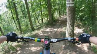
Photos of Hády Mountain Bike
Videos of Hády Mountain Bike
trail: Obřanský hrad
0:44 |
848 |
Aug 8, 2020 , Brno

trail: Krtek
3:05 |
543 |
Apr 5, 2018 , Brno

trail: Obřanský hrad
1414 |
Nov 1, 2016 , Brno
Recent Trail Reports
| status | trail | date | condition | info | user |
|---|---|---|---|---|---|
| Hádecká planinka | Aug 11, 2024 @ 11:05am Aug 11, 2024 | Ideal | imons1Q34H | ||
| Svitava | May 6, 2024 @ 7:37am May 6, 2024 | Ideal | ufoncz | ||
| Obřanský hrad | May 21, 2023 @ 5:54am May 21, 2023 | Ideal | Zlobr | ||
| Panorama Hády spodek | Oct 30, 2021 @ 3:01am Oct 30, 2021 | Ideal | Gorakhal | ||
| Krtek | Oct 2, 2020 @ 6:37am Oct 2, 2020 | Ideal | Zlobr | ||
| Konečná | Sep 15, 2020 @ 5:43am Sep 15, 2020 | Ideal | rkonecny | ||
| Babická punk | May 16, 2020 @ 6:50am May 16, 2020 | Variable | Vesmir |
Activity Feed
| username | action | type | title | date |
|---|---|---|---|---|
| SuperMartas | ridden | trail | activity #69064570 | Apr 5, 2025 @ 1:04pm Apr 5, 2025 |
| Jensen1234 | vote | trail | activity #68959870 | Apr 4, 2025 @ 12:31am Apr 4, 2025 |
| David57l7WJ | wishlist | region | activity #57612224 | Aug 21, 2024 @ 10:58pm Aug 21, 2024 |
| FreeEn | wishlist | trail | activity #57569400 and 1 more | Aug 21, 2024 @ 4:39am Aug 21, 2024 |
| SuperMartas | wishlist | trail | activity #57220039 | Aug 14, 2024 @ 10:37am Aug 14, 2024 |
Recent Comments
| username | type | title | comment | date |
|---|---|---|---|---|
| trail | Trail je zarostlý, pár padlých stromů.... | Aug 20, 2020 @ 12:46am Aug 20, 2020 |
Nearby Areas
| name | distance | ||||
|---|---|---|---|---|---|
| Singletrail Moravský kras | Mariánské údolí | 7 | 6 | 1.8 km | ||
| Kanice | 6 | 4 | 2.2 km | ||
| Brno sever | 8 | 9 | 3.3 km | ||
| Zamilec Trails | 1 | 3 | 3.7 km | ||
| Adamov | 8 | 4 | 1 | 4.9 km |
Activity Type Stats
| activitytype | trails | distance | descent | descent distance | total vertical | rating | global rank | state rank | photos | reports | routes | ridelogs |
|---|---|---|---|---|---|---|---|---|---|---|---|---|
| Mountain Bike | 12 | 6 miles | 2,513 ft | 4 miles | 768 ft | #3,987 | #33 | 18 | 88 | 3,524 | ||
| Hike | 12 | 6 miles | 2,513 ft | 4 miles | 768 ft | #3,736 | #36 | 88 | 65 | |||
| Trail Running | 12 | 6 miles | 2,513 ft | 4 miles | 768 ft | #2,899 | #35 | 88 | 182 |
Frequently Asked Questions About Hády
▼
What are the highest rated mountain biking trails in Hády?
The highest rated mountain biking trails in Hády are:
- Obřanský hrad (4.3/5)
- Krtek (4.1/5)
- Panorama Hády spodek (4.1/5)
- Hádecká planinka (3.9/5)
- Konečná (3.8/5)
▼
What is the best time of the year to ride in Hády?
Based on ride log data, the most popular months to ride in Hády are:
- May (5 activities)
- February (5 activities)
- July (5 activities)
▼
Where can I park to ride in Hády?
There are 1 parking locations listed in Hády. The most popular parking spots are:
▼
What is the longest trail in Hády?
The longest trail in Hády is Hádecká planinka at 1.6 km. View all trails sorted by distance.
- By trailforks
 Trailforks & contributors
 - Admins: apply
- #13451 - 5,684 views
- hády activity log | embed map of Hády mountain bike trails | hády mountain biking points of interest
Downloading of trail gps tracks in kml & gpx formats is enabled for Hády.
You must login to download files.