close
-
Layers w
- Weather Layers
- Pro
- Pro
- Pro
- Pro
- Pro
- Pro
- More Layers
- Pro
- Pro
- Pro
- Pro
-
Upgrade to

3D
Trail Conditions
- Unknown
- Snow Groomed
- Snow Packed
- Snow Covered
- Snow Cover Partial
- Freeze/thaw Cycle
- Icy
- Prevalent Mud
- Wet
- Variable
- Ideal
- Dry
- Very Dry
Trail Flow (Ridden Direction)
Trailforks scans users ridelogs to determine the most popular direction each trail is ridden. A good flowing trail network will have most trails flowing in a single direction according to their intension.
The colour categories are based on what percentage of riders are riding a trail in its intended direction.
The colour categories are based on what percentage of riders are riding a trail in its intended direction.
- > 96%
- > 90%
- > 80%
- > 70%
- > 50%
- < 50%
- bi-directional trail
- no data
Trail Last Ridden
Trailforks scans ridelogs to determine the last time a trail was ridden.
- < 2 days
- < 1 week
- < 2 weeks
- < 1 month
- < 6 months
- > 6 months
Trail Ridden Direction
The intended direction a trail should be ridden.
- Downhill Only
- Downhill Primary
- Both Directions
- Uphill Primary
- Uphill Only
- One Direction
Contribute Details
Colors indicate trail is missing specified detail.
- Description
- Photos
- Description & Photos
- Videos
Trail Popularity ?
Trailforks scans ridelogs to determine which trails are ridden the most in the last 9 months.
Trails are compared with nearby trails in the same city region with a possible 25 colour shades.
Think of this as a heatmap, more rides = more kinetic energy = warmer colors.
- most popular
- popular
- less popular
- not popular
ATV/ORV/OHV Filter
Max Vehicle Width
inches
US Cell Coverage
Legend

Radar Time
Activity Recordings
Trailforks uses anonymized public activity data.
?
Activity Recordings
Trailforks uses anonymized public activity data.
?
Personal Heatmap
▶
Activity Types
all
/
none
▶
Options
2
Date range
month
–
Winter Trails
Warning
A routing network for winter maps does not exist. Selecting trails using the winter trails layer has been disabled.
Missing Trails
Most Popular
Least Popular
Trails are colored based on popularity. The more popular a trail is, the more red. Less popular trails trend towards green.
Jump Magnitude Heatmap
Heatmap of where riders jump on trails. Zoom in to see individual jumps, click circles to view jump details.
BC Backroad Status
![map legend]()
Service Road Atlas is a free to use, community-driven service for viewing and creating reports on the numerous back-country service roads around B.C. and Alberta.

Slope Aspect
Direction the slope faces
Trails Deemphasized
Trails are shown in grey.
Only show trails with no bike usage.
Suggested Layers
Based on selected activity type
Save the current map location and zoom level as your default home location whenever this page is loaded.
Save
No description for Hakuba has been added yet!
Login or register to submit one.
Activities Click to view
- Mountain Bike
17 trails
- E-Bike
10 trails
- Adaptive Bike
0 trails
- Hike
11 trails
- Trail Running
11 trails
Region Details
- 4
- 3
- 8
- 1
- 1
Region Status
Open as of Mar 24, 2026Local Trail Association
Stats
- Avg Trail Rating
- Trails (view details)
- 17
- Trails Mountain Bike
- 17
- Trails E-Bike
- 10
- Trails Hike
- 11
- Trails Trail Running
- 11
- Total Distance
- 22 miles
- Total Descent
- 7,676 ft
- Total Vertical
- 1,977 ft
- Highest Trailhead
- 4,211 ft
- Reports
- 21
- Photos
- 1
- Ridden Counter
- 437
Sub Regions
-
Hakuba Iwatake MTB Park
- 3
- 5
- 1
-
Minekata
- 2
Popular Hakuba Mountain Biking Trails
• 90 ★ 0.0 • 994 ft • 0 ft • 67 •
A small alternative to the Alps DH main course through the trees.
• 40 ★ 5.0 • 4 miles • 191 ft • 57 •
Moderately popular green difficulty singletrack. This mountain bike primary trail can be used downhill only. On average it takes 8 minutes to complete this trail.
• 70 ★ 0.0 • 3,156 ft • 11 ft • 39 •
Popular blue difficulty singletrack. This mountain bike primary trail can be used downhill only. On average it takes 12 minutes to complete this trail.
• 80 ★ 0.0 • 3,730 ft • 10 ft • 38 •
Popular blue difficulty singletrack. This mountain bike primary trail can be used downhill only.
• 60 ★ 0.0 • 2,628 ft • 9 ft • 37 •
Moderately popular blue difficulty singletrack. This mountain bike primary trail can be used downhill only.
• 50 ★ 0.0 • 3,442 ft • 259 ft • 31 •
Moderately popular blue difficulty singletrack. This mountain bike primary trail can be used downhill only.
• 5 ★ 0.0 • 1 mile • 94 ft • 18 •
Less popular blue difficulty singletrack. This mountain bike primary trail can be used downhill primary. On average it takes 26 minutes to complete this trail.
Videos of Hakuba Mountain Bike
trail: Minekata A Course
8:54 |
86 |
May 4, 2016

trail: Minekata A Course
8:10 |
514 |
Aug 6, 2014
trail: Minekata A Course
0:29 |
556 |
Feb 14, 2013

trail: Minekata B Course
2:21 |
305 |
Aug 9, 2010
trail: Minekata A Course
5:09 |
234 |
Jun 29, 2009
trail: Minekata A Course
2:30 |
824 |
Oct 13, 2008
youtuber
![SOLO EXPLORATION MISSION IN JAPAN | Riding...]()

13:46 |
621 |
Feb 16, 2018
youtuber
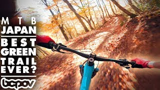
![BEST GREEN BIKE TRAIL EVER? | Riding Iwatake...]()
29:33 |
1056 |
Feb 9, 2018
Recent Trail Reports
| status | trail | date | condition | info | user |
|---|---|---|---|---|---|
| Flow Trail | Aug 12, 2024 @ 3:28am Aug 12, 2024 | Very Dry | zehavi | ||
| Expert | Aug 12, 2024 @ 3:28am Aug 12, 2024 | Very Dry | zehavi | ||
| Black Bear 黒熊 | Aug 28, 2022 @ 4:33pm Aug 28, 2022 | Wet | robmcm | ||
| Alps Downhill Course | Jul 1, 2022 @ 7:08pm Jul 1, 2022 | Dry | robmcm |
Activity Feed
| username | action | type | title | date |
|---|---|---|---|---|
| hatchleader | wishlist | region | activity #92341891 | Apr 10, 2026 @ 1:58pm Apr 10, 2026 |
| megge | ridden | trail | activity #76156350 | Jul 18, 2025 @ 7:52am Jul 18, 2025 |
| megge | ridden | trail | activity #75786617 and 2 more | Jul 12, 2025 @ 8:09pm Jul 12, 2025 |
| yondaimeeeeee | wishlist | region | activity #73164863 | Jun 5, 2025 @ 5:16pm Jun 5, 2025 |
| yondaimeeeeee | wishlist | trail | activity #73164669 and 1 more | Jun 5, 2025 @ 5:13pm Jun 5, 2025 |
Local Badges
-

Epic Mountain Bike Climb 2k40 awarded -

Climbing 10k Badge3 awarded -

Mountain Biking 100k Badge0 awarded -

Epic Ride Descent 2k40 awarded -

Descent 10k Badge5 awarded -

Descent 100k Badge0 awarded
Bike & Skill Parks
| name | type | city | rating |
|---|---|---|---|
| Hakuba Iwatake MTB Park | bike park | Hakuba |
Activity Type Stats
| activitytype | trails | distance | descent | descent distance | total vertical | rating | global rank | state rank | photos | reports | routes | ridelogs |
|---|---|---|---|---|---|---|---|---|---|---|---|---|
| Mountain Bike | 17 | 22 miles | 7,677 ft | 13 miles | 1,978 ft | #2,695 | #5 | 1 | 21 | 572 | ||
| E-Bike | 10 | 16 miles | 3,638 ft | 8 miles | 1,952 ft | #1,422 | #4 | 16 | 9 | |||
| Hike | 11 | 17 miles | 4,547 ft | 9 miles | 1,952 ft | #2,231 | #7 | 21 | 149 | |||
| Trail Running | 11 | 17 miles | 4,547 ft | 9 miles | 1,952 ft | #1,762 | #6 | 21 | 10 |
Frequently Asked Questions About Hakuba
▼
What are the best places to ride in Hakuba?
Hakuba has 2 areas to explore for mountain biking. The top rated areas are:
▼
What are the highest rated mountain biking trails in Hakuba?
The highest rated mountain biking trails in Hakuba are:
- Alps Downhill Course (4.1/5)
- Flow Trail (4/5)
- Expert (0/5)
- Minekata A Course (0/5)
- Black Bear 黒熊 (0/5)
▼
What is the best time of the year to ride in Hakuba?
Based on ride log data, the most popular months to ride in Hakuba are:
- November (2 activities)
- May (2 activities)
- February (1 activities)
▼
Where can I park to ride in Hakuba?
Check the Hakuba trail map for trailhead and parking information. Community members regularly update access and parking details for trails in the area.
Activities
Trails
Points of Interest
- By BCpov
 & contributors
 - Admins: KABA
- #21831 - 4,793 views
- hakuba activity log | embed map of Hakuba mountain bike trails |
Downloading of trail gps tracks in kml & gpx formats is enabled for Hakuba.
You must login to download files.