close
-
Layers w
- Weather Layers
- Pro
- Pro
- Pro
- Pro
- Pro
- Pro
- More Layers
- Pro
- Pro
- Pro
- Pro
-
Upgrade to

3D
Trail Conditions
- Unknown
- Snow Groomed
- Snow Packed
- Snow Covered
- Snow Cover Partial
- Freeze/thaw Cycle
- Icy
- Prevalent Mud
- Wet
- Variable
- Ideal
- Dry
- Very Dry
Trail Flow (Ridden Direction)
Trailforks scans users ridelogs to determine the most popular direction each trail is ridden. A good flowing trail network will have most trails flowing in a single direction according to their intension.
The colour categories are based on what percentage of riders are riding a trail in its intended direction.
The colour categories are based on what percentage of riders are riding a trail in its intended direction.
- > 96%
- > 90%
- > 80%
- > 70%
- > 50%
- < 50%
- bi-directional trail
- no data
Trail Last Ridden
Trailforks scans ridelogs to determine the last time a trail was ridden.
- < 2 days
- < 1 week
- < 2 weeks
- < 1 month
- < 6 months
- > 6 months
Trail Ridden Direction
The intended direction a trail should be ridden.
- Downhill Only
- Downhill Primary
- Both Directions
- Uphill Primary
- Uphill Only
- One Direction
Contribute Details
Colors indicate trail is missing specified detail.
- Description
- Photos
- Description & Photos
- Videos
Trail Popularity ?
Trailforks scans ridelogs to determine which trails are ridden the most in the last 9 months.
Trails are compared with nearby trails in the same city region with a possible 25 colour shades.
Think of this as a heatmap, more rides = more kinetic energy = warmer colors.
- most popular
- popular
- less popular
- not popular
ATV/ORV/OHV Filter
Max Vehicle Width
inches
US Cell Coverage
Legend

Radar Time
Activity Recordings
Trailforks uses anonymized public activity data.
?
Activity Recordings
Trailforks uses anonymized public activity data.
?
Personal Heatmap
▶
Activity Types
all
/
none
▶
Options
2
Date range
month
–
Winter Trails
Warning
A routing network for winter maps does not exist. Selecting trails using the winter trails layer has been disabled.
Missing Trails
Most Popular
Least Popular
Trails are colored based on popularity. The more popular a trail is, the more red. Less popular trails trend towards green.
Jump Magnitude Heatmap
Heatmap of where riders jump on trails. Zoom in to see individual jumps, click circles to view jump details.
BC Backroad Status
![map legend]()
Service Road Atlas is a free to use, community-driven service for viewing and creating reports on the numerous back-country service roads around B.C. and Alberta.

Slope Aspect
Direction the slope faces
Trails Deemphasized
Trails are shown in grey.
Only show trails with no bike usage.
Suggested Layers
Based on selected activity type
Save the current map location and zoom level as your default home location whenever this page is loaded.
SaveNo trails have been added to Halfmoon Bay.
Help build the crowd sourced database by submitting a trail.
No description for Halfmoon Bay has been added yet!
Login or register to submit one.
Activities Click to view
- Mountain Bike
1 trails
- Hike
1 trails
- Trail Running
1 trails
Region Details
Region Status
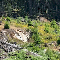
Caution as of Jun 2, 2026Popular Halfmoon Bay Mountain Biking Trails
• 100 ★ 3.9 • 1,375 ft • 22 ft • 285 •
A fun series of rock face rides with a few jumps thrown for added spice.
• 60 ★ 4.5 • 1 mile • 50 ft • 157 •
was built in late 90's and the bridges were recently upgraded. Good flow and some difficult skinnies.
• 75 ★ 0.0 • 636 ft • 0 ft • 120 •
Popular blue difficulty singletrack. This mountain bike primary trail can be used both directions and has a moderate overall physical rating with a 0 ft blue climb. On average it takes minutes to complete this trail.
• 30 ★ 0.0 • 2,329 ft • 187 ft • 107 • • moto
Less popular blue difficulty singletrack. This dirtbike/moto primary trail can be used both directions and has a moderate overall physical rating with a 187 ft blue climb. On average it takes 9 minutes to complete this trail.
• 45 ★ 4.0 • 1 mile • 46 ft • 12 • • moto
Moderately popular double black diamond difficulty singletrack. This dirtbike/moto primary trail can be used downhill primary. On average it takes 9 minutes to complete this trail.
• 90 ★ 0.0 • 1,650 ft • 51 ft • 12 • • moto
This trail has a few sections that are a bit challenging. The intention is to re-evaluate the rating to a Blue trail in the near future
• 5 ★ 0.0 • 1,329 ft • 0 ft • 8 • • atv
Time Saving quad trail shortcut parallel to Halfmoon Creek
Halfmoon Bay Mountain Bike Routes
★ 5.0 • 23 miles • 2,128 ft • 35 •
Day 1 of Great Explorations - Sunshine Coast Challenge! We start in the beautiful trails of Halfmoon Bay...
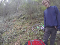
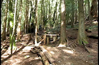
Photos of Halfmoon Bay Mountain Bike
Videos of Halfmoon Bay Mountain Bike
trail: *ROCK STAR*
0:08 |
414 |
Jul 3, 2017
trail: Elevator
6:59 |
663 |
Apr 24, 2014
trail: Elevator
2:07 |
311 |
Jan 15, 2013
trail: Elevator
0:17 |
1261 |
Apr 21, 2012

trail: Elevator
2:41 |
302 |
Jan 30, 2011

trail: Escalator
0:08 |
2114 |
May 11, 2009

trail: *ROCK STAR*
5:06 |
447 |
Sep 21, 2020 , Halfmoon Bay
Recent Trail Reports
| status | trail | date | condition | info | user |
|---|---|---|---|---|---|
| Millipede | Nov 15, 2025 @ 12:48pm (America/Vancouver) Nov 15, 2025 | Variable | 421coast | ||
| *ROCK STAR* | Aug 26, 2025 @ 12:45pm Aug 26, 2025 | Dry | 421coast | ||
| Elevator | Apr 24, 2023 @ 8:08pm Apr 24, 2023 | Ideal | 421coast | ||
| Escalator | Apr 24, 2023 @ 8:08pm Apr 24, 2023 | Variable | 421coast | ||
| ATV Trail | Sep 17, 2022 @ 9:36am Sep 17, 2022 | Dry | canadaka Trailforks |
Activity Feed
| username | action | type | title | date |
|---|---|---|---|---|
| Samobro | ridden | trail | activity #96945420 | Jun 14, 2026 @ 1:53am Jun 14, 2026 |
| AnnaCatharinajn9KR7 | wishlist | route | activity #96374820 | Jun 6, 2026 @ 8:38am Jun 6, 2026 |
| Stanbarry | ridden | trail | activity #93064060 | Apr 20, 2026 @ 11:54pm Apr 20, 2026 |
| Matthewm2upMw | wishlist | route | activity #84732733 | Nov 25, 2025 @ 8:40pm Nov 25, 2025 |
| 421coast | add | report | activity #84254676 | Nov 16, 2025 @ 9:57am Nov 16, 2025 |
Recent Comments
| username | type | title | comment | date |
|---|---|---|---|---|
| trail | Trail appears to have been closed. There is a... | Jul 14, 2024 @ 11:35am Jul 14, 2024 | ||
| trail | More slabs on the sunshine coast! This is a... | Mar 30, 2024 @ 10:52pm Mar 30, 2024 | ||
| trail | Once a great rip...now alot of overgrowth in... | Mar 26, 2023 @ 6:47pm Mar 26, 2023 | ||
| report | Glad someone is riding it! | Oct 17, 2021 @ 5:21pm Oct 17, 2021 | ||
| trail | Not too much flow here | Aug 18, 2021 @ 7:37pm Aug 18, 2021 |
Activity Type Stats
| activitytype | trails | distance | descent | descent distance | total vertical | rating | global rank | state rank | photos | reports | routes | ridelogs |
|---|---|---|---|---|---|---|---|---|---|---|---|---|
| Mountain Bike | 1 | 1,430 ft | 95 ft | 1,142 ft | 95 ft | #9,213 | #156 | 1,685 | 4 | 109 | ||
| Hike | 1 | 1,430 ft | 95 ft | 1,142 ft | 95 ft | #14,324 | #195 | 1,646 | 94 | |||
| Trail Running | 1 | 1,430 ft | 95 ft | 1,142 ft | 95 ft | #13,865 | #189 | 1,646 | 6 |
- By 1partatatime
 PACA & contributors
 - Admins: CMBTA, SCDBA
- #6405 - 8,353 views
- halfmoon bay activity log | embed map of Halfmoon Bay mountain bike trails | halfmoon bay mountain biking points of interest
Downloading of trail gps tracks in kml & gpx formats is enabled for Halfmoon Bay.
You must login to download files.