close
-
Layers w
- Weather Layers
- Pro
- Pro
- Pro
- Pro
- Pro
- Pro
- More Layers
- Pro
- Pro
- Pro
- Pro
-
Upgrade to

3D
Trail Conditions
- Unknown
- Snow Groomed
- Snow Packed
- Snow Covered
- Snow Cover Partial
- Freeze/thaw Cycle
- Icy
- Prevalent Mud
- Wet
- Variable
- Ideal
- Dry
- Very Dry
Trail Flow (Ridden Direction)
Trailforks scans users ridelogs to determine the most popular direction each trail is ridden. A good flowing trail network will have most trails flowing in a single direction according to their intension.
The colour categories are based on what percentage of riders are riding a trail in its intended direction.
The colour categories are based on what percentage of riders are riding a trail in its intended direction.
- > 96%
- > 90%
- > 80%
- > 70%
- > 50%
- < 50%
- bi-directional trail
- no data
Trail Last Ridden
Trailforks scans ridelogs to determine the last time a trail was ridden.
- < 2 days
- < 1 week
- < 2 weeks
- < 1 month
- < 6 months
- > 6 months
Trail Ridden Direction
The intended direction a trail should be ridden.
- Downhill Only
- Downhill Primary
- Both Directions
- Uphill Primary
- Uphill Only
- One Direction
Contribute Details
Colors indicate trail is missing specified detail.
- Description
- Photos
- Description & Photos
- Videos
Trail Popularity ?
Trailforks scans ridelogs to determine which trails are ridden the most in the last 9 months.
Trails are compared with nearby trails in the same city region with a possible 25 colour shades.
Think of this as a heatmap, more rides = more kinetic energy = warmer colors.
- most popular
- popular
- less popular
- not popular
ATV/ORV/OHV Filter
Max Vehicle Width
inches
US Cell Coverage
Legend

Radar Time
Activity Recordings
Trailforks uses anonymized public activity data.
?
Activity Recordings
Trailforks uses anonymized public activity data.
?
Personal Heatmap
▶
Activity Types
all
/
none
▶
Options
2
Date range
month
–
Winter Trails
Warning
A routing network for winter maps does not exist. Selecting trails using the winter trails layer has been disabled.
Missing Trails
Most Popular
Least Popular
Trails are colored based on popularity. The more popular a trail is, the more red. Less popular trails trend towards green.
Jump Magnitude Heatmap
Heatmap of where riders jump on trails. Zoom in to see individual jumps, click circles to view jump details.
BC Backroad Status
![map legend]()
Service Road Atlas is a free to use, community-driven service for viewing and creating reports on the numerous back-country service roads around B.C. and Alberta.

Slope Aspect
Direction the slope faces
Trails Deemphasized
Trails are shown in grey.
Only show trails with no bike usage.
Suggested Layers
Based on selected activity type
Save the current map location and zoom level as your default home location whenever this page is loaded.
SavePopular Trail Networks
view all areas »
No description for Halland has been added yet!
Login or register to submit one.
This region uses the Uk/Euro style trail grading system.
Region Details
- 208
- 217
- 357
- 106
- 17
Stats
- Avg Trail Rating
- Trails (view details)
- 937
- Trails Mountain Bike
- 905
- Trails E-Bike
- 23
- Trails Gravel Bike
- 212
- Trails Adaptive Bike
- 79
- Trails Winter Fat Bike
- 22
- Trails Horse
- 31
- Trails Hike
- 879
- Trails Trail Running
- 878
- Trails Nordic Ski
- 13
- Total Distance
- 421 miles
- Total Descent
- 45,726 ft
- Total Vertical
- 739 ft
- Highest Trailhead
- 740 ft
- Reports
- 918
- Photos
- 174
- Ridden Counter
- 35,500
Articles
Video & Race Report: Enduro Sweden Series 2019 Round 05 - Hallandsåsen
Sep 24, 2019 from pinkbike.com
Sub Regions
- Falkenberg (39)
- Assarp Trails (10)
- Bänared Bike Park (3)
- Centrala Falkenberg (9)
- Ljungsjön (15)
- Halmstad (101)
- Biskopstorp (8)
- Gullbrandstorp (23)
- Haverdal (3)
- Mannarp (15)
- Sandhamn (4)
- Simlångsdalen (22)
- Skedala (22)
- Hylte (6)
- Torup (2)
- Kungsbacka (585)
- Åsa (30)
- Bröndomeskogen (45)
- Fjärås (98)
- Frillesås (87)
- Hördalen (5)
- Kungsbackaskogen (20)
- Onsala (162)
- Rigortorpet (19)
- Särö (33)
- Södra Sandsjöbacka (65)
- Stättared (7)
- Laholm (56)
- Kungsbygget (10)
- Vallåsen Bike Park (16)
- Vallåsens Omnejd (11)
- Varberg (118)
- Åkulla bokskogar (34)
- Centrala Varberg (21)
- Höråsen (10)
- Tångaberg (18)
- Tofta (9)
- Trönninge (20)
Popular Halland Mountain Biking Trails
• 80 ★ 4.2 • 3,100 ft • 0 ft • 869 •
Mix of machine-built berms and hand-built trail. The trail finisesh with some bigger jumps.
• 85 ★ 3.8 • 1 mile • 11 ft • 854 •
The beginners trail, a really smooth built trail with big berms. Makes a great warm up for stronger riders.
• 90 ★ 4.4 • 3,045 ft • 0 ft • 764 •
A steep beginning that flows in a mix of hand-built trail and built-up berms.
• 100 ★ 4.6 • 1,476 ft • 11 ft • 619 •
Highly rated popular red difficulty machine groomed. This mountain bike primary trail. It features berm, bridge, drop, jump, gap jump and rock garden. Trail visibility is always easy to follow. On average it takes 2 minutes to complete this trail.
Halland Mountain Bike Routes
★ 5.0 • 8 miles • 255 ft • 4 • Loop •
Flowig, kul och naturskön led i strandnära tallskog. Buktenbanan tar dig genom naturreservatets...
★ 5.0 • 12 miles • 983 ft • 1 •
Some downhill sections, but also nice sections of flat trails.
★ 4.4 • 6 miles • 632 ft • 0 • Loop •
Börjar vid Smedingeskolan / "Stora-slingan" går på Hallandsleden, och kommer ut på landsvägen i...
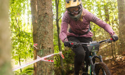
Photos of Halland Mountain Bike
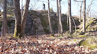
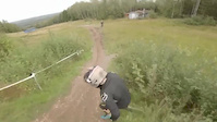
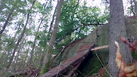
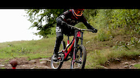
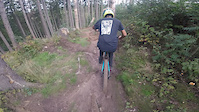
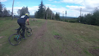
Videos of Halland Mountain Bike
trail: Two Doubles
0:03 |
56 |
Jul 15, 2022
trail: Push Up Ramp Down
0:07 |
113 |
Jul 15, 2022
trail: Lilla Kycklingen
0:20 |
236 |
Jun 17, 2020
trail: Fab's & Wic's Rampage Line
0:05 |
202 |
Aug 13, 2019
trail: Maggan
5:59 |
205 |
Oct 30, 2018
trail: Lilla Kycklingen
0:50 |
184 |
Sep 3, 2018
trail: Lilla Kycklingen
0:58 |
135 |
Sep 3, 2018
trail: Tårtan
0:04 |
193 |
May 19, 2018
Recent Trail Reports
| status | trail | date | condition | info | user |
|---|---|---|---|---|---|
| Pipeline Vallåsen Bike Park | Jun 23, 2026 @ 7:04pm (Europe/Stockholm) 37 mins | Ideal | any0ngmtb | ||
| Woodstock Vallåsen Bike Park | Jun 23, 2026 @ 7:04pm (Europe/Stockholm) 37 mins | Ideal | any0ngmtb | ||
| V-Line Vallåsen Bike Park | Jun 23, 2026 @ 7:03pm (Europe/Stockholm) 38 mins | Ideal | any0ngmtb | ||
| Tårtan Vallåsen Bike Park | Jun 23, 2026 @ 7:03pm (Europe/Stockholm) 38 mins | Ideal | any0ngmtb | ||
| Spruffs Vallåsen Bike Park | Jun 23, 2026 @ 7:02pm (Europe/Stockholm) 39 mins | Ideal | any0ngmtb | ||
| Loas Gröna Vallåsen Bike Park | Jun 23, 2026 @ 7:02pm (Europe/Stockholm) 39 mins | Ideal | any0ngmtb | ||
| Klättringen Kungsbygget | Jun 8, 2026 @ 12:50pm (Europe/Stockholm) Jun 8, 2026 | Ideal | Tobbe040 | ||
| Kyrkbyn Till Grönabur Södra Sandsjöbacka | May 29, 2026 @ 7:09pm (Europe/Stockholm) May 29, 2026 | Unknown | SebastianM74 | ||
| Skedalaslingan HMTB 1 Skedala | May 14, 2026 @ 8:09am (Europe/Stockholm) May 13, 2026 | Unknown | Erik38x3cy | ||
| Ljungheden Södra Sandsjöbacka | Apr 17, 2026 @ 4:07pm (Europe/Copenhagen) Apr 17, 2026 | Prevalent Mud | oleander |
Activity Feed
| username | action | type | title | date |
|---|---|---|---|---|
| any0ngmtb | add | report | activity #97634989 and 5 more | Jun 23, 2026 @ 10:02am 39 mins |
| any0ngmtb | vote | trail | activity #97634952 and 6 more | Jun 23, 2026 @ 10:01am 40 mins |
| any0ngmtb | ridden | trail | activity #97634931 and 7 more | Jun 23, 2026 @ 10:01am 40 mins |
| any0ngmtb | ridden | trail | activity #97634901 and 1 more | Jun 23, 2026 @ 10:00am 40 mins |
| Tobbe040 | add | report | activity #97345588 | Jun 19, 2026 @ 2:38pm Jun 19, 2026 |
Recent Comments
| username | type | title | comment | date |
|---|---|---|---|---|
| trail | Gör en stigrapport (Trail report) istället. | Aug 1, 2025 @ 12:37am Aug 1, 2025 | ||
| trail | Kalhygge , stig försvunnen eller blockerad... | Jul 31, 2025 @ 11:13pm Jul 31, 2025 | ||
| trail | Bra flow och vissa lite mer tekniska delar | Jul 27, 2025 @ 10:45am Jul 27, 2025 | ||
| report | Borde polisanmälas. Tog du bort kabeln? | Aug 17, 2024 @ 9:30am Aug 17, 2024 | ||
| trail | Någon har hänt en kabel på slutet av... | Aug 17, 2024 @ 6:13am Aug 17, 2024 |
Local Badges
-

Descent 10k Badge13 awarded -

Epic Ride Descent 2k30 awarded -
Epic Ride Descent 2k318 awarded -
Epic Ride Descent 2k1 awarded -

Mountain Biking 100k Badge0 awarded -
Descent 10k Badge70 awarded
Bike & Skill Parks
| name | type | city | rating |
|---|---|---|---|
| Vallåsen Bike Park | bike park | Laholm | |
| Kungsbygget | bike park | Laholm | |
| Onsaladirten | skill park | Kungsbacka | |
| Drop Zone | skill park | Laholm | |
| Varberg motocross | skill park | Varberg |
Activity Type Stats
| activitytype | trails | distance | descent | descent distance | total vertical | rating | global rank | state rank | photos | reports | routes | ridelogs |
|---|---|---|---|---|---|---|---|---|---|---|---|---|
| Mountain Bike | 905 | 408 miles | 44,898 ft | 184 miles | 738 ft | 171 | 918 | 29 | 57,860 | |||
| E-Bike | 23 | 8 miles | 1,795 ft | 4 miles | 486 ft | 808 | 1 | 1,309 | ||||
| Gravel Bike | 212 | 109 miles | 7,051 ft | 42 miles | 656 ft | 1 | 193 | |||||
| Adaptive Bike | 79 | 38 miles | 2,828 ft | 15 miles | 656 ft | 42 | ||||||
| Winter Fat Bike | 22 | 18 miles | 1,542 ft | 7 miles | 574 ft | 36 | ||||||
| Horse | 31 | 10 miles | 1,214 ft | 5 miles | 400 ft | 60 | ||||||
| Hike | 879 | 394 miles | 38,222 ft | 173 miles | 738 ft | 891 | 3 | 2,344 | ||||
| Trail Running | 878 | 388 miles | 37,913 ft | 171 miles | 738 ft | 1 | 886 | 8 | 6,010 | |||
| Nordic Ski | 13 | 7 miles | 515 ft | 3 miles | 308 ft | 531 |
Activities
Trails
Points of Interest
- By brenthillier
 NSMBA TRAILFORKS & contributors
 - Admins: ollesvenskonthetrail, JALLE, OrjanX, martinlindstr, MrJekyll
- #9832 - 10,307 views
- halland activity log | embed map of Halland mountain bike trails | halland mountain biking points of interest
Downloading of trail gps tracks in kml & gpx formats is enabled for Halland.
You must login to download files.