
close
-
Layers w
- Weather Layers
- Pro
- Pro
- Pro
- Pro
- Pro
- Pro
- More Layers
- Pro
- Pro
- Pro
- Pro
-
Upgrade to

3D
Trail Conditions
- Unknown
- Snow Groomed
- Snow Packed
- Snow Covered
- Snow Cover Partial
- Freeze/thaw Cycle
- Icy
- Prevalent Mud
- Wet
- Variable
- Ideal
- Dry
- Very Dry
Trail Flow (Ridden Direction)
Trailforks scans users activity logs to determine the most popular direction each trail is ridden. A good flowing trail network will have most trails flowing in a single direction according to their intension.
The colour categories are based on what percentage of users are riding a trail in its intended direction.
The colour categories are based on what percentage of users are riding a trail in its intended direction.
- > 96%
- > 90%
- > 80%
- > 70%
- > 50%
- < 50%
- bi-directional trail
- no data
Trail Last Ridden
Trailforks scans activity logs to determine the last time a trail was ridden.
- < 2 days
- < 1 week
- < 2 weeks
- < 1 month
- < 6 months
- > 6 months
Trail Ridden Direction
The intended direction a trail should be ridden.
- Downhill Only
- Downhill Primary
- Both Directions
- Uphill Primary
- Uphill Only
- One Direction
Contribute Details
Colors indicate trail is missing specified detail.
- Description
- Photos
- Description & Photos
- Videos
Trail Popularity ?
Trailforks scans activity logs to determine which trails are ridden the most in the last 9 months.
Trails are compared with nearby trails in the same city region with a possible 25 colour shades.
Think of this as a heatmap, more activities = more kinetic energy = warmer colors.
- most popular
- popular
- less popular
- not popular
ATV/ORV/OHV Filter
Max Vehicle Width
inches
US Cell Coverage
Legend

Radar Time
Activity Recordings
Trailforks uses anonymized public activity data.
?
Activity Recordings
Trailforks uses anonymized public activity data.
?
Personal Heatmap
▶
Activity Types
all
/
none
▶
Options
2
Date range
month
–
Winter Trails
Warning
A routing network for winter maps does not exist. Selecting trails using the winter trails layer has been disabled.
Missing Trails
Most Popular
Least Popular
Trails are colored based on popularity. The more popular a trail is, the more red. Less popular trails trend towards green.
Jump Magnitude Heatmap
Heatmap of where users jump on trails. Zoom in to see individual jumps, click circles to view jump details.
BC Backroad Status
![map legend]()
Service Road Atlas is a free to use, community-driven service for viewing and creating reports on the numerous back-country service roads around B.C. and Alberta.

Slope Aspect
Direction the slope faces
Trails Deemphasized
Trails are shown in grey.
Only show trails with no bike usage.
Suggested Layers
Based on selected activity type
Save the current map location and zoom level as your default home location whenever this page is loaded.
SaveDear Hammerfest Trail Users,
The Arrowsmith Cycling Club (ACC) advises all trail users that Mosaic Forest Management has recently completed the logging activities in the trail network. There is continued log hauling in progress as well as possible site clean-up. Affected trails are primarily open but riders still need to use caution in the newly logged areas and give any industrial activity a wide berth. Some trails may still have closures.
At Mosaic, safety is our highest priority. Our employees and contractors abide by strict safety rules and we expect trail users to do the same. Hours of operation for the area shown above are 5am to midnight, seven days/week.
Please respect all signage and not enter any active or closed area for everyone’s safety and stay clear of any industrial traffic.
The following information applies to this area:
• Our Professional foresters and biologists have designed the area taking into consideration safety, recreation, visual quality, wildlife, biodiversity and other values. For information related to commercial thinning, please visit https://www.mosaicforests.com/news-views/tree-thinning-as-forest-gardening
• Mosaic supports many recreation access groups throughout Vancouver Island. Our current ACC partnership agreement relating to our private land in this area enables both groups to work together in the creation of trail strategies that support mountain biking, race events, tourism and other forms of recreation in the community.
• If you’re interested in more information about Mosaic Forest Management, please visit our website at: https://www.mosaicforests.com
Our sincere apologies for any inconvenience this may
Any additional updates to logging activities will be posted when known
Please be advised that Mosaic operations could take place at anytime, including firewood access permits. At Mosaic, safety is a high priority. When any activities are taking place employees and contractors abide by strict safety rules. Mosaic expects trail users to abide by their safety rules and respect their worksite by not entering any active or closed areas – please respect all signage.
Mosaic Forest Management currently provides ACC with an Access Agreement to their private managed forest lands in and around Hammerfest. This agreement enables both groups to work together in the creation of trails strategies that support mountain biking, race events, tourism and recreation.
The agreement gives ACC formal access to manage, maintain, and recreate in the Hammerfest Trail Network while providing Mosaic with assurance of a high level of conduct among users and a focus on safety. ACC will be responsible for stewardship of the trails to ensure compliance with industry standards for trail building.[/FONT]
THANKS to Mosaic for the small parking area (about 12 vehicles) that was constructed just prior to the yellow gate.
HammerFest Trail Network is located near the Englishman River Falls Provincial Park. This is primarily an Intermediate riding area, especially for the trails below the Hydro ROW. Trails above this ROW tend towards Black diamond. Trails that drop down to the Englishman River are also Black Diamond but very scenic with a stiff climb back up, always a challenge. Ride these river trails in a down river direction.
HammerFest is host to the XC and Enduro races as part of the Island Cup Series. This is a 'pedal up' riding area, there are no shuttle options.
Best place to start is in the main parking lot in the Englishman River Falls Park. Use the newly completed Park trails to access Walrus for the start of a HammerFest tour.
Have fun, ride safe and join the Arrowsmith Cycling Club!
The Arrowsmith Cycling Club (ACC) advises all trail users that Mosaic Forest Management has recently completed the logging activities in the trail network. There is continued log hauling in progress as well as possible site clean-up. Affected trails are primarily open but riders still need to use caution in the newly logged areas and give any industrial activity a wide berth. Some trails may still have closures.
At Mosaic, safety is our highest priority. Our employees and contractors abide by strict safety rules and we expect trail users to do the same. Hours of operation for the area shown above are 5am to midnight, seven days/week.
Please respect all signage and not enter any active or closed area for everyone’s safety and stay clear of any industrial traffic.
The following information applies to this area:
• Our Professional foresters and biologists have designed the area taking into consideration safety, recreation, visual quality, wildlife, biodiversity and other values. For information related to commercial thinning, please visit https://www.mosaicforests.com/news-views/tree-thinning-as-forest-gardening
• Mosaic supports many recreation access groups throughout Vancouver Island. Our current ACC partnership agreement relating to our private land in this area enables both groups to work together in the creation of trail strategies that support mountain biking, race events, tourism and other forms of recreation in the community.
• If you’re interested in more information about Mosaic Forest Management, please visit our website at: https://www.mosaicforests.com
Our sincere apologies for any inconvenience this may
Any additional updates to logging activities will be posted when known
Please be advised that Mosaic operations could take place at anytime, including firewood access permits. At Mosaic, safety is a high priority. When any activities are taking place employees and contractors abide by strict safety rules. Mosaic expects trail users to abide by their safety rules and respect their worksite by not entering any active or closed areas – please respect all signage.
Mosaic Forest Management currently provides ACC with an Access Agreement to their private managed forest lands in and around Hammerfest. This agreement enables both groups to work together in the creation of trails strategies that support mountain biking, race events, tourism and recreation.
The agreement gives ACC formal access to manage, maintain, and recreate in the Hammerfest Trail Network while providing Mosaic with assurance of a high level of conduct among users and a focus on safety. ACC will be responsible for stewardship of the trails to ensure compliance with industry standards for trail building.[/FONT]
THANKS to Mosaic for the small parking area (about 12 vehicles) that was constructed just prior to the yellow gate.
HammerFest Trail Network is located near the Englishman River Falls Provincial Park. This is primarily an Intermediate riding area, especially for the trails below the Hydro ROW. Trails above this ROW tend towards Black diamond. Trails that drop down to the Englishman River are also Black Diamond but very scenic with a stiff climb back up, always a challenge. Ride these river trails in a down river direction.
HammerFest is host to the XC and Enduro races as part of the Island Cup Series. This is a 'pedal up' riding area, there are no shuttle options.
Best place to start is in the main parking lot in the Englishman River Falls Park. Use the newly completed Park trails to access Walrus for the start of a HammerFest tour.
Have fun, ride safe and join the Arrowsmith Cycling Club!
Primary Trail Type: Cross-Country
eBikes Allowed:
Yes
Land Status: Private Managed Forest
Land Manager: Mosaic Forest Management
 google parking directions
 Access Info:
Yellow Gate about 100m before the Park. Kiosk map of trail network at this location.
Main parking lot in the Englishman River Falls Provincial Park!
Main parking lot in the Englishman River Falls Provincial Park!
Links
Activities Click to view
- Mountain Bike
144 trails
- E-Bike
142 trails
- Gravel Bike
42 trails
- Hike
138 trails
- Trail Running
139 trails
Region Details
- 41
- 11
- 63
- 24
- 5
Region Status
Open as of 1 day

Stats
- Avg Trail Rating
- Trails (view details)
- 144
- Trails Mountain Bike
- 144
- Trails E-Bike
- 142
- Trails Gravel Bike
- 42
- Trails Adaptive Bike
- 35
- Trails Winter Fat Bike
- 4
- Trails Hike
- 138
- Trails Trail Running
- 139
- Trails Dirtbike/Moto
- 5
- Total Distance
- 67 miles
- Total Descent Distance
- 28 miles
- Total Descent
- 15,121 ft
- Total Vertical
- 3,155 ft
- Highest Trailhead
- 3,615 ft
- Reports
- 4,827
- Photos
- 1,377
- Completed Counter
- 90,373
Popular HammerFest Mountain Biking Trails
• 100 ★ 3.9 • 2,467 ft • 0 ft • 2,547 •
Combine this with to start an easy climb to other lower HammerFest trails. The last section in the whole trail network.
• 85 ★ 4.3 • 1,224 ft • 9 ft • 1,663 •
The under the powerlines portion of . Fast and flowy!
• 100 ★ 3.9 • 476 ft • 4 ft • 1,573 •
Steep section that has the most elevation on the whole trail. Use for the climb.
• 95 ★ 4.7 • 1,775 ft • 19 ft • 1,461 •
A new, multi-use, access trail at Englishman River Falls Provincial Park. A family friendly route connecting the lower 'Little Dipper' to the 'Big Dipper' trail loops. Also provides a connection to the adjacent mountain bike trail...
• 100 ★ 4.7 • 548 ft • 102 ft • 1,447 •
Fun twisty, turny section of Temple of the Dog. Crosses the road under the powerlines and gives access to , and more.
• 95 ★ 4.7 • 1,033 ft • 112 ft • 1,396 •
Starts from a road landing known as the Saloon. Fun little trail that connects down to some of the more popular trails at HF.
• 95 ★ 4.9 • 1,158 ft • 75 ft • 1,388 •
Phase 2 portion of the trail in the Englishman River Falls Park. A family friendly final climb up to the ' '. Also with a connection to the adjacent mountain bike trail network at HammerFest. Being machine built, trail is wide enough...
HammerFest Mountain Bike Routes
★ 4.0 • 5 miles • 880 ft • 14 • Loop •
Pretty much a bit of everything in this loop. Located primarily in the lower portions of HammerFest so...
★ 3.0 • 20 miles • 3,602 ft • 39 •
BCBR 2026 Stage 4 at Hammerfest, a brand new stage location located near Parksville, BC. Racers are going...
3 miles • 377 ft • 11 • Loop •
May Contest time! This is a special YOUTH ONLY loop. Youth riders are more then welcome to drag their...
5 miles • 838 ft • 10 • Loop •
Classic HammerFest loop, great for beginner to intermediate riders. Takes about an hour, has some roots on...
★ 2.0 • 8 miles • 1,264 ft • 11 • Loop •
Two laps up to the powerlines to make a 13km Loop riding two of the best trails on the lower mountain....
Photos of HammerFest Mountain Bike
Videos of HammerFest Mountain Bike
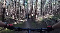
trail: Jughead
0:13 |
470 |
Dec 5, 2021
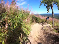
trail: Dirt Farm
0:32 |
623 |
Aug 12, 2021

trail: Scooby-Doo
6:24 |
324 |
Mar 12, 2021
trail: Jughead
7:51 |
284 |
Mar 12, 2021
trail: Cranky
0:10 |
116 |
Oct 5, 2020
trail: Free Fall
0:11 |
189 |
Jun 28, 2020
trail: Tomcat
0:11 |
329 |
May 6, 2020
trail: Pumpkinator
0:27 |
208 |
Jul 4, 2019
Current Trail Warnings
| status | trail | date | condition | user | info |
|---|---|---|---|---|---|
| Alt Energy | Jul 19, 2026 @ 10:18am (America/Vancouver) Jul 19, 2026 | Ideal | mpatt | ||
| Coombs Glacier Con | Jul 11, 2026 @ 12:14pm (America/Vancouver) Jul 11, 2026 | Unknown | cyclotoine CMBC | Overgrown unused. This is not the way |
Recent Trail Reports
Activity Feed
| username | action | type | title | date |
|---|---|---|---|---|
| FCase | wishlist | route | activity #99791856 | Jul 22, 2026 @ 7:11pm 24 mins |
| mpatt | add | report | activity #99751418 and 19 more | Jul 22, 2026 @ 8:37am 11 hours |
| mpatt | add | report | activity #99606213 and 18 more | Jul 20, 2026 @ 7:25am 3 days |
| Rebecca500tgu | vote | trail | activity #99560451 and 1 more | Jul 19, 2026 @ 12:23pm Jul 19, 2026 |
| adfam | add | report | activity #99559090 and 1 more | Jul 19, 2026 @ 12:10pm Jul 19, 2026 |
Recent Comments
| username | type | title | comment | date |
|---|---|---|---|---|
| report | The ride around appears in good order. | Jul 12, 2026 @ 10:23pm Jul 12, 2026 | ||
| report | Roughly 200 m (?) in from the west entrance.... | Jul 11, 2026 @ 7:07pm Jul 11, 2026 | ||
| trail | Climbed up this yesterday and on the last of... | Jul 6, 2026 @ 1:27pm Jul 6, 2026 | ||
| trail | Really fun track with some legit steep... | Jun 15, 2026 @ 4:37pm Jun 15, 2026 | ||
| report | Hard to imagine that Insurrection would be at... | Jun 14, 2026 @ 1:27pm Jun 14, 2026 |
Nearby Areas
| name | distance | ||||
|---|---|---|---|---|---|
| Little Mountain | 4 | 16 | 2 | 2 | 4.3 km |
| Top Bridge/Englishman River Regional Park | 8 | 6 | 1 | 6.1 km | |
| Pheasant Glen | 33 | 58 | 7 | 6.2 km | |
| Northwest Bay Trails | 75 | 33 | 7.1 km | ||
| Laburnum Road | 21 | 25 | 8.3 km |
Local Mountain Biking Directory
-
Arrowsmith Cycling ClubClub
![Arrowsmith Cycling Club]()
-
Arrowsmith Bikes PBike Shop
![Arrowsmith Bikes P]()
-
Island CycleBike Shop

Local Products
Activity Type Stats
| activitytype | trails | distance | descent | descent distance | total vertical | rating | global rank | state rank | photos | reports | routes | activity logs |
|---|---|---|---|---|---|---|---|---|---|---|---|---|
| Mountain Bike | 144 | 67 miles | 15,121 ft | 28 miles | 3,156 ft | #94 | #13 | 1,362 | 4,827 | 26 | 27,243 | |
| E-Bike | 142 | 60 miles | 14,495 ft | 27 miles | 1,811 ft | #809 | #40 | 6 | 4,483 | 6 | 1,345 | |
| Gravel Bike | 42 | 33 miles | 3,494 ft | 10 miles | 3,153 ft | #18 | #7 | 357 | 36 | |||
| Adaptive Bike | 35 | 25 miles | 2,959 ft | 7 miles | 3,130 ft | #117 | #26 | 548 | 1 | |||
| Winter Fat Bike | 4 | 1 mile | 499 ft | 4,370 ft | 476 ft | #117 | #26 | 164 | 1 | |||
| Hike | 138 | 61 miles | 12,946 ft | 25 miles | 3,156 ft | #1,815 | #96 | 3 | 4,697 | 2 | 559 | |
| Trail Running | 139 | 62 miles | 13,196 ft | 26 miles | 3,156 ft | #1,073 | #44 | 4 | 4,697 | 3 | 433 | |
| Dirtbike/Moto | 5 | 3 miles | 112 ft | 2,487 ft | 843 ft | 581 | 68 |
Frequently Asked Questions About HammerFest
▼
What are the highest rated mountain biking trails in HammerFest?
The highest rated mountain biking trails in HammerFest are:
- Tomcat (4.6/5)
- Barefoot (4.5/5)
- Milky Way (4.5/5)
- Scooby-Doo (4.5/5)
- DUI (4.4/5)
▼
What is the best time of the year to ride in HammerFest?
Based on ride log data, the most popular months to ride in HammerFest are:
- July (678 activities)
- August (601 activities)
- May (550 activities)
▼
Where can I park to ride in HammerFest?
There are 2 parking locations listed in HammerFest. The most popular parking spots are:
▼
What is the longest trail in HammerFest?
The longest trail in HammerFest is Barefoot at 3.7 km. View all trails sorted by distance.
Activities
Trails
- By rapid-roy
 TrailsBC ACC & contributors
 - Admins: ACC, heavyd21, arrowsmithcyclingclub, adfam
- #1352 - 78,290 views
- hammerfest activity log | embed map of HammerFest mountain bike trails | hammerfest mountain biking points of interest polygons
Downloading of trail gps tracks in kml & gpx formats is enabled for HammerFest.
You must login to download files.