close
-
Layers w
- Weather Layers
- Pro
- Pro
- Pro
- Pro
- Pro
- Pro
- More Layers
- Pro
- Pro
- Pro
- Pro
-
Upgrade to

3D
Trail Conditions
- Unknown
- Snow Groomed
- Snow Packed
- Snow Covered
- Snow Cover Partial
- Freeze/thaw Cycle
- Icy
- Prevalent Mud
- Wet
- Variable
- Ideal
- Dry
- Very Dry
Trail Flow (Ridden Direction)
Trailforks scans users ridelogs to determine the most popular direction each trail is ridden. A good flowing trail network will have most trails flowing in a single direction according to their intension.
The colour categories are based on what percentage of riders are riding a trail in its intended direction.
The colour categories are based on what percentage of riders are riding a trail in its intended direction.
- > 96%
- > 90%
- > 80%
- > 70%
- > 50%
- < 50%
- bi-directional trail
- no data
Trail Last Ridden
Trailforks scans ridelogs to determine the last time a trail was ridden.
- < 2 days
- < 1 week
- < 2 weeks
- < 1 month
- < 6 months
- > 6 months
Trail Ridden Direction
The intended direction a trail should be ridden.
- Downhill Only
- Downhill Primary
- Both Directions
- Uphill Primary
- Uphill Only
- One Direction
Contribute Details
Colors indicate trail is missing specified detail.
- Description
- Photos
- Description & Photos
- Videos
Trail Popularity ?
Trailforks scans ridelogs to determine which trails are ridden the most in the last 9 months.
Trails are compared with nearby trails in the same city region with a possible 25 colour shades.
Think of this as a heatmap, more rides = more kinetic energy = warmer colors.
- most popular
- popular
- less popular
- not popular
ATV/ORV/OHV Filter
Max Vehicle Width
inches
US Cell Coverage
Legend

Radar Time
Activity Recordings
Trailforks uses anonymized public activity data.
?
Activity Recordings
Trailforks uses anonymized public activity data.
?
Personal Heatmap
▶
Activity Types
all
/
none
▶
Options
2
Date range
month
–
Winter Trails
Warning
A routing network for winter maps does not exist. Selecting trails using the winter trails layer has been disabled.
Missing Trails
Most Popular
Least Popular
Trails are colored based on popularity. The more popular a trail is, the more red. Less popular trails trend towards green.
Jump Magnitude Heatmap
Heatmap of where riders jump on trails. Zoom in to see individual jumps, click circles to view jump details.
BC Backroad Status
![map legend]()
Service Road Atlas is a free to use, community-driven service for viewing and creating reports on the numerous back-country service roads around B.C. and Alberta.

Slope Aspect
Direction the slope faces
Trails Deemphasized
Trails are shown in grey.
Only show trails with no bike usage.
Suggested Layers
Based on selected activity type
Save the current map location and zoom level as your default home location whenever this page is loaded.
Save
No description for Harrisburg has been added yet!
Login or register to submit one.
Activities Click to view
- Mountain Bike
16 trails
- E-Bike
1 trails
- Adaptive Bike
0 trails
- Winter Fat Bike
0 trails
- Hike
25 trails
- Trail Running
25 trails
Region Details
- 1
- 1
- 10
- 4
Region Status
Open as of May 11, 2026Stats
- Avg Trail Rating
- Trails (view details)
- 16
- Trails Mountain Bike
- 16
- Trails E-Bike
- 1
- Trails Hike
- 25
- Trails Trail Running
- 25
- Trails Snowshoe
- 1
- Total Distance
- 15 miles
- Total Descent
- 1,104 ft
- Total Vertical
- 166 ft
- Highest Trailhead
- 466 ft
- Reports
- 244
- Photos
- 31
- Ridden Counter
- 4,137
Sub Regions
-
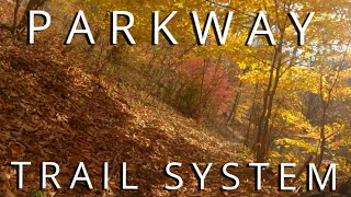
Parkway Trail System
- 1
- 8
- 4
-
Susquehanna Riverlands State Park
-
Wildwood Park
Popular Harrisburg Mountain Biking Trails
• 80 ★ 3.0 • 833 ft • 19 ft • 327 •
Popular blue difficulty singletrack. This mountain bike primary trail can be used one direction and has a moderate overall physical rating with a 19 ft blue climb. Trail visibility is always easy to follow. On average it takes minutes to complete this trail.
• 85 ★ 2.0 • 827 ft • 11 ft • 289 •
Popular blue difficulty singletrack. This mountain bike primary trail can be used one direction and has a moderate overall physical rating with a 11 ft blue climb. Trail visibility is always easy to follow. On average it takes 1 minutes to complete this trail.
• 65 ★ 4.0 • 1,650 ft • 41 ft • 269 •
Moderately popular blue difficulty singletrack. This mountain bike primary trail can be used one direction. On average it takes 2 minutes to complete this trail.
• 100 ★ 3.5 • 5,148 ft • 115 ft • 263 •
Add-on trail to PAX-1.. sometimes referred to as the graveyard
• 95 ★ 3.5 • 2,070 ft • 26 ft • 255 •
Popular blue difficulty singletrack. This mountain bike primary trail can be used both directions. On average it takes 3 minutes to complete this trail.
Harrisburg Mountain Bike Routes
★ 5.0 • 5 miles • 493 ft • 10 •
All Greenbelt Parkway Pax trails 1 through 5 loop. Start and end at parking lot.
12 miles • 796 ft • 15 •
This route follows almost every trail in the Cam and Pax loops of the Capital Parkway trail system.
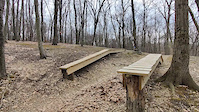
Photos of Harrisburg Mountain Bike
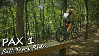
Videos of Harrisburg Mountain Bike
trail: Capital Area Greenbelt
0:10 |
200 |
Mar 21, 2022

trail: PAX 1
0:22 |
87 |
Jun 28, 2021

trail: PAX 4
2:11 |
289 |
Feb 13, 2020

trail: PAX 1
2:22 |
264 |
Dec 3, 2021 , Harrisburg
trail: CAM 3
1:10:39 |
339 |
Nov 24, 2021 , Harrisburg
trail: PAX 1
17:04 |
530 |
Aug 19, 2021 , Harrisburg

trail: CAM 1
10:52 |
454 |
Dec 31, 2019 , Harrisburg

trail: PAX 1A
3:00 |
487 |
Dec 31, 2019 , Harrisburg
Recent Trail Reports
| status | trail | date | condition | info | user |
|---|---|---|---|---|---|
| PAX 3 | Apr 15, 2026 @ 11:49am (America/New_York) Apr 15, 2026 | Ideal | JasonzrTzp8 | ||
| PAX 2 | Apr 15, 2026 @ 11:49am (America/New_York) Apr 15, 2026 | Ideal | JasonzrTzp8 | ||
| PAX 1A | Apr 15, 2026 @ 11:49am (America/New_York) Apr 15, 2026 | Ideal | JasonzrTzp8 | ||
| PAX 1 | Apr 15, 2026 @ 11:49am (America/New_York) Apr 15, 2026 | Ideal | JasonzrTzp8 | ||
| Doc 1 | Mar 9, 2026 @ 12:29pm (America/New_York) Mar 9, 2026 | Ideal | JasonzrTzp8 | ||
| PAX 5B | Mar 9, 2026 @ 12:29pm (America/New_York) Mar 9, 2026 | Variable | JasonzrTzp8 | ||
| PAX 4 | Mar 9, 2026 @ 12:29pm (America/New_York) Mar 9, 2026 | Ideal | JasonzrTzp8 | ||
| CAM 4 | Oct 20, 2025 @ 12:05pm (America/New_York) Oct 20, 2025 | Dry | JasonzrTzp8 | ||
| CAM 3 | Oct 20, 2025 @ 12:05pm (America/New_York) Oct 20, 2025 | Dry | JasonzrTzp8 | ||
| CAM 2 | Oct 20, 2025 @ 12:05pm (America/New_York) Oct 20, 2025 | Ideal | JasonzrTzp8 |
Activity Feed
| username | action | type | title | date |
|---|---|---|---|---|
| joecapshit | ridden | trail | activity #97262097 and 1 more | Jun 18, 2026 @ 10:38am Jun 18, 2026 |
| Justin2mDOiV | ridden | trail | activity #96965426 | Jun 14, 2026 @ 7:16am Jun 14, 2026 |
| nailgrinder | ridden | trail | activity #96545494 | Jun 8, 2026 @ 9:36am Jun 8, 2026 |
| hobbesflop | wishlist | route | activity #95768374 | May 29, 2026 @ 4:58am May 29, 2026 |
| JasonzrTzp8 | add | report | activity #92668938 | Apr 15, 2026 @ 10:16am Apr 15, 2026 |
Recent Comments
| username | type | title | comment | date |
|---|---|---|---|---|
| trail | Trail closed 500 yards in What a disappointment. | Oct 18, 2024 @ 5:53am Oct 18, 2024 | ||
| report | Samba maintains these trails. Post on... | Sep 7, 2022 @ 5:21pm Sep 7, 2022 | ||
| report | Massive tree down on cam 3. Right before the... | Mar 2, 2022 @ 1:55pm Mar 2, 2022 | ||
| trail | Takes off from the parking lot. Need to make a... | Dec 13, 2020 @ 10:33am Dec 13, 2020 | ||
| trail | Large tree across the trail | Oct 18, 2020 @ 5:50pm Oct 18, 2020 |
Local Badges
-

Epic Ride Climb 2k3 awarded -

Climbing 10k Badge27 awarded -

Climbing 100k Badge0 awarded -

Epic Ride Descent 2k3 awarded -

Descent 10k Badge26 awarded -

Descent 100k Badge0 awarded
Activity Type Stats
| activitytype | trails | distance | descent | descent distance | total vertical | rating | global rank | state rank | photos | reports | routes | ridelogs |
|---|---|---|---|---|---|---|---|---|---|---|---|---|
| Mountain Bike | 16 | 15 miles | 1,106 ft | 7 miles | 167 ft | #3,899 | #1,307 | 31 | 244 | 3 | 8,306 | |
| E-Bike | 1 | 6 miles | 197 ft | 4 miles | 167 ft | #8,541 | #2,597 | 218 | 242 | |||
| Hike | 25 | 13 miles | 892 ft | 6 miles | 167 ft | #8,178 | #2,878 | 240 | 1 | 375 | ||
| Trail Running | 25 | 13 miles | 892 ft | 6 miles | 167 ft | #8,734 | #2,929 | 238 | 172 | |||
| Snowshoe | 1 |
Frequently Asked Questions About Harrisburg
▼
What are the best places to ride in Harrisburg?
Harrisburg has 4 areas to explore for mountain biking. The top rated areas are:
▼
What are the highest rated mountain biking trails in Harrisburg?
▼
What is the best time of the year to ride in Harrisburg?
Based on ride log data, the most popular months to ride in Harrisburg are:
- October (70 activities)
- July (65 activities)
- August (61 activities)
▼
Where can I park to ride in Harrisburg?
Activities
Trails
Points of Interest
- By RDSmtbiker
 SAMBA-GD & contributors
 - Admins: SAMBA
- #19703 - 8,451 views
- harrisburg activity log | embed map of Harrisburg mountain bike trails | harrisburg mountain biking points of interest
Downloading of trail gps tracks in kml & gpx formats is enabled for Harrisburg.
You must login to download files.