
close
-
Layers w
- Weather Layers
- Pro
- Pro
- Pro
- Pro
- Pro
- Pro
- More Layers
- Pro
- Pro
- Pro
- Pro
-
Upgrade to

3D
Trail Conditions
- Unknown
- Snow Groomed
- Snow Packed
- Snow Covered
- Snow Cover Partial
- Freeze/thaw Cycle
- Icy
- Prevalent Mud
- Wet
- Variable
- Ideal
- Dry
- Very Dry
Trail Flow (Ridden Direction)
Trailforks scans users ridelogs to determine the most popular direction each trail is ridden. A good flowing trail network will have most trails flowing in a single direction according to their intension.
The colour categories are based on what percentage of riders are riding a trail in its intended direction.
The colour categories are based on what percentage of riders are riding a trail in its intended direction.
- > 96%
- > 90%
- > 80%
- > 70%
- > 50%
- < 50%
- bi-directional trail
- no data
Trail Last Ridden
Trailforks scans ridelogs to determine the last time a trail was ridden.
- < 2 days
- < 1 week
- < 2 weeks
- < 1 month
- < 6 months
- > 6 months
Trail Ridden Direction
The intended direction a trail should be ridden.
- Downhill Only
- Downhill Primary
- Both Directions
- Uphill Primary
- Uphill Only
- One Direction
Contribute Details
Colors indicate trail is missing specified detail.
- Description
- Photos
- Description & Photos
- Videos
Trail Popularity ?
Trailforks scans ridelogs to determine which trails are ridden the most in the last 9 months.
Trails are compared with nearby trails in the same city region with a possible 25 colour shades.
Think of this as a heatmap, more rides = more kinetic energy = warmer colors.
- most popular
- popular
- less popular
- not popular
ATV/ORV/OHV Filter
Max Vehicle Width
inches
US Cell Coverage
Legend

Radar Time
Activity Recordings
Trailforks uses anonymized public activity data.
?
Activity Recordings
Trailforks uses anonymized public activity data.
?
Personal Heatmap
▶
Activity Types
all
/
none
▶
Options
2
Date range
month
–
Winter Trails
Warning
A routing network for winter maps does not exist. Selecting trails using the winter trails layer has been disabled.
Missing Trails
Most Popular
Least Popular
Trails are colored based on popularity. The more popular a trail is, the more red. Less popular trails trend towards green.
Jump Magnitude Heatmap
Heatmap of where riders jump on trails. Zoom in to see individual jumps, click circles to view jump details.
BC Backroad Status
![map legend]()
Service Road Atlas is a free to use, community-driven service for viewing and creating reports on the numerous back-country service roads around B.C. and Alberta.

Slope Aspect
Direction the slope faces
Trails Deemphasized
Trails are shown in grey.
Only show trails with no bike usage.
Suggested Layers
Based on selected activity type
Save the current map location and zoom level as your default home location whenever this page is loaded.
SaveThe Lyme Corner Trails complex includes, Hartman Park, Walbridge Woodlands, and the Philip E. Young Preserve. The Lyme Land Conservation Trust map and guide covers all three.
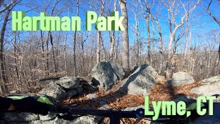
Hartman park is owned by the Town of Lyme as is a great place to ride a mountain bike. The terrain is more a “Rough XC” surface but has more than enough fire road and XC style trails as well as hidden little gems here and there for the bigger bouncy guys to play on. The town and NEMBA have had a really good relationship and we have worked together on multiple projects to improve the ride and trail sustainability of the area. Recently the town acquired the Philip Young Preserve a rather large parcel of property on the southern border and added trails to and from Hartman Park almost doubling the mileage of ride able trails. If you want even more mileage the park is 3/4’s surrounded but Nehantic State Forest (northern block) which the fire road connects to.
Trails are for non-motorized multi-use except for the white blazed trails designated for foot travel only.
The park also hosts a portion of the Goodwin Trail. A local map can be found here: http://www.eightmileriver.org/wp-content/uploads/2017/07/GrassyHillGungy_20170421.pdf
Hartman park is owned by the Town of Lyme as is a great place to ride a mountain bike. The terrain is more a “Rough XC” surface but has more than enough fire road and XC style trails as well as hidden little gems here and there for the bigger bouncy guys to play on. The town and NEMBA have had a really good relationship and we have worked together on multiple projects to improve the ride and trail sustainability of the area. Recently the town acquired the Philip Young Preserve a rather large parcel of property on the southern border and added trails to and from Hartman Park almost doubling the mileage of ride able trails. If you want even more mileage the park is 3/4’s surrounded but Nehantic State Forest (northern block) which the fire road connects to.
Trails are for non-motorized multi-use except for the white blazed trails designated for foot travel only.
The park also hosts a portion of the Goodwin Trail. A local map can be found here: http://www.eightmileriver.org/wp-content/uploads/2017/07/GrassyHillGungy_20170421.pdf
source: Lyme Corner Trails
Primary Trail Type: Cross-Country
eBikes Allowed:
No
Land Status: Conservation Reserve
Land Manager: Lyme Land Trust
 google parking directions
Links
Activities Click to view
- Mountain Bike
36 trails
- Horse
14 trails
- Hike
39 trails
- Trail Running
38 trails
- Snowshoe
10 trails
- Nordic Ski
20 trails
Region Details
- 4
- 8
- 24
Region Status
Caution as of Jul 11, 2026
Stats
- Avg Trail Rating
- Trails (view details)
- 39
- Trails Mountain Bike
- 36
- Trails E-Bike
- 1
- Trails Horse
- 14
- Trails Hike
- 39
- Trails Trail Running
- 38
- Trails Snowshoe
- 10
- Trails Nordic Ski
- 20
- Total Distance
- 13 miles
- Total Descent
- 1,182 ft
- Total Vertical
- 272 ft
- Highest Trailhead
- 435 ft
- Reports
- 32
- Photos
- 19
- Ridden Counter
- 1,766
Popular Lyme Corner Trails Mountain Biking Trails
• 85 ★ 0.0 • 4,147 ft • 85 ft • 92 •
Popular blue difficulty singletrack. This multi-use trail can be used both directions and has a moderate overall physical rating with a 85 ft blue climb. Trail visibility is always easy to follow. On average it takes 8 minutes to complete this trail.
• 100 ★ 0.0 • 692 ft • 15 ft • 75 •
Popular blue difficulty singletrack. This multi-use trail can be used both directions and has a moderate overall physical rating with a 15 ft blue climb. Trail visibility is always easy to follow. On average it takes 1 minutes to complete this trail.
• 90 ★ 0.0 • 581 ft • 16 ft • 72 •
Popular green difficulty singletrack. This multi-use trail can be used both directions. On average it takes minutes to complete this trail.
• 75 ★ 3.0 • 4,649 ft • 134 ft • 66 •
Popular blue difficulty singletrack. This multi-use trail can be used both directions and has a moderate overall physical rating with a 134 ft blue climb. Trail visibility is always easy to follow. On average it takes 13 minutes to complete this trail.
• 95 ★ 0.0 • 561 ft • 0 ft • 64 • • hike
Portion of used by the Heritage Trail. Follow the source link to the guide describing the features on the Heritage Trail. Section has both purple and orange blazes
• 100 ★ 0.0 • 1,968 ft • 174 ft • 55 •
This 82-acre preserve was given to the Town of Lyme in 2012 in memory of Ruth Young’s son who grew up in Lyme and cherished this precious natural land. THE TRAILS have a variety of habitats with beautiful thickets of mountain laurel,...
• 95 ★ 0.0 • 1,263 ft • 50 ft • 52 •
Popular blue difficulty singletrack. This multi-use trail can be used both directions and has a moderate overall physical rating. Trail visibility is always easy to follow. On average it takes 4 minutes to complete this trail.
Photos of Lyme Corner Trails Mountain Bike
Videos of Lyme Corner Trails Mountain Bike
6:56 |
232 |
Mar 3, 2023
Current Trail Warnings
| status | trail | date | condition | user | info |
|---|---|---|---|---|---|
| Hartman Red / Goodwin Trail | Jul 11, 2026 @ 7:29am (America/New_York) Jul 11, 2026 | Unknown | bmwtech7 | Closed, pending reroute by land manager.... |
Recent Trail Reports
| status | trail | date | condition | info | user |
|---|---|---|---|---|---|
| Heritage Trail | Mar 22, 2025 @ 8:21am Mar 22, 2025 | Dry | amc-minimott08 AMC-NARR | ||
| Park Road | Oct 15, 2022 @ 8:39am Oct 15, 2022 | Wet | tina-sev SECT NEMBA | ||
| Park Road | Aug 20, 2022 @ 8:10am Aug 20, 2022 | Ideal | Gnarmania | ||
| Park Road | Aug 20, 2022 @ 8:10am Aug 20, 2022 | Ideal | Gnarmania | ||
| Hartman Red | Aug 20, 2022 @ 8:10am Aug 20, 2022 | Ideal | Gnarmania | ||
| Hartman Red | Aug 20, 2022 @ 8:10am Aug 20, 2022 | Ideal | Gnarmania | ||
| Goodwin Bypass Trail | Oct 7, 2021 @ 1:44pm Oct 7, 2021 | Unknown | PlumbBobM TRAILFORKS | ||
| Walbridge Yellow | Nov 9, 2020 @ 12:32pm Nov 9, 2020 | Variable | SalemFireRetired | ||
| Young Preserve Access | Nov 9, 2020 @ 12:32pm Nov 9, 2020 | Variable | SalemFireRetired | ||
| Young Preserve Red | Nov 9, 2020 @ 10:49am Nov 9, 2020 | Dry | tmenzano |
National Scenic Trails & Official Routes
-
Goodwin Trail
- Mountain Bike
- Horse
- Hike
- Trail Running
- Snowshoe
- Nordic Ski
Activity Feed
| username | action | type | title | date |
|---|---|---|---|---|
| bmwtech7 | add | report | activity #98917910 | Jul 11, 2026 @ 4:29am Jul 11, 2026 |
| Huubes | wishlist | region | activity #92992584 | Apr 19, 2026 @ 5:08pm Apr 19, 2026 |
| deniseseoPL6 | add | photo | activity #85393127 | Dec 12, 2025 @ 2:57am Dec 12, 2025 |
| deniseseoPL6 | add | photo | activity #85233100 and 1 more | Dec 7, 2025 @ 7:47am Dec 7, 2025 |
| duschtin | wishlist | region | activity #81534965 | Oct 2, 2025 @ 4:28am Oct 2, 2025 |
Recent Comments
| username | type | title | comment | date |
|---|---|---|---|---|
| trail | Tree down blocks path | Jan 29, 2025 @ 7:11am Jan 29, 2025 |
Nearby Areas
| name | distance | ||||
|---|---|---|---|---|---|
| Chapal Farm | 2.6 km | ||||
| Ayers Preserve | 2 | 3 km | |||
| Walden Preserve | 2 | 3.2 km | |||
| Edith Lefebvre Preserve | 3 | 3.4 km | |||
| Nehantic State Forest Lyme Block | 2 | 3.4 km |
Local Badges
-

Completionist0 awarded


Activity Type Stats
| activitytype | trails | distance | descent | descent distance | total vertical | rating | global rank | state rank | photos | reports | routes | ridelogs |
|---|---|---|---|---|---|---|---|---|---|---|---|---|
| Mountain Bike | 36 | 12 miles | 1,161 ft | 4 miles | 272 ft | #12,153 | #4,970 | 8 | 32 | 712 | ||
| E-Bike | 1 | 4,124 ft | 43 ft | 1,398 ft | 69 ft | 26 | 57 | |||||
| Horse | 14 | 6 miles | 614 ft | 2 miles | 262 ft | #2,882 | #1,652 | 20 | ||||
| Hike | 39 | 13 miles | 1,181 ft | 4 miles | 272 ft | #3,514 | #1,220 | 11 | 32 | 131 | ||
| Trail Running | 38 | 13 miles | 1,181 ft | 4 miles | 272 ft | #8,849 | #3,131 | 32 | 19 | |||
| Snowshoe | 10 | 4 miles | 285 ft | 1 mile | 253 ft | #1,797 | #977 | 2 | 4 | |||
| Nordic Ski | 20 | 8 miles | 919 ft | 3 miles | 272 ft | #1,384 | #649 | 3 | 1 |
Frequently Asked Questions About Lyme Corner Trails
▼
What are the highest rated mountain biking trails in Lyme Corner Trails?
The highest rated mountain biking trails in Lyme Corner Trails are:
- Young Preserve Access (3.8/5)
- Heritage Trail (3.7/5)
- Beech Hill Trail (3.7/5)
- Hartman Red (0/5)
- Young Preserve Red (0/5)
▼
What is the best time of the year to ride in Lyme Corner Trails?
Based on ride log data, the most popular months to ride in Lyme Corner Trails are:
- September (14 activities)
- March (11 activities)
- July (10 activities)
▼
Where can I park to ride in Lyme Corner Trails?
There are 6 parking locations listed in Lyme Corner Trails. The most popular parking spots are: View all parking and trailhead locations on the map to plan your visit.
▼
What is the longest trail in Lyme Corner Trails?
The longest trail in Lyme Corner Trails is Heritage Trail at 1.2 miles. View all trails sorted by distance.
Activities
Trails
- By CTNebraska
 FAST & contributors
 - Admins: apply
- #3955 - 5,216 views
- lyme corner trails activity log | embed map of Lyme Corner Trails mountain bike trails | lyme corner trails mountain biking points of interest polygons
Downloading of trail gps tracks in kml & gpx formats is enabled for Lyme Corner Trails.
You must login to download files.