close
-
Layers w
- Weather Layers
- Pro
- Pro
- Pro
- Pro
- Pro
- Pro
- More Layers
- Pro
- Pro
- Pro
- Pro
-
Upgrade to

3D
Trail Conditions
- Unknown
- Snow Groomed
- Snow Packed
- Snow Covered
- Snow Cover Partial
- Freeze/thaw Cycle
- Icy
- Prevalent Mud
- Wet
- Variable
- Ideal
- Dry
- Very Dry
Trail Flow (Ridden Direction)
Trailforks scans users ridelogs to determine the most popular direction each trail is ridden. A good flowing trail network will have most trails flowing in a single direction according to their intension.
The colour categories are based on what percentage of riders are riding a trail in its intended direction.
The colour categories are based on what percentage of riders are riding a trail in its intended direction.
- > 96%
- > 90%
- > 80%
- > 70%
- > 50%
- < 50%
- bi-directional trail
- no data
Trail Last Ridden
Trailforks scans ridelogs to determine the last time a trail was ridden.
- < 2 days
- < 1 week
- < 2 weeks
- < 1 month
- < 6 months
- > 6 months
Trail Ridden Direction
The intended direction a trail should be ridden.
- Downhill Only
- Downhill Primary
- Both Directions
- Uphill Primary
- Uphill Only
- One Direction
Contribute Details
Colors indicate trail is missing specified detail.
- Description
- Photos
- Description & Photos
- Videos
Trail Popularity ?
Trailforks scans ridelogs to determine which trails are ridden the most in the last 9 months.
Trails are compared with nearby trails in the same city region with a possible 25 colour shades.
Think of this as a heatmap, more rides = more kinetic energy = warmer colors.
- most popular
- popular
- less popular
- not popular
ATV/ORV/OHV Filter
Max Vehicle Width
inches
US Cell Coverage
Legend

Radar Time
Activity Recordings
Trailforks uses anonymized public activity data.
?
Activity Recordings
Trailforks uses anonymized public activity data.
?
Personal Heatmap
▶
Activity Types
all
/
none
▶
Options
2
Date range
month
–
Winter Trails
Warning
A routing network for winter maps does not exist. Selecting trails using the winter trails layer has been disabled.
Missing Trails
Most Popular
Least Popular
Trails are colored based on popularity. The more popular a trail is, the more red. Less popular trails trend towards green.
Jump Magnitude Heatmap
Heatmap of where riders jump on trails. Zoom in to see individual jumps, click circles to view jump details.
BC Backroad Status
![map legend]()
Service Road Atlas is a free to use, community-driven service for viewing and creating reports on the numerous back-country service roads around B.C. and Alberta.

Slope Aspect
Direction the slope faces
Trails Deemphasized
Trails are shown in grey.
Only show trails with no bike usage.
Suggested Layers
Based on selected activity type
Save the current map location and zoom level as your default home location whenever this page is loaded.
Save
No description for Hayesville has been added yet!
Login or register to submit one.
Activities Click to view
- Mountain Bike
20 trails
- Hike
66 trails
- Trail Running
65 trails
Region Details
- 2
- 3
- 12
- 3
Region Status
Open as of May 29, 2026Stats
- Avg Trail Rating
- Trails (view details)
- 66
- Trails Mountain Bike
- 20
- Trails E-Bike
- 2
- Trails Gravel Bike
- 2
- Trails Horse
- 3
- Trails Hike
- 66
- Trails Trail Running
- 65
- Total Distance
- 112 miles
- Total Descent
- 24,960 ft
- Total Vertical
- 3,356 ft
- Highest Trailhead
- 5,213 ft
- Reports
- 103
- Photos
- 88
- Ridden Counter
- 5,936
Sub Regions
-
Davy Mountain
- 1
- 2
- 2
-
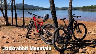
Jackrabbit Mountain Bike Trails
- 2
- 10
- 1
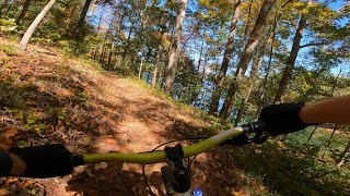
Popular Hayesville Mountain Biking Trails
• 90 ★ 4.3 • 686 ft • 0 ft • 664 •
Popular blue difficulty singletrack. This mountain bike primary trail can be used both directions. On average it takes minutes to complete this trail.
• 80 ★ 4.4 • 4,790 ft • 105 ft • 648 •
Highly rated popular blue difficulty singletrack. This mountain bike primary trail can be used both directions. On average it takes 7 minutes to complete this trail.
• 95 ★ 4.3 • 2 miles • 395 ft • 555 •
Popular blue difficulty singletrack. This mountain bike primary trail can be used both directions. On average it takes 16 minutes to complete this trail.
• 100 ★ 3.5 • 551 ft • 0 ft • 528 •
Popular blue difficulty singletrack. This mountain bike primary trail can be used downhill primary. On average it takes minutes to complete this trail.
• 60 ★ 3.7 • 3 miles • 397 ft • 486 •
Moderately popular green difficulty singletrack. This mountain bike primary trail can be used both directions. On average it takes 21 minutes to complete this trail.
• 70 ★ 5.0 • 2,093 ft • 44 ft • 473 •
Popular blue difficulty singletrack. This mountain bike primary trail can be used downhill primary. On average it takes 7 minutes to complete this trail.
• 50 ★ 4.8 • 2 miles • 127 ft • 431 •
Moderately popular blue difficulty singletrack. This mountain bike primary trail can be used both directions. On average it takes 8 minutes to complete this trail.
• 85 ★ 5.0 • 1 mile • 172 ft • 419 •
Popular blue difficulty singletrack. This mountain bike primary trail can be used both directions. On average it takes 10 minutes to complete this trail.
Hayesville Mountain Bike Routes
Photos of Hayesville Mountain Bike
Videos of Hayesville Mountain Bike
5:02 |
57 |
May 4, 2025

trail: Upper Ridge
8:12 |
651 |
Nov 27, 2020 , Hayesville

trail: High Point Trail
8:01 |
907 |
Nov 27, 2020 , Hayesville

trail: SABA Beach Loop
3:28 |
413 |
Nov 27, 2020 , Hayesville

trail: Burnt Tree Penninsula
4:48 |
421 |
Nov 27, 2020 , Hayesville
trail: Yotee's Run
8:40 |
528 |
Nov 27, 2020 , Hayesville
Recent Trail Reports
| status | trail | date | condition | info | user |
|---|---|---|---|---|---|
| Burrell`s Cove | Mar 25, 2026 @ 10:55am (America/Kentucky/Monticello) Mar 25, 2026 | Dry | jbgay | ||
| Central Loop | Mar 25, 2026 @ 10:55am (America/Kentucky/Monticello) Mar 25, 2026 | Dry | jbgay | ||
| Campground Connector Trail | Mar 25, 2026 @ 10:55am (America/Kentucky/Monticello) Mar 25, 2026 | Dry | jbgay | ||
| Rabbit Ridge Trail | Oct 16, 2025 @ 9:51am (America/New_York) Oct 16, 2025 | Ideal | jpcorry | ||
| Sneaking Creek Trail | Aug 24, 2025 @ 11:57am Aug 24, 2025 | Ideal | Mattegel | ||
| Upper Ridge | Aug 24, 2025 @ 11:57am Aug 24, 2025 | Ideal | Mattegel | ||
| SABA Beach Loop | Aug 24, 2025 @ 11:57am Aug 24, 2025 | Ideal | Mattegel | ||
| SABA Beach | Aug 24, 2025 @ 11:57am Aug 24, 2025 | Ideal | Mattegel | ||
| Yotee's Run Loop | Aug 24, 2025 @ 11:57am Aug 24, 2025 | Ideal | Mattegel | ||
| Yotee's Run | Aug 24, 2025 @ 11:57am Aug 24, 2025 | Ideal | Mattegel |
Activity Feed
| username | action | type | title | date |
|---|---|---|---|---|
| UwfPKO | wishlist | region | activity #97566501 | Jun 22, 2026 @ 9:17am 3 days |
| TTSjVQ | ridden | trail | activity #97510786 | Jun 21, 2026 @ 12:31pm Jun 21, 2026 |
| Sleahcim | wishlist | badge | activity #96605778 | Jun 9, 2026 @ 7:55am Jun 9, 2026 |
| F5Hzs3 | add | report | activity #95801875 | May 29, 2026 @ 2:19pm May 29, 2026 |
| scofflaw23 | wishlist | trail | activity #94810949 | May 16, 2026 @ 6:57am May 16, 2026 |
Recent Comments
| username | type | title | comment | date |
|---|---|---|---|---|
| report | Jackrabbit now prohibits e-bikes! Must be... | Jun 28, 2025 @ 10:49am Jun 28, 2025 | ||
| trail | Wow, was this fun. I rode clockwise, and if... | Mar 19, 2025 @ 11:38am Mar 19, 2025 | ||
| trail | Best to ride counter clockwise. Great trail in... | Mar 11, 2025 @ 9:37am Mar 11, 2025 | ||
| trail | Great trail. Love riding here. Be aware that... | Nov 9, 2024 @ 6:54pm Nov 9, 2024 | ||
| trail | Any report on damage after hurricane Helene? | Oct 2, 2024 @ 1:13pm Oct 2, 2024 |
Local Badges
-

Epic Ride Climb 2k10 awarded -

Climbing 10k Badge7 awarded -

Climbing 100k Badge0 awarded -

Epic Ride Descent 2k10 awarded -

Descent 10k Badge7 awarded -

Descent 100k Badge0 awarded
Activity Type Stats
| activitytype | trails | distance | descent | descent distance | total vertical | rating | global rank | state rank | photos | reports | routes | ridelogs |
|---|---|---|---|---|---|---|---|---|---|---|---|---|
| Mountain Bike | 20 | 32 miles | 5,440 ft | 12 miles | 2,280 ft | #3,053 | #1,062 | 56 | 103 | 1 | 3,283 | |
| E-Bike | 2 | 11 miles | 341 ft | 2 miles | 1,824 ft | 79 | 86 | |||||
| Gravel Bike | 2 | 11 miles | 341 ft | 2 miles | 1,824 ft | #1,460 | #776 | 1 | 10 | |||
| Horse | 3 | 13 miles | 2,260 ft | 4 miles | 1,919 ft | 10 | 7 | |||||
| Hike | 66 | 112 miles | 24,961 ft | 46 miles | 3,356 ft | #985 | #444 | 32 | 103 | 124 | ||
| Trail Running | 65 | 107 miles | 24,327 ft | 45 miles | 3,356 ft | #3,849 | #1,150 | 100 | 91 |
Frequently Asked Questions About Hayesville
▼
What are the best places to ride in Hayesville?
Hayesville has 2 areas to explore for mountain biking. The top rated areas are:
▼
What are the highest rated mountain biking trails in Hayesville?
The highest rated mountain biking trails in Hayesville are:
- Rabbit Ridge Trail (4.5/5)
- Burrell`s Cove (4.4/5)
- Upper Ridge (4.3/5)
- SABA Beach Loop (4.3/5)
- Yotee's Run Loop (4.2/5)
▼
What is the best time of the year to ride in Hayesville?
Based on ride log data, the most popular months to ride in Hayesville are:
- July (58 activities)
- June (49 activities)
- August (49 activities)
▼
Where can I park to ride in Hayesville?
There are 9 parking locations listed in Hayesville. The most popular parking spots are:
- Jackrabbit Mountain Bike Trail Parking
- Parking
- Parking
- A.T. Parking: Unicoi Gap (GA Rte 17 & GA Rte 75) Parking Area
- A.T. Parking: Indian Grave Gap (USFS 283) Parking Area
Activities
Trails
Points of Interest
- Davy Mountain Summit
- Jackrabbit Mountain Campground Camping
- Summit - Rich Knob
- Boteler Peak Summit
- Trail Map Kiosk Information
- Summit - Spaniards Knob
- Jackrabbit Mountain Summit
- Lake Burton Overlook Vista Viewpoint
- Kelly Knob Vista (GA) Viewpoint
- Little Bald Knob Campsite Camping
- Potrock Bald (5,167 ft)
- Signal Bald (5,161 ft)
- Boteler Peak (4,997 ft)
- By markholloway
 Trailforks Map Team & contributors
 - Admins: SABA
- #10863 - 8,725 views
- hayesville activity log | embed map of Hayesville mountain bike trails | hayesville mountain biking points of interest
Downloading of trail gps tracks in kml & gpx formats is enabled for Hayesville.
You must login to download files.