close
-
Layers w
- Weather Layers
- Pro
- Pro
- Pro
- Pro
- Pro
- Pro
- More Layers
- Pro
- Pro
- Pro
- Pro
-
Upgrade to

3D
Trail Conditions
- Unknown
- Snow Groomed
- Snow Packed
- Snow Covered
- Snow Cover Partial
- Freeze/thaw Cycle
- Icy
- Prevalent Mud
- Wet
- Variable
- Ideal
- Dry
- Very Dry
Trail Flow (Ridden Direction)
Trailforks scans users ridelogs to determine the most popular direction each trail is ridden. A good flowing trail network will have most trails flowing in a single direction according to their intension.
The colour categories are based on what percentage of riders are riding a trail in its intended direction.
The colour categories are based on what percentage of riders are riding a trail in its intended direction.
- > 96%
- > 90%
- > 80%
- > 70%
- > 50%
- < 50%
- bi-directional trail
- no data
Trail Last Ridden
Trailforks scans ridelogs to determine the last time a trail was ridden.
- < 2 days
- < 1 week
- < 2 weeks
- < 1 month
- < 6 months
- > 6 months
Trail Ridden Direction
The intended direction a trail should be ridden.
- Downhill Only
- Downhill Primary
- Both Directions
- Uphill Primary
- Uphill Only
- One Direction
Contribute Details
Colors indicate trail is missing specified detail.
- Description
- Photos
- Description & Photos
- Videos
Trail Popularity ?
Trailforks scans ridelogs to determine which trails are ridden the most in the last 9 months.
Trails are compared with nearby trails in the same city region with a possible 25 colour shades.
Think of this as a heatmap, more rides = more kinetic energy = warmer colors.
- most popular
- popular
- less popular
- not popular
ATV/ORV/OHV Filter
Max Vehicle Width
inches
US Cell Coverage
Legend

Radar Time
Activity Recordings
Trailforks uses anonymized public activity data.
?
Activity Recordings
Trailforks uses anonymized public activity data.
?
Personal Heatmap
▶
Activity Types
all
/
none
▶
Options
2
Date range
month
–
Winter Trails
Warning
A routing network for winter maps does not exist. Selecting trails using the winter trails layer has been disabled.
Missing Trails
Most Popular
Least Popular
Trails are colored based on popularity. The more popular a trail is, the more red. Less popular trails trend towards green.
Jump Magnitude Heatmap
Heatmap of where riders jump on trails. Zoom in to see individual jumps, click circles to view jump details.
BC Backroad Status
![map legend]()
Service Road Atlas is a free to use, community-driven service for viewing and creating reports on the numerous back-country service roads around B.C. and Alberta.

Slope Aspect
Direction the slope faces
Trails Deemphasized
Trails are shown in grey.
Only show trails with no bike usage.
Suggested Layers
Based on selected activity type
Save the current map location and zoom level as your default home location whenever this page is loaded.
Save
No description for Hayward has been added yet!
Login or register to submit one.
Activities Click to view
- Mountain Bike
25 trails
- E-Bike
16 trails
- Adaptive Bike
0 trails
- Winter Fat Bike
0 trails
- Hike
24 trails
- Trail Running
21 trails
- Snowshoe
17 trails
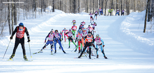
- Nordic Ski
64 trails
Region Details
- 13
- 9
- 1
Region Status
Open as of Jun 12, 2026Stats
- Avg Trail Rating
- Trails (view details)
- 79
- Trails Mountain Bike
- 26
- Trails E-Bike
- 16
- Trails Hike
- 24
- Trails Trail Running
- 21
- Trails Snowshoe
- 17
- Trails Nordic Ski
- 64
- Total Distance
- 124 miles
- Total Descent Distance
- 50 miles
- Total Descent
- 5,009 ft
- Total Vertical
- 553 ft
- Highest Trailhead
- 1,736 ft
- Reports
- 439
- Photos
- 58
- Ridden Counter
- 7,893
Sub Regions
-
American Birkebeiner Trail System
-
CAMBA Gravel - Moose Lake
-
CAMBA Hayward Cluster
- 10
Popular Hayward Mountain Biking Trails
• 100 ★ 4.2 • 4 miles • 334 ft • 539 •
With multiple loop options and the ability to connect to the , is a great place for a long, all day adventure. A little more rocky and climb intensive than the smoother options at Highway OO, but not bone rattling by any means.
• 75 ★ 4.0 • 4 miles • 288 ft • 486 •
West side for looping back. The trail intersects at multiple locations to create loops
• 80 ★ 4.5 • 2,405 ft • 11 ft • 351 •
Popular green difficulty family friendly singletrack. This multi-use trail can be used one direction and has a easy overall physical rating with a 11 ft green climb. It features berm. Winter use: Groomed Smooth snow grooming. Trail visibility is always easy to follow. On average it takes 3 minutes to complete this trail.
• 100 ★ 4.5 • 1,942 ft • 26 ft • 332 •
Popular green difficulty family friendly singletrack. This multi-use trail can be used one direction and has a easy overall physical rating with a 26 ft green climb. It features berm. Winter use: Groomed Smooth snow grooming. Trail visibility is always easy to follow. On average it takes 2 minutes to complete this trail.
• 95 ★ 4.7 • 2,100 ft • 30 ft • 323 •
Popular green difficulty family friendly singletrack. This multi-use trail can be used one direction and has a easy overall physical rating with a 30 ft green climb. It features berm. Winter use: Groomed Smooth snow grooming. Trail visibility is always easy to follow. On average it takes 2 minutes to complete this trail.
• 85 ★ 4.5 • 3,609 ft • 9 ft • 318 •
Popular green difficulty family friendly singletrack. This mountain bike primary trail can be used one direction and has a easy overall physical rating with a 9 ft green climb. Winter use: Groomed Smooth snow grooming. Trail visibility is always easy to follow. On average it takes 3 minutes to complete this trail.
• 95 ★ 4.0 • 4,190 ft • 23 ft • 292 •
Popular green difficulty family friendly singletrack. This multi-use trail can be used both directions and has a easy overall physical rating with a 23 ft green climb. Winter use: Groomed Smooth snow grooming. Trail visibility is always easy to follow. On average it takes 4 minutes to complete this trail.
• 90 ★ 4.0 • 2,667 ft • 5 ft • 276 •
Popular green difficulty family friendly singletrack. This multi-use trail can be used one direction and has a easy overall physical rating with a 5 ft green climb. Winter use: Groomed Smooth snow grooming. Trail visibility is always easy to follow. On average it takes 3 minutes to complete this trail.
Hayward Mountain Bike Routes
34 miles • 2,467 ft • 8 •
Camba single track going north to gravel around lake Helene then back to single track to Telemark Trails
49 miles • 530 ft • 1 • Loop •
Starting Point: Intersection of Hwy 77 East and between Hayward and Clam Lake. There is no trailhead,...
28 miles • 1,564 ft • 3 • Out & Back •
Great way to get some good single track with fire road as part of return.
33 miles • 611 ft • 0 • Loop •
Starting Point: New Moon Bike Shop, Hayward Alternate Starting Point: Sawmill Saloon, Seeley All distances...
26 miles • 300 ft • 0 • Loop •
Starting Point: New Moon Bike Shop, Hayward Alternate Starting Point: Sawmill Saloon, Seeley All distances...
49 miles • 530 ft • 0 • Loop •
Starting Point: Intersection of Hwy 77 East and FR 174 between Hayward and Clam Lake. There is no...
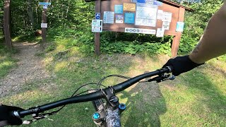
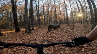
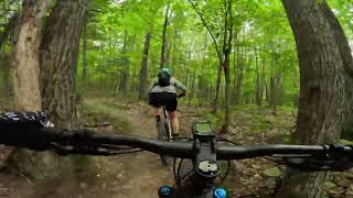
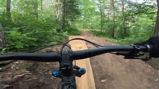
Photos of Hayward Mountain Bike
Videos of Hayward Mountain Bike

trail: More Difficult Jump Trail
17:27 |
43 |
Sep 21, 2025 , Hayward
trail: Skills Area
17:27 |
40 |
Sep 21, 2025 , Hayward

trail: Hatchery Creek Northbound
17:27 |
52 |
Sep 21, 2025 , Hayward
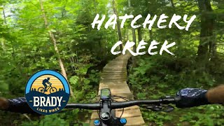
trail: Hatchery Creek Northbound
22:32 |
137 |
Nov 10, 2024 , Hayward
trail: Hatchery Creek Southbound
7:31 |
94 |
Oct 23, 2024 , Hayward
trail: Hatchery Creek Southbound
110 |
Aug 25, 2024 , Hayward
trail: More Difficult Jump Trail
0:24 |
111 |
Jul 1, 2024 , Hayward

trail: Hatchery Creek Northbound
36:03 |
485 |
Jul 12, 2022 , Hayward
Current Trail Warnings
| status | trail | date | condition | user | info |
|---|---|---|---|---|---|
| The Bridge Link | Jun 11, 2026 @ 11:29am (America/Chicago) Jun 11, 2026 | Unknown | darylgmcnutt |
Recent Trail Reports
National Scenic Trails & Official Routes
-
American Birkebeiner Trail
- Mountain Bike
- Hike
- Trail Running
- Nordic Ski
Activity Feed
| username | action | type | title | date |
|---|---|---|---|---|
| ruthdover | add | report | activity #96827478 | Jun 12, 2026 @ 2:15pm Jun 12, 2026 |
| darylgmcnutt | comment | report | activity #96743262 | Jun 11, 2026 @ 9:30am Jun 11, 2026 |
| darylgmcnutt | add | report | activity #96742488 and 3 more | Jun 11, 2026 @ 9:18am Jun 11, 2026 |
| UhrenholdtAdventureclub | add | report | activity #96634655 | Jun 9, 2026 @ 3:55pm Jun 9, 2026 |
| davidjaberg | wishlist | trail | activity #96578410 | Jun 8, 2026 @ 6:32pm Jun 8, 2026 |
Recent Comments
| username | type | title | comment | date |
|---|---|---|---|---|
| report | Big tree down | Jun 11, 2026 @ 9:30am Jun 11, 2026 | ||
| report | Need chain saw on creek loop | Nov 26, 2025 @ 11:40am Nov 26, 2025 | ||
| report | Lick if CTH-OOPS I me m on fjy on im | Jun 25, 2025 @ 9:05am Jun 25, 2025 | ||
| report | i will get it. Thanks | Dec 9, 2024 @ 10:30am Dec 9, 2024 | ||
| report | Yeah, actually texted one of the groomers. ... | Dec 9, 2024 @ 8:27am Dec 9, 2024 |
Local Badges
-

Epic Mountain Bike Climb 2k0 awarded -

Climbing 10k Badge4 awarded -

Mountain Biking 100k Badge0 awarded -

Epic Ride Descent 2k0 awarded -

Descent 10k Badge4 awarded -

Descent 100k Badge0 awarded
Activity Type Stats
| activitytype | trails | distance | descent | descent distance | total vertical | rating | global rank | state rank | photos | reports | routes | ridelogs |
|---|---|---|---|---|---|---|---|---|---|---|---|---|
| Mountain Bike | 25 | 58 miles | 1,178 ft | 25 miles | 318 ft | #2,634 | #942 | 61 | 451 | 15 | 5,391 | |
| E-Bike | 16 | 49 miles | 554 ft | 22 miles | 318 ft | #3,574 | #1,242 | 380 | 4 | 68 | ||
| Hike | 24 | 37 miles | 1,027 ft | 15 miles | 318 ft | #5,745 | #2,020 | 447 | 2 | 688 | ||
| Trail Running | 21 | 37 miles | 1,027 ft | 15 miles | 318 ft | #5,895 | #1,889 | 447 | 2 | 150 | ||
| Snowshoe | 17 | 9 miles | 607 ft | 3 miles | 177 ft | #868 | #406 | 193 | 1 | 65 | ||
| Nordic Ski | 64 | 66 miles | 3,832 ft | 25 miles | 554 ft | #150 | #41 | 1 | 19 | 1 | 3,539 |
Frequently Asked Questions About Hayward
▼
What are the best places to ride in Hayward?
Hayward has 4 areas to explore for mountain biking. The top rated areas are:
▼
What are the highest rated mountain biking trails in Hayward?
The highest rated mountain biking trails in Hayward are:
- The Creek Loop (4.2/5)
- The Berries Loop (4.1/5)
- Four Cubs Loop (4.1/5)
- Pig's Knuckle Loop (4.1/5)
- The Marsh Loop (4.1/5)
▼
What is the best time of the year to ride in Hayward?
Based on ride log data, the most popular months to ride in Hayward are:
- August (76 activities)
- July (75 activities)
- September (72 activities)
▼
Where can I park to ride in Hayward?
There are 9 parking locations listed in Hayward. The most popular parking spots are:
- Startline Parking
- Boedecker Road Trailhead Parking
- Hatchery Creek Trailhead
- Olson Road Trailhead
- Hospital Rd Parking
Activities
Trails
Points of Interest
- Timber Trail Warming Shelter Cabin
- Startline Warming Shelter Cabin
- Firetower Warming Shelter Cabin
- Boedecker Warming Shelter Cabin
- Highway 00 Warming Shelter Cabin
- Gravel Pit Warming Shelter Cabin
- Mosquito Brook Warming Shelter Cabin
- Fish Hatchery Warming Shelter Cabin
- Boedecker Cabin
- Gravel Pit Cabin
- By MrJwoj
 & contributors
 - Admins: Birkie, CAMBA, CORBA
- #9855 - 9,694 views
- hayward activity log | embed map of Hayward mountain bike trails | hayward mountain biking points of interest polygons
Downloading of trail gps tracks in kml & gpx formats is enabled for Hayward.
You must login to download files.