close
-
Layers w
- Weather Layers
- Pro
- Pro
- Pro
- Pro
- Pro
- Pro
- More Layers
- Pro
- Pro
- Pro
- Pro
-
Upgrade to

3D
Trail Conditions
- Unknown
- Snow Groomed
- Snow Packed
- Snow Covered
- Snow Cover Partial
- Freeze/thaw Cycle
- Icy
- Prevalent Mud
- Wet
- Variable
- Ideal
- Dry
- Very Dry
Trail Flow (Ridden Direction)
Trailforks scans users ridelogs to determine the most popular direction each trail is ridden. A good flowing trail network will have most trails flowing in a single direction according to their intension.
The colour categories are based on what percentage of riders are riding a trail in its intended direction.
The colour categories are based on what percentage of riders are riding a trail in its intended direction.
- > 96%
- > 90%
- > 80%
- > 70%
- > 50%
- < 50%
- bi-directional trail
- no data
Trail Last Ridden
Trailforks scans ridelogs to determine the last time a trail was ridden.
- < 2 days
- < 1 week
- < 2 weeks
- < 1 month
- < 6 months
- > 6 months
Trail Ridden Direction
The intended direction a trail should be ridden.
- Downhill Only
- Downhill Primary
- Both Directions
- Uphill Primary
- Uphill Only
- One Direction
Contribute Details
Colors indicate trail is missing specified detail.
- Description
- Photos
- Description & Photos
- Videos
Trail Popularity ?
Trailforks scans ridelogs to determine which trails are ridden the most in the last 9 months.
Trails are compared with nearby trails in the same city region with a possible 25 colour shades.
Think of this as a heatmap, more rides = more kinetic energy = warmer colors.
- most popular
- popular
- less popular
- not popular
ATV/ORV/OHV Filter
Max Vehicle Width
inches
US Cell Coverage
Legend

Radar Time
Activity Recordings
Trailforks uses anonymized public activity data.
?
Activity Recordings
Trailforks uses anonymized public activity data.
?
Personal Heatmap
▶
Activity Types
all
/
none
▶
Options
2
Date range
month
–
Winter Trails
Warning
A routing network for winter maps does not exist. Selecting trails using the winter trails layer has been disabled.
Missing Trails
Most Popular
Least Popular
Trails are colored based on popularity. The more popular a trail is, the more red. Less popular trails trend towards green.
Jump Magnitude Heatmap
Heatmap of where riders jump on trails. Zoom in to see individual jumps, click circles to view jump details.
BC Backroad Status
![map legend]()
Service Road Atlas is a free to use, community-driven service for viewing and creating reports on the numerous back-country service roads around B.C. and Alberta.

Slope Aspect
Direction the slope faces
Trails Deemphasized
Trails are shown in grey.
Only show trails with no bike usage.
Suggested Layers
Based on selected activity type
Save the current map location and zoom level as your default home location whenever this page is loaded.
Save
No description for Hebron has been added yet!
Login or register to submit one.
Activities Click to view
- Mountain Bike
62 trails
- E-Bike
0 trails
- Adaptive Bike
0 trails
- Winter Fat Bike
0 trails
- Hike
65 trails
- Trail Running
65 trails
- Snowshoe
5 trails
- Nordic Ski
5 trails
Region Details
- 9
- 18
- 23
- 12
Region Status
Open as of Apr 3, 2026Stats
- Avg Trail Rating
- Trails (view details)
- 65
- Trails Mountain Bike
- 62
- Trails Horse
- 2
- Trails Hike
- 65
- Trails Trail Running
- 65
- Trails Snowshoe
- 5
- Trails Backcountry Ski
- 2
- Trails Nordic Ski
- 5
- Total Distance
- 36 miles
- Total Descent
- 5,774 ft
- Total Vertical
- 573 ft
- Highest Trailhead
- 857 ft
- Reports
- 352
- Photos
- 74
- Ridden Counter
- 7,862
Sub Regions
-
Gay City State Park
- 14
- 6
- 2
-
Grayville Falls
- 4
- 16
- 10
Popular Hebron Mountain Biking Trails
• 90 ★ 5.0 • 2,910 ft • 21 ft • 323 •
Popular blue difficulty singletrack. This mountain bike primary trail can be used both directions. On average it takes 4 minutes to complete this trail.
• 100 ★ 0.0 • 2,277 ft • 22 ft • 317 •
Popular blue difficulty singletrack. This mountain bike primary trail can be used both directions. On average it takes 3 minutes to complete this trail.
• 100 ★ 4.8 • 1 mile • 145 ft • 293 •
Popular black diamond difficulty singletrack. This multi-use trail can be used downhill primary. It features drop, rock face and rock garden. On average it takes 20 minutes to complete this trail.
• 100 ★ 0.0 • 863 ft • 8 ft • 274 •
Popular blue difficulty singletrack. This mountain bike primary trail can be used both directions and has a easy overall physical rating with a 8 ft green climb. It features rock face and rock garden. On average it takes 1 minutes to complete this trail.
• 45 ★ 0.0 • 3 miles • 191 ft • 209 •
Moderately popular black diamond difficulty singletrack. This mountain bike primary trail can be used both directions and has a moderate overall physical rating with a 191 ft blue climb. On average it takes 36 minutes to complete this trail.
• 70 ★ 0.0 • 1 mile • 241 ft • 205 •
Popular blue difficulty singletrack. This mountain bike primary trail can be used both directions. On average it takes 17 minutes to complete this trail.
• 85 ★ 4.0 • 1,972 ft • 24 ft • 200 •
Popular black diamond difficulty singletrack. This mountain bike primary trail can be used both directions. On average it takes 4 minutes to complete this trail.
Hebron Mountain Bike Routes
16 miles • 1,803 ft • 19 •
Inspired by Gene's route with a start from Gay State Park
11 miles • 1,407 ft • 14 •
Nice loop in Case and this description needs 25 characters...blah blah blah
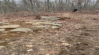
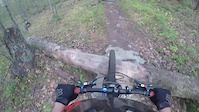
Photos of Hebron Mountain Bike
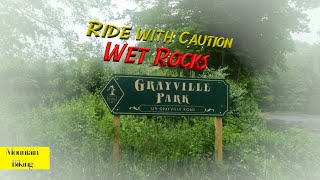
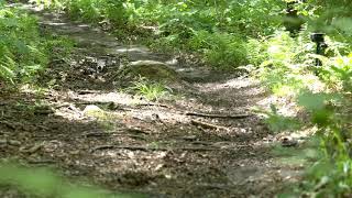
Videos of Hebron Mountain Bike
trail: Grayville Main
0:09 |
|
Jan 24, 2021
trail: Ghost
0:38 |
322 |
Sep 8, 2016
trail: The Kings Trail
11:29 |
38 |
Sep 8, 2025 , Hebron
0:54 |
218 |
Jan 16, 2022
trail: Blackledge
9:44 |
768 |
Sep 30, 2020 , Hebron
Recent Trail Reports
| status | trail | date | condition | info | user |
|---|---|---|---|---|---|
| Ghost | Nov 15, 2025 @ 12:31pm (America/New_York) Nov 15, 2025 | Unknown | Alcutler | ||
| South Loop | Sep 29, 2025 @ 5:23am (America/New_York) Sep 29, 2025 | Ideal | dmanley4 | ||
| Blackledge | Sep 22, 2024 @ 10:19am Sep 22, 2024 | Dry | Bls94001 | ||
| Shenipsit-Gay City Connector & Outer Loop | Sep 22, 2023 @ 6:11am Sep 22, 2023 | Variable | LarryByrnesmW1 | ||
| Outer Loop Trail (North) | Sep 22, 2023 @ 6:11am Sep 22, 2023 | Ideal | LarryByrnesmW1 | ||
| Gay City Park Road | Sep 22, 2023 @ 6:11am Sep 22, 2023 | Ideal | LarryByrnesmW1 | ||
| CRWC Alternate | Aug 25, 2023 @ 2:10pm Aug 25, 2023 | Dry | alecbyrne | ||
| connector | Apr 26, 2023 @ 1:44am Apr 26, 2023 | Variable | bmwtech7 | ||
| Dead and Bloated | Apr 26, 2023 @ 1:44am Apr 26, 2023 | Ideal | bmwtech7 | ||
| Carmen's Dry Dream | Apr 26, 2023 @ 1:44am Apr 26, 2023 | Ideal | bmwtech7 |
Activity Feed
| username | action | type | title | date |
|---|---|---|---|---|
| Huubes | vote | trail | activity #93520244 | Apr 27, 2026 @ 8:52am Apr 27, 2026 |
| ThisIsStank | wishlist | region | activity #91318615 | Mar 26, 2026 @ 7:04am Mar 26, 2026 |
| Idobie | wishlist | region | activity #90982373 | Mar 21, 2026 @ 6:40am Mar 21, 2026 |
| Alcutler | add | report | activity #84183888 | Nov 15, 2025 @ 9:31am Nov 15, 2025 |
| PaveliBuLqY | wishlist | region | activity #83334128 | Oct 31, 2025 @ 2:08pm Oct 31, 2025 |
Recent Comments
| username | type | title | comment | date |
|---|---|---|---|---|
| trail | The start and finish red and green marks... | Oct 30, 2025 @ 6:10pm Oct 30, 2025 | ||
| trail | Over grown! Needs to be cleaned up. | Sep 28, 2024 @ 4:47pm Sep 28, 2024 | ||
| trail | This trail is more fun riding North to South... | Jun 19, 2023 @ 4:00am Jun 19, 2023 | ||
| trail | Technical masterpiece of natural slab and... | Jun 19, 2023 @ 3:54am Jun 19, 2023 | ||
| trail | Rock heads all over. Trail sucked! | Sep 25, 2020 @ 5:52pm Sep 25, 2020 |
Local Badges
-

Top 10 Trails2 awarded -

Descent 100k Badge0 awarded -

Epic Ride 50k71 awarded -

10 Green Trails51 awarded -

Descent 10k Badge16 awarded -

Big Ride 30k138 awarded
Activity Type Stats
| activitytype | trails | distance | descent | descent distance | total vertical | rating | global rank | state rank | photos | reports | routes | ridelogs |
|---|---|---|---|---|---|---|---|---|---|---|---|---|
| Mountain Bike | 62 | 35 miles | 5,525 ft | 15 miles | 558 ft | #2,962 | #1,042 | 60 | 352 | 4 | 7,122 | |
| Horse | 2 | 423 ft | 13 ft | 94 | 8 | |||||||
| Hike | 65 | 36 miles | 5,774 ft | 16 miles | 574 ft | #2,959 | #1,083 | 14 | 352 | 1 | 557 | |
| Trail Running | 65 | 36 miles | 5,774 ft | 16 miles | 574 ft | #4,998 | #1,561 | 352 | 122 | |||
| Snowshoe | 5 | 2,073 ft | 43 ft | 1,381 ft | 43 ft | #1,821 | #1,062 | 16 | ||||
| Backcountry Ski | 2 | 843 ft | 43 ft | 18 | ||||||||
| Nordic Ski | 5 | 4,275 ft | 49 ft | 1,818 ft | 66 ft | #1,972 | #1,075 | 7 |
Frequently Asked Questions About Hebron
▼
What are the best places to ride in Hebron?
Hebron has 2 areas to explore for mountain biking.
▼
What are the highest rated mountain biking trails in Hebron?
The highest rated mountain biking trails in Hebron are:
- The Kings Trail (4.3/5)
- Bushwacking by the stream (4.1/5)
- Grayville Main (4.1/5)
- Vengeance Rocks (4/5)
- Breathe (4/5)
▼
What is the best time of the year to ride in Hebron?
Based on ride log data, the most popular months to ride in Hebron are:
- May (198 activities)
- July (180 activities)
- June (152 activities)
▼
Where can I park to ride in Hebron?
There are 9 parking locations listed in Hebron. The most popular parking spots are: View all parking and trailhead locations on the map to plan your visit.
Activities
Trails
Points of Interest
- By acunaca
 & contributors
 - Admins: HCH, NEMBAEXEC, QC NEMBA
- #28871 - 2,501 views
- hebron activity log | embed map of Hebron mountain bike trails | hebron mountain biking points of interest
Downloading of trail gps tracks in kml & gpx formats is enabled for Hebron.
You must login to download files.