close
-
Layers w
- Weather Layers
- Pro
- Pro
- Pro
- Pro
- Pro
- Pro
- More Layers
- Pro
- Pro
- Pro
- Pro
-
Upgrade to

3D
Trail Conditions
- Unknown
- Snow Groomed
- Snow Packed
- Snow Covered
- Snow Cover Partial
- Freeze/thaw Cycle
- Icy
- Prevalent Mud
- Wet
- Variable
- Ideal
- Dry
- Very Dry
Trail Flow (Ridden Direction)
Trailforks scans users ridelogs to determine the most popular direction each trail is ridden. A good flowing trail network will have most trails flowing in a single direction according to their intension.
The colour categories are based on what percentage of riders are riding a trail in its intended direction.
The colour categories are based on what percentage of riders are riding a trail in its intended direction.
- > 96%
- > 90%
- > 80%
- > 70%
- > 50%
- < 50%
- bi-directional trail
- no data
Trail Last Ridden
Trailforks scans ridelogs to determine the last time a trail was ridden.
- < 2 days
- < 1 week
- < 2 weeks
- < 1 month
- < 6 months
- > 6 months
Trail Ridden Direction
The intended direction a trail should be ridden.
- Downhill Only
- Downhill Primary
- Both Directions
- Uphill Primary
- Uphill Only
- One Direction
Contribute Details
Colors indicate trail is missing specified detail.
- Description
- Photos
- Description & Photos
- Videos
Trail Popularity ?
Trailforks scans ridelogs to determine which trails are ridden the most in the last 9 months.
Trails are compared with nearby trails in the same city region with a possible 25 colour shades.
Think of this as a heatmap, more rides = more kinetic energy = warmer colors.
- most popular
- popular
- less popular
- not popular
ATV/ORV/OHV Filter
Max Vehicle Width
inches
US Cell Coverage
Legend

Radar Time
Activity Recordings
Trailforks uses anonymized public activity data.
?
Activity Recordings
Trailforks uses anonymized public activity data.
?
Personal Heatmap
▶
Activity Types
all
/
none
▶
Options
2
Date range
month
–
Winter Trails
Warning
A routing network for winter maps does not exist. Selecting trails using the winter trails layer has been disabled.
Missing Trails
Most Popular
Least Popular
Trails are colored based on popularity. The more popular a trail is, the more red. Less popular trails trend towards green.
Jump Magnitude Heatmap
Heatmap of where riders jump on trails. Zoom in to see individual jumps, click circles to view jump details.
BC Backroad Status
![map legend]()
Service Road Atlas is a free to use, community-driven service for viewing and creating reports on the numerous back-country service roads around B.C. and Alberta.

Slope Aspect
Direction the slope faces
Trails Deemphasized
Trails are shown in grey.
Only show trails with no bike usage.
Suggested Layers
Based on selected activity type
Save the current map location and zoom level as your default home location whenever this page is loaded.
Save
No description for Heidelberg has been added yet!
Login or register to submit one.
This region uses the Uk/Euro style trail grading system.
Activities Click to view
- Mountain Bike
272 trails
- E-Bike
277 trails
- Gravel Bike
0 trails
- Adaptive Bike
0 trails
- Winter Fat Bike
0 trails
- Hike
204 trails
- Trail Running
203 trails
Region Details
- 9
- 117
- 65
- 33
- 14
Region Status
Caution as of Jun 16, 2026Stats
- Avg Trail Rating
- Trails (view details)
- 244
- Trails Mountain Bike
- 280
- Trails E-Bike
- 277
- Trails Hike
- 204
- Trails Trail Running
- 203
- Total Distance
- 83 miles
- Total Descent
- 44,263 ft
- Total Vertical
- 1,527 ft
- Highest Trailhead
- 1,889 ft
- Reports
- 2,916
- Photos
- 737
- Ridden Counter
- 26,812
Sub Regions
-
Königstuhl
- 71
- 43
- 23
- 11
-
Weißer Stein
- 32
- 18
- 6
Popular Heidelberg Mountain Biking Trails
• 100 ★ 4.7 • 505 ft • 3 ft • 426 •
Trail, der zum eigentlichen -Trail führt. Der Ausstieg bzw. der Trail an sich wird immer wieder zugelegt vom Forst.
• 100 ★ 5.0 • 1,276 ft • 0 ft • 374 •
Ein Trail, der sich größtenteils in Kurven hinabschlängelt. Im oberen Abschnitt haben sich ein paar B-Lines gebildet, die sich aber recht schnell wieder vereinen. Bei Nässe kann es hier stellenweise viele Pfützen und Matsch geben,...
• 95 ★ 4.6 • 1,316 ft • 0 ft • 345 •
Trail des HD Freeride e.V. Eine sehr natürliche Strecke, die zum Hauptteil steinig und verblockt ist, auf der aber auch der ein oder andere Anlieger oder Double auf Dich wartet. Trotz des anspruchsvollen Terrains ist die Strecke aber...
• 100 ★ 4.6 • 771 ft • 0 ft • 344 •
Sehr naturbelassener Trail mit Wurzeln, Steinfeldern, einem Drop, steilen Sektionen, eigentlich ist alles dabei. Feinstes Highspeed-Geballer. Parallel gibt es noch den -Trail, wenn man mehr auf Anlieger steht, und man kann direkt nach...
• 95 ★ 4.3 • 1,122 ft • 0 ft • 325 •
Relativ flowig geht es hier nicht allzu steil hinunter, stellenweise kann man es laufen lassen und kann dann durchaus recht schnell werden.
• 95 ★ 4.9 • 1,112 ft • 0 ft • 324 •
Anfangs relativ flowig und schnell, fährt man doch recht bald in rumpeligeres Gelände vor. Teilweise tiefe Erosionsrinnen uns sehr sandiger Boden. Nach der kleinen Anliegerkurve gibt es inzwischen nur noch eine Variante (die ganz...
• 95 ★ 4.2 • 1,778 ft • 3 ft • 319 •
Trail des HD Freeride e.V. Eine klassische Flowline mit steinigem Untergrund. Die Strecke ist zum größten Teil sehr breit gebaut und bietet hiermit die perfekte Möglichkeit für Anfänger mit Sicherheit und Spaß den Berg abzufahren....
• 100 ★ 4.9 • 2,116 ft • 0 ft • 308 •
Es gibt mehrere Linien (links, rechts, mittig rechts). Die linke Linie hat kleinere Sprünge, die rechte Linie hat Tables und kleinere Doubles, und die mittlere hat größere Doubles. Im zweiten Abschnitt gibt es dann zwei Einstiege,...
Heidelberg Mountain Bike Routes
★ 5.0 • 3 miles • 281 ft • 10 • Point to Point •
Zuerst fährt man die Falknerei, bis hinunter zum Felsenmeerweg. Variationen sind da möglich, z.B....
★ 5.0 • 4 miles • 577 ft • 7 • Point to Point •
Startpunkt ist am Weißen Stein, wo man das erste Stück Gelbe X mitnimmt (bzw. den alternativen Einstieg)...
★ 5.0 • 2 miles • 9 ft • 6 • Point to Point •
Vom Königstuhl die hinunter, inklusive des überarbeiteten letzten Abschnittes mit den steilen Kurven....
★ 5.0 • 2 miles • 56 ft • 8 • Point to Point •
Most popular Heidelberg route. Perfect to shred after work or school.
5 miles • 1,565 ft • 3 • Point to Point •
Relativ entspannt geht es hier vom Steigerweg hoch zum Königstuhl, wobei man auch zwei, drei einfachere...
2 miles • 36 ft • 3 • Point to Point •
Vom Weißen Stein hinunter zum Parkplatz , dort bei der Schranke rechts in den Trail einbiegen, der sich...
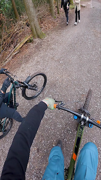
Photos of Heidelberg Mountain Bike
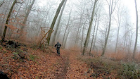
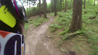
Videos of Heidelberg Mountain Bike
trail: Toblerone
0:14 |
28 |
Jan 3, 2026
trail: Hakka Kakka Due
0:46 |
|
Mar 27, 2024
trail: Bärlauchtrail Upper
0:43 |
161 |
Jan 23, 2019
trail: Falknerei
4:17 |
378 |
Oct 26, 2013
trail: Falknerei
3:10 |
273 |
Mar 16, 2013
youtuber
![HEIDELBERG KÖNIGSTUHL Klumpen Rumpeln: Dark...]()
trail: Zapfenstreich
7:50 |
4 |
Jun 19, 2026 , Heidelberg
youtuber
![Noch ein Biketreff mit Premium-Trails //...]()
trail: Rock N Roll upper
10:28 |
12 |
Jun 15, 2026 , Heidelberg
youtuber
![Schauenburg No More? // Heidelberg - Weißer...]()
trail: Gelbes X Hohlweg
9:39 |
10 |
Jun 6, 2026 , Heidelberg
Current Trail Warnings
| status | trail | date | condition | user | info |
|---|---|---|---|---|---|
| Little Dabo to Wäldchen | Jun 14, 2026 @ 5:03pm (Europe/Berlin) Jun 14, 2026 | Variable | muffi | frequently blocked by cut-down trees | |
| Little Dabo | Jun 11, 2026 @ 9:35pm (Europe/Berlin) Jun 11, 2026 | Variable | sp00n82 HDRiders | Mindestens der Ausstieg auf die... | |
| Zapfenstreich | Jun 11, 2026 @ 9:34pm (Europe/Berlin) Jun 11, 2026 | Variable | sp00n82 HDRiders | Beim Ausstieg zum Blockhausweg sind... |
Recent Trail Reports
| status | trail | date | condition | info | user |
|---|---|---|---|---|---|
| Toad & Roll | Jun 16, 2026 @ 6:20am (Pacific/Midway) Jun 16, 2026 | Dry | nod0 | ||
| Toad Two | Jun 16, 2026 @ 6:20am (Pacific/Midway) Jun 16, 2026 | Dry | nod0 | ||
| Toad | Jun 16, 2026 @ 6:20am (Pacific/Midway) Jun 16, 2026 | Dry | nod0 | ||
| Wurzeltrail Extended | Jun 14, 2026 @ 8:29pm (Europe/Berlin) Jun 14, 2026 | Ideal | Allmann10 | ||
| Hakka Kakka Lower | Jun 14, 2026 @ 8:29pm (Europe/Berlin) Jun 14, 2026 | Ideal | Allmann10 | ||
| Hakka Kakka Due | Jun 14, 2026 @ 8:28pm (Europe/Berlin) Jun 14, 2026 | Ideal | Allmann10 | ||
| Hakka Kakka Quattro | Jun 14, 2026 @ 8:28pm (Europe/Berlin) Jun 14, 2026 | Ideal | Allmann10 | ||
| Falknerei Flowline | Jun 14, 2026 @ 8:28pm (Europe/Berlin) Jun 14, 2026 | Ideal | Allmann10 | ||
| Falknerei | Jun 14, 2026 @ 8:27pm (Europe/Berlin) Jun 14, 2026 | Ideal | Allmann10 | ||
| Falknerei Top | Jun 14, 2026 @ 8:27pm (Europe/Berlin) Jun 14, 2026 | Ideal | Allmann10 |
Activity Feed
| username | action | type | title | date |
|---|---|---|---|---|
| jayridestrails | add | video | activity #97350689 | Jun 19, 2026 @ 4:00pm 1 day |
| Tim12302827 | ridden | trail | activity #97253925 and 3 more | Jun 18, 2026 @ 8:26am 2 days |
| kevinzur8lG | ridden | trail | activity #97240662 | Jun 18, 2026 @ 3:21am 3 days |
| kevinzur8lG | vote | trail | activity #97240660 | Jun 18, 2026 @ 3:21am 3 days |
| sp00n82 | add | video | activity #97089224 | Jun 15, 2026 @ 11:00pm Jun 15, 2026 |
Recent Comments
| username | type | title | comment | date |
|---|---|---|---|---|
| report | embrace the gnar | May 16, 2026 @ 5:24am May 16, 2026 | ||
| report | Stark! | May 3, 2026 @ 1:14pm May 3, 2026 | ||
| trail | Yesterday, I took a chance and rode the second... | Apr 19, 2026 @ 6:39am Apr 19, 2026 | ||
| report | So schade, das war der Trail auf dem ich... | Apr 6, 2026 @ 9:09am Apr 6, 2026 | ||
| report | Beim Egal hängt im oberen kurzen Stück das... | Mar 25, 2026 @ 1:46pm Mar 25, 2026 |
Local Badges
-

Tech Stones6 awarded -

I like it hard!65 awarded -

The Kessel Run3 awarded -

Local Gnar0 awarded -

Top 10 Trails29 awarded -

Completionist3 awarded
Bike & Skill Parks
| name | type | city | rating |
|---|---|---|---|
| Pumptrack Rohrbach | skill park | Heidelberg | |
| Pumptrack der IGH Heidelberg | skill park | Heidelberg | |
| Pumptrack Sandhausen | skill park | Heidelberg |
Activity Type Stats
| activitytype | trails | distance | descent | descent distance | total vertical | rating | global rank | state rank | photos | reports | routes | ridelogs |
|---|---|---|---|---|---|---|---|---|---|---|---|---|
| Mountain Bike | 272 | 82 miles | 43,658 ft | 61 miles | 1,526 ft | #355 | #2 | 722 | 2,908 | 11 | 23,985 | |
| E-Bike | 277 | 82 miles | 43,658 ft | 61 miles | 1,526 ft | #114 | #6 | 17 | 2,161 | 6 | 2,800 | |
| Hike | 204 | 72 miles | 33,494 ft | 52 miles | 1,526 ft | #582 | #8 | 2,129 | 1 | 794 | ||
| Trail Running | 203 | 72 miles | 33,858 ft | 52 miles | 1,526 ft | #609 | #9 | 2,130 | 1 | 1,043 |
Frequently Asked Questions About Heidelberg
▼
What are the best places to ride in Heidelberg?
Heidelberg has 2 areas to explore for mountain biking. The top rated areas are:
▼
What are the highest rated mountain biking trails in Heidelberg?
The highest rated mountain biking trails in Heidelberg are:
- Hakka Kakka (4.6/5)
- Gaisbergtrail (links) (4.6/5)
- Falknerei Rinne (4.5/5)
- Falknerei (4.5/5)
- Foxy (4.5/5)
▼
What is the best time of the year to ride in Heidelberg?
Based on ride log data, the most popular months to ride in Heidelberg are:
- May (199 activities)
- April (185 activities)
- July (153 activities)
▼
Where can I park to ride in Heidelberg?
There are 9 parking locations listed in Heidelberg. The most popular parking spots are: View all parking and trailhead locations on the map to plan your visit.
Activities
Trails
Points of Interest
- Aussichtspunkt am Königstuhl Viewpoint
- Aussichtspunkt auf Heidelberg Viewpoint
- Aussichtspunkt aufs Heidelberger Schloss Viewpoint
- Aussichtspunkt aufs Heidelberger Schloss Viewpoint
- Aussichtspunkt Viewpoint
- Gaisbergturm Viewpoint
- Aussichtsturm Viewpoint
- Gedenktafel für Flugzeugabsturz Other
- Birkenbank Viewpoint
- Aussichtspunkt Ruine Schauenburg Viewpoint
- Königstuhl (1,883 ft)
- Weißer Stein (1,834 ft)
- Schriesheimer Kopf (1,762 ft)
- By axl666 & contributors
- Admins: HDRiders, Sasse82, sp00n82, martywis, HDFreeride
- #6107 - 39,565 views
- heidelberg activity log | embed map of Heidelberg mountain bike trails | heidelberg mountain biking points of interest
Downloading of trail gps tracks in kml & gpx formats is enabled for Heidelberg.
You must login to download files.