close
-
Layers w
- Weather Layers
- Pro
- Pro
- Pro
- Pro
- Pro
- Pro
- More Layers
- Pro
- Pro
- Pro
- Pro
-
Upgrade to

3D
Trail Conditions
- Unknown
- Snow Groomed
- Snow Packed
- Snow Covered
- Snow Cover Partial
- Freeze/thaw Cycle
- Icy
- Prevalent Mud
- Wet
- Variable
- Ideal
- Dry
- Very Dry
Trail Flow (Ridden Direction)
Trailforks scans users ridelogs to determine the most popular direction each trail is ridden. A good flowing trail network will have most trails flowing in a single direction according to their intension.
The colour categories are based on what percentage of riders are riding a trail in its intended direction.
The colour categories are based on what percentage of riders are riding a trail in its intended direction.
- > 96%
- > 90%
- > 80%
- > 70%
- > 50%
- < 50%
- bi-directional trail
- no data
Trail Last Ridden
Trailforks scans ridelogs to determine the last time a trail was ridden.
- < 2 days
- < 1 week
- < 2 weeks
- < 1 month
- < 6 months
- > 6 months
Trail Ridden Direction
The intended direction a trail should be ridden.
- Downhill Only
- Downhill Primary
- Both Directions
- Uphill Primary
- Uphill Only
- One Direction
Contribute Details
Colors indicate trail is missing specified detail.
- Description
- Photos
- Description & Photos
- Videos
Trail Popularity ?
Trailforks scans ridelogs to determine which trails are ridden the most in the last 9 months.
Trails are compared with nearby trails in the same city region with a possible 25 colour shades.
Think of this as a heatmap, more rides = more kinetic energy = warmer colors.
- most popular
- popular
- less popular
- not popular
ATV/ORV/OHV Filter
Max Vehicle Width
inches
US Cell Coverage
Legend

Radar Time
Activity Recordings
Trailforks uses anonymized public activity data.
?
Activity Recordings
Trailforks uses anonymized public activity data.
?
Personal Heatmap
▶
Activity Types
all
/
none
▶
Options
2
Date range
month
–
Winter Trails
Warning
A routing network for winter maps does not exist. Selecting trails using the winter trails layer has been disabled.
Missing Trails
Most Popular
Least Popular
Trails are colored based on popularity. The more popular a trail is, the more red. Less popular trails trend towards green.
Jump Magnitude Heatmap
Heatmap of where riders jump on trails. Zoom in to see individual jumps, click circles to view jump details.
BC Backroad Status
![map legend]()
Service Road Atlas is a free to use, community-driven service for viewing and creating reports on the numerous back-country service roads around B.C. and Alberta.

Slope Aspect
Direction the slope faces
Trails Deemphasized
Trails are shown in grey.
Only show trails with no bike usage.
Suggested Layers
Based on selected activity type
Save the current map location and zoom level as your default home location whenever this page is loaded.
Save
No description for Helsinki has been added yet!
Login or register to submit one.
Activities Click to view
- Mountain Bike
653 trails
- E-Bike
628 trails
- Gravel Bike
0 trails
- Adaptive Bike
0 trails
- Winter Fat Bike
0 trails
- Hike
626 trails
- Trail Running
649 trails
- Dirtbike/Moto
67 trails
- Snowshoe
44 trails
- Downhill Ski
6 trails
- Backcountry Ski
42 trails
- Nordic Ski
191 trails
Region Details
- 205
- 18
- 158
- 232
- 33
- 3
- 1
Region Status
Open as of 5 hoursStats
- Avg Trail Rating
- Trails (view details)
- 651
- Trails Mountain Bike
- 656
- Trails E-Bike
- 628
- Trails Horse
- 2
- Trails Hike
- 626
- Trails Trail Running
- 649
- Trails Dirtbike/Moto
- 67
- Trails Snowshoe
- 44
- Trails Downhill Ski
- 6
- Trails Backcountry Ski
- 42
- Trails Nordic Ski
- 191
- Total Distance
- 155 miles
- Total Descent
- 12,573 ft
- Total Vertical
- 256 ft
- Highest Trailhead
- 259 ft
- Reports
- 2,698
- Photos
- 57
- Ridden Counter
- 16,669
Sub Regions
-
Bunker Hill - Pikisaari
- 2
- 10
- 2
-
Haltiala/Paloheinä
- 6
- 40
- 34
- 2
-
Helsingin Keskuspuisto
- 1
- 31
- 99
- 10
- 2
-
Kivikko
- 9
- 6
-
Laajasalo
- 4
- 4
-
Littoistenjärvi
- 1
- 1
-
Malminkartanonhuippu
- 1
- 2
- 2
- 1
-
Pääskyvuori - Kohmo
- 9
- 6
-
Paloheinä Trail Center
- 2
- 6
- 1
-
Ruissalo
- 1
-
Suurmetsä
- 4
- 5
- 1
-
Turku Bike Park
- 3
- 6
-
Veräjämäki
- 1
- 8
- 1
-
Vuosaari
- 3
- 28
- 39
- 8
Popular Helsinki Mountain Biking Trails
• 95 ★ 3.4 • 1,207 ft • 9 ft • 104 •
Popular blue difficulty singletrack. This mountain bike primary trail can be used downhill primary. It features berm, drop and jump. On average it takes minutes to complete this trail.
• 90 ★ 0.0 • 736 ft • 0 ft • 95 •
Popular green difficulty singletrack. This mountain bike primary trail can be used downhill primary. It features berm and drop. On average it takes 2 minutes to complete this trail.
• 100 ★ 4.7 • 620 ft • 0 ft • 93 •
Sisältää useita Strava-segmenttejä, molempiin suuntiin.
• 90 ★ 0.0 • 835 ft • 4 ft • 93 •
Popular blue difficulty singletrack. This mountain bike primary trail can be used downhill primary. It features berm, drop and jump. On average it takes 1 minutes to complete this trail.
• 95 ★ 0.0 • 1,053 ft • 0 ft • 92 •
Vauhdikas flowbaana Paloheinän huipulta nousuladun alkuun. Sadekelillä alaosan muta on liukasta ja tahmeeta...
• 100 ★ 5.0 • 928 ft • 0 ft • 91 •
Tuttuja polkuja, sivuaa joitain Strava segmenttejä, mutta on pidempi kuin paikalliset segmentit. Tässä saa jo polkea tosissaan.
• 95 ★ 3.5 • 3,668 ft • 43 ft • 90 •
Keskuspuiston pohjoisosan "perus ", joka on suurelta osin aika hermeettistä juurakkoa. Alueella risteilee paljon polkuja joten reittiä ei ole välttämättä hirveän helppo seurata, mutta päälinjaa seuraillen löytää perile.
• 100 ★ 4.0 • 2,031 ft • 27 ft • 85 •
Popular blue difficulty singletrack. This mountain bike primary trail can be used both directions. On average it takes 4 minutes to complete this trail.
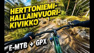
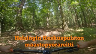
Helsinki Mountain Bike Routes
★ 4.0 • 10 miles • 602 ft • 6 • Point to Point •
Helsingin Keskuspuiston MTB-reittiä mukaileva reitti. Sopii vähän kokemattomammallekin...
10 miles • 583 ft • 26 •
The official MTB route of HKP central park of Helsinki. Fairly unique in it's official status as usually...
10 miles • 656 ft • 27 • Loop •
Reitti alkaa Paloheinän mäeltä, seuraa osittain virallista HKP:n maastopyöräreittiä mutta poikkeaa...
12 miles • 1,227 ft • 2 • Loop •
Loistava lenkki, jonka voi aloittaa Cool Head -panimolta ja päättää sinne ajon jälkeisille oluille....
25 miles • 1,724 ft • 49 • Out & Back •
HKP maastopyöräreitti 2024 viitoitettua reittiä pitkin edestakaisin, Laaksosta Paloheinään ja takaisin.
52 miles • 2,180 ft • 16 • Point to Point •
A lot of the best trails of Vuosaari, Sipoo and Järvenpää. There's a lot of trails in 82km but there...
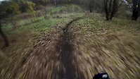
Photos of Helsinki Mountain Bike
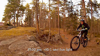
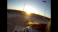
Videos of Helsinki Mountain Bike
trail: Peikko
0:08 |
558 |
Oct 28, 2015
trail: Dreamed Trail
0:26 |
964 |
Apr 21, 2015
trail: A Line
0:23 |
613 |
Apr 23, 2014
trail: A Line
0:20 |
526 |
Aug 29, 2013
trail: Hallainvuori singletrack
18:42 |
54 |
May 9, 2026 , Helsinki
49:37 |
291 |
Sep 5, 2023
trail: Pitkospuut
5:33 |
157 |
Oct 10, 2010
trail: Woods
0:07 |
518 |
Sep 17, 2010
Recent Trail Reports
| status | trail | date | condition | info | user |
|---|---|---|---|---|---|
| Mikkolanmäki - Upper | Jun 23, 2026 @ 6:26pm (Europe/Mariehamn) 5 hours | Ideal | aarne10 | ||
| Ruskeasuo Access132 | Jun 11, 2026 @ 12:17pm (Europe/Helsinki) Jun 11, 2026 | Ideal | tsalesto | ||
| Pohjois-Haaga Access1 | Jun 11, 2026 @ 12:17pm (Europe/Helsinki) Jun 11, 2026 | Ideal | tsalesto | ||
| Access56 | Jun 11, 2026 @ 12:17pm (Europe/Helsinki) Jun 11, 2026 | Ideal | tsalesto | ||
| mouse trail | Jun 7, 2026 @ 9:41pm (Europe/Helsinki) Jun 7, 2026 | Ideal | Larppamatic | ||
| Rollercoaster | Jun 7, 2026 @ 9:41pm (Europe/Helsinki) Jun 7, 2026 | Ideal | Larppamatic | ||
| Access 74 | Jun 1, 2026 @ 11:05am (Europe/Helsinki) Jun 1, 2026 | Ideal | tsalesto | ||
| Access 107 | Jun 1, 2026 @ 11:05am (Europe/Helsinki) Jun 1, 2026 | Ideal | tsalesto | ||
| Kivihaaka Access2 | Jun 1, 2026 @ 11:05am (Europe/Helsinki) Jun 1, 2026 | Ideal | tsalesto | ||
| Ruskeasuo Access156 | Jun 1, 2026 @ 11:05am (Europe/Helsinki) Jun 1, 2026 | Ideal | tsalesto |
Activity Feed
| username | action | type | title | date |
|---|---|---|---|---|
| aarne10 | add | report | activity #97635018 | Jun 23, 2026 @ 10:02am 3 hours |
| tsalesto | add | report | activity #96819962 | Jun 12, 2026 @ 12:00pm Jun 12, 2026 |
| tsalesto | add | report | activity #96819961 and 1 more | Jun 12, 2026 @ 12:00pm Jun 12, 2026 |
| NirgmaX2Y | wishlist | region | activity #96610096 | Jun 9, 2026 @ 9:11am Jun 9, 2026 |
| Larppamatic | add | report | activity #96588717 | Jun 9, 2026 @ 12:19am Jun 9, 2026 |
Recent Comments
| username | type | title | comment | date |
|---|---|---|---|---|
| trail | Awesome trail in good condition | Aug 17, 2025 @ 3:51am Aug 17, 2025 | ||
| trail | Tää on alaspäin mennessä kivasti haastava... | Jul 31, 2024 @ 8:56am Jul 31, 2024 | ||
| trail | Tää on helppo aloitus HKP reitille. Muutama... | Jul 31, 2024 @ 8:48am Jul 31, 2024 | ||
| skillpark | nice | Jun 30, 2024 @ 5:14am Jun 30, 2024 | ||
| trail | Arvostelisin 3.7 jos voisin todella hyvä... | Jul 4, 2023 @ 8:48am Jul 4, 2023 |
Local Badges
-

Completionist1 awarded -

10 Blue Trails93 awarded -

10 Green Trails56 awarded -

Top 10 Trails0 awarded -
Completionist0 awarded -

10 Black Trails5 awarded
Bike & Skill Parks
| name | type | city | rating |
|---|---|---|---|
| Paltan dirt rata | skill park | Helsinki | |
| Koskelan dirtti | skill park | Helsinki | |
| Savelan Pumptrack | skill park | Helsinki | |
| Kupittaa BMX Track | skill park | Helsinki | |
| Kivikko BMX Race Park | skill park | Helsinki |
Local Mountain Biking Directory
-
Ridemore
-
Hi5bikesBike Shop
-
FoxcompBike Shop
-
Pyorahuolto.comBike Shop
-
Polkupyörien Erikoisosat Bb Team OyBike Shop
-
Foxcomp HelsinkiBike Shop
Activity Type Stats
| activitytype | trails | distance | descent | descent distance | total vertical | rating | global rank | state rank | photos | reports | routes | ridelogs |
|---|---|---|---|---|---|---|---|---|---|---|---|---|
| Mountain Bike | 653 | 154 miles | 12,513 ft | 63 miles | 256 ft | #204 | #2 | 56 | 2,701 | 20 | 29,957 | |
| E-Bike | 628 | 146 miles | 11,099 ft | 60 miles | 256 ft | #175 | #4 | 1 | 2,581 | 14 | 4,096 | |
| Horse | 2 | 2,126 ft | 85 ft | 1,709 ft | 69 ft | 14 | ||||||
| Hike | 626 | 146 miles | 11,394 ft | 60 miles | 256 ft | #373 | #4 | 2,680 | 3 | 338 | ||
| Trail Running | 649 | 153 miles | 12,169 ft | 63 miles | 256 ft | #254 | #3 | 2,694 | 4 | 1,602 | ||
| Dirtbike/Moto | 67 | 11 miles | 748 ft | 5 miles | 233 ft | #212 | #1 | 13 | 3 | |||
| Snowshoe | 44 | 9 miles | 617 ft | 4 miles | 154 ft | #152 | #5 | 105 | 4 | |||
| Downhill Ski | 6 | 4,961 ft | 66 ft | 2,119 ft | 36 ft | #344 | #3 | 91 | 1 | |||
| Backcountry Ski | 42 | 9 miles | 600 ft | 3 miles | 154 ft | #195 | #5 | 3 | 19 | |||
| Nordic Ski | 191 | 44 miles | 2,602 ft | 18 miles | 253 ft | #108 | #2 | 107 | 1,554 |
Frequently Asked Questions About Helsinki
▼
What are the best places to ride in Helsinki?
Helsinki has 9 areas to explore for mountain biking. The top rated areas are:
▼
What are the highest rated mountain biking trails in Helsinki?
The highest rated mountain biking trails in Helsinki are:
- Tenholanpolku-Kivihaka, short (4.2/5)
- Haltiavuori HC lasku (4.1/5)
- Valtatieltä Metsälään (4.1/5)
- Maunula Kovala (4.1/5)
- Pirkkola SideWinder (4.1/5)
▼
What is the best time of the year to ride in Helsinki?
Based on ride log data, the most popular months to ride in Helsinki are:
- July (209 activities)
- August (152 activities)
- May (148 activities)
▼
Where can I park to ride in Helsinki?
There are 12 parking locations listed in Helsinki. The most popular parking spots are: View all parking and trailhead locations on the map to plan your visit.
Activities
Trails
- By ridethelive & contributors
- Admins: Bunabe
- #8438 - 23,445 views
- helsinki activity log | embed map of Helsinki mountain bike trails | helsinki mountain biking points of interest
Downloading of trail gps tracks in kml & gpx formats is enabled for Helsinki.
You must login to download files.