close
-
Layers w
- Weather Layers
- Pro
- Pro
- Pro
- Pro
- Pro
- Pro
- More Layers
- Pro
- Pro
- Pro
- Pro
-
Upgrade to

3D
Trail Conditions
- Unknown
- Snow Groomed
- Snow Packed
- Snow Covered
- Snow Cover Partial
- Freeze/thaw Cycle
- Icy
- Prevalent Mud
- Wet
- Variable
- Ideal
- Dry
- Very Dry
Trail Flow (Ridden Direction)
Trailforks scans users ridelogs to determine the most popular direction each trail is ridden. A good flowing trail network will have most trails flowing in a single direction according to their intension.
The colour categories are based on what percentage of riders are riding a trail in its intended direction.
The colour categories are based on what percentage of riders are riding a trail in its intended direction.
- > 96%
- > 90%
- > 80%
- > 70%
- > 50%
- < 50%
- bi-directional trail
- no data
Trail Last Ridden
Trailforks scans ridelogs to determine the last time a trail was ridden.
- < 2 days
- < 1 week
- < 2 weeks
- < 1 month
- < 6 months
- > 6 months
Trail Ridden Direction
The intended direction a trail should be ridden.
- Downhill Only
- Downhill Primary
- Both Directions
- Uphill Primary
- Uphill Only
- One Direction
Contribute Details
Colors indicate trail is missing specified detail.
- Description
- Photos
- Description & Photos
- Videos
Trail Popularity ?
Trailforks scans ridelogs to determine which trails are ridden the most in the last 9 months.
Trails are compared with nearby trails in the same city region with a possible 25 colour shades.
Think of this as a heatmap, more rides = more kinetic energy = warmer colors.
- most popular
- popular
- less popular
- not popular
ATV/ORV/OHV Filter
Max Vehicle Width
inches
US Cell Coverage
Legend

Radar Time
Activity Recordings
Trailforks uses anonymized public activity data.
?
Activity Recordings
Trailforks uses anonymized public activity data.
?
Personal Heatmap
▶
Activity Types
all
/
none
▶
Options
2
Date range
month
–
Winter Trails
Warning
A routing network for winter maps does not exist. Selecting trails using the winter trails layer has been disabled.
Missing Trails
Most Popular
Least Popular
Trails are colored based on popularity. The more popular a trail is, the more red. Less popular trails trend towards green.
Jump Magnitude Heatmap
Heatmap of where riders jump on trails. Zoom in to see individual jumps, click circles to view jump details.
BC Backroad Status
![map legend]()
Service Road Atlas is a free to use, community-driven service for viewing and creating reports on the numerous back-country service roads around B.C. and Alberta.

Slope Aspect
Direction the slope faces
Trails Deemphasized
Trails are shown in grey.
Only show trails with no bike usage.
Suggested Layers
Based on selected activity type
Save the current map location and zoom level as your default home location whenever this page is loaded.
Save
No description for Henderson has been added yet!
Login or register to submit one.
Links
Activities Click to view
- Mountain Bike
191 trails
- E-Bike
72 trails
- Gravel Bike
3 trails
- Adaptive Bike
1 trails
- Winter Fat Bike
0 trails
- Horse
9 trails
- Hike
212 trails
- Trail Running
208 trails
- Dirtbike/Moto
2 trails
- ATV/ORV/OHV
2 trails
Region Details
- 12
- 45
- 25
- 83
- 10
- 1
Region Status
Open as of 12 hoursStats
- Avg Trail Rating
- Trails (view details)
- 190
- Trails Mountain Bike
- 191
- Trails E-Bike
- 72
- Trails Gravel Bike
- 3
- Trails Adaptive Bike
- 1
- Trails Horse
- 9
- Trails Hike
- 212
- Trails Trail Running
- 208
- Trails Dirtbike/Moto
- 2
- Trails Observed Trials
- 2
- Trails ATV/ORV/OHV
- 2
- Total Distance
- 239 miles
- Total Descent
- 26,406 ft
- Total Vertical
- 9,566 ft
- Highest Trailhead
- 11,109 ft
- Reports
- 2,513
- Photos
- 487
- Ridden Counter
- 28,698
Sub Regions
-
Sloan Canyon Trails
- 6
- 15
- 70
- 9
- 1
Popular Henderson Mountain Biking Trails
• 100 ★ 3.9 • 2,799 ft • 86 ft • 798 •
Nice desert trail. Going south the climb might be a little challenging but rideable. Very good transition trail, from , to get into the heart of the trails.
• 100 ★ 3.2 • 2 miles • 136 ft • 756 •
Pretty flowy and smooth. A short sandy and loose drop in the middle, then a grind down the , difficult to climb up when dry and sandy
• 100 ★ 4.2 • 3,022 ft • 137 ft • 720 •
Highly rated popular blue difficulty singletrack. This multi-use trail can be used both directions. On average it takes 6 minutes to complete this trail.
• 95 ★ 3.2 • 1,384 ft • 59 ft • 604 •
Little backdoor canyon single track that is labeled as 601 on the trail. It winds up the canyon and drops you quickly down to the 601 powerline double track.
• 95 ★ 3.9 • 2,587 ft • 87 ft • 542 •
Popular green difficulty singletrack. This multi-use trail can be used both directions and has a moderate overall physical rating with a 87 ft blue climb. On average it takes 4 minutes to complete this trail.
• 100 ★ 4.6 • 2 miles • 129 ft • 484 •
Highly rated popular blue difficulty singletrack. This multi-use trail can be used both directions and has a moderate overall physical rating with a 129 ft blue climb. On average it takes 16 minutes to complete this trail.
• 100 ★ 4.0 • 2 miles • 388 ft • 471 •
Highly rated popular blue difficulty singletrack. This multi-use trail can be used both directions and has a moderate overall physical rating with a 388 ft blue climb. On average it takes 21 minutes to complete this trail.
• 100 ★ 4.5 • 2 miles • 11 ft • 467 •
Flowy desert riding. Not steep or difficult. Heading north it flows really good if you keep on the gas. A few spots to air out and a couple little sandy washes with some river stone, but nothing too difficult.
Henderson Mountain Bike Routes
★ 4.0 • 7 miles • 808 ft • 5 •
601 to down to to to to to then return to parking lot on Nitro Bench.
★ 5.0 • 15 miles • 1,864 ft • 2 •
Great new trail connecting Nitro Trails to Anthem Trails without having to use McCullough Fire Road.
★ 5.0 • 14 miles • 1,431 ft • 23 • Loop •
Fun, flow, and a good workout. I ride this CCW. From the parking lot and the McCullough trail ... you're...
9 miles • 1,131 ft • 9 • Loop •
Shorter loop that hits the most fun single black diamond trails in Canyon, & .
★ 2.0 • 8 miles • 748 ft • 5 • Loop •
Fun loop up 601 over to 701 connector and back
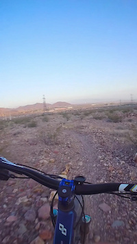
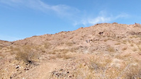
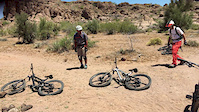
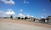
Photos of Henderson Mountain Bike
Videos of Henderson Mountain Bike
trail: Ivy the Flyer
0:57 |
18 |
Sep 26, 2025
trail: Nitro Bench
0:17 |
315 |
Mar 18, 2021
trail: Trick
0:06 |
314 |
May 29, 2017
trail: Trick
0:31 |
99 |
Jul 2, 2016
trail: Anthem East Trail
2:34 |
499 |
Mar 23, 2015
trail: Anthem East Trail
0:16 |
147 |
Mar 4, 2015

trail: Grandma's Arm Chair
4:04 |
15 |
May 27, 2026 , Henderson
trail: Rampage
4:04 |
11 |
May 27, 2026 , Henderson
Recent Trail Reports
| status | trail | date | condition | info | user |
|---|---|---|---|---|---|
| Connector | Jun 28, 2026 @ 10:15am (America/Los_Angeles) 12 hours | Very Dry | TheSlowpokes | ||
| Truckin' | Jun 26, 2026 @ 6:08am (America/Los_Angeles) 3 days | Ideal | Mechead | ||
| The Nudist | Jun 14, 2026 @ 7:07am (America/Los_Angeles) Jun 14, 2026 | Ideal | jkrincek | ||
| Chupacabra | Jun 14, 2026 @ 7:07am (America/Los_Angeles) Jun 14, 2026 | Ideal | jkrincek | ||
| ZYMA | Jun 14, 2026 @ 7:07am (America/Los_Angeles) Jun 14, 2026 | Ideal | jkrincek | ||
| Litterbox | Jun 14, 2026 @ 7:07am (America/Los_Angeles) Jun 14, 2026 | Dry | jkrincek | ||
| Sidewinder | Jun 14, 2026 @ 7:07am (America/Los_Angeles) Jun 14, 2026 | Ideal | jkrincek | ||
| Casper | Jun 14, 2026 @ 7:07am (America/Los_Angeles) Jun 14, 2026 | Ideal | jkrincek | ||
| 601 Powerline Connector | Jun 7, 2026 @ 6:34pm (America/Los_Angeles) Jun 7, 2026 | Very Dry | Mechead | ||
| 601 Powerline | Jun 7, 2026 @ 6:34pm (America/Los_Angeles) Jun 7, 2026 | Dry | Mechead |
Activity Feed
| username | action | type | title | date |
|---|---|---|---|---|
| TheSlowpokes | add | report | activity #98021752 and 1 more | Jun 28, 2026 @ 1:45pm 8 hours |
| JustBigmac14 | ridden | trail | activity #97870930 and 6 more | Jun 26, 2026 @ 6:50pm 2 days |
| Mechead | add | report | activity #97839770 | Jun 26, 2026 @ 9:26am 3 days |
| JustBigmac14 | comment | trail | activity #97813005 | Jun 25, 2026 @ 8:27pm Jun 25, 2026 |
| JustBigmac14 | ridden | trail | activity #97812802 | Jun 25, 2026 @ 8:21pm Jun 25, 2026 |
Recent Comments
| username | type | title | comment | date |
|---|---|---|---|---|
| trail | I really like this new trail! If you’re... | Jun 25, 2026 @ 8:27pm Jun 25, 2026 | ||
| trail | Y seemed ye yd you b ye. K l: expel l love y... | May 7, 2026 @ 9:15am May 7, 2026 | ||
| report | L l L llu | May 7, 2026 @ 8:46am May 7, 2026 | ||
| trail | fantastic trail with some great, fun climbing. | Apr 9, 2026 @ 2:59pm Apr 9, 2026 | ||
| trail | The Sloan Canyon 403 Trail, also known as the... | Mar 15, 2026 @ 6:23am Mar 15, 2026 |
Local Badges
-

Henderson Top 10 Trails1 awarded -

10 Green Trails169 awarded -

Epic Ride 50k1,926 awarded -

Completionist1 awarded -

Big Ride 30k5,366 awarded -

Top 10 Trails3 awarded
Bike & Skill Parks
| name | type | city | rating |
|---|---|---|---|
| Arroyo Grande Bike Park | skill park | Henderson | |
| Whitney Mesa BMX | skill park | Henderson |
Activity Type Stats
| activitytype | trails | distance | descent | descent distance | total vertical | rating | global rank | state rank | photos | reports | routes | ridelogs |
|---|---|---|---|---|---|---|---|---|---|---|---|---|
| Mountain Bike | 191 | 219 miles | 22,726 ft | 106 miles | 9,567 ft | #425 | #157 | 470 | 2,510 | 10 | 44,168 | |
| E-Bike | 72 | 59 miles | 5,459 ft | 31 miles | 1,762 ft | #2,103 | #940 | 1 | 2,363 | 1 | 4,260 | |
| Gravel Bike | 3 | #510 | #1,052 | 1 | 7 | 38 | ||||||
| Adaptive Bike | 1 | #470 | #1,772 | |||||||||
| Horse | 9 | 10 miles | 276 ft | 4 miles | 1,207 ft | #1,771 | #1,002 | 103 | ||||
| Hike | 212 | 231 miles | 25,348 ft | 107 miles | 9,567 ft | #608 | #281 | 8 | 2,506 | 1,743 | ||
| Trail Running | 208 | 225 miles | 24,902 ft | 104 miles | 9,567 ft | #371 | #144 | 18 | 2,506 | 1 | 2,873 | |
| Dirtbike/Moto | 2 | 3 miles | 30 ft | 4,009 ft | 92 ft | #920 | #340 | 101 | 55 | |||
| Observed Trials | 2 | 4 miles | 174 ft | 1 mile | 180 ft | 1 | 2 | 2 | ||||
| ATV/ORV/OHV | 2 | 4 miles | 174 ft | 1 mile | 180 ft | #748 | #314 | 101 | 12 |
Frequently Asked Questions About Henderson
▼
What are the best places to ride in Henderson?
Henderson has 2 areas to explore for mountain biking. The top rated areas are:
▼
What are the highest rated mountain biking trails in Henderson?
The highest rated mountain biking trails in Henderson are:
- Nitro CirKus (4.5/5)
- Extinguisher (4.4/5)
- Nitro Super G (4.4/5)
- Yippee Ki-Yay (4.4/5)
- Party Lap (4.4/5)
▼
What is the best time of the year to ride in Henderson?
Based on ride log data, the most popular months to ride in Henderson are:
- October (398 activities)
- May (392 activities)
- April (350 activities)
▼
Where can I park to ride in Henderson?
There are 15 parking locations listed in Henderson. The most popular parking spots are: View all parking and trailhead locations on the map to plan your visit.
Activities
Trails
- By brenthillier
 NSMBA TRAILFORKS & contributors
 - Admins: SNMBA, JonnieDangerously, BLM NV GBNM
- #3962 - 19,044 views
- henderson activity log | embed map of Henderson mountain bike trails | henderson mountain biking points of interest polygons
Downloading of trail gps tracks in kml & gpx formats is enabled for Henderson.
You must login to download files.