close
-
Layers w
- Weather Layers
- Pro
- Pro
- Pro
- Pro
- Pro
- Pro
- More Layers
- Pro
- Pro
- Pro
- Pro
-
Upgrade to

3D
Trail Conditions
- Unknown
- Snow Groomed
- Snow Packed
- Snow Covered
- Snow Cover Partial
- Freeze/thaw Cycle
- Icy
- Prevalent Mud
- Wet
- Variable
- Ideal
- Dry
- Very Dry
Trail Flow (Ridden Direction)
Trailforks scans users ridelogs to determine the most popular direction each trail is ridden. A good flowing trail network will have most trails flowing in a single direction according to their intension.
The colour categories are based on what percentage of riders are riding a trail in its intended direction.
The colour categories are based on what percentage of riders are riding a trail in its intended direction.
- > 96%
- > 90%
- > 80%
- > 70%
- > 50%
- < 50%
- bi-directional trail
- no data
Trail Last Ridden
Trailforks scans ridelogs to determine the last time a trail was ridden.
- < 2 days
- < 1 week
- < 2 weeks
- < 1 month
- < 6 months
- > 6 months
Trail Ridden Direction
The intended direction a trail should be ridden.
- Downhill Only
- Downhill Primary
- Both Directions
- Uphill Primary
- Uphill Only
- One Direction
Contribute Details
Colors indicate trail is missing specified detail.
- Description
- Photos
- Description & Photos
- Videos
Trail Popularity ?
Trailforks scans ridelogs to determine which trails are ridden the most in the last 9 months.
Trails are compared with nearby trails in the same city region with a possible 25 colour shades.
Think of this as a heatmap, more rides = more kinetic energy = warmer colors.
- most popular
- popular
- less popular
- not popular
ATV/ORV/OHV Filter
Max Vehicle Width
inches
US Cell Coverage
Legend

Radar Time
Activity Recordings
Trailforks uses anonymized public activity data.
?
Activity Recordings
Trailforks uses anonymized public activity data.
?
Personal Heatmap
▶
Activity Types
all
/
none
▶
Options
2
Date range
month
–
Winter Trails
Warning
A routing network for winter maps does not exist. Selecting trails using the winter trails layer has been disabled.
Missing Trails
Most Popular
Least Popular
Trails are colored based on popularity. The more popular a trail is, the more red. Less popular trails trend towards green.
Jump Magnitude Heatmap
Heatmap of where riders jump on trails. Zoom in to see individual jumps, click circles to view jump details.
BC Backroad Status
![map legend]()
Service Road Atlas is a free to use, community-driven service for viewing and creating reports on the numerous back-country service roads around B.C. and Alberta.

Slope Aspect
Direction the slope faces
Trails Deemphasized
Trails are shown in grey.
Only show trails with no bike usage.
Suggested Layers
Based on selected activity type
Save the current map location and zoom level as your default home location whenever this page is loaded.
Save
No description for Hérault has been added yet!
Login or register to submit one.
This region uses the Uk/Euro style trail grading system.
Activities Click to view
- Mountain Bike
913 trails
- E-Bike
769 trails
- Horse
19 trails
- Hike
733 trails
- Trail Running
730 trails
- Dirtbike/Moto
3 trails
- ATV/ORV/OHV
1 trails
- Snowmobile
0 trails
- Snowshoe
0 trails
- Downhill Ski
0 trails
- Backcountry Ski
0 trails
- Nordic Ski
0 trails
Stats
- Avg Trail Rating
- Trails (view details)
- 909
- Trails Mountain Bike
- 913
- Trails E-Bike
- 769
- Trails Gravel Bike
- 49
- Trails Adaptive Bike
- 112
- Trails Winter Fat Bike
- 1
- Trails Horse
- 19
- Trails Hike
- 733
- Trails Trail Running
- 730
- Trails Dirtbike/Moto
- 3
- Trails ATV/ORV/OHV
- 1
- Total Distance
- 701 miles
- Total Descent
- 192,053 ft
- Total Vertical
- 3,506 ft
- Highest Trailhead
- 3,510 ft
- Reports
- 940
- Photos
- 283
- Ridden Counter
- 16,381
Articles
Race Recap: Dirtlej Epic Enduro 2025
May 7, 2025 from pinkbike.com
With over 120 km of racing and 4,900 meters of elevation gain and loss, the Epic Enduro is no ordinary race.
Sub Regions
- Aniane (7)
- Bédarieux (28)
- Cabrerolles (1)
- Castries (2)
- Caussiniojouls (18)
- Clermont L'Herault (92)
- Cabrières (31)
- Lac du Salagou (56)
- Combes (34)
- Dio-et-Valquières (2)
- Fabrègues (19)
- Fozières (5)
- Gigean (74)
- Grabels (32)
- Graissessac (22)
- La Boissiere (2)
- La Salvetat-sur-Agout (3)
- La Tour-sur-Orb (15)
- Lamalou les bains (19)
- Le Pradal (25)
- Lunas (14)
- Mireval (2)
- Montferrier-sur-Lez (16)
- Montpellier (10)
- La Gardiole (8)
- Murviel-lès-Montpellier (12)
- Olargues (24)
- Pignan (31)
- Rosis (7)
- Saint Jean De La Blaquière (3)
- Saint-Bauzille-de-la-Sylve (6)
- Saint-Bauzille-de-Montmel (6)
- Saint-Chinian (106)
- Saint-Clement-de-Rivière (6)
- Saint-Geniès-des-Mourgues (4)
- Saint-Georges-d'Orques (30)
- Saint-Guilhem-le-Désert (9)
- Saint-Jean-de-la-Blaquière (35)
- Saint-Saturnin-de-Lucian (21)
- Roc des deux Vierges (21)
- Soubes (20)
- Ste-Croix-de-Quintillargues (22)
- Taussac-la-Bilière (11)
- Vendemian (6)
- Vic-la-Gardiole (17)
- Vieussan (10)
- Montagnes du Caroux (76)
- Saint-Nazaire-de-Ladarez (18)
Popular Hérault Mountain Biking Trails
• 100 ★ 4.8 • 1,109 ft • 7 ft • 198 •
Trail assez fun qui commence avec quelques virage dans de la gravette avec quelques racine en plongeant dans la pente. Un chicken pass permet d'eviter un passage dur. Puis les courbes s'alongent et ca accelère j'usqu'a la relance. Fast...
• 95 ★ 4.7 • 1 mile • 0 ft • 192 •
Very winding path but with flow. On middle part, pay attention to the toboggan in a left turn, technical section. Then the trail opens on a ridge and the pace accelerates until the arrival.
• 95 ★ 3.5 • 2 miles • 29 ft • 182 • • hike
Popular red difficulty singletrack. This hike primary trail can be used downhill primary and has a hard overall physical rating with a 29 ft black diamond climb. It features berm, gap jump, rock face and rock garden. Trail visibility is always easy to follow. On average it takes 33 minutes to complete this trail.
• 100 ★ 4.5 • 2 miles • 125 ft • 156 •
Trail superbe tracé de côte positives et négatives qui s’enchaînent rapidement
• 80 ★ 4.7 • 1 mile • 6 ft • 151 •
Popular black difficulty singletrack. This mountain bike primary trail can be used downhill primary. On average it takes 17 minutes to complete this trail.
• 95 ★ 4.5 • 1 mile • 134 ft • 141 •
Sentier entre le camping et la chapelle, très facile, aucune difficultés.
• 80 ★ 3.7 • 1 mile • 3 ft • 140 • • hike
Popular blue difficulty singletrack. This hike primary trail can be used downhill primary and has a hard overall physical rating with a 3 ft double black diamond climb. It features berm, jump, rock garden, roller coaster and skinny. On average it takes 10 minutes to complete this trail.
• 100 ★ 4.6 • 4,127 ft • 3 ft • 140 • • hike
Popular red difficulty singletrack. This hike primary trail can be used downhill primary. On average it takes 7 minutes to complete this trail.
Hérault Mountain Bike Routes
12 miles • 1,102 ft • 4 • Loop •
Parcours de 20 kms en passant par la Chapelle Saint-Martin-du-Cardonnet et après quelques kms sur des...
21 miles • 2,158 ft • 26 • Loop •
Une route agréable à travers les paysages typiques de la région, avec de nombreux vignobles. Terrain...
13 miles • 1,127 ft • 15 • Loop •
Parcours à travers les vignobles. La plupart du temps, le parcours est constitué de cailloux, ce qui est...
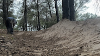
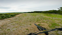
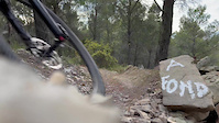
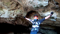
Videos of Hérault Mountain Bike
trail: Mini Rampage
0:06 |
64 |
Jan 2, 2025
trail: Les Écoliers
0:20 |
62 |
Jun 13, 2024
trail: La Street
0:00 |
|
Jul 27, 2023
trail: La Street
0:16 |
22 |
Jul 27, 2023
trail: La Street
0:00 |
|
Jul 27, 2023
trail: La Street
0:26 |
29 |
Jul 27, 2023
trail: Enduro
7:23 |
53 |
Dec 2, 2019
trail: Enduro
7:50 |
44 |
Dec 2, 2019
Current Trail Warnings
| status | trail | date | condition | user | info |
|---|---|---|---|---|---|
| X-Files Cabrières | Jun 25, 2026 @ 2:53pm (Europe/Paris) 3 days | Very Dry | Lhassa | Végétation qui recouvre la trace, pas... | |
| La fin des Fayssolles Clermont L'Herault | Jun 23, 2026 @ 9:08am (Europe/Paris) Jun 23, 2026 | Unknown | Lhassa | Privé | |
| Les Fayssolles Lac du Salagou | Jun 23, 2026 @ 9:06am (Europe/Paris) Jun 23, 2026 | Unknown | Lhassa | Terrain privé |
Recent Trail Reports
National Scenic Trails & Official Routes
-
Grande Traversée VTT du Massif Central
- Mountain Bike
- E-Bike
Activity Feed
| username | action | type | title | date |
|---|---|---|---|---|
| Lhassa | add | report | activity #97891740 | Jun 27, 2026 @ 4:43am 22 hours |
| Lhassa | comment | trail | activity #97891648 | Jun 27, 2026 @ 4:41am 22 hours |
| Lhassa | comment | trail | activity #97891406 and 2 more | Jun 27, 2026 @ 4:36am 23 hours |
| MikaelB7TwKD | wishlist | trail | activity #97821258 | Jun 26, 2026 @ 1:37am 2 days |
| MikaelB7TwKD | wishlist | trail | activity #97821237 | Jun 26, 2026 @ 1:36am 2 days |
Recent Comments
| username | type | title | comment | date |
|---|---|---|---|---|
| trail | Descente assez technique. | Jun 27, 2026 @ 4:45am 22 hours | ||
| trail | Accès en montée, 1ère piste à droite... | Jun 27, 2026 @ 4:41am 22 hours | ||
| trail | Descente assez facile de la pierre sur la fin.... | Jun 27, 2026 @ 4:38am 22 hours | ||
| trail | Pas très raide sur les 3/4, la fin est plus... | Jun 27, 2026 @ 4:36am 23 hours | ||
| trail | Sentier en impasse, sans sortie sur une piste... | Jun 25, 2026 @ 5:55am 3 days |
Local Badges
-

Epic Ride Descent 2k0 awarded -
Epic Ride Descent 2k0 awarded -
Epic Ride Descent 2k0 awarded -
Epic Ride Descent 2k0 awarded -
Epic Ride Descent 2k0 awarded -

Mountain Biking 100k Badge0 awarded
Bike & Skill Parks
| name | type | city | rating |
|---|---|---|---|
| Pumptrack Gigean | skill park | Gigean | |
| pumptrack Montpellier | skill park | Montpellier | |
| Pumptrack Lézignan-le-Cèbe | skill park | Lézignan-le-Cèbe | |
| pumptrack Lattes | skill park | Lattes | |
| pumptrack Mireval | skill park | Mireval |
Activity Type Stats
| activitytype | trails | distance | descent | descent distance | total vertical | rating | global rank | state rank | photos | reports | routes | ridelogs |
|---|---|---|---|---|---|---|---|---|---|---|---|---|
| Mountain Bike | 913 | 692 miles | 187,654 ft | 332 miles | 3,507 ft | 275 | 940 | 30 | 15,166 | |||
| E-Bike | 769 | 576 miles | 151,204 ft | 273 miles | 3,507 ft | 852 | 13 | 2,746 | ||||
| Gravel Bike | 49 | 56 miles | 6,729 ft | 15 miles | 3,343 ft | 22 | 3 | 139 | ||||
| Adaptive Bike | 112 | 177 miles | 9,521 ft | 35 miles | 3,366 ft | 161 | ||||||
| Winter Fat Bike | 1 | 1,709 ft | 10 ft | 138 ft | ||||||||
| Horse | 19 | 10 miles | 2,110 ft | 4 miles | 2,572 ft | 42 | ||||||
| Hike | 733 | 617 miles | 139,311 ft | 273 miles | 3,507 ft | 876 | 4 | 952 | ||||
| Trail Running | 730 | 614 miles | 138,520 ft | 271 miles | 3,507 ft | 8 | 876 | 4 | 455 | |||
| Dirtbike/Moto | 3 | 4,892 ft | 404 ft | 4,085 ft | 397 ft | 42 | 1 | 3 | ||||
| ATV/ORV/OHV | 1 | 860 ft | 62 ft | 860 ft | 66 ft | 42 | 1 |
Frequently Asked Questions About Hérault
▼
What are the best places to ride in Hérault?
Hérault has 6 areas to explore for mountain biking. The top rated areas are:
▼
What are the highest rated mountain biking trails in Hérault?
The highest rated mountain biking trails in Hérault are:
- Bourdelles (4.4/5)
- Tobbogans V2 (4.4/5)
- La Mienne (4.4/5)
- Trottinettes Upper (4.4/5)
- Les Fayssolles (4.4/5)
▼
What is the best time of the year to ride in Hérault?
Based on ride log data, the most popular months to ride in Hérault are:
- May (80 activities)
- July (76 activities)
- April (74 activities)
▼
What is the longest trail in Hérault?
The longest trail in Hérault is Voie Verte de Sète à Marseillan at 8.6 miles. View all trails sorted by distance.
Activities
Trails
Points of Interest
- By Freyjir & contributors
- Admins: TFFRANCE, elyari, freerider48, provencemb, kikou, provencemb, qfeger
- #27213 - 8,540 views
- hérault activity log | embed map of Hérault mountain bike trails | hérault mountain biking points of interest polygons
Downloading of trail gps tracks in kml & gpx formats is enabled for Hérault.
You must login to download files.