close
-
Layers w
- Weather Layers
- Pro
- Pro
- Pro
- Pro
- Pro
- Pro
- More Layers
- Pro
- Pro
- Pro
- Pro
-
Upgrade to

3D
Trail Conditions
- Unknown
- Snow Groomed
- Snow Packed
- Snow Covered
- Snow Cover Partial
- Freeze/thaw Cycle
- Icy
- Prevalent Mud
- Wet
- Variable
- Ideal
- Dry
- Very Dry
Trail Flow (Ridden Direction)
Trailforks scans users ridelogs to determine the most popular direction each trail is ridden. A good flowing trail network will have most trails flowing in a single direction according to their intension.
The colour categories are based on what percentage of riders are riding a trail in its intended direction.
The colour categories are based on what percentage of riders are riding a trail in its intended direction.
- > 96%
- > 90%
- > 80%
- > 70%
- > 50%
- < 50%
- bi-directional trail
- no data
Trail Last Ridden
Trailforks scans ridelogs to determine the last time a trail was ridden.
- < 2 days
- < 1 week
- < 2 weeks
- < 1 month
- < 6 months
- > 6 months
Trail Ridden Direction
The intended direction a trail should be ridden.
- Downhill Only
- Downhill Primary
- Both Directions
- Uphill Primary
- Uphill Only
- One Direction
Contribute Details
Colors indicate trail is missing specified detail.
- Description
- Photos
- Description & Photos
- Videos
Trail Popularity ?
Trailforks scans ridelogs to determine which trails are ridden the most in the last 9 months.
Trails are compared with nearby trails in the same city region with a possible 25 colour shades.
Think of this as a heatmap, more rides = more kinetic energy = warmer colors.
- most popular
- popular
- less popular
- not popular
ATV/ORV/OHV Filter
Max Vehicle Width
inches
US Cell Coverage
Legend

Radar Time
Activity Recordings
Trailforks uses anonymized public activity data.
?
Activity Recordings
Trailforks uses anonymized public activity data.
?
Personal Heatmap
▶
Activity Types
all
/
none
▶
Options
2
Date range
month
–
Winter Trails
Warning
A routing network for winter maps does not exist. Selecting trails using the winter trails layer has been disabled.
Missing Trails
Most Popular
Least Popular
Trails are colored based on popularity. The more popular a trail is, the more red. Less popular trails trend towards green.
Jump Magnitude Heatmap
Heatmap of where riders jump on trails. Zoom in to see individual jumps, click circles to view jump details.
BC Backroad Status
![map legend]()
Service Road Atlas is a free to use, community-driven service for viewing and creating reports on the numerous back-country service roads around B.C. and Alberta.

Slope Aspect
Direction the slope faces
Trails Deemphasized
Trails are shown in grey.
Only show trails with no bike usage.
Suggested Layers
Based on selected activity type
Save the current map location and zoom level as your default home location whenever this page is loaded.
SaveThe trail offers a little of everything that you will find on trails in Michigan: tight twisty singletrack through heavily wooded areas, open double-track, sweet flowing singletrack with switchbacks, some interesting technical areas (log piles, bridges, rock garden, downhill with drop-offs) and a VERY fast downhill we call Big Bertha. Of course you could always ride it backwards and call it a BIG KICK BUTT climb The trail is considered moderately technical. There are not many big climbs, but there are three short steep ones with switchbacks in a row. Also there are some off camber climbs as well as on the descents.
The trail dries out fast in the rain, and is one of the first trails to be ready after the spring thaw. There is some sand, but not like a lot of the trails get in the late summer. There is a lot of the trail that isn't sandy and is really fast and fun when it's dry in the summer. There also is some problems in the summer with overgrowth... but hey only a few people help maintain this area and they have done a heck of a good job at that! This trail has grown in length and increased in the fun factor in the past 5 years - is actually one of Michigan's best-kept secrets.
The mileage is somewhere in the 7-10 mile range depending on how much double -track and park/meadow road you want to ride. It seems a lot longer when you are riding it. It's also a city park so there is no hunting allowed. There are some trail markings and a map in the parking lot, but the best way to get around is to ride with a local. #1 TIP = BRING BUG SPRAY!!!
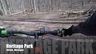
source: Heritage Park
Primary Trail Type: Cross-Country
 google parking directions
 Activities Click to view
- Mountain Bike
7 trails
- Hike
7 trails
- Trail Running
7 trails
Region Details
- 3
- 4
Region Status
Open as of Apr 23, 2026Stats
- Avg Trail Rating
- Trails (view details)
- 7
- Trails Mountain Bike
- 7
- Trails Hike
- 7
- Trails Trail Running
- 7
- Total Distance
- 8 miles
- Total Descent Distance
- 3 miles
- Total Descent
- 366 ft
- Total Vertical
- 70 ft
- Highest Trailhead
- 782 ft
- Reports
- 116
- Photos
- 10
- Ridden Counter
- 1,377
Popular Heritage Park Mountain Biking Trails
• 100 ★ 3.6 • 2 miles • 91 ft • 201 •
Same start as the but stays closer to the parking lot. Does not venture out into the swamps but still goes down Big Bertha.
• 90 ★ 4.4 • 2 miles • 54 ft • 178 •
A two-way loop that is also the end of the orange loop. There are a couple of tight spots and log-overs, but nothing too difficult.
• 80 ★ 3.8 • 1 mile • 99 ft • 169 •
The trail offers a little of everything that you will find on trails in Michigan: tight twisty singletrack through heavily wooded areas, open double-track, sweet flowing singletrack with switchbacks, some interesting technical areas...
• 70 ★ 0.0 • 1,939 ft • 3 ft • 161 •
Popular blue difficulty singletrack. This mountain bike primary trail can be used one direction. On average it takes 2 minutes to complete this trail.
• 50 ★ 0.0 • 1 mile • 64 ft • 153 •
Green Trail uses the center of the Orange Trail, but skips all of the steep ups and downs. It still goes down to the swamp and across the long boardwalk, so it's quite the fun trail!
• 60 ★ 0.0 • 774 ft • 10 ft • 110 •
Moderately popular blue difficulty singletrack. This mountain bike primary trail can be used one direction. On average it takes minutes to complete this trail.
• 55 ★ 4.0 • 3,071 ft • 0 ft • 104 •
This is a short connector trail or alternate route and has no details, though it will appear on all maps.
Heritage Park Mountain Bike Routes
Videos of Heritage Park Mountain Bike
8:03 |
575 |
Mar 30, 2021
Recent Trail Reports
| status | trail | date | condition | info | user |
|---|---|---|---|---|---|
| Red Loop | Sep 28, 2025 @ 5:53pm (America/Detroit) Sep 28, 2025 | Dry | TheytINt1 | ||
| Orange Loop | Jun 1, 2025 @ 3:48pm Jun 1, 2025 | Ideal | Tkeating61 | ||
| Orange Loop | Jun 1, 2025 @ 3:48pm Jun 1, 2025 | Ideal | Tkeating61 | ||
| Orange shortcut | May 15, 2023 @ 5:54am May 15, 2023 | Dry | prusek | ||
| Stubnitz Trail Head Access Road | May 15, 2023 @ 5:54am May 15, 2023 | Dry | prusek | ||
| Stubnitz Trail Head Access Road | Mar 16, 2023 @ 7:23am Mar 16, 2023 | Ideal | WillieJacobsz Trailforks |
Activity Feed
| username | action | type | title | date |
|---|---|---|---|---|
| k8kg77 | wishlist | trail | activity #89014842 and 5 more | Feb 16, 2026 @ 6:43am Feb 16, 2026 |
| XDptgv | wishlist | region | activity #84993611 | Nov 30, 2025 @ 3:34pm Nov 30, 2025 |
| GregRoyBean | ridden | trail | activity #83317031 and 6 more | Oct 31, 2025 @ 8:21am Oct 31, 2025 |
| TheytINt1 | add | report | activity #81323569 and 1 more | Sep 28, 2025 @ 2:53pm Sep 28, 2025 |
| TracyHwEFh6 | wishlist | route | activity #79440958 | Sep 1, 2025 @ 1:36pm Sep 1, 2025 |
Recent Comments
| username | type | title | comment | date |
|---|---|---|---|---|
| trail | Great trail system very flowy | Apr 14, 2021 @ 6:01pm Apr 14, 2021 | ||
| trail | Great trail for beginners, smooth and flowy | Jun 13, 2020 @ 1:55pm Jun 13, 2020 | ||
| trail | Red trail is a shorter version of Orange... | Apr 20, 2020 @ 3:45pm Apr 20, 2020 | ||
| trail | Orange loop distance is 8.8 miles according to... | Apr 20, 2020 @ 3:43pm Apr 20, 2020 |
Nearby Areas
| name | distance | ||||
|---|---|---|---|---|---|
| Watson Lake State Park | 5 | 15.7 km | |||
| Sharon Mills | 2 | 18.1 km | |||
| Sylvan Prairie Park | 3 | 20.6 km | |||
| Secor Metro Park | 4 | 21.4 km | |||
| Wiregrass Lake | 1 | 22.6 km |
Activity Type Stats
| activitytype | trails | distance | descent | descent distance | total vertical | rating | global rank | state rank | photos | reports | routes | ridelogs |
|---|---|---|---|---|---|---|---|---|---|---|---|---|
| Mountain Bike | 7 | 8 miles | 367 ft | 3 miles | 69 ft | #10,219 | #4,040 | 10 | 115 | 1 | 1,114 | |
| Hike | 7 | 8 miles | 367 ft | 3 miles | 69 ft | #15,293 | #6,850 | 115 | 14 | |||
| Trail Running | 7 | 8 miles | 367 ft | 3 miles | 69 ft | #13,931 | #5,842 | 115 | 61 |
Frequently Asked Questions About Heritage Park
▼
What are the highest rated mountain biking trails in Heritage Park?
The highest rated mountain biking trails in Heritage Park are:
- Yellow Loop (4.1/5)
- Orange Loop - Bidirectional Section (4/5)
- Orange Loop (3.9/5)
- Red Loop (3.8/5)
- Green Trail (0/5)
▼
What is the best time of the year to ride in Heritage Park?
Based on ride log data, the most popular months to ride in Heritage Park are:
- September (11 activities)
- August (8 activities)
- April (5 activities)
▼
Where can I park to ride in Heritage Park?
There are 5 parking locations listed in Heritage Park. The most popular parking spots are: View all parking and trailhead locations on the map to plan your visit.
▼
What is the longest trail in Heritage Park?
The longest trail in Heritage Park is Red Loop at 2.4 miles. View all trails sorted by distance.
Activities
- By markholloway
 Trailforks Map Team & contributors
 - Admins: PotoMBA, PotoMBA
- #11727 - 7,023 views
- heritage park activity log | embed map of Heritage Park mountain bike trails | heritage park mountain biking points of interest
Downloading of trail gps tracks in kml & gpx formats is enabled for Heritage Park.
You must login to download files.