close
-
Layers w
- Weather Layers
- Pro
- Pro
- Pro
- Pro
- Pro
- Pro
- More Layers
- Pro
- Pro
- Pro
- Pro
-
Upgrade to

3D
Trail Conditions
- Unknown
- Snow Groomed
- Snow Packed
- Snow Covered
- Snow Cover Partial
- Freeze/thaw Cycle
- Icy
- Prevalent Mud
- Wet
- Variable
- Ideal
- Dry
- Very Dry
Trail Flow (Ridden Direction)
Trailforks scans users ridelogs to determine the most popular direction each trail is ridden. A good flowing trail network will have most trails flowing in a single direction according to their intension.
The colour categories are based on what percentage of riders are riding a trail in its intended direction.
The colour categories are based on what percentage of riders are riding a trail in its intended direction.
- > 96%
- > 90%
- > 80%
- > 70%
- > 50%
- < 50%
- bi-directional trail
- no data
Trail Last Ridden
Trailforks scans ridelogs to determine the last time a trail was ridden.
- < 2 days
- < 1 week
- < 2 weeks
- < 1 month
- < 6 months
- > 6 months
Trail Ridden Direction
The intended direction a trail should be ridden.
- Downhill Only
- Downhill Primary
- Both Directions
- Uphill Primary
- Uphill Only
- One Direction
Contribute Details
Colors indicate trail is missing specified detail.
- Description
- Photos
- Description & Photos
- Videos
Trail Popularity ?
Trailforks scans ridelogs to determine which trails are ridden the most in the last 9 months.
Trails are compared with nearby trails in the same city region with a possible 25 colour shades.
Think of this as a heatmap, more rides = more kinetic energy = warmer colors.
- most popular
- popular
- less popular
- not popular
ATV/ORV/OHV Filter
Max Vehicle Width
inches
US Cell Coverage
Legend

Radar Time
Activity Recordings
Trailforks uses anonymized public activity data.
?
Activity Recordings
Trailforks uses anonymized public activity data.
?
Personal Heatmap
▶
Activity Types
all
/
none
▶
Options
2
Date range
month
–
Winter Trails
Warning
A routing network for winter maps does not exist. Selecting trails using the winter trails layer has been disabled.
Missing Trails
Most Popular
Least Popular
Trails are colored based on popularity. The more popular a trail is, the more red. Less popular trails trend towards green.
Jump Magnitude Heatmap
Heatmap of where riders jump on trails. Zoom in to see individual jumps, click circles to view jump details.
BC Backroad Status
![map legend]()
Service Road Atlas is a free to use, community-driven service for viewing and creating reports on the numerous back-country service roads around B.C. and Alberta.

Slope Aspect
Direction the slope faces
Trails Deemphasized
Trails are shown in grey.
Only show trails with no bike usage.
Suggested Layers
Based on selected activity type
Save the current map location and zoom level as your default home location whenever this page is loaded.
Save
No description for Hershey has been added yet!
Login or register to submit one.
AKA: Chocolatetown, Derry Township
Activities Click to view
- Mountain Bike
18 trails
- Adaptive Bike
0 trails
- Hike
15 trails
- Trail Running
15 trails
Region Details
- 2
- 6
- 6
- 4
Region Status
Open as of Mar 31, 2026Local Trail Association
Stats
- Avg Trail Rating
- Trails (view details)
- 18
- Trails Mountain Bike
- 18
- Trails Hike
- 15
- Trails Trail Running
- 15
- Total Distance
- 13 miles
- Total Descent
- 1,458 ft
- Total Vertical
- 280 ft
- Highest Trailhead
- 664 ft
- Reports
- 443
- Photos
- 58
- Ridden Counter
- 8,937
Sub Regions
-
Hershey Medical Center
- 4
- 6
- 4
Popular Hershey Mountain Biking Trails
• 90 ★ 3.4 • 2 miles • 185 ft • 679 •
Popular blue difficulty singletrack. This mountain bike primary trail can be used one direction. On average it takes 12 minutes to complete this trail.
• 60 ★ 3.6 • 3,609 ft • 80 ft • 631 •
Nice flow, a few small rock gardens. When you exit, turn left on the road, then right to enter W1.
• 45 ★ 3.8 • 2,448 ft • 44 ft • 612 •
Moderately popular green difficulty singletrack. This mountain bike primary trail can be used both directions. On average it takes 4 minutes to complete this trail.
• 65 ★ 3.0 • 2,274 ft • 48 ft • 582 •
Moderately popular blue difficulty singletrack. This mountain bike primary trail can be used one direction. On average it takes 4 minutes to complete this trail.
• 70 ★ 3.5 • 1,250 ft • 25 ft • 576 •
Popular green difficulty singletrack. This mountain bike primary trail can be used one direction. On average it takes 1 minutes to complete this trail.
• 95 ★ 3.9 • 1 mile • 112 ft • 560 •
Popular blue difficulty singletrack. This mountain bike primary trail can be used one direction. On average it takes 6 minutes to complete this trail.
• 40 ★ 3.4 • 3,783 ft • 49 ft • 557 •
Moderately popular blue difficulty singletrack. This mountain bike primary trail can be used one direction. On average it takes 10 minutes to complete this trail.
Hershey Mountain Bike Routes
★ 3.5 • 10 miles • 1,135 ft • 22 • Loop •
Covers all trails in proper directions with very minimal repeated sections; rides the East side 1st, then...
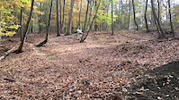
Photos of Hershey Mountain Bike


Recent Trail Reports
| status | trail | date | condition | info | user |
|---|---|---|---|---|---|
| Reservoir | Mar 31, 2026 @ 12:31pm (America/New_York) Mar 31, 2026 | Ideal | JasonzrTzp8 | ||
| W4 | Mar 31, 2026 @ 12:31pm (America/New_York) Mar 31, 2026 | Ideal | JasonzrTzp8 | ||
| W5 Loop | Mar 31, 2026 @ 12:31pm (America/New_York) Mar 31, 2026 | Ideal | JasonzrTzp8 | ||
| W2 | Mar 31, 2026 @ 12:31pm (America/New_York) Mar 31, 2026 | Ideal | JasonzrTzp8 | ||
| E4 | Mar 31, 2026 @ 12:31pm (America/New_York) Mar 31, 2026 | Ideal | JasonzrTzp8 | ||
| E5 | Mar 31, 2026 @ 12:31pm (America/New_York) Mar 31, 2026 | Ideal | JasonzrTzp8 | ||
| E3 | Mar 31, 2026 @ 12:31pm (America/New_York) Mar 31, 2026 | Ideal | JasonzrTzp8 | ||
| E5 Loop | Mar 31, 2026 @ 12:31pm (America/New_York) Mar 31, 2026 | Ideal | JasonzrTzp8 | ||
| E2 | Mar 31, 2026 @ 12:31pm (America/New_York) Mar 31, 2026 | Ideal | JasonzrTzp8 | ||
| E1 | Mar 31, 2026 @ 12:31pm (America/New_York) Mar 31, 2026 | Ideal | JasonzrTzp8 |
Activity Feed
| username | action | type | title | date |
|---|---|---|---|---|
| Rten360 | wishlist | route | activity #95674885 | May 27, 2026 @ 5:50pm May 27, 2026 |
| Choobs89PiiZ | ridden | trail | activity #95578532 and 7 more | May 26, 2026 @ 11:24am May 26, 2026 |
| NevrEnuf | wishlist | region | activity #94980314 | May 18, 2026 @ 9:12am May 18, 2026 |
| Lee4 | wishlist | trail | activity #94347895 and 1 more | May 9, 2026 @ 9:05am May 9, 2026 |
| Mdzimiera | ridden | route | activity #93276842 | Apr 24, 2026 @ 6:36am Apr 24, 2026 |
Recent Comments
| username | type | title | comment | date |
|---|---|---|---|---|
| trail | How do we get actual jumps on the jump line? | Feb 6, 2024 @ 5:33am Feb 6, 2024 | ||
| trail | 10/19/23: trail blocked by large downed tree... | Oct 19, 2023 @ 9:47am Oct 19, 2023 | ||
| trail | Glorious | Jul 12, 2023 @ 5:03am Jul 12, 2023 | ||
| trail | Not fun to climb up but it’s extremely fun... | Jun 2, 2022 @ 8:58pm Jun 2, 2022 | ||
| trail | RIP ...the local trail police removed the jumps | Apr 26, 2021 @ 8:29am Apr 26, 2021 |
Local Badges
-

Epic Ride Climb 2k0 awarded -

Climbing 10k Badge26 awarded -

Climbing 100k Badge0 awarded -

Epic Ride Descent 2k0 awarded -

Descent 10k Badge26 awarded -

Descent 100k Badge0 awarded
Activity Type Stats
| activitytype | trails | distance | descent | descent distance | total vertical | rating | global rank | state rank | photos | reports | routes | ridelogs |
|---|---|---|---|---|---|---|---|---|---|---|---|---|
| Mountain Bike | 18 | 13 miles | 1,457 ft | 5 miles | 279 ft | #3,250 | #1,117 | 58 | 443 | 2 | 6,599 | |
| Hike | 15 | 12 miles | 1,286 ft | 5 miles | 279 ft | #9,966 | #3,536 | 442 | 185 | |||
| Trail Running | 15 | 12 miles | 1,286 ft | 5 miles | 279 ft | #9,635 | #3,283 | 442 | 86 |
Frequently Asked Questions About Hershey
▼
What are the best places to ride in Hershey?
Hershey has 1 areas to explore for mountain biking. The top rated areas are:
▼
What are the highest rated mountain biking trails in Hershey?
▼
What is the best time of the year to ride in Hershey?
Based on ride log data, the most popular months to ride in Hershey are:
- July (99 activities)
- May (92 activities)
- September (75 activities)
▼
Where can I park to ride in Hershey?
There are 1 parking locations listed in Hershey. The most popular parking spots are:
Trails
Points of Interest
- By chuktA
 TRAILFORKS NFTA & contributors
 - Admins: SAMBA
- #26048 - 3,609 views
- hershey activity log | embed map of Hershey mountain bike trails | hershey mountain biking points of interest
Downloading of trail gps tracks in kml & gpx formats is enabled for Hershey.
You must login to download files.