close
-
Layers w
- Weather Layers
- Pro
- Pro
- Pro
- Pro
- Pro
- Pro
- More Layers
- Pro
- Pro
- Pro
- Pro
-
Upgrade to

3D
Trail Conditions
- Unknown
- Snow Groomed
- Snow Packed
- Snow Covered
- Snow Cover Partial
- Freeze/thaw Cycle
- Icy
- Prevalent Mud
- Wet
- Variable
- Ideal
- Dry
- Very Dry
Trail Flow (Ridden Direction)
Trailforks scans users ridelogs to determine the most popular direction each trail is ridden. A good flowing trail network will have most trails flowing in a single direction according to their intension.
The colour categories are based on what percentage of riders are riding a trail in its intended direction.
The colour categories are based on what percentage of riders are riding a trail in its intended direction.
- > 96%
- > 90%
- > 80%
- > 70%
- > 50%
- < 50%
- bi-directional trail
- no data
Trail Last Ridden
Trailforks scans ridelogs to determine the last time a trail was ridden.
- < 2 days
- < 1 week
- < 2 weeks
- < 1 month
- < 6 months
- > 6 months
Trail Ridden Direction
The intended direction a trail should be ridden.
- Downhill Only
- Downhill Primary
- Both Directions
- Uphill Primary
- Uphill Only
- One Direction
Contribute Details
Colors indicate trail is missing specified detail.
- Description
- Photos
- Description & Photos
- Videos
Trail Popularity ?
Trailforks scans ridelogs to determine which trails are ridden the most in the last 9 months.
Trails are compared with nearby trails in the same city region with a possible 25 colour shades.
Think of this as a heatmap, more rides = more kinetic energy = warmer colors.
- most popular
- popular
- less popular
- not popular
ATV/ORV/OHV Filter
Max Vehicle Width
inches
US Cell Coverage
Legend

Radar Time
Activity Recordings
Trailforks uses anonymized public activity data.
?
Activity Recordings
Trailforks uses anonymized public activity data.
?
Personal Heatmap
▶
Activity Types
all
/
none
▶
Options
2
Date range
month
–
Winter Trails
Warning
A routing network for winter maps does not exist. Selecting trails using the winter trails layer has been disabled.
Missing Trails
Most Popular
Least Popular
Trails are colored based on popularity. The more popular a trail is, the more red. Less popular trails trend towards green.
Jump Magnitude Heatmap
Heatmap of where riders jump on trails. Zoom in to see individual jumps, click circles to view jump details.
BC Backroad Status
![map legend]()
Service Road Atlas is a free to use, community-driven service for viewing and creating reports on the numerous back-country service roads around B.C. and Alberta.

Slope Aspect
Direction the slope faces
Trails Deemphasized
Trails are shown in grey.
Only show trails with no bike usage.
Suggested Layers
Based on selected activity type
Save the current map location and zoom level as your default home location whenever this page is loaded.
Save
No description for Herten has been added yet!
Login or register to submit one.
This region uses the Uk/Euro style trail grading system.
Activities Click to view
- Mountain Bike
4 trails
- E-Bike
4 trails
Region Details
- 2
- 2
Region Status
Open as of Aug 18, 2024Stats
- Avg Trail Rating
- Trails (view details)
- 4
- Trails Mountain Bike
- 4
- Trails E-Bike
- 4
- Total Distance
- 5 miles
- Total Descent Distance
- 2 miles
- Total Descent
- 989 ft
- Total Vertical
- 271 ft
- Highest Trailhead
- 433 ft
- Reports
- 41
- Photos
- 2
- Ridden Counter
- 602
Popular Herten Mountain Biking Trails
• 100 ★ 4.0 • 843 ft • 0 ft • 160 •
Popular red difficulty singletrack. This mountain bike primary trail can be used downhill only. It features jump and gap jump. On average it takes minutes to complete this trail.
• 50 ★ 4.6 • 1,627 ft • 0 ft • 147 •
Moderately popular blue difficulty singletrack. This mountain bike primary trail can be used downhill only. It features berm, drop and jump. On average it takes 2 minutes to complete this trail.
• 75 ★ 4.5 • 1,736 ft • 0 ft • 140 •
Popular red difficulty singletrack. This mountain bike primary trail can be used downhill only. It features drop, jump and gap jump. On average it takes 6 minutes to complete this trail.
• 25 ★ 4.5 • 4 miles • 628 ft • 66 •
Official XC Trail Halde Hoheward made by Regionalverband Ruhr
Videos of Herten Mountain Bike
trail: Halde Hoppenbruch Freeride
7:08 |
317 |
Mar 31, 2021 , Herten

trail: Hoppenbruch Jumpline
7:08 |
669 |
Mar 31, 2021 , Herten

trail: XC Route Halde Hoheward
5:07 |
599 |
Oct 4, 2020 , Herten

trail: XC Route Halde Hoheward
4:05 |
499 |
Jun 22, 2020 , Herten
Recent Trail Reports
| status | trail | date | condition | info | user |
|---|---|---|---|---|---|
| Halde Hoppenbruch Freeride | Aug 18, 2024 @ 2:16pm Aug 18, 2024 | Ideal | Fifolotek | ||
| Hoppenbruch Singletrail | Aug 18, 2024 @ 2:16pm Aug 18, 2024 | Ideal | Fifolotek | ||
| Hoppenbruch Jumpline | Aug 18, 2024 @ 2:16pm Aug 18, 2024 | Ideal | Fifolotek | ||
| XC Route Halde Hoheward | Mar 7, 2024 @ 9:12am Mar 7, 2024 | Variable | martinkuznik |
Activity Feed
| username | action | type | title | date |
|---|---|---|---|---|
| Spurherbst | ridden | trail | activity #96458921 | Jun 7, 2026 @ 7:31am Jun 7, 2026 |
| CemGaG7zi | difficultyvote | trail | activity #93868668 | May 2, 2026 @ 9:23am May 2, 2026 |
| muZyhU | wishlist | trail | activity #91362735 | Mar 27, 2026 @ 12:16am Mar 27, 2026 |
| xtnessi | wishlist | trail | activity #91200241 | Mar 24, 2026 @ 7:12am Mar 24, 2026 |
| TAddsn | wishlist | trail | activity #88208151 | Feb 2, 2026 @ 1:25am Feb 2, 2026 |
Recent Comments
| username | type | title | comment | date |
|---|---|---|---|---|
| trail | Joa viele Sprünge aber können auch noch... | Nov 25, 2023 @ 2:23am Nov 25, 2023 | ||
| trail | Hier steht zwar schwarz ist jedoch nur Blau.... | Aug 29, 2022 @ 3:02pm Aug 29, 2022 | ||
| trail | Extrem coole Jumpline, sehr gut gebaut. Mega geil | Aug 6, 2021 @ 10:11pm Aug 6, 2021 |
Activity Type Stats
| activitytype | trails | distance | descent | descent distance | total vertical | rating | global rank | state rank | photos | reports | routes | ridelogs |
|---|---|---|---|---|---|---|---|---|---|---|---|---|
| Mountain Bike | 4 | 5 miles | 988 ft | 2 miles | 272 ft | #7,255 | #270 | 2 | 41 | 3,225 | ||
| E-Bike | 4 | 5 miles | 988 ft | 2 miles | 272 ft | #7,295 | #347 | 36 | 407 |
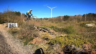
- By Sasse82
 TRAILFORKS & contributors
 - Admins: apply
- #38904 - 1,249 views
- herten activity log | embed map of Herten mountain bike trails |
Downloading of trail gps tracks in kml & gpx formats is enabled for Herten.
You must login to download files.