close
-
Layers w
- Weather Layers
- Pro
- Pro
- Pro
- Pro
- Pro
- Pro
- More Layers
- Pro
- Pro
- Pro
- Pro
-
Upgrade to

3D
Trail Conditions
- Unknown
- Snow Groomed
- Snow Packed
- Snow Covered
- Snow Cover Partial
- Freeze/thaw Cycle
- Icy
- Prevalent Mud
- Wet
- Variable
- Ideal
- Dry
- Very Dry
Trail Flow (Ridden Direction)
Trailforks scans users ridelogs to determine the most popular direction each trail is ridden. A good flowing trail network will have most trails flowing in a single direction according to their intension.
The colour categories are based on what percentage of riders are riding a trail in its intended direction.
The colour categories are based on what percentage of riders are riding a trail in its intended direction.
- > 96%
- > 90%
- > 80%
- > 70%
- > 50%
- < 50%
- bi-directional trail
- no data
Trail Last Ridden
Trailforks scans ridelogs to determine the last time a trail was ridden.
- < 2 days
- < 1 week
- < 2 weeks
- < 1 month
- < 6 months
- > 6 months
Trail Ridden Direction
The intended direction a trail should be ridden.
- Downhill Only
- Downhill Primary
- Both Directions
- Uphill Primary
- Uphill Only
- One Direction
Contribute Details
Colors indicate trail is missing specified detail.
- Description
- Photos
- Description & Photos
- Videos
Trail Popularity ?
Trailforks scans ridelogs to determine which trails are ridden the most in the last 9 months.
Trails are compared with nearby trails in the same city region with a possible 25 colour shades.
Think of this as a heatmap, more rides = more kinetic energy = warmer colors.
- most popular
- popular
- less popular
- not popular
ATV/ORV/OHV Filter
Max Vehicle Width
inches
US Cell Coverage
Legend

Radar Time
Activity Recordings
Trailforks uses anonymized public activity data.
?
Activity Recordings
Trailforks uses anonymized public activity data.
?
Personal Heatmap
▶
Activity Types
all
/
none
▶
Options
2
Date range
month
–
Winter Trails
Warning
A routing network for winter maps does not exist. Selecting trails using the winter trails layer has been disabled.
Missing Trails
Most Popular
Least Popular
Trails are colored based on popularity. The more popular a trail is, the more red. Less popular trails trend towards green.
Jump Magnitude Heatmap
Heatmap of where riders jump on trails. Zoom in to see individual jumps, click circles to view jump details.
BC Backroad Status
![map legend]()
Service Road Atlas is a free to use, community-driven service for viewing and creating reports on the numerous back-country service roads around B.C. and Alberta.

Slope Aspect
Direction the slope faces
Trails Deemphasized
Trails are shown in grey.
Only show trails with no bike usage.
Suggested Layers
Based on selected activity type
Save the current map location and zoom level as your default home location whenever this page is loaded.
Save
No description for High Bridge has been added yet!
Login or register to submit one.
Activities Click to view
- Mountain Bike
37 trails
- E-Bike
26 trails
- Adaptive Bike
0 trails
- Winter Fat Bike
0 trails
- Horse
2 trails
- Hike
39 trails
- Trail Running
39 trails
Region Details
- 2
- 11
- 14
Region Status
Open as of Jun 6, 2026Local Trail Association
Stats
- Avg Trail Rating
- Trails (view details)
- 35
- Trails Mountain Bike
- 37
- Trails E-Bike
- 26
- Trails Horse
- 2
- Trails Hike
- 39
- Trails Trail Running
- 39
- Total Distance
- 21 miles
- Total Descent
- 1,563 ft
- Total Vertical
- 471 ft
- Highest Trailhead
- 727 ft
- Reports
- 1,462
- Photos
- 61
- Ridden Counter
- 17,422
Sub Regions
-
Commons Flow Trails
- 3
- 1
-
High Bridge Flow Trails
- 2
- 1
-
Nassau Trails
- 11
- 15
Popular High Bridge Mountain Biking Trails
• 100 ★ 5.0 • 2,756 ft • 93 ft • 629 •
is a uphill only trail to get to the top of the downhill flow trails.
• 85 ★ 0.0 • 2,333 ft • 16 ft • 613 •
Popular blue difficulty singletrack. This mountain bike primary trail can be used both directions and has a moderate overall physical rating with a 16 ft green climb. It features roller coaster. On average it takes 4 minutes to complete this trail.
• 70 ★ 3.8 • 2,871 ft • 52 ft • 606 •
Popular blue difficulty singletrack. This mountain bike primary trail can be used downhill primary. On average it takes 4 minutes to complete this trail.
• 50 ★ 5.0 • 3,845 ft • 52 ft • 596 •
Moderately popular green difficulty singletrack. This mountain bike primary trail can be used both directions and has a easy overall physical rating with a 52 ft green climb. On average it takes 5 minutes to complete this trail.
• 75 ★ 5.0 • 1,919 ft • 81 ft • 573 •
Popular blue difficulty singletrack. This mountain bike primary trail can be used both directions and has a moderate overall physical rating with a 81 ft blue climb. It features rock garden and skinny. Trail visibility is always easy to follow. On average it takes 4 minutes to complete this trail.
• 40 ★ 0.0 • 3,501 ft • 56 ft • 538 •
Moderately popular green difficulty singletrack. This mountain bike primary trail can be used both directions. On average it takes 6 minutes to complete this trail.
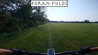
High Bridge Mountain Bike Routes
★ 5.0 • 11 miles • 1,075 ft • 19 • Out & Back •
11 mile Trails loop from Foran Fields
Photos of High Bridge Mountain Bike
Videos of High Bridge Mountain Bike

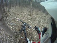
trail: Green Flash
0:54 |
91 |
Oct 1, 2023
trail: Rocky Trail
0:17 |
361 |
Mar 31, 2013
trail: Rocky Trail
2:29 |
461 |
Sep 17, 2012
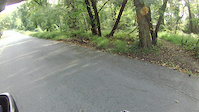
trail: Foran Field Access
9:08 |
194 |
Jul 26, 2023 , High Bridge

trail: Blue Steel
8:03 |
856 |
Jun 14, 2021 , High Bridge
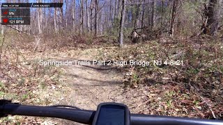
13:46 |
248 |
Apr 9, 2021
28:52 |
422 |
Apr 9, 2021

trail: Blue Steel
0:22 |
916 |
Jan 5, 2021 , High Bridge
Recent Trail Reports
| status | trail | date | condition | info | user |
|---|---|---|---|---|---|
| HT - Columbia Trail | May 31, 2026 @ 9:55am (America/New_York) May 31, 2026 | Ideal | antz1116 | ||
| Columbia Trail | May 31, 2026 @ 7:04am (America/New_York) May 31, 2026 | Ideal | antz1116 | ||
| Blue Steel | May 30, 2026 @ 5:17pm (America/New_York) May 30, 2026 | Dry | 8K0DVDmg | ||
| Green Flash | May 30, 2026 @ 5:15pm (America/New_York) May 30, 2026 | Dry | 8K0DVDmg | ||
| Matt's Trail | Sep 17, 2025 @ 1:47pm (America/New_York) Sep 17, 2025 | Dry | MichaelHWmDHI | ||
| Flatlands | Sep 17, 2025 @ 1:47pm (America/New_York) Sep 17, 2025 | Dry | MichaelHWmDHI | ||
| Untitled Path | Sep 17, 2025 @ 1:47pm (America/New_York) Sep 17, 2025 | Dry | MichaelHWmDHI | ||
| La Primera | Sep 17, 2025 @ 1:47pm (America/New_York) Sep 17, 2025 | Dry | MichaelHWmDHI | ||
| Ridgeline Trail | Sep 17, 2025 @ 1:47pm (America/New_York) Sep 17, 2025 | Dry | MichaelHWmDHI | ||
| Rocky Trail | Sep 17, 2025 @ 1:47pm (America/New_York) Sep 17, 2025 | Dry | MichaelHWmDHI |
Activity Feed
| username | action | type | title | date |
|---|---|---|---|---|
| ajm247 | wishlist | trail | activity #98173569 | Jun 30, 2026 @ 7:19pm 3 days |
| Billy32bFRg | wishlist | badge | activity #98023535 | Jun 28, 2026 @ 2:10pm Jun 28, 2026 |
| jefflosco | wishlist | region | activity #97926517 | Jun 27, 2026 @ 12:13pm Jun 27, 2026 |
| BryanB76 | wishlist | region | activity #97784260 | Jun 25, 2026 @ 12:01pm Jun 25, 2026 |
| ajm247 | wishlist | region | activity #97537938 | Jun 21, 2026 @ 7:05pm Jun 21, 2026 |
Recent Comments
| username | type | title | comment | date |
|---|---|---|---|---|
| trail | Tree dining in the sharp corner at the bottom | Nov 8, 2025 @ 7:56am Nov 8, 2025 | ||
| trail | Great trail system that's conveniently close... | Apr 30, 2025 @ 11:13am Apr 30, 2025 | ||
| report | Wrong trail- probably not closed | Apr 28, 2025 @ 6:58am Apr 28, 2025 | ||
| report | When will trails reopen? | Mar 15, 2024 @ 1:18pm Mar 15, 2024 | ||
| trail | Fairly level, hard packed gravel and dirt... | Oct 15, 2023 @ 4:36pm Oct 15, 2023 |
Local Badges
-

Completionist0 awarded -

Epic Ride 50k311 awarded -

Top 10 Trails20 awarded -
Completionist0 awarded -

Big Ride 30k899 awarded -

10 Green Trails329 awarded
Activity Type Stats
| activitytype | trails | distance | descent | descent distance | total vertical | rating | global rank | state rank | photos | reports | routes | ridelogs |
|---|---|---|---|---|---|---|---|---|---|---|---|---|
| Mountain Bike | 37 | 17 miles | 1,263 ft | 9 miles | 312 ft | #1,847 | #679 | 62 | 1,468 | 2 | 6,420 | |
| E-Bike | 26 | #7,283 | #2,193 | 946 | 1 | 279 | ||||||
| Horse | 2 | 8 miles | 157 ft | 5 miles | 154 ft | #2,779 | #1,545 | 303 | 1 | |||
| Hike | 39 | 20 miles | 1,394 ft | 9 miles | 472 ft | #7,282 | #2,573 | 1,397 | 1 | 88 | ||
| Trail Running | 39 | 20 miles | 1,394 ft | 9 miles | 472 ft | #7,042 | #2,319 | 1,397 | 1 | 92 |
Frequently Asked Questions About High Bridge
▼
What are the best places to ride in High Bridge?
High Bridge has 3 areas to explore for mountain biking. The top rated areas are:
▼
What are the highest rated mountain biking trails in High Bridge?
The highest rated mountain biking trails in High Bridge are:
- Blue Steel (4.3/5)
- Jump Trail (4.2/5)
- Flatlands (4.1/5)
- Forge Ahead (4.1/5)
- Ridgeline Trail (4.1/5)
▼
What is the best time of the year to ride in High Bridge?
Based on ride log data, the most popular months to ride in High Bridge are:
- June (151 activities)
- July (123 activities)
- May (98 activities)
▼
Where can I park to ride in High Bridge?
There are 4 parking locations listed in High Bridge. The most popular parking spots are: View all parking and trailhead locations on the map to plan your visit.
Activities
Trails
Points of Interest
- By nickmx & contributors
- Admins: JORBA, JORBAHi-Bridge, JORBA Central
- #12306 - 11,932 views
- high bridge activity log | embed map of High Bridge mountain bike trails | high bridge mountain biking points of interest
Downloading of trail gps tracks in kml & gpx formats is enabled for High Bridge.
You must login to download files.