close
-
Layers w
- Weather Layers
- Pro
- Pro
- Pro
- Pro
- Pro
- Pro
- More Layers
- Pro
- Pro
- Pro
- Pro
-
Upgrade to

3D
Trail Conditions
- Unknown
- Snow Groomed
- Snow Packed
- Snow Covered
- Snow Cover Partial
- Freeze/thaw Cycle
- Icy
- Prevalent Mud
- Wet
- Variable
- Ideal
- Dry
- Very Dry
Trail Flow (Ridden Direction)
Trailforks scans users ridelogs to determine the most popular direction each trail is ridden. A good flowing trail network will have most trails flowing in a single direction according to their intension.
The colour categories are based on what percentage of riders are riding a trail in its intended direction.
The colour categories are based on what percentage of riders are riding a trail in its intended direction.
- > 96%
- > 90%
- > 80%
- > 70%
- > 50%
- < 50%
- bi-directional trail
- no data
Trail Last Ridden
Trailforks scans ridelogs to determine the last time a trail was ridden.
- < 2 days
- < 1 week
- < 2 weeks
- < 1 month
- < 6 months
- > 6 months
Trail Ridden Direction
The intended direction a trail should be ridden.
- Downhill Only
- Downhill Primary
- Both Directions
- Uphill Primary
- Uphill Only
- One Direction
Contribute Details
Colors indicate trail is missing specified detail.
- Description
- Photos
- Description & Photos
- Videos
Trail Popularity ?
Trailforks scans ridelogs to determine which trails are ridden the most in the last 9 months.
Trails are compared with nearby trails in the same city region with a possible 25 colour shades.
Think of this as a heatmap, more rides = more kinetic energy = warmer colors.
- most popular
- popular
- less popular
- not popular
ATV/ORV/OHV Filter
Max Vehicle Width
inches
US Cell Coverage
Legend

Radar Time
Activity Recordings
Trailforks uses anonymized public activity data.
?
Activity Recordings
Trailforks uses anonymized public activity data.
?
Personal Heatmap
▶
Activity Types
all
/
none
▶
Options
2
Date range
month
–
Winter Trails
Warning
A routing network for winter maps does not exist. Selecting trails using the winter trails layer has been disabled.
Missing Trails
Most Popular
Least Popular
Trails are colored based on popularity. The more popular a trail is, the more red. Less popular trails trend towards green.
Jump Magnitude Heatmap
Heatmap of where riders jump on trails. Zoom in to see individual jumps, click circles to view jump details.
BC Backroad Status
![map legend]()
Service Road Atlas is a free to use, community-driven service for viewing and creating reports on the numerous back-country service roads around B.C. and Alberta.

Slope Aspect
Direction the slope faces
Trails Deemphasized
Trails are shown in grey.
Only show trails with no bike usage.
Suggested Layers
Based on selected activity type
Save the current map location and zoom level as your default home location whenever this page is loaded.
Save
No description for Highland UT has been added yet!
Login or register to submit one.
Activities Click to view
- Mountain Bike
58 trails
- E-Bike
37 trails
- Gravel Bike
0 trails
- Adaptive Bike
0 trails
- Hike
46 trails
- Trail Running
54 trails
Region Details
- 4
- 30
- 12
- 6
Region Status
Caution as of Jun 15, 2026Stats
- Avg Trail Rating
- Trails (view details)
- 53
- Trails Mountain Bike
- 58
- Trails E-Bike
- 37
- Trails Horse
- 2
- Trails Hike
- 46
- Trails Trail Running
- 54
- Trails Snowshoe
- 1
- Trails Nordic Ski
- 1
- Total Distance
- 5 miles
- Total Descent
- 518 ft
- Total Vertical
- 968 ft
- Highest Trailhead
- 5,672 ft
- Reports
- 262
- Photos
- 55
- Ridden Counter
- 11,466
Sub Regions
-
Highland Glen Bike Park
- 11
- 1
- 2
-
Highland Hollow
- 4
- 4
- 4
-
Windsor Meadows
- 6
Popular Highland UT Mountain Biking Trails
• 100 ★ 0.0 • 1 mile • 0 ft • 635 •
Paved path over an underground canal
• 90 ★ 3.0 • 492 ft • 5 ft • 598 •
Popular green difficulty singletrack. This multi-use trail can be used both directions. On average it takes minutes to complete this trail.
• 95 ★ 0.0 • 2 miles • 13 ft • 434 •
Paved path at the base of the foothills
• 95 ★ 0.0 • 3,143 ft • 0 ft • 383 •
Paved walking path parallel with Murdock
Highland UT Mountain Bike Routes
Vertigo Loop Featured
★ 4.9 • 4 miles • 577 ft • 4 •
This is a really nice easy spin up, nothing too steep, and a pretty smooth climb. It puts you right at the...
7 miles • 1,152 ft • 16 • Loop •
This route shows both paths to the top of Suncrest (Maple Hollow or Woods Hollow) and Vertigo and Levitate...
★ 3.0 • 17 miles • 3,020 ft • 20 • Loop •
This loop starts at the South Maple Hollow Trail Head (you can find this on google maps), climbs to do the...
7 miles • 1,000 ft • 3 • Loop •
Good loop for beginners who are getting more fit and more confident in their abilities.
Videos of Highland UT Mountain Bike
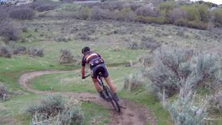
trail: Lone Peak
1224 |
Apr 27, 2017 , Highland UT
Recent Trail Reports
Activity Feed
| username | action | type | title | date |
|---|---|---|---|---|
| 0plu1EwZ | wishlist | route | activity #97348815 | Jun 19, 2026 @ 3:30pm 3 days |
| soonercougarjr | add | report | activity #97119879 | Jun 16, 2026 @ 10:09am Jun 16, 2026 |
| Jfhquattro | add | report | activity #97075638 and 1 more | Jun 15, 2026 @ 5:10pm Jun 15, 2026 |
| MartyK1 | wishlist | trail | activity #96365142 | Jun 6, 2026 @ 6:49am Jun 6, 2026 |
| mchalverus | wishlist | route | activity #96313765 | Jun 5, 2026 @ 12:14pm Jun 5, 2026 |
Recent Comments
| username | type | title | comment | date |
|---|---|---|---|---|
| trail | This trail is basically just the pathways... | Jun 18, 2025 @ 8:16am Jun 18, 2025 | ||
| trail | Closed. A developer has blocked this trail.... | Dec 4, 2021 @ 12:23pm Dec 4, 2021 | ||
| trail | Beginners might enjoy, but it’s not one that... | Jul 24, 2020 @ 9:54am Jul 24, 2020 | ||
| trail | Trail is very narrow with dry grass starting... | May 16, 2020 @ 4:53pm May 16, 2020 | ||
| trail | I rode this trail for the first time on... | May 27, 2018 @ 12:39pm May 27, 2018 |
Local Badges
-

Epic Ride Climb 2k34 awarded -

Climbing 10k Badge73 awarded -

Climbing 100k Badge0 awarded -

Epic Ride Descent 2k36 awarded -

Descent 10k Badge76 awarded -

Descent 100k Badge1 awarded
Bike & Skill Parks
| name | type | city | rating |
|---|---|---|---|
| lone peak jumps | skill park | Highland UT | |
| lone peak jumps | skill park | Highland UT |
Activity Type Stats
| activitytype | trails | distance | descent | descent distance | total vertical | rating | global rank | state rank | photos | reports | routes | ridelogs |
|---|---|---|---|---|---|---|---|---|---|---|---|---|
| Mountain Bike | 58 | 5 miles | 518 ft | 2 miles | 968 ft | #4,915 | #1,654 | 55 | 262 | 9 | 18,544 | |
| E-Bike | 37 | #5,472 | #1,699 | 2 | 239 | 1 | 709 | |||||
| Horse | 2 | 486 ft | 30 ft | 486 ft | 30 ft | 84 | 2 | |||||
| Hike | 46 | 5 miles | 518 ft | 2 miles | 968 ft | #7,114 | #2,525 | 1 | 260 | 575 | ||
| Trail Running | 54 | 5 miles | 518 ft | 2 miles | 968 ft | #5,622 | #1,787 | 260 | 2,184 | |||
| Snowshoe | 1 | 1 | 7 | |||||||||
| Nordic Ski | 1 |
Frequently Asked Questions About Highland UT
▼
What are the best places to ride in Highland UT?
Highland UT has 3 areas to explore for mountain biking. The top rated areas are:
▼
What are the highest rated mountain biking trails in Highland UT?
The highest rated mountain biking trails in Highland UT are:
- Dry Creek (3.8/5)
- Deb's Ravine (3.8/5)
- Shotgun (B-Line) (3.8/5)
- Lizard Skins (3.7/5)
- Adrenaline (3.6/5)
▼
What is the best time of the year to ride in Highland UT?
Based on ride log data, the most popular months to ride in Highland UT are:
- July (76 activities)
- May (52 activities)
- June (51 activities)
▼
Where can I park to ride in Highland UT?
There are 2 parking locations listed in Highland UT. The most popular parking spots are:
Activities
- By 4x4snowboard & contributors
- Admins: jkwilliamz, UtahJohn, jpmcghee, jasonmalczyk
- #16164 - 5,113 views
- highland ut activity log | embed map of Highland UT mountain bike trails | highland ut mountain biking points of interest
Downloading of trail gps tracks in kml & gpx formats is enabled for Highland UT.
You must login to download files.