close
-
Layers w
- Weather Layers
- Pro
- Pro
- Pro
- Pro
- Pro
- Pro
- More Layers
- Pro
- Pro
- Pro
- Pro
-
Upgrade to

3D
Trail Conditions
- Unknown
- Snow Groomed
- Snow Packed
- Snow Covered
- Snow Cover Partial
- Freeze/thaw Cycle
- Icy
- Prevalent Mud
- Wet
- Variable
- Ideal
- Dry
- Very Dry
Trail Flow (Ridden Direction)
Trailforks scans users ridelogs to determine the most popular direction each trail is ridden. A good flowing trail network will have most trails flowing in a single direction according to their intension.
The colour categories are based on what percentage of riders are riding a trail in its intended direction.
The colour categories are based on what percentage of riders are riding a trail in its intended direction.
- > 96%
- > 90%
- > 80%
- > 70%
- > 50%
- < 50%
- bi-directional trail
- no data
Trail Last Ridden
Trailforks scans ridelogs to determine the last time a trail was ridden.
- < 2 days
- < 1 week
- < 2 weeks
- < 1 month
- < 6 months
- > 6 months
Trail Ridden Direction
The intended direction a trail should be ridden.
- Downhill Only
- Downhill Primary
- Both Directions
- Uphill Primary
- Uphill Only
- One Direction
Contribute Details
Colors indicate trail is missing specified detail.
- Description
- Photos
- Description & Photos
- Videos
Trail Popularity ?
Trailforks scans ridelogs to determine which trails are ridden the most in the last 9 months.
Trails are compared with nearby trails in the same city region with a possible 25 colour shades.
Think of this as a heatmap, more rides = more kinetic energy = warmer colors.
- most popular
- popular
- less popular
- not popular
ATV/ORV/OHV Filter
Max Vehicle Width
inches
US Cell Coverage
Legend

Radar Time
Activity Recordings
Trailforks uses anonymized public activity data.
?
Activity Recordings
Trailforks uses anonymized public activity data.
?
Personal Heatmap
▶
Activity Types
all
/
none
▶
Options
2
Date range
month
–
Winter Trails
Warning
A routing network for winter maps does not exist. Selecting trails using the winter trails layer has been disabled.
Missing Trails
Most Popular
Least Popular
Trails are colored based on popularity. The more popular a trail is, the more red. Less popular trails trend towards green.
Jump Magnitude Heatmap
Heatmap of where riders jump on trails. Zoom in to see individual jumps, click circles to view jump details.
BC Backroad Status
![map legend]()
Service Road Atlas is a free to use, community-driven service for viewing and creating reports on the numerous back-country service roads around B.C. and Alberta.

Slope Aspect
Direction the slope faces
Trails Deemphasized
Trails are shown in grey.
Only show trails with no bike usage.
Suggested Layers
Based on selected activity type
Save the current map location and zoom level as your default home location whenever this page is loaded.
Save
No description for Hingham has been added yet!
Login or register to submit one.
Activities Click to view
- Mountain Bike
469 trails
- E-Bike
16 trails
- Gravel Bike
0 trails
- Adaptive Bike
0 trails
- Winter Fat Bike
0 trails
- Horse
16 trails
- Hike
469 trails
- Trail Running
469 trails
- Dirtbike/Moto
12 trails
- Observed Trials
12 trails
- ATV/ORV/OHV
12 trails
Region Details
- 136
- 35
- 107
- 134
- 57
Region Status
Open as of Jun 7, 2026Stats
- Avg Trail Rating
- Trails (view details)
- 469
- Trails Mountain Bike
- 469
- Trails E-Bike
- 16
- Trails Horse
- 16
- Trails Hike
- 469
- Trails Trail Running
- 469
- Trails Dirtbike/Moto
- 12
- Trails Observed Trials
- 12
- Trails ATV/ORV/OHV
- 12
- Trails Snowshoe
- 2
- Trails Backcountry Ski
- 2
- Total Distance
- 103 miles
- Total Descent
- 7,703 ft
- Total Vertical
- 231 ft
- Highest Trailhead
- 239 ft
- Reports
- 2,389
- Photos
- 261
- Ridden Counter
- 209,299
Sub Regions
-
Wompatuck State Park
- 34
- 100
- 134
- 57
-
World's End
- 5
Popular Hingham Mountain Biking Trails
• 100 ★ 4.0 • 2,166 ft • 24 ft • 1,460 •
Highly rated popular blue difficulty singletrack. This multi-use trail can be used downhill primary and has a moderate overall physical rating with a 24 ft blue climb. Trail visibility is always easy to follow. On average it takes 2 minutes to complete this trail.
• 100 ★ 5.0 • 824 ft • 7 ft • 1,446 •
Popular blue difficulty singletrack. This multi-use trail can be used both directions and has a moderate overall physical rating with a 7 ft blue climb. On average it takes minutes to complete this trail.
• 100 ★ 0.0 • 931 ft • 10 ft • 1,405 •
Popular blue difficulty singletrack. This multi-use trail can be used both directions and has a moderate overall physical rating with a 10 ft blue climb. Trail visibility is always easy to follow. On average it takes 1 minutes to complete this trail.
• 100 ★ 4.4 • 720 ft • 2 ft • 1,393 •
Popular green difficulty family friendly singletrack. This multi-use trail can be used downhill primary and has a easy overall physical rating with a 2 ft green climb. Trail visibility is always easy to follow. On average it takes minutes to complete this trail.
• 100 ★ 4.5 • 446 ft • 0 ft • 1,342 •
Popular green difficulty singletrack. This multi-use trail can be used both directions. On average it takes minutes to complete this trail.
• 100 ★ 4.5 • 2,399 ft • 28 ft • 1,315 •
Popular blue difficulty singletrack. This multi-use trail can be used both directions and has a moderate overall physical rating with a 28 ft blue climb. Trail visibility is always easy to follow. On average it takes 3 minutes to complete this trail.
• 100 ★ 0.0 • 1,234 ft • 16 ft • 1,291 •
Popular green difficulty singletrack. This multi-use trail can be used both directions and has a easy overall physical rating with a 16 ft green climb. It features bridge. Trail visibility is always easy to follow. On average it takes 1 minutes to complete this trail.
• 100 ★ 0.0 • 553 ft • 25 ft • 1,283 •
Popular green difficulty singletrack. This multi-use trail can be used both directions. On average it takes minutes to complete this trail.
Hingham Mountain Bike Routes
★ 4.0 • 19 miles • 773 ft • 175 • Loop •
This takes you around the entire Wompatuck State Park hitting most of the favorite trails. Can be done in...
★ 5.0 • 10 miles • 500 ft • 33 • Loop •
The Cat 3 course on the Visitors Center side of Wompatuck will always be a fun, fast 11 miles. Running the...
★ 5.0 • 25 miles • 1,198 ft • 75 • Loop •
Want a fun, challenging, thats slightly opposite the traditional 25 mile route? This feels more "downhill"...
★ 5.0 • 8 miles • 332 ft • 27 • Loop •
Great fast ride that covers a range of what Wompatuck has to offer without being technical. Excellent ride...
★ 5.0 • 12 miles • 598 ft • 42 • Loop •
2018 Classic - Cat 3 starting at Visitors Center. The large open field half way through the would of been...
★ 4.0 • 25 miles • 1,270 ft • 95 • Loop •
25 mile Cat 1/2 starting from Visitors Center. Once you get to (about 19.5 miles in) would be the start of...
Photos of Hingham Mountain Bike
Videos of Hingham Mountain Bike
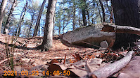
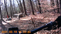
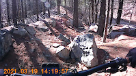
trail: Wompatuck Bikeway
0:15 |
140 |
Mar 23, 2021
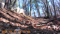
trail: Wompatuck Bikeway
0:18 |
96 |
Mar 23, 2021
trail: Wompatuck Bikeway
0:35 |
48 |
Mar 23, 2021
trail: Wompatuck Bikeway
0:14 |
30 |
Mar 23, 2021
trail: Wompatuck Bikeway
0:08 |
76 |
Mar 23, 2021
trail: Wompatuck Bikeway
0:08 |
67 |
Mar 23, 2021
trail: Wompatuck Bikeway
0:12 |
99 |
Mar 23, 2021
trail: Wompatuck Bikeway
0:17 |
68 |
Mar 23, 2021
Recent Trail Reports
| status | trail | date | condition | info | user |
|---|---|---|---|---|---|
| Freeride Loop 2 | Jun 7, 2026 @ 9:08am (America/New_York) Jun 7, 2026 | Ideal | Gushue3 BRAINTREE | ||
| DMX Freeride | Jun 7, 2026 @ 9:08am (America/New_York) Jun 7, 2026 | Variable | Gushue3 BRAINTREE | ||
| NW8 - NW9 | Jun 7, 2026 @ 9:08am (America/New_York) Jun 7, 2026 | Snow Groomed | Gushue3 BRAINTREE | ||
| NW2-NW3 | Jun 7, 2026 @ 9:08am (America/New_York) Jun 7, 2026 | Variable | Gushue3 BRAINTREE | ||
| N14-N33 | Jun 7, 2026 @ 9:08am (America/New_York) Jun 7, 2026 | Variable | Gushue3 BRAINTREE | ||
| N32-N33 | Jun 7, 2026 @ 9:08am (America/New_York) Jun 7, 2026 | Variable | Gushue3 BRAINTREE | ||
| Rogue Dead Guy | Jun 7, 2026 @ 9:08am (America/New_York) Jun 7, 2026 | Ideal | Gushue3 BRAINTREE | ||
| Green Rogue Dead Guy | Jun 7, 2026 @ 9:08am (America/New_York) Jun 7, 2026 | Variable | Gushue3 BRAINTREE | ||
| flat connector | Jun 7, 2026 @ 9:08am (America/New_York) Jun 7, 2026 | Ideal | Gushue3 BRAINTREE | ||
| Billy Baroo | Jun 7, 2026 @ 9:08am (America/New_York) Jun 7, 2026 | Ideal | Gushue3 BRAINTREE |
Activity Feed
| username | action | type | title | date |
|---|---|---|---|---|
| ajt530 | wishlist | route | activity #97254572 | Jun 18, 2026 @ 8:37am 22 hours |
| russellmcd89 | wishlist | route | activity #97245737 | Jun 18, 2026 @ 5:44am 1 day |
| ajt530 | wishlist | route | activity #97080180 | Jun 15, 2026 @ 6:28pm Jun 15, 2026 |
| Gushue3 | add | report | activity #96530026 and 12 more | Jun 8, 2026 @ 4:15am Jun 8, 2026 |
| ajt530 | wishlist | route | activity #96392577 | Jun 6, 2026 @ 11:42am Jun 6, 2026 |
Recent Comments
| username | type | title | comment | date |
|---|---|---|---|---|
| report | Its total BS. DCR doing MORE damage to the... | Apr 27, 2026 @ 12:37pm Apr 27, 2026 | ||
| trail | The jumps are gone, anyone know why? | Apr 26, 2026 @ 12:17pm Apr 26, 2026 | ||
| trail | We as oooor | Aug 18, 2025 @ 1:12pm Aug 18, 2025 | ||
| trail | The trail is underwater water and I have never... | Aug 4, 2025 @ 6:47am Aug 4, 2025 | ||
| trail | Hi - when the water drops during the summer... | Aug 4, 2025 @ 5:47am Aug 4, 2025 |
Local Badges
-

10 Green Trails1,162 awarded -

10 Blue Trails1,415 awarded -

10 Black Trails627 awarded -

Epic Ride Climb 2k3 awarded -

Climbing 10k Badge101 awarded -

Climbing 100k Badge6 awarded
Activity Type Stats
| activitytype | trails | distance | descent | descent distance | total vertical | rating | global rank | state rank | photos | reports | routes | ridelogs |
|---|---|---|---|---|---|---|---|---|---|---|---|---|
| Mountain Bike | 469 | 103 miles | 7,703 ft | 39 miles | 233 ft | #58 | #22 | 300 | 2,387 | 31 | 36,255 | |
| E-Bike | 16 | 4 miles | 66 ft | 4,934 ft | 43 ft | #7,490 | #2,257 | 1,497 | 292 | |||
| Horse | 16 | 4 miles | 66 ft | 4,934 ft | 43 ft | #2,696 | #1,498 | 171 | 2 | |||
| Hike | 469 | 103 miles | 7,703 ft | 39 miles | 233 ft | #991 | #447 | 1 | 2,387 | 7 | 1,195 | |
| Trail Running | 469 | 103 miles | 7,703 ft | 39 miles | 233 ft | #708 | #264 | 2,387 | 8 | 1,174 | ||
| Dirtbike/Moto | 12 | 3 miles | 23 ft | 2,710 ft | 30 ft | #1,146 | #457 | 171 | 4 | |||
| Observed Trials | 12 | 3 miles | 23 ft | 2,710 ft | 30 ft | #190 | #35 | 1 | 40 | |||
| ATV/ORV/OHV | 12 | 3 miles | 23 ft | 2,710 ft | 30 ft | #894 | #412 | 171 | 7 | |||
| Snowshoe | 2 | 2,149 ft | 7 ft | 650 ft | 13 ft | 466 | 19 | |||||
| Backcountry Ski | 2 | 2,149 ft | 7 ft | 650 ft | 13 ft | 466 | 8 |
Frequently Asked Questions About Hingham
▼
What are the best places to ride in Hingham?
Hingham has 2 areas to explore for mountain biking. The top rated areas are:
▼
What are the highest rated mountain biking trails in Hingham?
The highest rated mountain biking trails in Hingham are:
- Pine Run (4.5/5)
- Yah Mon! (4.4/5)
- Rogue Dead Guy (4.4/5)
- Jump Line (4.3/5)
- NN4-NN5 (4.3/5)
▼
What is the best time of the year to ride in Hingham?
Based on ride log data, the most popular months to ride in Hingham are:
- September (717 activities)
- July (709 activities)
- August (636 activities)
▼
Where can I park to ride in Hingham?
There are 13 parking locations listed in Hingham. The most popular parking spots are: View all parking and trailhead locations on the map to plan your visit.
Activities
Trails
- By WillieJacobsz
 Trailforks SBP SWW & contributors
 - Admins: SEMASS NEMBA, FOW
- #14847 - 13,597 views
- hingham activity log | embed map of Hingham mountain bike trails | hingham mountain biking points of interest polygons
Downloading of trail gps tracks in kml & gpx formats is enabled for Hingham.
You must login to download files.