close
-
Layers w
- Weather Layers
- Pro
- Pro
- Pro
- Pro
- Pro
- Pro
- More Layers
- Pro
- Pro
- Pro
- Pro
-
Upgrade to

3D
Trail Conditions
- Unknown
- Snow Groomed
- Snow Packed
- Snow Covered
- Snow Cover Partial
- Freeze/thaw Cycle
- Icy
- Prevalent Mud
- Wet
- Variable
- Ideal
- Dry
- Very Dry
Trail Flow (Ridden Direction)
Trailforks scans users ridelogs to determine the most popular direction each trail is ridden. A good flowing trail network will have most trails flowing in a single direction according to their intension.
The colour categories are based on what percentage of riders are riding a trail in its intended direction.
The colour categories are based on what percentage of riders are riding a trail in its intended direction.
- > 96%
- > 90%
- > 80%
- > 70%
- > 50%
- < 50%
- bi-directional trail
- no data
Trail Last Ridden
Trailforks scans ridelogs to determine the last time a trail was ridden.
- < 2 days
- < 1 week
- < 2 weeks
- < 1 month
- < 6 months
- > 6 months
Trail Ridden Direction
The intended direction a trail should be ridden.
- Downhill Only
- Downhill Primary
- Both Directions
- Uphill Primary
- Uphill Only
- One Direction
Contribute Details
Colors indicate trail is missing specified detail.
- Description
- Photos
- Description & Photos
- Videos
Trail Popularity ?
Trailforks scans ridelogs to determine which trails are ridden the most in the last 9 months.
Trails are compared with nearby trails in the same city region with a possible 25 colour shades.
Think of this as a heatmap, more rides = more kinetic energy = warmer colors.
- most popular
- popular
- less popular
- not popular
ATV/ORV/OHV Filter
Max Vehicle Width
inches
US Cell Coverage
Legend

Radar Time
Activity Recordings
Trailforks uses anonymized public activity data.
?
Activity Recordings
Trailforks uses anonymized public activity data.
?
Personal Heatmap
▶
Activity Types
all
/
none
▶
Options
2
Date range
month
–
Winter Trails
Warning
A routing network for winter maps does not exist. Selecting trails using the winter trails layer has been disabled.
Missing Trails
Most Popular
Least Popular
Trails are colored based on popularity. The more popular a trail is, the more red. Less popular trails trend towards green.
Jump Magnitude Heatmap
Heatmap of where riders jump on trails. Zoom in to see individual jumps, click circles to view jump details.
BC Backroad Status
![map legend]()
Service Road Atlas is a free to use, community-driven service for viewing and creating reports on the numerous back-country service roads around B.C. and Alberta.

Slope Aspect
Direction the slope faces
Trails Deemphasized
Trails are shown in grey.
Only show trails with no bike usage.
Suggested Layers
Based on selected activity type
Save the current map location and zoom level as your default home location whenever this page is loaded.
SaveHinton is home to a vibrant mountain biking community, with trails offering a diverse range of experiences for all skill levels. Hinton is a town of approximately 10,000 people just East of the Jasper National Park boundary or 3 hours West of Edmonton. Town trails are overseen by the Hinton Mountain Bike Association featuring the Hinton Bike Park, Happy Creek Trails, Bighorn Trail Network, as well as other trails in the surrounding area. Jack’s Trail System was recently unsanctioned due to construction activity - however efforts are underway for rebuilding.
The Hinton Mountain Bike Park features beginner-friendly trails, technical zones for skill development, and multiple jump lines. Riders often use this as their first ride in Hinton to test out the difficulty of the trails. The Happy Creek Trail Network expands into the forest from the bike park and features primarily intermediate single track over 25km of cross-country riding. The Bighorn Trail Network is an enduro-style network, with one climb trail (Stairway to Heaven) and multiple descent options. The trails are for all skill levels; however, riders should ensure they are in strong physical condition to fully enjoy the experience. There are many other trails to explore outside these main riding areas, however conditions and difficulty levels vary greatly, and it is recommended to check-in with the Hinton Mountain Bike Association for the status of all trails.
All trails in Hinton are ridden at the riders own risk - bear spray is recommended. Navigation tools are available online at TrailForks and BikeHinton.com, or pick up a trail map at Vicious Cycle, Hinton Government Centre, or the Hinton Info Centre. You can visit the community Facebook page or Instagram @bikehinton - Rocky Mountain Ride Guides also offers paid guiding services.

Activities Click to view
- Mountain Bike
191 trails
- E-Bike
36 trails
- Gravel Bike
0 trails
- Adaptive Bike
0 trails
- Winter Fat Bike
0 trails
- Horse
23 trails
- Hike
161 trails
- Trail Running
160 trails
- Dirtbike/Moto
28 trails
- ATV/ORV/OHV
8 trails
- Snowmobile
5 trails
- Snowshoe
24 trails
- Nordic Ski
69 trails
Region Details
- 28
- 6
- 51
- 65
- 11
- 1
Region Status
Caution as of Jun 18, 2026Stats
- Avg Trail Rating
- Trails (view details)
- 221
- Trails Mountain Bike
- 192
- Trails E-Bike
- 36
- Trails Horse
- 23
- Trails Hike
- 161
- Trails Trail Running
- 160
- Trails Dirtbike/Moto
- 28
- Trails ATV/ORV/OHV
- 8
- Trails Snowmobile
- 5
- Trails Snowshoe
- 24
- Trails Backcountry Ski
- 3
- Trails Nordic Ski
- 69
- Total Distance
- 203 miles
- Total Descent
- 26,676 ft
- Total Vertical
- 3,665 ft
- Highest Trailhead
- 6,857 ft
- Reports
- 1,321
- Photos
- 440
- Ridden Counter
- 22,251
Sub Regions
-
Athabasca Ranch Public Land Use Zone
- 2
- 6
-
Bighorn Ridge
- 1
- 5
- 1
-
Brule
- 6
- 16
- 1
-
Happy Creek
- 6
- 6
- 19
- 1
-
Hinton Bike Park
- 11
- 8
- 3
- 1
-
Hinton Nordic Centre Cross Country Ski Area
- 6
- 4
-
Jacks
- 1
- 7
-
William A. Switzer Provincial Park
- 11
- 2
- 1
Popular Hinton Mountain Biking Trails
• 100 ★ 4.6 • 1,164 ft • 31 ft • 841 •
Hinton Bike Park A progression trail with drops, skinnies, teeter totter, log-stacles, steps and rock garden. Starts at the dirt jumps and climbs to the start of trail.
• 100 ★ 4.5 • 1,732 ft • 0 ft • 803 •
The Hinton bike parks signature trail. If you come here you have to ride it.
• 100 ★ 4.0 • 899 ft • 25 ft • 801 •
The of the Hinton Bike Park features progressive TTF's from green to black diamond and a beginner pump track. The skill area was revamped in 2014 by HMBA and Hoots Inc. The is extremely sensitive to weather conditions. Please only use...
• 100 ★ 4.4 • 592 ft • 19 ft • 786 •
The Dirt Jump section of the Hinton Bike Park. There are 4 sets of 3 table jumps ranging from Green to Black. The dirt jumps were re-machined by HMBA and Hoots Inc. in 2017.
• 100 ★ 4.2 • 1,020 ft • 68 ft • 606 •
Hinton Bike Park Climbs to the start of Flowmaster
• 100 ★ 4.4 • 618 ft • 8 ft • 600 •
Hinton Bike Park A quick and easy single track for beginners.
• 95 ★ 4.2 • 654 ft • 38 ft • 586 •
Hinton Bike Park Connector trail to the start of several trailheads and the pump track.
Hinton Mountain Bike Routes
★ 5.0 • 3 miles • 228 ft • 10 • Loop •
HMBA Growler 2024 race in Hinton, AB on February 10, 2024. Starts on Maxwell Lake and rides mostly in the...
★ 5.0 • 4 miles • 882 ft • 3 • Loop •
A fun quick loop with a Moderate Climb and a really fun descent down Froehler Coaster.
★ 1.0 • 6 miles • 709 ft • 8 • Loop •
A rewarding and fun loop to do, linking some great trails together.
9 miles • 940 ft • 8 • Loop •
A fun loop with some good views that is still accessible during the pipeline construction.
41 miles • 5,148 ft • 20 • Loop •
This covers all of the xc trails in the Hinton Bike Park.
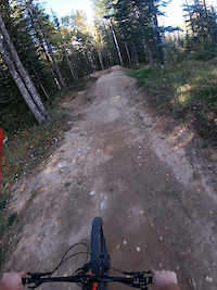
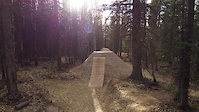
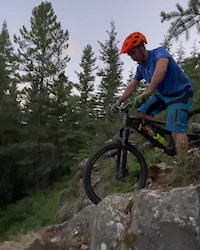
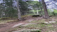
Photos of Hinton Mountain Bike
Videos of Hinton Mountain Bike
trail: Froehler Coaster
0:24 |
167 |
Aug 4, 2023
trail: Fo' Shore
0:26 |
52 |
Jun 30, 2023
trail: Flow Master 2021 Extension
2:48 |
107 |
Jun 30, 2023
trail: Dirt Jam
0:13 |
187 |
Jun 30, 2023
trail: Trans Mountain Sender
0:28 |
205 |
Oct 2, 2022
trail: Trans Mountain Sender
2:16 |
435 |
Sep 30, 2021
trail: Watchdog
0:15 |
241 |
Aug 10, 2021
trail: Rock Band
0:16 |
95 |
Aug 6, 2021
Recent Trail Reports
| status | trail | date | condition | info | user |
|---|---|---|---|---|---|
| Joachim Valley Trail | Jun 18, 2026 @ 10:07pm (America/Edmonton) Jun 18, 2026 | Ideal | NikiKw3Sbm | ||
| Bighorn Parking Connector | Jun 15, 2026 @ 3:07pm (America/Edmonton) Jun 15, 2026 | Ideal | DelSneath | ||
| Stairway to Heaven | May 25, 2026 @ 11:07am (America/Edmonton) May 25, 2026 | Unknown | labbink | ||
| Froehler Coaster | May 18, 2026 @ 9:35pm (America/Edmonton) May 18, 2026 | Ideal | GEAllen | ||
| Send Me Up | May 15, 2026 @ 7:17am (America/Edmonton) May 15, 2026 | Unknown | LuluOhLala | ||
| MS Bike Tour Day 1 Classic to Black Cat | Oct 16, 2025 @ 12:52pm (America/Edmonton) Oct 16, 2025 | Variable | ZippyWashington | ||
| BH | Oct 13, 2025 @ 2:19pm (America/Edmonton) Oct 13, 2025 | Snow Cover Partial | ZippyWashington | ||
| Powerline Connector | Oct 13, 2025 @ 2:19pm (America/Edmonton) Oct 13, 2025 | Snow Cover Partial | ZippyWashington | ||
| Beam Me Up | Oct 13, 2025 @ 2:19pm (America/Edmonton) Oct 13, 2025 | Snow Covered | ZippyWashington | ||
| Okey Spokey | Oct 13, 2025 @ 2:19pm (America/Edmonton) Oct 13, 2025 | Snow Cover Partial | ZippyWashington |
Activity Feed
| username | action | type | title | date |
|---|---|---|---|---|
| Riverpiratesteve | ridden | trail | activity #97747680 | Jun 24, 2026 @ 9:57pm 4 hours |
| Joel9 | ridden | trail | activity #97717047 | Jun 24, 2026 @ 12:31pm 13 hours |
| NikiKw3Sbm | add | report | activity #97295535 | Jun 18, 2026 @ 9:07pm Jun 18, 2026 |
| NikiKw3Sbm | add | photo | activity #97295487 and 1 more | Jun 18, 2026 @ 9:05pm Jun 18, 2026 |
| NikiKw3Sbm | add | photo | activity #97295416 and 3 more | Jun 18, 2026 @ 9:03pm Jun 18, 2026 |
Recent Comments
| username | type | title | comment | date |
|---|---|---|---|---|
| trail | Dry and clean except for two fallen trees. | Feb 8, 2026 @ 10:33am Feb 8, 2026 | ||
| report | These trees were cleared on the same day. | Nov 23, 2025 @ 6:01pm Nov 23, 2025 | ||
| report | tree down between 4-5 km | Oct 10, 2025 @ 10:00am Oct 10, 2025 | ||
| trail | This is an interpretive walking train used by... | Sep 4, 2025 @ 8:34pm Sep 4, 2025 | ||
| trail | Wow, what a good climb trail. Yes there is a... | Jul 13, 2025 @ 9:39pm Jul 13, 2025 |
Local Badges
-

Completionist0 awarded -

Epic Ride 50k38 awarded -

Top 10 Trails14 awarded -
Completionist1 awarded -
Completionist0 awarded -

10 Black Trails3 awarded
Bike & Skill Parks
| name | type | city | rating |
|---|---|---|---|
| Brule Bike Park | skill park | Hinton | |
| Hinton Bike Park | skill park | Hinton |
Local Trail Supporters
- Hinton Mountain Bike Association
![]()
- Creating Flow Trail Designs
Activity Type Stats
| activitytype | trails | distance | descent | descent distance | total vertical | rating | global rank | state rank | photos | reports | routes | ridelogs |
|---|---|---|---|---|---|---|---|---|---|---|---|---|
| Mountain Bike | 191 | 157 miles | 19,199 ft | 79 miles | 2,346 ft | #490 | #6 | 429 | 1,294 | 15 | 10,898 | |
| E-Bike | 36 | 49 miles | 4,902 ft | 27 miles | 2,060 ft | #2,596 | #21 | 1 | 1,024 | 8 | 306 | |
| Horse | 23 | 49 miles | 3,839 ft | 26 miles | 1,089 ft | #894 | #11 | 604 | ||||
| Hike | 161 | 148 miles | 18,389 ft | 73 miles | 3,645 ft | #1,159 | #14 | 1,197 | 584 | |||
| Trail Running | 160 | 146 miles | 18,333 ft | 72 miles | 3,645 ft | #915 | #11 | 1,196 | 1,296 | |||
| Dirtbike/Moto | 28 | 47 miles | 3,750 ft | 24 miles | 820 ft | #390 | #8 | 1 | 602 | 100 | ||
| ATV/ORV/OHV | 8 | 29 miles | 1,490 ft | 15 miles | 794 ft | #367 | #5 | 602 | 39 | |||
| Snowmobile | 5 | 28 miles | 1,309 ft | 14 miles | 794 ft | #118 | #2 | 25 | 5 | |||
| Snowshoe | 24 | 44 miles | 7,142 ft | 24 miles | 3,599 ft | #425 | #14 | 31 | 7 | |||
| Backcountry Ski | 3 | 5 miles | 3,497 ft | 4 miles | 3,041 ft | 25 | 17 | |||||
| Nordic Ski | 69 | 76 miles | 5,689 ft | 36 miles | 2,054 ft | #51 | #2 | 9 | 33 | 1,317 |
Frequently Asked Questions About Hinton
▼
What are the best places to ride in Hinton?
Hinton has 9 areas to explore for mountain biking. The top rated areas are:
▼
What are the highest rated mountain biking trails in Hinton?
The highest rated mountain biking trails in Hinton are:
- Shiver Me Timbers (4.6/5)
- Rock Band (4.6/5)
- Froehler Coaster (4.6/5)
- Blowdown Flowdown (4.5/5)
- Drop Zone (4.5/5)
▼
What is the best time of the year to ride in Hinton?
Based on ride log data, the most popular months to ride in Hinton are:
- August (206 activities)
- July (175 activities)
- June (145 activities)
▼
Where can I park to ride in Hinton?
There are 12 parking locations listed in Hinton. The most popular parking spots are:
- Hinton Bike Park Parking Area
- Bighorn Ridge Parking Lot
- Thompson Lake Trail Parking
- Hinton Nordic Centre (Upper Lodge / K9 Loop)
- Parking
Activities
Trails
- By jayhore HMBA & contributors
- Admins: HMBA, YCPR, napsack, CAAG
- #3639 - 29,673 views
- hinton activity log | embed map of Hinton mountain bike trails | hinton mountain biking points of interest
Downloading of trail gps tracks in kml & gpx formats is enabled for Hinton.
You must login to download files.