close
-
Layers w
- Weather Layers
- Pro
- Pro
- Pro
- Pro
- Pro
- Pro
- More Layers
- Pro
- Pro
- Pro
- Pro
-
Upgrade to

3D
Trail Conditions
- Unknown
- Snow Groomed
- Snow Packed
- Snow Covered
- Snow Cover Partial
- Freeze/thaw Cycle
- Icy
- Prevalent Mud
- Wet
- Variable
- Ideal
- Dry
- Very Dry
Trail Flow (Ridden Direction)
Trailforks scans users ridelogs to determine the most popular direction each trail is ridden. A good flowing trail network will have most trails flowing in a single direction according to their intension.
The colour categories are based on what percentage of riders are riding a trail in its intended direction.
The colour categories are based on what percentage of riders are riding a trail in its intended direction.
- > 96%
- > 90%
- > 80%
- > 70%
- > 50%
- < 50%
- bi-directional trail
- no data
Trail Last Ridden
Trailforks scans ridelogs to determine the last time a trail was ridden.
- < 2 days
- < 1 week
- < 2 weeks
- < 1 month
- < 6 months
- > 6 months
Trail Ridden Direction
The intended direction a trail should be ridden.
- Downhill Only
- Downhill Primary
- Both Directions
- Uphill Primary
- Uphill Only
- One Direction
Contribute Details
Colors indicate trail is missing specified detail.
- Description
- Photos
- Description & Photos
- Videos
Trail Popularity ?
Trailforks scans ridelogs to determine which trails are ridden the most in the last 9 months.
Trails are compared with nearby trails in the same city region with a possible 25 colour shades.
Think of this as a heatmap, more rides = more kinetic energy = warmer colors.
- most popular
- popular
- less popular
- not popular
ATV/ORV/OHV Filter
Max Vehicle Width
inches
US Cell Coverage
Legend

Radar Time
Activity Recordings
Trailforks uses anonymized public activity data.
?
Activity Recordings
Trailforks uses anonymized public activity data.
?
Personal Heatmap
▶
Activity Types
all
/
none
▶
Options
2
Date range
month
–
Winter Trails
Warning
A routing network for winter maps does not exist. Selecting trails using the winter trails layer has been disabled.
Missing Trails
Most Popular
Least Popular
Trails are colored based on popularity. The more popular a trail is, the more red. Less popular trails trend towards green.
Jump Magnitude Heatmap
Heatmap of where riders jump on trails. Zoom in to see individual jumps, click circles to view jump details.
BC Backroad Status
![map legend]()
Service Road Atlas is a free to use, community-driven service for viewing and creating reports on the numerous back-country service roads around B.C. and Alberta.

Slope Aspect
Direction the slope faces
Trails Deemphasized
Trails are shown in grey.
Only show trails with no bike usage.
Suggested Layers
Based on selected activity type
Save the current map location and zoom level as your default home location whenever this page is loaded.
SaveThe marked Hofuf or AlHofuf area (31982) consists of :
- AlHofuf City, AlMubarraz City, their villages and districts.
- Oyoun City.
- Ghowaybah Distinct.
- AlAhsa International Airport.
- Hubail and AlAsfar Lakes.
- Oqair Road Bridge.
- AlHofuf City, AlMubarraz City, their villages and districts.
- Oyoun City.
- Ghowaybah Distinct.
- AlAhsa International Airport.
- Hubail and AlAsfar Lakes.
- Oqair Road Bridge.
eBikes Allowed:
Yes
AKA: Hasa
Region Supporters & Maintainers
![]()
Modern Bicycle
since 2018Sponsor![]()
Aljabr SoftDrink (Rita)
since 2022Sponsor![]()
Darraj AlAhsa
since 2018Maintainer
Activities Click to view
- Mountain Bike
50 trails
- E-Bike
41 trails
- Adaptive Bike
1 trails
- Winter Fat Bike
1 trails
- Horse
27 trails
- Hike
48 trails
- Trail Running
48 trails
- Dirtbike/Moto
27 trails
- Observed Trials
27 trails
- ATV/ORV/OHV
27 trails
Region Details
- 19
- 1
- 13
- 12
- 5
Region Status
Caution as of May 15, 2026Local Trail Association
Stats
- Avg Trail Rating
- Trails (view details)
- 50
- Trails Mountain Bike
- 50
- Trails E-Bike
- 41
- Trails Adaptive Bike
- 1
- Trails Winter Fat Bike
- 1
- Trails Horse
- 27
- Trails Hike
- 48
- Trails Trail Running
- 48
- Trails Dirtbike/Moto
- 27
- Trails Observed Trials
- 27
- Trails ATV/ORV/OHV
- 27
- Total Distance
- 380 miles
- Total Descent
- 3,691 ft
- Total Vertical
- 702 ft
- Highest Trailhead
- 703 ft
- Reports
- 31
- Photos
- 211
- Ridden Counter
- 46
Sub Regions
-
Al-Asfar
- 3
- 1
-
Al-Qarah Mountain
- 1
- 3
- 2
- 2
-
Al-Thulaim Mountain
- 1
- 3
-
Northern Braiga
- 2
-
Southern Braiga
- 3
- 6
- 3
-
Uqair Beach
Popular Hofuf Mountain Biking Trails
• 5 ★ 5.0 • 1 mile • 0 ft • 2 •
Less popular blue difficulty family friendly singletrack. This mountain bike primary trail can be used both directions and has a moderate overall physical rating with a 0 ft blue climb. Trail visibility is sometimes hard to follow. On average it takes 18 minutes to complete this trail.
• 5 ★ 5.0 • 2,853 ft • 36 ft • 1 •
Dust, loose rocks, tight turns and a punchy climb. A demanding piece that connects to Al-Shu'ba Loop.
• 5 ★ 5.0 • 1,749 ft • 3 ft • 1 •
Another exist from Al-Shu'ba to Braiga's mountainside farms.
• 5 ★ 5.0 • 13 miles • 0 ft • 1 •
A gravel road beside the electrical power lines heading north towards Al Uqair Beach Road.
Hofuf Mountain Bike Routes
10 miles • 369 ft • 3 • Loop •
Darraj AlAhsa's Annual Cross-Country Mountain Biking Challenge is held on top of Al-Shu'ba Mountain.
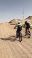
Photos of Hofuf Mountain Bike
Videos of Hofuf Mountain Bike
trail: Mountain Exit
0:02 |
66 |
Jun 28, 2019
Recent Trail Reports
| status | trail | date | condition | info | user |
|---|---|---|---|---|---|
| SB Loop | Nov 21, 2022 @ 7:12pm Nov 21, 2022 | Ideal | abunawafjr BMBC | ||
| Bigger Boys Climb | Mar 26, 2022 @ 2:43pm Mar 26, 2022 | Ideal | abunawafjr BMBC | ||
| Big Boys Shortcut Down | Mar 26, 2022 @ 2:43pm Mar 26, 2022 | Ideal | abunawafjr BMBC | ||
| Ugly Rock Face | Mar 26, 2022 @ 2:43pm Mar 26, 2022 | Ideal | abunawafjr BMBC | ||
| TV Tower Maneuver | Mar 26, 2022 @ 2:43pm Mar 26, 2022 | Ideal | abunawafjr BMBC | ||
| Big Boys Shortcut Up | Mar 26, 2022 @ 2:43pm Mar 26, 2022 | Ideal | abunawafjr BMBC | ||
| Ugly Rock Face Extension | Mar 26, 2022 @ 2:43pm Mar 26, 2022 | Ideal | abunawafjr BMBC | ||
| Hill Tops | Mar 26, 2022 @ 2:43pm Mar 26, 2022 | Ideal | abunawafjr BMBC | ||
| Old Sandy Road | Mar 26, 2022 @ 2:43pm Mar 26, 2022 | Ideal | abunawafjr BMBC | ||
| Mariana Trench | Mar 26, 2022 @ 2:43pm Mar 26, 2022 | Ideal | abunawafjr BMBC |
Activity Feed
| username | action | type | title | date |
|---|---|---|---|---|
| abunawafjr | add | trail | activity #94009856 | May 4, 2026 @ 12:31am May 4, 2026 |
| ClareU5cxJo | wishlist | region | activity #92123089 | Apr 7, 2026 @ 9:25am Apr 7, 2026 |
| abunawafjr | update | trail | activity #74893312 | Jun 30, 2025 @ 9:08am Jun 30, 2025 |
| abunawafjr | update | trail | activity #53249448 | May 27, 2024 @ 2:39pm May 27, 2024 |
| WillieJacobsz | update | trail | activity #49722092 | Mar 5, 2024 @ 6:16am Mar 5, 2024 |
Local Badges
-

Al-Shu'ba Ridden1 awarded -

Epic Mountain Bike Climb 2k0 awarded -

Climbing 10k Badge1 awarded -

Mountain Biking 100k Badge0 awarded -

Epic Ride Descent 2k0 awarded -

Descent 10k Badge1 awarded
Local Trail Supporters
- Ali AlHajji
![]()
- Modern Bicycles
Activity Type Stats
| activitytype | trails | distance | descent | descent distance | total vertical | rating | global rank | state rank | photos | reports | routes | ridelogs |
|---|---|---|---|---|---|---|---|---|---|---|---|---|
| Mountain Bike | 50 | 380 miles | 3,691 ft | 182 miles | 702 ft | #459 | #2 | 210 | 31 | 3 | 317 | |
| E-Bike | 41 | 330 miles | 3,317 ft | 162 miles | 702 ft | #226 | #1 | 27 | ||||
| Adaptive Bike | 1 | #210 | #2 | |||||||||
| Winter Fat Bike | 1 | #177 | #4 | |||||||||
| Horse | 27 | 310 miles | 3,005 ft | 155 miles | 682 ft | #44 | #1 | 19 | ||||
| Hike | 48 | 379 miles | 3,645 ft | 182 miles | 702 ft | #329 | #1 | 31 | 2 | |||
| Trail Running | 48 | 379 miles | 3,645 ft | 182 miles | 702 ft | #252 | #1 | 31 | 3 | |||
| Dirtbike/Moto | 27 | 310 miles | 3,005 ft | 155 miles | 682 ft | #48 | #1 | 1 | 4 | |||
| Observed Trials | 27 | 310 miles | 3,005 ft | 155 miles | 682 ft | #4 | #1 | 4 | ||||
| ATV/ORV/OHV | 27 | 310 miles | 3,005 ft | 155 miles | 682 ft | #17 | #1 | 3 |
Frequently Asked Questions About Hofuf
▼
What are the best places to ride in Hofuf?
Hofuf has 6 areas to explore for mountain biking. The top rated areas are:
▼
What are the highest rated mountain biking trails in Hofuf?
The highest rated mountain biking trails in Hofuf are:
- No Talking is Allowed (4.1/5)
- Al-Qarah Trail Trunk (4.1/5)
- SB-NB Connector II (4.1/5)
- Northern Peak (4.1/5)
- No Brakes Allowed (4.1/5)
▼
What is the best time of the year to ride in Hofuf?
Based on ride log data, the most popular months to ride in Hofuf are:
- November (1 activities)
▼
Where can I park to ride in Hofuf?
There are 5 parking locations listed in Hofuf. The most popular parking spots are: View all parking and trailhead locations on the map to plan your visit.
Activities
Trails
- hofuf activity log | embed map of Hofuf mountain bike trails | hofuf mountain biking points of interest polygons
Downloading of trail gps tracks in kml & gpx formats is enabled for Hofuf.
You must login to download files.