close
-
Layers w
- Weather Layers
- Pro
- Pro
- Pro
- Pro
- Pro
- Pro
- More Layers
- Pro
- Pro
- Pro
- Pro
-
Upgrade to

3D
Trail Conditions
- Unknown
- Snow Groomed
- Snow Packed
- Snow Covered
- Snow Cover Partial
- Freeze/thaw Cycle
- Icy
- Prevalent Mud
- Wet
- Variable
- Ideal
- Dry
- Very Dry
Trail Flow (Ridden Direction)
Trailforks scans users ridelogs to determine the most popular direction each trail is ridden. A good flowing trail network will have most trails flowing in a single direction according to their intension.
The colour categories are based on what percentage of riders are riding a trail in its intended direction.
The colour categories are based on what percentage of riders are riding a trail in its intended direction.
- > 96%
- > 90%
- > 80%
- > 70%
- > 50%
- < 50%
- bi-directional trail
- no data
Trail Last Ridden
Trailforks scans ridelogs to determine the last time a trail was ridden.
- < 2 days
- < 1 week
- < 2 weeks
- < 1 month
- < 6 months
- > 6 months
Trail Ridden Direction
The intended direction a trail should be ridden.
- Downhill Only
- Downhill Primary
- Both Directions
- Uphill Primary
- Uphill Only
- One Direction
Contribute Details
Colors indicate trail is missing specified detail.
- Description
- Photos
- Description & Photos
- Videos
Trail Popularity ?
Trailforks scans ridelogs to determine which trails are ridden the most in the last 9 months.
Trails are compared with nearby trails in the same city region with a possible 25 colour shades.
Think of this as a heatmap, more rides = more kinetic energy = warmer colors.
- most popular
- popular
- less popular
- not popular
ATV/ORV/OHV Filter
Max Vehicle Width
inches
US Cell Coverage
Legend

Radar Time
Activity Recordings
Trailforks uses anonymized public activity data.
?
Activity Recordings
Trailforks uses anonymized public activity data.
?
Personal Heatmap
▶
Activity Types
all
/
none
▶
Options
2
Date range
month
–
Winter Trails
Warning
A routing network for winter maps does not exist. Selecting trails using the winter trails layer has been disabled.
Missing Trails
Most Popular
Least Popular
Trails are colored based on popularity. The more popular a trail is, the more red. Less popular trails trend towards green.
Jump Magnitude Heatmap
Heatmap of where riders jump on trails. Zoom in to see individual jumps, click circles to view jump details.
BC Backroad Status
![map legend]()
Service Road Atlas is a free to use, community-driven service for viewing and creating reports on the numerous back-country service roads around B.C. and Alberta.

Slope Aspect
Direction the slope faces
Trails Deemphasized
Trails are shown in grey.
Only show trails with no bike usage.
Suggested Layers
Based on selected activity type
Save the current map location and zoom level as your default home location whenever this page is loaded.
Save
No description for Horsens has been added yet!
Login or register to submit one.
Activities Click to view
- Mountain Bike
32 trails
- E-Bike
11 trails
- Adaptive Bike
0 trails
- Hike
21 trails
- Trail Running
21 trails
Region Details
- 8
- 4
- 8
- 2
Region Status
Caution as of Apr 11, 2026Stats
- Avg Trail Rating
- Trails (view details)
- 32
- Trails Mountain Bike
- 32
- Trails E-Bike
- 11
- Trails Hike
- 21
- Trails Trail Running
- 21
- Total Distance
- 21 miles
- Total Descent
- 2,999 ft
- Total Vertical
- 372 ft
- Highest Trailhead
- 397 ft
- Reports
- 402
- Photos
- 39
- Ridden Counter
- 2,011
Sub Regions
-
Bjerge Skov
- 4
- 7
- 6
- 4
Popular Horsens Mountain Biking Trails
• 80 ★ 5.0 • 3,041 ft • 79 ft • 152 •
Popular blue difficulty singletrack. This mountain bike primary trail can be used one direction and has a easy overall physical rating. Trail visibility is always easy to follow. On average it takes 3 minutes to complete this trail.
• 100 ★ 5.0 • 1,007 ft • 2 ft • 143 •
Popular black difficulty singletrack. This mountain bike primary trail can be used one direction and has a moderate overall physical rating with a 2 ft black diamond climb. It features berm, jump, gap jump and roller coaster. Trail visibility is always easy to follow. On average it takes 2 minutes to complete this trail.
• 70 ★ 5.0 • 4,144 ft • 117 ft • 142 •
"Den Sjove Skov" Rough downhill with many roots.Try and find the flow. Slippery when wet. Steep and quite technichal uphill. Åh Ja bakken: Mellow flow in the start.Speed increasinfg and pretty fast ending in a possible jump.(can be rolled)
• 75 ★ 5.0 • 2,526 ft • 138 ft • 140 •
Popular green difficulty singletrack. This mountain bike primary trail can be used both directions and has a moderate overall physical rating with a 138 ft green climb. On average it takes 6 minutes to complete this trail.
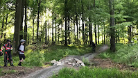
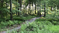
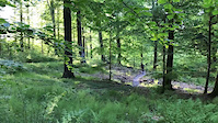
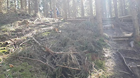
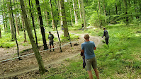
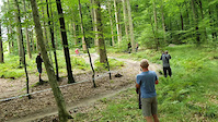
Photos of Horsens Mountain Bike
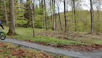
Videos of Horsens Mountain Bike
trail: Musvågen
0:03 |
30 |
Jun 23, 2022
trail: Musvågen
0:05 |
4 |
Jun 23, 2022
trail: Musvågen
0:13 |
9 |
Jun 23, 2022
trail: Musvågen
0:06 |
2 |
Jun 23, 2022

trail: Rybkas Corner
0:15 |
31 |
Sep 25, 2021
trail: Kulissen end
0:15 |
10 |
Sep 25, 2021
trail: Sort PseudoTsuga 2
0:13 |
21 |
Sep 25, 2021
trail: Sort PseudoTsuga 2
0:16 |
18 |
Sep 25, 2021
Recent Trail Reports
Activity Feed
| username | action | type | title | date |
|---|---|---|---|---|
| DanielV | wishlist | trail | activity #97094670 and 12 more | Jun 16, 2026 @ 1:56am Jun 16, 2026 |
| REN77 | wishlist | region | activity #94705086 | May 14, 2026 @ 12:08pm May 14, 2026 |
| Sly78 | vote | trail | activity #93078143 | Apr 21, 2026 @ 7:09am Apr 21, 2026 |
| MadEisi | add | report | activity #92389277 and 10 more | Apr 11, 2026 @ 7:24am Apr 11, 2026 |
| Matiasnombarasco | wishlist | trail | activity #78727552 | Aug 23, 2025 @ 2:04am Aug 23, 2025 |
Recent Comments
| username | type | title | comment | date |
|---|---|---|---|---|
| trail | Er det muligt at køre på off-road løbehjul... | Jan 5, 2025 @ 2:26pm Jan 5, 2025 | ||
| report | Very dry today but running well. Looks like... | Jun 20, 2022 @ 11:27am Jun 20, 2022 |
Local Badges
-

Epic Mountain Bike Climb 2k0 awarded -

Climbing 10k Badge4 awarded -

Mountain Biking 100k Badge0 awarded -

Epic Ride Descent 2k0 awarded -

Descent 10k Badge4 awarded -

Descent 100k Badge0 awarded
Activity Type Stats
| activitytype | trails | distance | descent | descent distance | total vertical | rating | global rank | state rank | photos | reports | routes | ridelogs |
|---|---|---|---|---|---|---|---|---|---|---|---|---|
| Mountain Bike | 32 | 21 miles | 2,999 ft | 10 miles | 371 ft | #1,453 | #3 | 38 | 402 | 2,709 | ||
| E-Bike | 11 | 5 miles | 925 ft | 3 miles | 266 ft | #1,608 | #24 | 1 | 388 | 232 | ||
| Hike | 21 | 10 miles | 1,634 ft | 5 miles | 269 ft | #2,601 | #18 | 400 | 85 | |||
| Trail Running | 21 | 10 miles | 1,634 ft | 5 miles | 269 ft | #2,101 | #18 | 400 | 1 |
Frequently Asked Questions About Horsens
▼
What are the best places to ride in Horsens?
Horsens has 1 areas to explore for mountain biking. The top rated areas are:
▼
What are the highest rated mountain biking trails in Horsens?
The highest rated mountain biking trails in Horsens are:
- Freeride (4.3/5)
- Red PseudoTsuga 3 (4.2/5)
- Kulissen (4.2/5)
- T-Rex (4.1/5)
- Sort PseudoTsuga 2 (4.1/5)
▼
What is the best time of the year to ride in Horsens?
Based on ride log data, the most popular months to ride in Horsens are:
- August (78 activities)
- November (60 activities)
- September (48 activities)
▼
Where can I park to ride in Horsens?
There are 3 parking locations listed in Horsens. The most popular parking spots are: View all parking and trailhead locations on the map to plan your visit.
Activities
- By ROBERTNORDENHOF
 & contributors
 - Admins: apply
- #38696 - 2,309 views
- horsens activity log | embed map of Horsens mountain bike trails | horsens mountain biking points of interest
Downloading of trail gps tracks in kml & gpx formats is enabled for Horsens.
You must login to download files.