close
-
Layers w
- Weather Layers
- Pro
- Pro
- Pro
- Pro
- Pro
- Pro
- More Layers
- Pro
- Pro
- Pro
- Pro
-
Upgrade to

3D
Trail Conditions
- Unknown
- Snow Groomed
- Snow Packed
- Snow Covered
- Snow Cover Partial
- Freeze/thaw Cycle
- Icy
- Prevalent Mud
- Wet
- Variable
- Ideal
- Dry
- Very Dry
Trail Flow (Ridden Direction)
Trailforks scans users ridelogs to determine the most popular direction each trail is ridden. A good flowing trail network will have most trails flowing in a single direction according to their intension.
The colour categories are based on what percentage of riders are riding a trail in its intended direction.
The colour categories are based on what percentage of riders are riding a trail in its intended direction.
- > 96%
- > 90%
- > 80%
- > 70%
- > 50%
- < 50%
- bi-directional trail
- no data
Trail Last Ridden
Trailforks scans ridelogs to determine the last time a trail was ridden.
- < 2 days
- < 1 week
- < 2 weeks
- < 1 month
- < 6 months
- > 6 months
Trail Ridden Direction
The intended direction a trail should be ridden.
- Downhill Only
- Downhill Primary
- Both Directions
- Uphill Primary
- Uphill Only
- One Direction
Contribute Details
Colors indicate trail is missing specified detail.
- Description
- Photos
- Description & Photos
- Videos
Trail Popularity ?
Trailforks scans ridelogs to determine which trails are ridden the most in the last 9 months.
Trails are compared with nearby trails in the same city region with a possible 25 colour shades.
Think of this as a heatmap, more rides = more kinetic energy = warmer colors.
- most popular
- popular
- less popular
- not popular
ATV/ORV/OHV Filter
Max Vehicle Width
inches
US Cell Coverage
Legend

Radar Time
Activity Recordings
Trailforks uses anonymized public activity data.
?
Activity Recordings
Trailforks uses anonymized public activity data.
?
Personal Heatmap
▶
Activity Types
all
/
none
▶
Options
2
Date range
month
–
Winter Trails
Warning
A routing network for winter maps does not exist. Selecting trails using the winter trails layer has been disabled.
Missing Trails
Most Popular
Least Popular
Trails are colored based on popularity. The more popular a trail is, the more red. Less popular trails trend towards green.
Jump Magnitude Heatmap
Heatmap of where riders jump on trails. Zoom in to see individual jumps, click circles to view jump details.
BC Backroad Status
![map legend]()
Service Road Atlas is a free to use, community-driven service for viewing and creating reports on the numerous back-country service roads around B.C. and Alberta.

Slope Aspect
Direction the slope faces
Trails Deemphasized
Trails are shown in grey.
Only show trails with no bike usage.
Suggested Layers
Based on selected activity type
Save the current map location and zoom level as your default home location whenever this page is loaded.
Save
No description for Horsham has been added yet!
Login or register to submit one.
This region uses the Uk/Euro style trail grading system.
Activities Click to view
- Mountain Bike
43 trails
- E-Bike
41 trails
- Winter Fat Bike
0 trails
- Horse
14 trails
- Hike
29 trails
- Trail Running
29 trails
Region Details
- 17
- 10
- 11
- 1
Region Status
Caution as of Jun 14, 2026Stats
- Avg Trail Rating
- Trails (view details)
- 39
- Trails Mountain Bike
- 43
- Trails E-Bike
- 41
- Trails Horse
- 14
- Trails Hike
- 29
- Trails Trail Running
- 29
- Total Distance
- 18 miles
- Total Descent
- 3,070 ft
- Total Vertical
- 322 ft
- Highest Trailhead
- 472 ft
- Reports
- 162
- Photos
- 43
- Ridden Counter
- 2,287
Sub Regions
-
St Leonards Forest
- 9
- 10
- 1
Popular Horsham Mountain Biking Trails
• 95 ★ 4.8 • 876 ft • 0 ft • 136 •
Popular blue difficulty singletrack. This mountain bike primary trail can be used downhill primary and has a easy overall physical rating with a 0 ft green climb. It features berm and jump. On average it takes 1 minutes to complete this trail.
• 75 ★ 3.4 • 3,753 ft • 6 ft • 90 •
Popular blue difficulty singletrack. This mountain bike primary trail can be used downhill primary and has a moderate overall physical rating with a 6 ft green climb. On average it takes 4 minutes to complete this trail.
• 45 ★ 3.2 • 1 mile • 48 ft • 88 •
Moderately popular green difficulty singletrack. This mountain bike primary trail can be used downhill primary and has a moderate overall physical rating with a 48 ft green climb. It features berm. On average it takes 13 minutes to complete this trail.
• 65 ★ 3.0 • 1,165 ft • 0 ft • 85 •
Moderately popular blue difficulty singletrack. This mountain bike primary trail can be used downhill only and has a moderate overall physical rating with a 0 ft green climb. It features berm. On average it takes 1 minutes to complete this trail.
• 90 ★ 3.0 • 1,220 ft • 0 ft • 84 •
Popular blue difficulty singletrack. This mountain bike primary trail can be used downhill only. It features jump and gap jump. On average it takes 1 minutes to complete this trail.
• 30 ★ 2.0 • 3,117 ft • 0 ft • 77 •
Less popular green difficulty family friendly singletrack. This mountain bike primary trail can be used downhill primary and has a easy overall physical rating with a 0 ft green climb. On average it takes 6 minutes to complete this trail.
• 90 ★ 0.0 • 1,158 ft • 0 ft • 61 •
Popular blue difficulty singletrack. This mountain bike primary trail can be used downhill only. On average it takes 1 minutes to complete this trail.
Horsham Mountain Bike Routes
22 miles • 719 ft • 0 •
This route starts at Christ Hospital rail Station, then follows the Downs Link South to Shoreham on sea...
27 miles • 654 ft • 0 • Loop •
This route starts and finishes at Christ hospitial Rail Station, West Sussex, It follows the Downs Link...
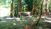
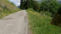
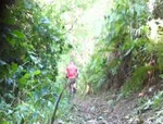
Photos of Horsham Mountain Bike
Videos of Horsham Mountain Bike
trail: River Run
0:31 |
634 |
Sep 2, 2013
trail: Golf Course
9:55 |
317 |
Jul 14, 2012
trail: River Run
0:46 |
186 |
Sep 2, 2010
Current Trail Warnings
| status | trail | date | condition | user | info |
|---|---|---|---|---|---|
| River Run | Jun 14, 2026 @ 7:26pm (Europe/London) Jun 14, 2026 | Unknown | pedallingplumber | So many trees down, almost impossible to... |
Recent Trail Reports
| status | trail | date | condition | info | user |
|---|---|---|---|---|---|
| Fire Road | May 31, 2026 @ 4:42pm (Europe/London) May 31, 2026 | Dry | pedallingplumber | ||
| Golf Course | May 10, 2026 @ 10:19am (Europe/London) May 10, 2026 | Ideal | Necron11 | ||
| Fire Road | May 10, 2026 @ 10:19am (Europe/London) May 10, 2026 | Ideal | Necron11 | ||
| Fire Road | May 10, 2026 @ 10:19am (Europe/London) May 10, 2026 | Dry | Necron11 | ||
| Fire Road | May 10, 2026 @ 10:19am (Europe/London) May 10, 2026 | Ideal | Necron11 | ||
| Jump Jump Rodney | May 10, 2026 @ 10:19am (Europe/London) May 10, 2026 | Dry | Necron11 | ||
| Access Road | May 10, 2026 @ 10:19am (Europe/London) May 10, 2026 | Ideal | Necron11 | ||
| St Leonard’s Singletrack | Apr 22, 2026 @ 6:11pm (Europe/London) Apr 22, 2026 | Variable | ThexMiniman | ||
| From Dusk Till Dawn | Apr 22, 2026 @ 6:11pm (Europe/London) Apr 22, 2026 | Ideal | ThexMiniman | ||
| Fat Of The Land | Apr 22, 2026 @ 6:11pm (Europe/London) Apr 22, 2026 | Ideal | ThexMiniman |
Activity Feed
| username | action | type | title | date |
|---|---|---|---|---|
| pedallingplumber | add | report | activity #96989768 | Jun 14, 2026 @ 11:26am Jun 14, 2026 |
| StanleyygBYJU | wishlist | region | activity #96065158 | Jun 1, 2026 @ 11:47pm Jun 1, 2026 |
| pedallingplumber | add | report | activity #95944454 | May 31, 2026 @ 8:42am May 31, 2026 |
| Necron11 | add | report | activity #94431250 and 5 more | May 10, 2026 @ 8:47am May 10, 2026 |
| Dogznob | wishlist | region | activity #94010429 | May 4, 2026 @ 12:50am May 4, 2026 |
Recent Comments
| username | type | title | comment | date |
|---|---|---|---|---|
| trail | Needs tlc badly, the jumps are all missing... | Aug 23, 2024 @ 12:08am Aug 23, 2024 | ||
| trail | Can't seem to add statues for this one,... | Jun 5, 2024 @ 12:10pm Jun 5, 2024 | ||
| report | Wet and slippery, needs a few dry weeks. | Mar 4, 2024 @ 4:33pm Mar 4, 2024 | ||
| report | Still soaked | Mar 4, 2024 @ 4:32pm Mar 4, 2024 | ||
| trail | Can't seem to find the entrance to this one.... | Nov 7, 2023 @ 4:34am Nov 7, 2023 |
Local Badges
-

Epic Ride Climb 2k3 awarded -

Climbing 10k Badge23 awarded -

Climbing 100k Badge1 awarded -

Epic Ride Descent 2k3 awarded -

Descent 10k Badge23 awarded -

Descent 100k Badge1 awarded
Local Mountain Biking Directory
-
Freeborn
![Freeborn]()
-
FreebornBike Shop
-
A D Cycles HorshamBike Shop
Activity Type Stats
| activitytype | trails | distance | descent | descent distance | total vertical | rating | global rank | state rank | photos | reports | routes | ridelogs |
|---|---|---|---|---|---|---|---|---|---|---|---|---|
| Mountain Bike | 43 | 18 miles | 3,071 ft | 12 miles | 322 ft | #5,158 | #181 | 43 | 162 | 2 | 5,994 | |
| E-Bike | 41 | 16 miles | 2,723 ft | 11 miles | 246 ft | #4,025 | #154 | 155 | 472 | |||
| Horse | 14 | 8 miles | 938 ft | 5 miles | 318 ft | #1,627 | #85 | 10 | 2 | |||
| Hike | 29 | 16 miles | 1,932 ft | 10 miles | 322 ft | #7,300 | #206 | 130 | 2 | 120 | ||
| Trail Running | 29 | 16 miles | 1,932 ft | 10 miles | 322 ft | #6,792 | #193 | 130 | 130 |
Frequently Asked Questions About Horsham
▼
What are the best places to ride in Horsham?
Horsham has 1 areas to explore for mountain biking. The top rated areas are:
▼
What are the highest rated mountain biking trails in Horsham?
The highest rated mountain biking trails in Horsham are:
- Ninja's Caravan (4.4/5)
- River Run (4.1/5)
- Jimmy Mac (4/5)
- Trail (3.9/5)
- River Run (3.9/5)
▼
What is the best time of the year to ride in Horsham?
Based on ride log data, the most popular months to ride in Horsham are:
- July (39 activities)
- June (32 activities)
- April (26 activities)
▼
Where can I park to ride in Horsham?
There are 1 parking locations listed in Horsham. The most popular parking spots are:
- By MathieuC
 TRAILFORKS & contributors
 - Admins: wisey, MathieuC, cemoorelife, FE
- #19467 - 5,049 views
- horsham activity log | embed map of Horsham mountain bike trails | horsham mountain biking points of interest
Downloading of trail gps tracks in kml & gpx formats is enabled for Horsham.
You must login to download files.