close
-
Layers w
- Weather Layers
- Pro
- Pro
- Pro
- Pro
- Pro
- Pro
- More Layers
- Pro
- Pro
- Pro
- Pro
-
Upgrade to

3D
Trail Conditions
- Unknown
- Snow Groomed
- Snow Packed
- Snow Covered
- Snow Cover Partial
- Freeze/thaw Cycle
- Icy
- Prevalent Mud
- Wet
- Variable
- Ideal
- Dry
- Very Dry
Trail Flow (Ridden Direction)
Trailforks scans users ridelogs to determine the most popular direction each trail is ridden. A good flowing trail network will have most trails flowing in a single direction according to their intension.
The colour categories are based on what percentage of riders are riding a trail in its intended direction.
The colour categories are based on what percentage of riders are riding a trail in its intended direction.
- > 96%
- > 90%
- > 80%
- > 70%
- > 50%
- < 50%
- bi-directional trail
- no data
Trail Last Ridden
Trailforks scans ridelogs to determine the last time a trail was ridden.
- < 2 days
- < 1 week
- < 2 weeks
- < 1 month
- < 6 months
- > 6 months
Trail Ridden Direction
The intended direction a trail should be ridden.
- Downhill Only
- Downhill Primary
- Both Directions
- Uphill Primary
- Uphill Only
- One Direction
Contribute Details
Colors indicate trail is missing specified detail.
- Description
- Photos
- Description & Photos
- Videos
Trail Popularity ?
Trailforks scans ridelogs to determine which trails are ridden the most in the last 9 months.
Trails are compared with nearby trails in the same city region with a possible 25 colour shades.
Think of this as a heatmap, more rides = more kinetic energy = warmer colors.
- most popular
- popular
- less popular
- not popular
ATV/ORV/OHV Filter
Max Vehicle Width
inches
US Cell Coverage
Legend

Radar Time
Activity Recordings
Trailforks uses anonymized public activity data.
?
Activity Recordings
Trailforks uses anonymized public activity data.
?
Personal Heatmap
▶
Activity Types
all
/
none
▶
Options
2
Date range
month
–
Winter Trails
Warning
A routing network for winter maps does not exist. Selecting trails using the winter trails layer has been disabled.
Missing Trails
Most Popular
Least Popular
Trails are colored based on popularity. The more popular a trail is, the more red. Less popular trails trend towards green.
Jump Magnitude Heatmap
Heatmap of where riders jump on trails. Zoom in to see individual jumps, click circles to view jump details.
BC Backroad Status
![map legend]()
Service Road Atlas is a free to use, community-driven service for viewing and creating reports on the numerous back-country service roads around B.C. and Alberta.

Slope Aspect
Direction the slope faces
Trails Deemphasized
Trails are shown in grey.
Only show trails with no bike usage.
Suggested Layers
Based on selected activity type
Save the current map location and zoom level as your default home location whenever this page is loaded.
Save
No description for Horst has been added yet!
Login or register to submit one.
Activities Click to view
- Mountain Bike
5 trails
- Winter Fat Bike
0 trails
- Hike
4 trails
- Trail Running
4 trails
Region Details
- 1
- 3
- 1
Region Status
Open as of Apr 1, 2026Stats
- Avg Trail Rating
- Trails (view details)
- 5
- Trails Mountain Bike
- 5
- Trails E-Bike
- 3
- Trails Hike
- 4
- Trails Trail Running
- 4
- Total Distance
- 13 miles
- Total Descent Distance
- 4 miles
- Total Descent
- 380 ft
- Total Vertical
- 69 ft
- Highest Trailhead
- 149 ft
- Reports
- 31
- Photos
- 19
- Ridden Counter
- 282
Popular Horst Mountain Biking Trails
• 100 ★ 3.9 • 11 miles • 318 ft • 244 •
Nearly 100% single-track. Some steep climbs and lots of berms.
• 80 ★ 0.0 • 1,647 ft • 4 ft • 10 •
Popular blue difficulty singletrack. This mountain bike primary trail can be used both directions and has a easy overall physical rating with a 4 ft blue climb. Trail visibility is always easy to follow. On average it takes 4 minutes to complete this trail.
• 60 ★ 0.0 • 4,790 ft • 27 ft • 9 •
Moderately popular green difficulty singletrack. This mountain bike primary trail can be used both directions and has a easy overall physical rating with a 27 ft green climb. Trail visibility is always easy to follow. On average it takes 4 minutes to complete this trail.
• 40 ★ 0.0 • 4,186 ft • 47 ft • 4 •
Moderately popular green difficulty singletrack. This mountain bike primary trail can be used both directions and has a easy overall physical rating with a 47 ft green climb. Trail visibility is always easy to follow. On average it takes 3 minutes to complete this trail.
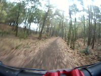
Photos of Horst Mountain Bike
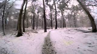
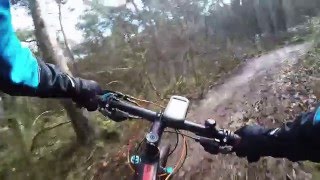
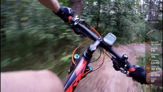
Videos of Horst Mountain Bike
trail: Ham
14:32 |
243 |
Nov 13, 2011

trail: MTB de Schaak
3:05 |
810 |
Sep 4, 2019 , Horst
4:24 |
395 |
Feb 28, 2018
3:47 |
502 |
Feb 28, 2018
5:15 |
412 |
Feb 28, 2018
Recent Trail Reports
| status | trail | date | condition | info | user |
|---|---|---|---|---|---|
| MTB de Schaak | May 6, 2021 @ 6:00am May 6, 2021 | Dry | intenso82 | ||
| Konijnswarande | Mar 7, 2021 @ 6:32am Mar 7, 2021 | Ideal | FvR1 |
Activity Feed
| username | action | type | title | date |
|---|---|---|---|---|
| mania7EQTSd | ridden | trail | activity #92474761 | Apr 12, 2026 @ 8:14am Apr 12, 2026 |
| MrPokerfaceNL | add | poi | activity #86427857 and 1 more | Jan 1, 2026 @ 1:54am Jan 1, 2026 |
| freedd | ridden | trail | activity #59585356 | Sep 27, 2024 @ 11:30pm Sep 27, 2024 |
| Marijn7 | ridden | trail | activity #51125523 | Apr 13, 2024 @ 10:21am Apr 13, 2024 |
| iMarWil | ridden | trail | activity #49257705 | Feb 17, 2024 @ 12:01pm Feb 17, 2024 |
Recent Comments
| username | type | title | comment | date |
|---|---|---|---|---|
| trail | I rode this trail today and it was awesome.... | Sep 29, 2020 @ 11:36am Sep 29, 2020 | ||
| trail | Awesome mtb track with tight high speed turns... | Aug 19, 2019 @ 3:13pm Aug 19, 2019 | ||
| trail | Very recommendable trail. | Mar 12, 2017 @ 11:48am Mar 12, 2017 |
Activity Type Stats
| activitytype | trails | distance | descent | descent distance | total vertical | rating | global rank | state rank | photos | reports | routes | ridelogs |
|---|---|---|---|---|---|---|---|---|---|---|---|---|
| Mountain Bike | 5 | 13 miles | 381 ft | 4 miles | 69 ft | #3,160 | #25 | 19 | 31 | 2,689 | ||
| E-Bike | 3 | 2 miles | 62 ft | 3,786 ft | 33 ft | 27 | 82 | |||||
| Hike | 4 | 3 miles | 66 ft | 4,285 ft | 39 ft | #3,028 | #30 | 27 | 24 | |||
| Trail Running | 4 | 3 miles | 66 ft | 4,285 ft | 39 ft | #2,516 | #30 | 27 | 16 |
- By schralpcc & contributors
- Admins: apply
- #4749 - 4,072 views
- horst activity log | embed map of Horst mountain bike trails | horst mountain biking points of interest
Downloading of trail gps tracks in kml & gpx formats is enabled for Horst.
You must login to download files.