close
-
Layers w
- Weather Layers
- Pro
- Pro
- Pro
- Pro
- Pro
- Pro
- More Layers
- Pro
- Pro
- Pro
- Pro
-
Upgrade to

3D
Trail Conditions
- Unknown
- Snow Groomed
- Snow Packed
- Snow Covered
- Snow Cover Partial
- Freeze/thaw Cycle
- Icy
- Prevalent Mud
- Wet
- Variable
- Ideal
- Dry
- Very Dry
Trail Flow (Ridden Direction)
Trailforks scans users ridelogs to determine the most popular direction each trail is ridden. A good flowing trail network will have most trails flowing in a single direction according to their intension.
The colour categories are based on what percentage of riders are riding a trail in its intended direction.
The colour categories are based on what percentage of riders are riding a trail in its intended direction.
- > 96%
- > 90%
- > 80%
- > 70%
- > 50%
- < 50%
- bi-directional trail
- no data
Trail Last Ridden
Trailforks scans ridelogs to determine the last time a trail was ridden.
- < 2 days
- < 1 week
- < 2 weeks
- < 1 month
- < 6 months
- > 6 months
Trail Ridden Direction
The intended direction a trail should be ridden.
- Downhill Only
- Downhill Primary
- Both Directions
- Uphill Primary
- Uphill Only
- One Direction
Contribute Details
Colors indicate trail is missing specified detail.
- Description
- Photos
- Description & Photos
- Videos
Trail Popularity ?
Trailforks scans ridelogs to determine which trails are ridden the most in the last 9 months.
Trails are compared with nearby trails in the same city region with a possible 25 colour shades.
Think of this as a heatmap, more rides = more kinetic energy = warmer colors.
- most popular
- popular
- less popular
- not popular
ATV/ORV/OHV Filter
Max Vehicle Width
inches
US Cell Coverage
Legend

Radar Time
Activity Recordings
Trailforks uses anonymized public activity data.
?
Activity Recordings
Trailforks uses anonymized public activity data.
?
Personal Heatmap
▶
Activity Types
all
/
none
▶
Options
2
Date range
month
–
Winter Trails
Warning
A routing network for winter maps does not exist. Selecting trails using the winter trails layer has been disabled.
Missing Trails
Most Popular
Least Popular
Trails are colored based on popularity. The more popular a trail is, the more red. Less popular trails trend towards green.
Jump Magnitude Heatmap
Heatmap of where riders jump on trails. Zoom in to see individual jumps, click circles to view jump details.
BC Backroad Status
![map legend]()
Service Road Atlas is a free to use, community-driven service for viewing and creating reports on the numerous back-country service roads around B.C. and Alberta.

Slope Aspect
Direction the slope faces
Trails Deemphasized
Trails are shown in grey.
Only show trails with no bike usage.
Suggested Layers
Based on selected activity type
Save the current map location and zoom level as your default home location whenever this page is loaded.
Save
No description for Hörstel has been added yet!
Login or register to submit one.
This region uses the Uk/Euro style trail grading system.
Activities Click to view
- Mountain Bike
22 trails
- E-Bike
22 trails
- Adaptive Bike
0 trails
- Hike
12 trails
- Trail Running
12 trails
Region Details
- 1
- 12
- 4
- 2
Region Status
Open as of May 28, 2026Stats
- Avg Trail Rating
- Trails (view details)
- 19
- Trails Mountain Bike
- 22
- Trails E-Bike
- 22
- Trails Hike
- 12
- Trails Trail Running
- 12
- Total Distance
- 5 miles
- Total Descent
- 1,060 ft
- Total Vertical
- 252 ft
- Highest Trailhead
- 491 ft
- Reports
- 128
- Photos
- 13
- Ridden Counter
- 1,051
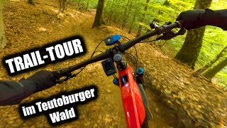
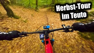
Popular Hörstel Mountain Biking Trails
• 75 ★ 3.0 • 3,533 ft • 73 ft • 120 •
Popular green difficulty singletrack. This mountain bike primary trail can be used both directions. On average it takes 4 minutes to complete this trail.
• 100 ★ 3.7 • 2,205 ft • 0 ft • 111 •
Popular blue difficulty singletrack. This mountain bike primary trail can be used downhill only and has a moderate overall physical rating. It features drop and jump. On average it takes 7 minutes to complete this trail.
• 95 ★ 4.3 • 3,877 ft • 6 ft • 106 •
Popular green difficulty singletrack. This multi-use trail can be used downhill primary and has a moderate overall physical rating with a 6 ft green climb. It features drop. Trail visibility is always easy to follow. On average it takes 4 minutes to complete this trail.
• 90 ★ 4.4 • 801 ft • 0 ft • 66 •
Popular red difficulty singletrack. This mountain bike primary trail. It features jump and gap jump. Exposure: High Risk of Serious Injury. On average it takes minutes to complete this trail.
• 60 ★ 0.0 • 1,457 ft • 19 ft • 60 •
Moderately popular green difficulty singletrack. This mountain bike primary trail can be used downhill only. On average it takes 2 minutes to complete this trail.
• 80 ★ 0.0 • 2,241 ft • 48 ft • 58 •
Popular blue difficulty singletrack. This mountain bike primary trail can be used downhill primary. On average it takes 6 minutes to complete this trail.
• 55 ★ 1.0 • 3,930 ft • 39 ft • 54 •
Moderately popular blue difficulty singletrack. This mountain bike primary trail can be used downhill only and has a hard overall physical rating. On average it takes 6 minutes to complete this trail.
Photos of Hörstel Mountain Bike
Videos of Hörstel Mountain Bike

trail: Thomas Trail
1:18:46 |
21 |
Oct 20, 2025 , Hörstel

trail: Steinbruch trail
1:18:46 |
33 |
Oct 19, 2025 , Hörstel

trail: Doktors Hang
1:18:46 |
29 |
Oct 19, 2025 , Hörstel
trail: Schlange
1:18:46 |
16 |
Oct 19, 2025 , Hörstel

trail: Zaunkönig
1:18:46 |
32 |
Oct 19, 2025 , Hörstel

trail: Steiler Hans
29:41 |
18 |
Oct 16, 2025 , Hörstel

trail: Doktors Hang
29:41 |
24 |
Oct 15, 2025 , Hörstel
trail: Schlange
29:41 |
16 |
Oct 15, 2025 , Hörstel
Current Trail Warnings
| status | trail | date | condition | user | info |
|---|---|---|---|---|---|
| Thomas Trail | May 28, 2026 @ 7:58pm (Europe/Berlin) May 28, 2026 | Unknown | pantharina | Am Ende liegt ein dicker Baum quer über... |
Recent Trail Reports
| status | trail | date | condition | info | user |
|---|---|---|---|---|---|
| Ameise | May 26, 2026 @ 10:02pm (Europe/Berlin) May 26, 2026 | Variable | Fuchsian | ||
| Hidden Trail - Postdamm | May 25, 2026 @ 2:54am (Europe/Berlin) May 24, 2026 | Ideal | Fuchsian | ||
| Schlange | May 25, 2026 @ 2:46am (Europe/Berlin) May 24, 2026 | Ideal | Fuchsian | ||
| Steinbruch trail | Apr 25, 2026 @ 1:27pm (Europe/Berlin) Apr 25, 2026 | Ideal | moshpanda | ||
| Speedy Towards Ponds | Apr 23, 2026 @ 8:24pm (Europe/Berlin) Apr 23, 2026 | Dry | pantharina | ||
| UDO Abfahrt | Apr 23, 2026 @ 7:50pm (Europe/Berlin) Apr 23, 2026 | Variable | Fuchsian | ||
| Rocky H | Apr 23, 2026 @ 6:47pm (Europe/Berlin) Apr 23, 2026 | Ideal | Fuchsian | ||
| Upper Bambi Sands | Apr 16, 2026 @ 11:18pm (Europe/Berlin) Apr 16, 2026 | Variable | Fuchsian | ||
| Der Hühnerbauer-Trail made bei Lars | Apr 16, 2026 @ 11:18pm (Europe/Berlin) Apr 16, 2026 | Prevalent Mud | pantharina | ||
| Lower Bambi Sands | Aug 10, 2024 @ 8:15am Aug 10, 2024 | Ideal | Michi2212 |
Activity Feed
| username | action | type | title | date |
|---|---|---|---|---|
| ploeti84 | wishlist | trail | activity #96524482 | Jun 8, 2026 @ 12:15am Jun 8, 2026 |
| Fuchsian | comment | trail | activity #95972535 | May 31, 2026 @ 1:17pm May 31, 2026 |
| Fuchsian | vote | trail | activity #95888830 | May 30, 2026 @ 2:46pm May 30, 2026 |
| Fuchsian | vote | trail | activity #95852410 | May 30, 2026 @ 7:59am May 30, 2026 |
| pantharina | add | report | activity #95719565 | May 28, 2026 @ 10:58am May 28, 2026 |
Recent Comments
| username | type | title | comment | date |
|---|---|---|---|---|
| trail | Fahre ich nicht mehr da schon der Eingang ein... | May 31, 2026 @ 1:17pm May 31, 2026 | ||
| trail | Könnte man auch als rot einzeichnen,... | May 26, 2026 @ 6:02pm May 26, 2026 | ||
| trail | Einfach top macht Riesen Spaß, uns hat eine... | Apr 16, 2026 @ 2:22pm Apr 16, 2026 | ||
| trail | Heute gefahren Boden top Strecke naja. Muss... | Apr 16, 2026 @ 10:05am Apr 16, 2026 | ||
| trail | Guter Zustand und macht Laune | Oct 9, 2025 @ 2:54pm Oct 9, 2025 |
Local Badges
-

Epic Mountain Bike Climb 2k4 awarded -

Climbing 10k Badge8 awarded -

Mountain Biking 100k Badge0 awarded -

Epic Ride Descent 2k4 awarded -

Descent 10k Badge8 awarded -

Descent 100k Badge0 awarded
Activity Type Stats
| activitytype | trails | distance | descent | descent distance | total vertical | rating | global rank | state rank | photos | reports | routes | ridelogs |
|---|---|---|---|---|---|---|---|---|---|---|---|---|
| Mountain Bike | 22 | 5 miles | 1,060 ft | 3 miles | 253 ft | #6,603 | #201 | 13 | 128 | 1,240 | ||
| E-Bike | 22 | 5 miles | 1,060 ft | 3 miles | 253 ft | #6,580 | #273 | 116 | 162 | |||
| Hike | 12 | 2 miles | 440 ft | 1 mile | 230 ft | #12,288 | #408 | 116 | 9 | |||
| Trail Running | 12 | 2 miles | 440 ft | 1 mile | 230 ft | #11,790 | #398 | 116 | 9 |
Frequently Asked Questions About Hörstel
▼
What are the highest rated mountain biking trails in Hörstel?
The highest rated mountain biking trails in Hörstel are:
- UDO Abfahrt (4.1/5)
- Steinbruch trail (4.1/5)
- Ameise (4.1/5)
- Nasses Dreieck Trails (4/5)
- Rocky H (3.9/5)
▼
What is the best time of the year to ride in Hörstel?
Based on ride log data, the most popular months to ride in Hörstel are:
- June (6 activities)
- April (4 activities)
- September (3 activities)
▼
Where can I park to ride in Hörstel?
There are 1 parking locations listed in Hörstel. The most popular parking spots are:
▼
What is the longest trail in Hörstel?
The longest trail in Hörstel is Zaunkönig at 3,930 ft. View all trails sorted by distance.
- By Sasse82
 TRAILFORKS & contributors
 - Admins: apply
- #39847 - 1,406 views
- hörstel activity log | embed map of Hörstel mountain bike trails | hörstel mountain biking points of interest
Downloading of trail gps tracks in kml & gpx formats is enabled for Hörstel.
You must login to download files.