close
-
Layers w
- Weather Layers
- Pro
- Pro
- Pro
- Pro
- Pro
- Pro
- More Layers
- Pro
- Pro
- Pro
- Pro
-
Upgrade to

3D
Trail Conditions
- Unknown
- Snow Groomed
- Snow Packed
- Snow Covered
- Snow Cover Partial
- Freeze/thaw Cycle
- Icy
- Prevalent Mud
- Wet
- Variable
- Ideal
- Dry
- Very Dry
Trail Flow (Ridden Direction)
Trailforks scans users ridelogs to determine the most popular direction each trail is ridden. A good flowing trail network will have most trails flowing in a single direction according to their intension.
The colour categories are based on what percentage of riders are riding a trail in its intended direction.
The colour categories are based on what percentage of riders are riding a trail in its intended direction.
- > 96%
- > 90%
- > 80%
- > 70%
- > 50%
- < 50%
- bi-directional trail
- no data
Trail Last Ridden
Trailforks scans ridelogs to determine the last time a trail was ridden.
- < 2 days
- < 1 week
- < 2 weeks
- < 1 month
- < 6 months
- > 6 months
Trail Ridden Direction
The intended direction a trail should be ridden.
- Downhill Only
- Downhill Primary
- Both Directions
- Uphill Primary
- Uphill Only
- One Direction
Contribute Details
Colors indicate trail is missing specified detail.
- Description
- Photos
- Description & Photos
- Videos
Trail Popularity ?
Trailforks scans ridelogs to determine which trails are ridden the most in the last 9 months.
Trails are compared with nearby trails in the same city region with a possible 25 colour shades.
Think of this as a heatmap, more rides = more kinetic energy = warmer colors.
- most popular
- popular
- less popular
- not popular
ATV/ORV/OHV Filter
Max Vehicle Width
inches
US Cell Coverage
Legend

Radar Time
Activity Recordings
Trailforks uses anonymized public activity data.
?
Activity Recordings
Trailforks uses anonymized public activity data.
?
Personal Heatmap
▶
Activity Types
all
/
none
▶
Options
2
Date range
month
–
Winter Trails
Warning
A routing network for winter maps does not exist. Selecting trails using the winter trails layer has been disabled.
Missing Trails
Most Popular
Least Popular
Trails are colored based on popularity. The more popular a trail is, the more red. Less popular trails trend towards green.
Jump Magnitude Heatmap
Heatmap of where riders jump on trails. Zoom in to see individual jumps, click circles to view jump details.
BC Backroad Status
![map legend]()
Service Road Atlas is a free to use, community-driven service for viewing and creating reports on the numerous back-country service roads around B.C. and Alberta.

Slope Aspect
Direction the slope faces
Trails Deemphasized
Trails are shown in grey.
Only show trails with no bike usage.
Suggested Layers
Based on selected activity type
Save the current map location and zoom level as your default home location whenever this page is loaded.
Save
No description for Horten has been added yet!
Login or register to submit one.
This region uses the Uk/Euro style trail grading system.
Activities Click to view
- Mountain Bike
51 trails
- E-Bike
43 trails
- Horse
9 trails
- Hike
49 trails
- Trail Running
46 trails
Region Details
- 12
- 2
- 17
- 19
- 1
Stats
- Avg Trail Rating
- Global Ranking
- #6,072
- Trails (view details)
- 51
- Trails Mountain Bike
- 51
- Trails E-Bike
- 43
- Trails Horse
- 9
- Trails Hike
- 49
- Trails Trail Running
- 46
- Trails Nordic Ski
- 10
- Total Distance
- 10 miles
- Total Descent Distance
- 8 miles
- Total Descent
- 3,032 ft
- Total Vertical
- 384 ft
- Highest Trailhead
- 425 ft
- Reports
- 247
- Photos
- 1
- Ridden Counter
- 226
Sub Regions
- Hortensmarka (35)
- Trollskogen (3)
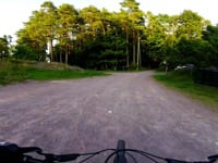
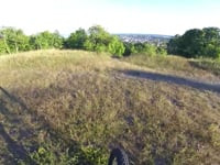
Popular Horten Mountain Biking Trails
• 75 ★ 5.0 • 1,627 ft • 0 ft • 27 •
Popular blue difficulty family friendly singletrack. This mountain bike primary trail can be used both directions and has a easy overall physical rating with a 0 ft blue climb. Trail visibility is sometimes hard to follow. On average it takes 2 minutes to complete this trail.
• 90 ★ 4.0 • 1,273 ft • 0 ft • 14 •
Popular blue difficulty singletrack. This mountain bike primary trail can be used downhill primary and has a easy overall physical rating with a 0 ft black diamond climb. It features rock face and other. On average it takes 1 minutes to complete this trail.
• 60 ★ 5.0 • 1,060 ft • 0 ft • 9 •
Moderately popular red difficulty singletrack. This mountain bike primary trail can be used downhill primary and has a moderate overall physical rating with a 0 ft black diamond climb. It features rock face. Trail visibility is always easy to follow. On average it takes 1 minutes to complete this trail.
• 80 ★ 0.0 • 886 ft • 0 ft • 8 •
Popular red difficulty singletrack. This mountain bike primary trail can be used downhill only and has a moderate overall physical rating. It features berm, jump and rock face. Trail visibility is sometimes hard to follow. On average it takes 2 minutes to complete this trail.
• 50 ★ 0.0 • 709 ft • 3 ft • 8 •
Moderately popular blue difficulty mixed. This mountain bike primary trail can be used both directions and has a moderate overall physical rating with a 3 ft black diamond climb. It features rock face, rock garden and other. Trail visibility is always easy to follow. On average it takes 3 minutes to complete this trail.
• 60 ★ 5.0 • 958 ft • 0 ft • 8 •
Moderately popular red difficulty singletrack. This mountain bike primary trail can be used both directions and has a moderate overall physical rating with a 0 ft double black diamond climb. It features bridge and rock garden. Trail visibility is always easy to follow. On average it takes 2 minutes to complete this trail.
• 45 ★ 5.0 • 1,286 ft • 0 ft • 8 •
There is a steep rock face at the start of the trail. If you want to skip this, there is an easier ridearound-trail a few meters back.
• 65 ★ 4.5 • 469 ft • 0 ft • 7 •
Moderately popular blue difficulty singletrack. This mountain bike primary trail can be used both directions. It features drop. Trail visibility is always easy to follow. On average it takes minutes to complete this trail.
Horten Mountain Bike Routes
★ 5.0 • 15 miles • 1,512 ft • 9 •
MTB on trial/tracks/gravel Hortensmarka skihytta Nykirke Borrevannet. The clock stopped 20 min before I...
★ 4.0 • 21 miles • 1,520 ft • 0 •
MTB on trial/tracks/gravel Horten Åsgårdstrand Eik Borre Skoppum
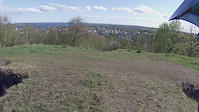
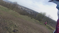
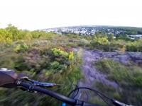
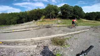
Videos of Horten Mountain Bike
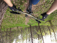
trail: Rollercoaster
0:35 |
|
May 8, 2024
trail: Artillery Hill
0:00 |
159 |
May 8, 2015
trail: Artillery Hill
0:57 |
121 |
Apr 21, 2015
trail: Milkyway
250 |
Sep 11, 2021 , My City

trail: Pass opp for troll!
2:18 |
238 |
Sep 7, 2021 , My City
trail: Trollknot
0:27 |
184 |
Aug 28, 2021 , My City
trail: Artillery Hill
0:56 |
298 |
Jul 17, 2021 , My City
0:23 |
189 |
May 20, 2021
Recent Trail Reports
| status | trail | date | condition | info | user |
|---|---|---|---|---|---|
| Let's Get Rowdy (del 2) Hortensmarka | Jul 8, 2025 @ 1:54pm Jul 8, 2025 | Ideal | jimiboiii | ||
| Knoteflyt Hortensmarka | Jul 8, 2025 @ 1:54pm Jul 8, 2025 | Ideal | jimiboiii | ||
| Let's Get Rowdy (del 1) Hortensmarka | Jul 4, 2025 @ 12:19pm Jul 4, 2025 | Ideal | jimiboiii | ||
| NORD Hortensmarka | Jul 4, 2025 @ 12:19pm Jul 4, 2025 | Ideal | jimiboiii | ||
| Bunkerstien Hortensmarka | Jul 1, 2025 @ 5:53pm Jul 1, 2025 | Ideal | jimiboiii | ||
| Til dypet Hortensmarka | Jun 24, 2025 @ 4:29pm Jun 24, 2025 | Ideal | jimiboiii | ||
| Golfparkering flyt Hortensmarka | May 29, 2025 @ 10:52am May 29, 2025 | Ideal | jimiboiii | ||
| Sembskogen flyt Hortensmarka | May 29, 2025 @ 10:52am May 29, 2025 | Ideal | jimiboiii | ||
| Steinrøysa ned (del 2) Hortensmarka | May 21, 2025 @ 12:06pm May 21, 2025 | Ideal | jimiboiii | ||
| Rollercoaster Hortensmarka | May 16, 2025 @ 10:29am May 16, 2025 | Ideal | jimiboiii |
Activity Feed
| username | action | type | title | date |
|---|---|---|---|---|
| bAwKU1 | ridden | trail | activity #95938779 | May 31, 2026 @ 7:39am May 31, 2026 |
| bAwKU1 | ridden | trail | activity #95938763 | May 31, 2026 @ 7:39am May 31, 2026 |
| Cykeljohan | comment | route | activity #94549887 | May 12, 2026 @ 4:36am May 12, 2026 |
| Cykeljohan | add | trail | activity #94549475 and 4 more | May 12, 2026 @ 4:25am May 12, 2026 |
| Cykeljohan | add | trail | activity #94548920 and 5 more | May 12, 2026 @ 4:09am May 12, 2026 |
Bike & Skill Parks
| name | type | city | rating |
|---|---|---|---|
| Norgescup Banen | skill park |
Activity Type Stats
| activitytype | trails | distance | descent | descent distance | total vertical | rating | global rank | state rank | photos | reports | routes | ridelogs |
|---|---|---|---|---|---|---|---|---|---|---|---|---|
| Mountain Bike | 51 | 10 miles | 3,031 ft | 8 miles | 384 ft | #6,072 | 1 | 247 | 3 | 1,006 | ||
| E-Bike | 43 | 10 miles | 3,031 ft | 8 miles | 384 ft | 247 | 11 | |||||
| Horse | 9 | 2 miles | 676 ft | 2 miles | 374 ft | |||||||
| Hike | 49 | 10 miles | 2,904 ft | 7 miles | 374 ft | #4,531 | #18 | 247 | 43 | |||
| Trail Running | 46 | 9 miles | 2,464 ft | 7 miles | 374 ft | #4,515 | #18 | 247 | 58 | |||
| Nordic Ski | 10 | 6 |
Frequently Asked Questions About Horten
▼
What are the best places to ride in Horten?
Horten has 2 areas to explore for mountain biking. The top rated areas are:
▼
What are the highest rated mountain biking trails in Horten?
The highest rated mountain biking trails in Horten are:
- Steinrøysa ned (del 2) (4.2/5)
- Vaffelstien (4.1/5)
- Steinrøysa ned (del 1) (4.1/5)
- Golfbanen flyt (4.1/5)
- Fartsflyten (4.1/5)
▼
What is the longest trail in Horten?
The longest trail in Horten is Knoteflyt at 1.0 km. View all trails sorted by distance.
▼
What are the best & highest rated hiking trails in Horten?
The best hiking trails in Horten are: View all hiking trails sorted by popularity score.
Activities
Trails
Points of Interest
- By Hetman64 & contributors
- Admins: mtbboy1993, Cykeljohan
- #8172 - 3,368 views
- horten activity log | embed map of Horten mountain bike trails | horten mountain biking points of interest
Downloading of trail gps tracks in kml & gpx formats is enabled for Horten.
You must login to download files.