close
-
Layers w
- Weather Layers
- Pro
- Pro
- Pro
- Pro
- Pro
- Pro
- More Layers
- Pro
- Pro
- Pro
- Pro
-
Upgrade to

3D
Trail Conditions
- Unknown
- Snow Groomed
- Snow Packed
- Snow Covered
- Snow Cover Partial
- Freeze/thaw Cycle
- Icy
- Prevalent Mud
- Wet
- Variable
- Ideal
- Dry
- Very Dry
Trail Flow (Ridden Direction)
Trailforks scans users ridelogs to determine the most popular direction each trail is ridden. A good flowing trail network will have most trails flowing in a single direction according to their intension.
The colour categories are based on what percentage of riders are riding a trail in its intended direction.
The colour categories are based on what percentage of riders are riding a trail in its intended direction.
- > 96%
- > 90%
- > 80%
- > 70%
- > 50%
- < 50%
- bi-directional trail
- no data
Trail Last Ridden
Trailforks scans ridelogs to determine the last time a trail was ridden.
- < 2 days
- < 1 week
- < 2 weeks
- < 1 month
- < 6 months
- > 6 months
Trail Ridden Direction
The intended direction a trail should be ridden.
- Downhill Only
- Downhill Primary
- Both Directions
- Uphill Primary
- Uphill Only
- One Direction
Contribute Details
Colors indicate trail is missing specified detail.
- Description
- Photos
- Description & Photos
- Videos
Trail Popularity ?
Trailforks scans ridelogs to determine which trails are ridden the most in the last 9 months.
Trails are compared with nearby trails in the same city region with a possible 25 colour shades.
Think of this as a heatmap, more rides = more kinetic energy = warmer colors.
- most popular
- popular
- less popular
- not popular
ATV/ORV/OHV Filter
Max Vehicle Width
inches
US Cell Coverage
Legend

Radar Time
Activity Recordings
Trailforks uses anonymized public activity data.
?
Activity Recordings
Trailforks uses anonymized public activity data.
?
Personal Heatmap
▶
Activity Types
all
/
none
▶
Options
2
Date range
month
–
Winter Trails
Warning
A routing network for winter maps does not exist. Selecting trails using the winter trails layer has been disabled.
Missing Trails
Most Popular
Least Popular
Trails are colored based on popularity. The more popular a trail is, the more red. Less popular trails trend towards green.
Jump Magnitude Heatmap
Heatmap of where riders jump on trails. Zoom in to see individual jumps, click circles to view jump details.
BC Backroad Status
![map legend]()
Service Road Atlas is a free to use, community-driven service for viewing and creating reports on the numerous back-country service roads around B.C. and Alberta.

Slope Aspect
Direction the slope faces
Trails Deemphasized
Trails are shown in grey.
Only show trails with no bike usage.
Suggested Layers
Based on selected activity type
Save the current map location and zoom level as your default home location whenever this page is loaded.
Save
No description for Hua Hin has been added yet!
Login or register to submit one.
Activities Click to view
- Mountain Bike
8 trails
- Hike
6 trails
- Trail Running
6 trails
Region Details
- 2
- 3
- 3
Region Status
Caution as of May 25, 2026Stats
- Avg Trail Rating
- Trails (view details)
- 8
- Trails Mountain Bike
- 8
- Trails E-Bike
- 3
- Trails Hike
- 6
- Trails Trail Running
- 6
- Trails Dirtbike/Moto
- 2
- Total Distance
- 14 miles
- Total Descent
- 3,212 ft
- Total Vertical
- 709 ft
- Highest Trailhead
- 797 ft
- Reports
- 59
- Photos
- 42
- Ridden Counter
- 61
Popular Hua Hin Mountain Biking Trails
• 90 ★ 5.0 • 3,555 ft • 20 ft • 16 •
Thailand gravity Series Competition track for 2 years now and the best DH track in the area, nice gnarly lines and new berms updated recently make this a short but very exciting ride!
• 100 ★ 4.7 • 3,281 ft • 5 ft • 14 •
another little ripping track with some steep sections and fast sections, also a competition held on this track, pretty rough and some nice features
• 5 ★ 5.0 • 4,888 ft • 33 ft • 4 •
Downhill single track,Rollers, berms and drops into Bamboo forest.
• 75 ★ 0.0 • 1,989 ft • 18 ft • 4 •
Introduction to enduro riding. This trail starts steep and levels out as you head down. Has some great drops, natural jumps, a rock face and other features that make it a great trail. All the features offer easy roll-arounds (except the...
• 5 ★ 0.0 • 3 miles • 384 ft • 3 •
Challenging rocky loop, a few very punchy climbs on steep rock slabs (one small section of pushing), followed by a flowy downhill on narrow single-track. Some nice ocean views along the way.
• 5 ★ 0.0 • 3 miles • 238 ft • 2 •
Starts with a super challenging climb (probably a push) from Falcon Hill development to get up on to the plateau. Tons of trails to explore here, some sand, some gravel single-track. Access to the enduro loop from here.
• 5 ★ 0.0 • 1 mile • 95 ft •
Single-track access from the car park and exercise area to the enduro loop (and from there to the XC loop).
Hua Hin Mountain Bike Routes
• 4,734 ft • 24 ft • 1 •
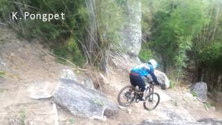
Photos of Hua Hin Mountain Bike
Videos of Hua Hin Mountain Bike

trail: Thara
17:16 |
118 |
Apr 3, 2025 , Hua Hin

trail: Wall Ride
17:16 |
73 |
Apr 3, 2025 , Hua Hin

trail: Thara
23:19 |
130 |
Aug 29, 2024 , Hua Hin

trail: Wall Ride
5:27 |
207 |
Sep 14, 2022 , Hua Hin

trail: Wall Ride
3:20 |
447 |
Apr 14, 2019 , Hua Hin

trail: Wall Ride
3:08 |
463 |
Apr 14, 2019 , Hua Hin
trail: Thara
1010 |
Sep 15, 2015 , Hua Hin

trail: Thara
861 |
Sep 4, 2015 , Hua Hin
Recent Trail Reports
| status | trail | date | condition | info | user |
|---|---|---|---|---|---|
| Wall Ride | Mar 22, 2026 @ 12:30pm (Asia/Bangkok) Mar 21, 2026 | Dry | osoyoooos OBC | ||
| Thara | Aug 13, 2023 @ 2:08am Aug 13, 2023 | Very Dry | sittichompoo | ||
| G-String | Aug 20, 2021 @ 11:46pm Aug 20, 2021 | Dry | Jokel92 | ||
| G-Spot | Oct 21, 2015 @ 10:07pm Oct 21, 2015 | Dry | Gees |
Activity Feed
| username | action | type | title | date |
|---|---|---|---|---|
| osoyoooos | add | report | activity #91047275 | Mar 21, 2026 @ 10:30pm Mar 21, 2026 |
| osoyoooos | vote | trail | activity #91047222 | Mar 21, 2026 @ 10:27pm Mar 21, 2026 |
| AntonSuper | add | video | activity #68904183 and 1 more | Apr 3, 2025 @ 1:05am Apr 3, 2025 |
| Remuston | ridden | trail | activity #67637653 | Mar 12, 2025 @ 8:04am Mar 12, 2025 |
| yfoog | wishlist | trail | activity #63097918 and 2 more | Dec 14, 2024 @ 7:18am Dec 14, 2024 |
Recent Comments
| username | type | title | comment | date |
|---|---|---|---|---|
| trail | The way out is a little tricky and confusing.... | Apr 16, 2019 @ 3:56am Apr 16, 2019 | ||
| trail | Just a note to check the Strava heat map... | Apr 16, 2019 @ 3:54am Apr 16, 2019 | ||
| trail | Not sure what’s going on with this trail. No... | Apr 16, 2019 @ 3:52am Apr 16, 2019 | ||
| report | whoooppee, new shit coming up! | Nov 19, 2015 @ 7:45pm Nov 19, 2015 |
Activity Type Stats
| activitytype | trails | distance | descent | descent distance | total vertical | rating | global rank | state rank | photos | reports | routes | ridelogs |
|---|---|---|---|---|---|---|---|---|---|---|---|---|
| Mountain Bike | 8 | 14 miles | 3,212 ft | 7 miles | 709 ft | #2,081 | #2 | 42 | 59 | 1 | 467 | |
| E-Bike | 3 | 6 miles | 489 ft | 2 miles | 456 ft | 53 | 8 | |||||
| Hike | 6 | 12 miles | 2,175 ft | 5 miles | 709 ft | #2,622 | #7 | 56 | 41 | |||
| Trail Running | 6 | 12 miles | 2,175 ft | 5 miles | 709 ft | #2,118 | #7 | 56 | 34 | |||
| Dirtbike/Moto | 2 | 5 miles | 459 ft | 2 miles | 456 ft | 29 |
Frequently Asked Questions About Hua Hin
▼
What are the highest rated mountain biking trails in Hua Hin?
The highest rated mountain biking trails in Hua Hin are:
- Thara (4.3/5)
- G-Spot (4.1/5)
- Wall Ride (4.1/5)
- B.C. Trail (0/5)
- G-String (0/5)
▼
What is the best time of the year to ride in Hua Hin?
Based on ride log data, the most popular months to ride in Hua Hin are:
- January (13 activities)
- February (4 activities)
- April (3 activities)
▼
Where can I park to ride in Hua Hin?
▼
What is the longest trail in Hua Hin?
The longest trail in Hua Hin is G-String at 7.3 km. View all trails sorted by distance.
- By brenthillier
 NSMBA TRAILFORKS & contributors
 - Admins: apply
- #9646 - 9,758 views
- hua hin activity log | embed map of Hua Hin mountain bike trails | hua hin mountain biking points of interest
Downloading of trail gps tracks in kml & gpx formats is enabled for Hua Hin.
You must login to download files.