close
-
Layers w
- Weather Layers
- Pro
- Pro
- Pro
- Pro
- Pro
- Pro
- More Layers
- Pro
- Pro
- Pro
- Pro
-
Upgrade to

3D
Trail Conditions
- Unknown
- Snow Groomed
- Snow Packed
- Snow Covered
- Snow Cover Partial
- Freeze/thaw Cycle
- Icy
- Prevalent Mud
- Wet
- Variable
- Ideal
- Dry
- Very Dry
Trail Flow (Ridden Direction)
Trailforks scans users ridelogs to determine the most popular direction each trail is ridden. A good flowing trail network will have most trails flowing in a single direction according to their intension.
The colour categories are based on what percentage of riders are riding a trail in its intended direction.
The colour categories are based on what percentage of riders are riding a trail in its intended direction.
- > 96%
- > 90%
- > 80%
- > 70%
- > 50%
- < 50%
- bi-directional trail
- no data
Trail Last Ridden
Trailforks scans ridelogs to determine the last time a trail was ridden.
- < 2 days
- < 1 week
- < 2 weeks
- < 1 month
- < 6 months
- > 6 months
Trail Ridden Direction
The intended direction a trail should be ridden.
- Downhill Only
- Downhill Primary
- Both Directions
- Uphill Primary
- Uphill Only
- One Direction
Contribute Details
Colors indicate trail is missing specified detail.
- Description
- Photos
- Description & Photos
- Videos
Trail Popularity ?
Trailforks scans ridelogs to determine which trails are ridden the most in the last 9 months.
Trails are compared with nearby trails in the same city region with a possible 25 colour shades.
Think of this as a heatmap, more rides = more kinetic energy = warmer colors.
- most popular
- popular
- less popular
- not popular
ATV/ORV/OHV Filter
Max Vehicle Width
inches
US Cell Coverage
Legend

Radar Time
Activity Recordings
Trailforks uses anonymized public activity data.
?
Activity Recordings
Trailforks uses anonymized public activity data.
?
Personal Heatmap
▶
Activity Types
all
/
none
▶
Options
2
Date range
month
–
Winter Trails
Warning
A routing network for winter maps does not exist. Selecting trails using the winter trails layer has been disabled.
Missing Trails
Most Popular
Least Popular
Trails are colored based on popularity. The more popular a trail is, the more red. Less popular trails trend towards green.
Jump Magnitude Heatmap
Heatmap of where riders jump on trails. Zoom in to see individual jumps, click circles to view jump details.
BC Backroad Status
![map legend]()
Service Road Atlas is a free to use, community-driven service for viewing and creating reports on the numerous back-country service roads around B.C. and Alberta.

Slope Aspect
Direction the slope faces
Trails Deemphasized
Trails are shown in grey.
Only show trails with no bike usage.
Suggested Layers
Based on selected activity type
Save the current map location and zoom level as your default home location whenever this page is loaded.
Save
No description for Hvar has been added yet!
Login or register to submit one.
This region uses the Uk/Euro style trail grading system.
Activities Click to view
- Mountain Bike
14 trails
- Hike
14 trails
- Trail Running
14 trails
Region Details
- 1
- 4
- 3
- 3
Region Status
Open as of Jun 3, 2026Stats
- Avg Trail Rating
- Trails (view details)
- 14
- Trails Mountain Bike
- 14
- Trails E-Bike
- 3
- Trails Hike
- 14
- Trails Trail Running
- 14
- Total Distance
- 27 miles
- Total Descent
- 10,095 ft
- Total Vertical
- 2,312 ft
- Highest Trailhead
- 2,344 ft
- Reports
- 25
- Photos
- 34
- Ridden Counter
- 226
Sub Regions
-
Hvar
- 4
- 3
Popular Hvar Mountain Biking Trails
• 55 ★ 4.0 • 2 miles • 22 ft • 33 •
Hiking path to Vidova gora. Also used among good MTB riders. Technical trail, drops and big rocks with switchbacks. Steady gradient though, without extremely steep parts. Avoid hot summer days and tourist season. A lot of hikers at that...
• 100 ★ 3.0 • 3,071 ft • 0 ft • 30 •
Technical and rocky trail with a lot of switch backs
• 95 ★ 0.0 • 3,800 ft • 596 ft • 25 • • hike
stori put, inkonjadura od vorha Dola Sv.Marije do Budinjca
• 65 ★ 0.0 • 2 miles • 90 ft • 23 •
Old path to Bol. It is a rocky trail with steady and not steep gradient. Technicly not demanding. It is not a MTB purpose built trail! Be careful and respect other users of the trail!
• 20 ★ 4.8 • 3 miles • 366 ft • 18 •
Nice sceneria. A lot of switchbacks and technical parts. Very funny. The finish part is between vineyards and trees.
• 45 ★ 5.0 • 2 miles • 0 ft • 15 •
Marked hiking trail. Also very fine for MTB riding. Rocky with a few drops and switchbacks. Dark blue difficulty. Avoid hot summer days and tourist season due to hikers. Respect hikers! Warning! There is no easy exit from trail to road!...
• 40 ★ 0.0 • 3,248 ft • 50 ft • 9 • • hike
Moderately popular green difficulty singletrack. This hike primary trail can be used both directions. It features rock face and rock garden. Trail visibility is always easy to follow. On average it takes 6 minutes to complete this trail.
• 75 ★ 4.0 • 1 mile • 0 ft • 5 •
From the top follow back the gravel road to the chapel at the left-hand side. Watch for the red & white mark on the stone that signals start of the single track. From then on just follow red & white marks all the way to the road...
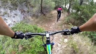
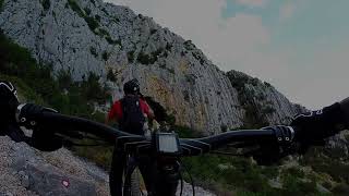
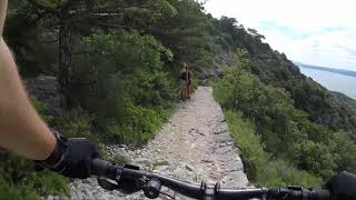
Photos of Hvar Mountain Bike
Videos of Hvar Mountain Bike
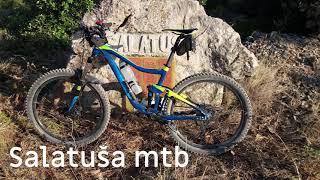
trail: SALATUŠA ROCK 'N' ROLL
4:45 |
58 |
Sep 10, 2025 , Hvar
trail: slow and steady
2:51 |
404 |
Aug 23, 2022 , Hvar
trail: RideToTheSea
6:45 |
529 |
Aug 23, 2022 , Hvar

trail: Vela staza
8:57 |
848 |
Oct 12, 2021 , Hvar
trail: Vela staza
2:44 |
1028 |
Sep 25, 2019 , Hvar
Recent Trail Reports
| status | trail | date | condition | info | user |
|---|---|---|---|---|---|
| SALATUŠA ROCK 'N' ROLL | Jun 3, 2026 @ 8:54pm (Europe/Zagreb) Jun 3, 2026 | Wet | christiancXnft | ||
| Gdje si Humac | Sep 23, 2025 @ 7:23pm (Europe/Zagreb) Sep 23, 2025 | Dry | zocknroll TRAILFORKS | ||
| Sjeverna Varbonjska Zaobilaznica | May 8, 2025 @ 7:07am May 8, 2025 | Ideal | Blaz1987 | ||
| Pustinja Blaca | Apr 19, 2025 @ 11:40am Apr 19, 2025 | Ideal | Flow-24 | ||
| Stari put | Apr 20, 2025 @ 3:02pm Apr 20, 2025 | Ideal | Flow-24 | ||
| slow and steady | Apr 3, 2024 @ 7:10am Apr 3, 2024 | Dry | Polio | ||
| RideToTheSea | Feb 18, 2024 @ 2:33am Feb 18, 2024 | Ideal | Flow-24 | ||
| Kotrolovac trail | Jan 18, 2024 @ 1:11am Jan 18, 2024 | Variable | adkarzen | ||
| Vela staza | Nov 1, 2023 @ 2:46am Nov 1, 2023 | Ideal | Flow-24 |
Activity Feed
| username | action | type | title | date |
|---|---|---|---|---|
| christiancXnft | add | report | activity #96171703 | Jun 3, 2026 @ 11:54am Jun 3, 2026 |
| zocknroll | add | photo | activity #80961895 | Sep 23, 2025 @ 10:26am Sep 23, 2025 |
| zocknroll | add | report | activity #80958108 and 1 more | Sep 23, 2025 @ 9:31am Sep 23, 2025 |
| zocknroll | vote | trail | activity #80957825 and 1 more | Sep 23, 2025 @ 9:27am Sep 23, 2025 |
| zocknroll | comment | trail | activity #80957815 and 1 more | Sep 23, 2025 @ 9:27am Sep 23, 2025 |
Recent Comments
| username | type | title | comment | date |
|---|---|---|---|---|
| trail | Very old mulatiera, nice for mtb downhill.... | Sep 23, 2025 @ 10:26am Sep 23, 2025 | ||
| trail | First part a wide gravel road (not so short),... | Sep 23, 2025 @ 9:27am Sep 23, 2025 | ||
| trail | Sehr schön zu fahren der Trail ohne größere... | Jun 14, 2021 @ 5:43am Jun 14, 2021 | ||
| trail | Heavy raw trail,big free Džone and sheep on... | Sep 22, 2019 @ 10:29am Sep 22, 2019 |
Local Badges
-

Epic Mountain Bike Climb 2k16 awarded -

Climbing 10k Badge3 awarded -

Mountain Biking 100k Badge0 awarded -

Epic Ride Descent 2k16 awarded -

Descent 10k Badge3 awarded -

Descent 100k Badge0 awarded
Activity Type Stats
| activitytype | trails | distance | descent | descent distance | total vertical | rating | global rank | state rank | photos | reports | routes | ridelogs |
|---|---|---|---|---|---|---|---|---|---|---|---|---|
| Mountain Bike | 14 | 27 miles | 10,095 ft | 16 miles | 2,313 ft | #2,932 | #21 | 33 | 25 | 1,351 | ||
| E-Bike | 3 | 9 miles | 2,064 ft | 4 miles | 1,654 ft | 1 | 21 | 200 | ||||
| Hike | 14 | 27 miles | 10,095 ft | 16 miles | 2,313 ft | #2,949 | #23 | 25 | 110 | |||
| Trail Running | 14 | 27 miles | 10,095 ft | 16 miles | 2,313 ft | #2,532 | #22 | 25 | 28 |
Frequently Asked Questions About Hvar
▼
What are the best places to ride in Hvar?
Hvar has 1 areas to explore for mountain biking. The top rated areas are:
▼
What are the highest rated mountain biking trails in Hvar?
The highest rated mountain biking trails in Hvar are:
- RideToTheSea (4.3/5)
- Pustinja Blaca (4.1/5)
- Gdje si Humac (4/5)
- Vela staza (4/5)
- SALATUŠA ROCK 'N' ROLL (3.8/5)
▼
What is the best time of the year to ride in Hvar?
Based on ride log data, the most popular months to ride in Hvar are:
- April (18 activities)
- June (8 activities)
- August (5 activities)
▼
Where can I park to ride in Hvar?
Check the Hvar trail map for trailhead and parking information. Community members regularly update access and parking details for trails in the area.
- By Lujo14 & contributors
- Admins: VjekoslavKrsanac
- #41620 - 4,535 views
- hvar activity log | embed map of Hvar mountain bike trails |
Downloading of trail gps tracks in kml & gpx formats is enabled for Hvar.
You must login to download files.