close
-
Layers w
- Weather Layers
- Pro
- Pro
- Pro
- Pro
- Pro
- Pro
- More Layers
- Pro
- Pro
- Pro
- Pro
-
Upgrade to

3D
Trail Conditions
- Unknown
- Snow Groomed
- Snow Packed
- Snow Covered
- Snow Cover Partial
- Freeze/thaw Cycle
- Icy
- Prevalent Mud
- Wet
- Variable
- Ideal
- Dry
- Very Dry
Trail Flow (Ridden Direction)
Trailforks scans users ridelogs to determine the most popular direction each trail is ridden. A good flowing trail network will have most trails flowing in a single direction according to their intension.
The colour categories are based on what percentage of riders are riding a trail in its intended direction.
The colour categories are based on what percentage of riders are riding a trail in its intended direction.
- > 96%
- > 90%
- > 80%
- > 70%
- > 50%
- < 50%
- bi-directional trail
- no data
Trail Last Ridden
Trailforks scans ridelogs to determine the last time a trail was ridden.
- < 2 days
- < 1 week
- < 2 weeks
- < 1 month
- < 6 months
- > 6 months
Trail Ridden Direction
The intended direction a trail should be ridden.
- Downhill Only
- Downhill Primary
- Both Directions
- Uphill Primary
- Uphill Only
- One Direction
Contribute Details
Colors indicate trail is missing specified detail.
- Description
- Photos
- Description & Photos
- Videos
Trail Popularity ?
Trailforks scans ridelogs to determine which trails are ridden the most in the last 9 months.
Trails are compared with nearby trails in the same city region with a possible 25 colour shades.
Think of this as a heatmap, more rides = more kinetic energy = warmer colors.
- most popular
- popular
- less popular
- not popular
ATV/ORV/OHV Filter
Max Vehicle Width
inches
US Cell Coverage
Legend

Radar Time
Activity Recordings
Trailforks uses anonymized public activity data.
?
Activity Recordings
Trailforks uses anonymized public activity data.
?
Personal Heatmap
▶
Activity Types
all
/
none
▶
Options
2
Date range
month
–
Winter Trails
Warning
A routing network for winter maps does not exist. Selecting trails using the winter trails layer has been disabled.
Missing Trails
Most Popular
Least Popular
Trails are colored based on popularity. The more popular a trail is, the more red. Less popular trails trend towards green.
Jump Magnitude Heatmap
Heatmap of where riders jump on trails. Zoom in to see individual jumps, click circles to view jump details.
BC Backroad Status
![map legend]()
Service Road Atlas is a free to use, community-driven service for viewing and creating reports on the numerous back-country service roads around B.C. and Alberta.

Slope Aspect
Direction the slope faces
Trails Deemphasized
Trails are shown in grey.
Only show trails with no bike usage.
Suggested Layers
Based on selected activity type
Save the current map location and zoom level as your default home location whenever this page is loaded.
Save
No description for Ibbenbüren has been added yet!
Login or register to submit one.
This region uses the Uk/Euro style trail grading system.
Activities Click to view
- Mountain Bike
19 trails
- E-Bike
19 trails
- Adaptive Bike
0 trails
- Hike
11 trails
- Trail Running
11 trails
Region Details
- 4
- 6
- 7
- 1
Region Status
Open as of May 28, 2026Stats
- Avg Trail Rating
- Trails (view details)
- 18
- Trails Mountain Bike
- 19
- Trails E-Bike
- 19
- Trails Hike
- 11
- Trails Trail Running
- 11
- Total Distance
- 7 miles
- Total Descent Distance
- 3 miles
- Total Descent
- 1,260 ft
- Total Vertical
- 273 ft
- Highest Trailhead
- 575 ft
- Reports
- 190
- Photos
- 9
- Ridden Counter
- 1,757
Popular Ibbenbüren Mountain Biking Trails
• 100 ★ 3.4 • 1,253 ft • 9 ft • 150 •
Popular black difficulty singletrack. This mountain bike primary trail. It features drop. Exposure: Life Threatening Consequences. On average it takes 1 minutes to complete this trail.
• 85 ★ 3.7 • 1,296 ft • 2 ft • 142 •
Popular blue difficulty singletrack. This mountain bike primary trail can be used downhill only. On average it takes minutes to complete this trail.
• 75 ★ 3.0 • 3,947 ft • 84 ft • 131 •
Popular green difficulty singletrack. This multi-use trail can be used both directions and has a moderate overall physical rating. Trail visibility is always easy to follow. On average it takes 8 minutes to complete this trail.
• 90 ★ 4.3 • 1,890 ft • 4 ft • 128 •
Popular blue difficulty singletrack. This mountain bike primary trail can be used downhill only. It features gap jump. On average it takes 2 minutes to complete this trail.
• 60 ★ 2.0 • 1,335 ft • 0 ft • 107 •
Moderately popular blue difficulty singletrack. This mountain bike primary trail can be used downhill only. On average it takes minutes to complete this trail.
• 70 ★ 1.0 • 2,211 ft • 92 ft • 95 • • hike
Nice enduro trail along the Dorenther cliffs
• 35 ★ 3.5 • 856 ft • 0 ft • 78 •
Quite technical trail with drops and steep sections. Slippery when wet.
Ibbenbüren Mountain Bike Routes
26 miles • 3,664 ft • 28 • Loop •
lot of single trail , lot of descends , a special round for endurobikers with strong legs ;) maybe the...
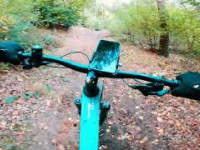
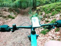
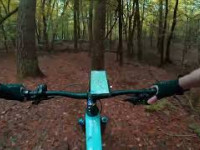
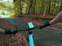
Videos of Ibbenbüren Mountain Bike
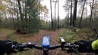
trail: Steinige Abfahrt
0:28 |
77 |
Nov 12, 2023
trail: Kletterwand Trail
18 |
Nov 24, 2025 , Ibbenbüren
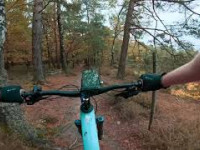
trail: Raupe
0:54 |
36 |
Nov 24, 2025 , Ibbenbüren
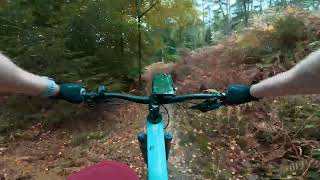
trail: Steinige Abfahrt
0:56 |
24 |
Nov 24, 2025 , Ibbenbüren
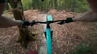
trail: Brumley Back
32 |
Nov 24, 2025 , Ibbenbüren
trail: Rotkäppchen
20 |
Nov 24, 2025 , Ibbenbüren
trail: Parallelwelt
16 |
Nov 23, 2025 , Ibbenbüren
trail: Absacker
40 |
Nov 23, 2025 , Ibbenbüren
Recent Trail Reports
| status | trail | date | condition | info | user |
|---|---|---|---|---|---|
| Raupe | May 28, 2026 @ 7:59pm (Europe/Berlin) May 28, 2026 | Dry | Fuchsian | ||
| Brumley Back | May 25, 2026 @ 2:43am (Europe/Berlin) May 24, 2026 | Ideal | Fuchsian | ||
| Parallelwelt | May 25, 2026 @ 2:40am (Europe/Berlin) May 24, 2026 | Ideal | Fuchsian | ||
| Absacker | May 5, 2026 @ 12:09pm (Europe/Amsterdam) May 5, 2026 | Ideal | Knagie | ||
| Rotkäppchen | May 5, 2026 @ 12:09pm (Europe/Amsterdam) May 5, 2026 | Ideal | Knagie | ||
| Dörenther Klippen Trail 1 | Aug 10, 2025 @ 10:52am Aug 10, 2025 | Dry | Trailomi | ||
| Squamish light | Aug 10, 2025 @ 10:52am Aug 10, 2025 | Ideal | Trailomi | ||
| Märchenwald | Aug 10, 2025 @ 10:52am Aug 10, 2025 | Very Dry | Trailomi | ||
| Unter Den Klippen | May 26, 2025 @ 12:46pm May 26, 2025 | Ideal | Icamas | ||
| Dorenther Klippen trail 2 | May 26, 2025 @ 12:46pm May 26, 2025 | Ideal | Icamas |
Activity Feed
| username | action | type | title | date |
|---|---|---|---|---|
| MariusyQVSTc | wishlist | route | activity #96525463 | Jun 8, 2026 @ 12:48am Jun 8, 2026 |
| Fuchsian | vote | trail | activity #95888661 | May 30, 2026 @ 2:43pm May 30, 2026 |
| Fuchsian | comment | trail | activity #95888551 | May 30, 2026 @ 2:42pm May 30, 2026 |
| Fuchsian | difficultyvote | trail | activity #95846816 | May 30, 2026 @ 6:50am May 30, 2026 |
| Fuchsian | ridden | trail | activity #95719652 | May 28, 2026 @ 10:59am May 28, 2026 |
Recent Comments
| username | type | title | comment | date |
|---|---|---|---|---|
| trail | Achtung Erosion hat hier starke Arbeit... | May 30, 2026 @ 2:42pm May 30, 2026 | ||
| trail | Also blau ist das ja mal wirklich nicht. Grün... | May 28, 2026 @ 10:58am May 28, 2026 | ||
| trail | War ganz nice. Aber die Ecke hat deutlich mehr... | May 24, 2026 @ 5:44pm May 24, 2026 | ||
| trail | Toller Flow Trail der etwas verspielt ist.... | May 24, 2026 @ 5:41pm May 24, 2026 |
Local Badges
-

Epic Mountain Bike Climb 2k1 awarded -

Climbing 10k Badge1 awarded -

Mountain Biking 100k Badge0 awarded -

Epic Ride Descent 2k1 awarded -

Descent 10k Badge1 awarded -

Descent 100k Badge0 awarded
Bike & Skill Parks
| name | type | city | rating |
|---|---|---|---|
| Dirtpark Ibbenbüren | skill park | Ibbenbüren |
Activity Type Stats
| activitytype | trails | distance | descent | descent distance | total vertical | rating | global rank | state rank | photos | reports | routes | ridelogs |
|---|---|---|---|---|---|---|---|---|---|---|---|---|
| Mountain Bike | 19 | 7 miles | 1,260 ft | 3 miles | 272 ft | #9,801 | #537 | 9 | 190 | 2 | 372 | |
| E-Bike | 19 | 7 miles | 1,260 ft | 3 miles | 272 ft | #4,419 | #130 | 180 | 1 | 43 | ||
| Hike | 11 | 5 miles | 338 ft | 2 miles | 272 ft | #8,070 | #141 | 176 | 16 | |||
| Trail Running | 11 | 5 miles | 338 ft | 2 miles | 272 ft | #7,626 | #140 | 176 | 1 |
Frequently Asked Questions About Ibbenbüren
▼
What are the highest rated mountain biking trails in Ibbenbüren?
The highest rated mountain biking trails in Ibbenbüren are:
- Absacker (4.1/5)
- Steinige Abfahrt (3.9/5)
- Squamish light (3.9/5)
- Raupe (3.8/5)
- Dörenther Klippen Trail 1 (3.7/5)
▼
What is the best time of the year to ride in Ibbenbüren?
Based on ride log data, the most popular months to ride in Ibbenbüren are:
- October (1 activities)
- September (1 activities)
- July (1 activities)
▼
Where can I park to ride in Ibbenbüren?
There are 3 parking locations listed in Ibbenbüren. The most popular parking spots are: View all parking and trailhead locations on the map to plan your visit.
▼
What is the longest trail in Ibbenbüren?
The longest trail in Ibbenbüren is Dörenther Klippen Trail 1 at 3,947 ft. View all trails sorted by distance.
Activities
Trails
Points of Interest
- By delarscuevas
 & contributors
 - Admins: apply
- #32735 - 4,409 views
- ibbenbüren activity log | embed map of Ibbenbüren mountain bike trails | ibbenbüren mountain biking points of interest
Downloading of trail gps tracks in kml & gpx formats is enabled for Ibbenbüren.
You must login to download files.