close
-
Layers w
- Weather Layers
- Pro
- Pro
- Pro
- Pro
- Pro
- Pro
- More Layers
- Pro
- Pro
- Pro
- Pro
-
Upgrade to

3D
Trail Conditions
- Unknown
- Snow Groomed
- Snow Packed
- Snow Covered
- Snow Cover Partial
- Freeze/thaw Cycle
- Icy
- Prevalent Mud
- Wet
- Variable
- Ideal
- Dry
- Very Dry
Trail Flow (Ridden Direction)
Trailforks scans users ridelogs to determine the most popular direction each trail is ridden. A good flowing trail network will have most trails flowing in a single direction according to their intension.
The colour categories are based on what percentage of riders are riding a trail in its intended direction.
The colour categories are based on what percentage of riders are riding a trail in its intended direction.
- > 96%
- > 90%
- > 80%
- > 70%
- > 50%
- < 50%
- bi-directional trail
- no data
Trail Last Ridden
Trailforks scans ridelogs to determine the last time a trail was ridden.
- < 2 days
- < 1 week
- < 2 weeks
- < 1 month
- < 6 months
- > 6 months
Trail Ridden Direction
The intended direction a trail should be ridden.
- Downhill Only
- Downhill Primary
- Both Directions
- Uphill Primary
- Uphill Only
- One Direction
Contribute Details
Colors indicate trail is missing specified detail.
- Description
- Photos
- Description & Photos
- Videos
Trail Popularity ?
Trailforks scans ridelogs to determine which trails are ridden the most in the last 9 months.
Trails are compared with nearby trails in the same city region with a possible 25 colour shades.
Think of this as a heatmap, more rides = more kinetic energy = warmer colors.
- most popular
- popular
- less popular
- not popular
ATV/ORV/OHV Filter
Max Vehicle Width
inches
US Cell Coverage
Legend

Radar Time
Activity Recordings
Trailforks uses anonymized public activity data.
?
Activity Recordings
Trailforks uses anonymized public activity data.
?
Personal Heatmap
▶
Activity Types
all
/
none
▶
Options
2
Date range
month
–
Winter Trails
Warning
A routing network for winter maps does not exist. Selecting trails using the winter trails layer has been disabled.
Missing Trails
Most Popular
Least Popular
Trails are colored based on popularity. The more popular a trail is, the more red. Less popular trails trend towards green.
Jump Magnitude Heatmap
Heatmap of where riders jump on trails. Zoom in to see individual jumps, click circles to view jump details.
BC Backroad Status
![map legend]()
Service Road Atlas is a free to use, community-driven service for viewing and creating reports on the numerous back-country service roads around B.C. and Alberta.

Slope Aspect
Direction the slope faces
Trails Deemphasized
Trails are shown in grey.
Only show trails with no bike usage.
Suggested Layers
Based on selected activity type
Save the current map location and zoom level as your default home location whenever this page is loaded.
Save
No description for Idrija has been added yet!
Login or register to submit one.
This region uses the Uk/Euro style trail grading system.
Activities Click to view
- Mountain Bike
22 trails
- Adaptive Bike
0 trails
- Winter Fat Bike
0 trails
- Horse
1 trails
- Hike
22 trails
- Trail Running
22 trails
- Downhill Ski
7 trails
Region Details
- 9
- 8
Region Status
Caution as of Jun 1, 2026Stats
- Avg Trail Rating
- Trails (view details)
- 29
- Trails Mountain Bike
- 22
- Trails E-Bike
- 1
- Trails Horse
- 1
- Trails Hike
- 22
- Trails Trail Running
- 22
- Trails Downhill Ski
- 7
- Total Distance
- 50 miles
- Total Descent
- 20,166 ft
- Total Vertical
- 3,255 ft
- Highest Trailhead
- 4,239 ft
- Reports
- 108
- Photos
- 17
- Ridden Counter
- 485
Popular Idrija Mountain Biking Trails
• 95 ★ 4.8 • 1 mile • 64 ft • 17 •
Popular black diamond difficulty singletrack. This mountain bike primary trail can be used downhill only and has a moderate overall physical rating. On average it takes 23 minutes to complete this trail.
• 85 ★ 4.5 • 2,188 ft • 0 ft • 16 •
Popular red difficulty singletrack. This mountain bike primary trail and has a moderate overall physical rating. Trail visibility is always easy to follow. On average it takes 3 minutes to complete this trail.
• 60 ★ 3.0 • 3,251 ft • 142 ft • 15 •
Moderately popular blue difficulty singletrack. This mountain bike primary trail can be used downhill only. On average it takes 5 minutes to complete this trail.
• 65 ★ 1.5 • 4,708 ft • 0 ft • 15 •
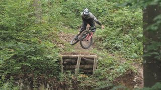
Moderately popular black diamond difficulty singletrack. This mountain bike primary trail can be used downhill only and has a hard overall physical rating. It features berm, jump, gap jump, rock garden and skinny. Trail visibility is always easy to follow. On average it takes 13 minutes to complete this trail.
• 40 ★ 4.5 • 3,455 ft • 16 ft • 10 •
Moderately popular blue difficulty alpine singletrack. This mountain bike primary trail can be used downhill only and has a moderate overall physical rating. Trail visibility is always easy to follow. On average it takes 7 minutes to complete this trail.
• 35 ★ 3.7 • 2,942 ft • 13 ft • 10 •
Less popular blue difficulty singletrack. This mountain bike primary trail can be used downhill only. On average it takes 3 minutes to complete this trail.
• 75 ★ 4.0 • 2 miles • 706 ft • 9 •
Popular blue difficulty singletrack. This mountain bike primary trail can be used both directions and has a moderate overall physical rating. Trail visibility is always easy to follow. On average it takes 19 minutes to complete this trail.
Idrija Mountain Bike Routes
23 miles • 5,061 ft • 0 • Point to Point •
Stage 12 of Slovenian mountain bike route (Slovenska turnokolesarska pot – STKP).
Photos of Idrija Mountain Bike
Recent Trail Reports
| status | trail | date | condition | info | user |
|---|---|---|---|---|---|
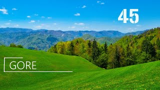
| Gore | Apr 26, 2026 @ 8:23pm (Europe/Ljubljana) Apr 26, 2026 | Dry | gasper-knavs AED Maribor | ||
| Strug | Apr 26, 2026 @ 8:22pm (Europe/Ljubljana) Apr 26, 2026 | Dry | gasper-knavs AED Maribor | ||
| Quckie + čez Kap | Apr 26, 2026 @ 8:22pm (Europe/Ljubljana) Apr 26, 2026 | Dry | gasper-knavs AED Maribor | ||
| Pevc | Apr 26, 2026 @ 8:18pm (Europe/Ljubljana) Apr 26, 2026 | Dry | gasper-knavs AED Maribor | ||
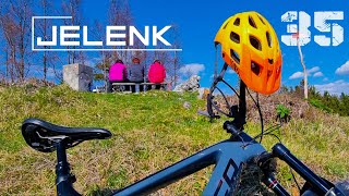
| Jelenk access | Apr 5, 2025 @ 7:58am Apr 5, 2025 | Ideal | agvlt | ||
| Jelenk | Apr 5, 2025 @ 7:56am Apr 5, 2025 | Ideal | agvlt | ||
| Jeprže | Aug 21, 2023 @ 4:52am Aug 21, 2023 | Variable | Naero | ||
| Trepališe | Aug 21, 2023 @ 4:52am Aug 21, 2023 | Ideal | Naero | ||
| Vzpon po Ključah | Aug 20, 2022 @ 6:47am Aug 20, 2022 | Dry | MrakA | ||
| Spodnja Idrija - Govšk access road | Apr 28, 2021 @ 1:03am Apr 28, 2021 | Variable | Banislav |
Activity Feed
| username | action | type | title | date |
|---|---|---|---|---|
| grafvonmarzipan | wishlist | trail | activity #95842747 and 2 more | May 30, 2026 @ 5:51am May 30, 2026 |
| gimoya | wishlist | trail | activity #94265965 | May 7, 2026 @ 10:47pm May 7, 2026 |
| gasper-knavs | vote | trail | activity #93462338 and 3 more | Apr 26, 2026 @ 11:19am Apr 26, 2026 |
| gasper-knavs | add | report | activity #93462194 and 3 more | Apr 26, 2026 @ 11:18am Apr 26, 2026 |
| alber_ding | wishlist | trail | activity #91578488 | Mar 30, 2026 @ 4:22am Mar 30, 2026 |
Recent Comments
| username | type | title | comment | date |
|---|---|---|---|---|
| trail | Nice Trail. As previous ratings suggest: some... | May 20, 2024 @ 9:46am May 20, 2024 | ||
| trail | Hiking trail that can be ridden, too ;) Some... | Aug 21, 2023 @ 10:41am Aug 21, 2023 | ||
| trail | technical and partly steep, really nice if u... | Jun 1, 2022 @ 12:09am Jun 1, 2022 | ||
| trail | Lower part is almost impossible to ride | Aug 4, 2021 @ 11:06am Aug 4, 2021 | ||
| trail | Na nekaterih mestih je voda naredila svoje. | Jun 2, 2019 @ 4:01am Jun 2, 2019 |
Local Badges
-

Epic Ride Climb 2k103 awarded -

Climbing 10k Badge10 awarded -

Climbing 100k Badge3 awarded -

Epic Ride Descent 2k103 awarded -

Descent 10k Badge10 awarded -

Descent 100k Badge3 awarded
Activity Type Stats
| activitytype | trails | distance | descent | descent distance | total vertical | rating | global rank | state rank | photos | reports | routes | ridelogs |
|---|---|---|---|---|---|---|---|---|---|---|---|---|
| Mountain Bike | 22 | 47 miles | 16,696 ft | 20 miles | 2,625 ft | #2,477 | #20 | 17 | 108 | 1 | 1,984 | |
| E-Bike | 1 | 5 miles | 200 ft | 2,792 ft | 2,510 ft | 98 | 75 | |||||
| Horse | 1 | 2 miles | 614 ft | 1 mile | 210 ft | #652 | #7 | |||||
| Hike | 22 | 47 miles | 16,696 ft | 20 miles | 2,625 ft | #2,301 | #20 | 108 | 776 | |||
| Trail Running | 22 | 47 miles | 16,696 ft | 20 miles | 2,625 ft | #1,854 | #17 | 108 | 62 | |||
| Downhill Ski | 7 | 3 miles | 3,468 ft | 3 miles | 1,076 ft | #320 | #3 | 4 |
Frequently Asked Questions About Idrija
▼
What are the highest rated mountain biking trails in Idrija?
The highest rated mountain biking trails in Idrija are:
- Gore (4.2/5)
- Quckie + čez Kap (4.1/5)
- Trepališe (4.1/5)
- Strug (4/5)
- Star Strug (4/5)
▼
What is the best time of the year to ride in Idrija?
Based on ride log data, the most popular months to ride in Idrija are:
- February (19 activities)
- June (14 activities)
- May (10 activities)
▼
Where can I park to ride in Idrija?
There are 1 parking locations listed in Idrija. The most popular parking spots are:
▼
What is the longest trail in Idrija?
The longest trail in Idrija is Jelenk at 2.6 miles. View all trails sorted by distance.
Activities
Trails
Points of Interest
- By Banislav & contributors
- Admins: VjekoslavKrsanac, zocknroll
- #8145 - 5,017 views
- idrija activity log | embed map of Idrija mountain bike trails | idrija mountain biking points of interest
Downloading of trail gps tracks in kml & gpx formats is enabled for Idrija.
You must login to download files.