close
-
Layers w
- Weather Layers
- Pro
- Pro
- Pro
- Pro
- Pro
- Pro
- More Layers
- Pro
- Pro
- Pro
- Pro
-
Upgrade to

3D
Trail Conditions
- Unknown
- Snow Groomed
- Snow Packed
- Snow Covered
- Snow Cover Partial
- Freeze/thaw Cycle
- Icy
- Prevalent Mud
- Wet
- Variable
- Ideal
- Dry
- Very Dry
Trail Flow (Ridden Direction)
Trailforks scans users ridelogs to determine the most popular direction each trail is ridden. A good flowing trail network will have most trails flowing in a single direction according to their intension.
The colour categories are based on what percentage of riders are riding a trail in its intended direction.
The colour categories are based on what percentage of riders are riding a trail in its intended direction.
- > 96%
- > 90%
- > 80%
- > 70%
- > 50%
- < 50%
- bi-directional trail
- no data
Trail Last Ridden
Trailforks scans ridelogs to determine the last time a trail was ridden.
- < 2 days
- < 1 week
- < 2 weeks
- < 1 month
- < 6 months
- > 6 months
Trail Ridden Direction
The intended direction a trail should be ridden.
- Downhill Only
- Downhill Primary
- Both Directions
- Uphill Primary
- Uphill Only
- One Direction
Contribute Details
Colors indicate trail is missing specified detail.
- Description
- Photos
- Description & Photos
- Videos
Trail Popularity ?
Trailforks scans ridelogs to determine which trails are ridden the most in the last 9 months.
Trails are compared with nearby trails in the same city region with a possible 25 colour shades.
Think of this as a heatmap, more rides = more kinetic energy = warmer colors.
- most popular
- popular
- less popular
- not popular
ATV/ORV/OHV Filter
Max Vehicle Width
inches
US Cell Coverage
Legend

Radar Time
Activity Recordings
Trailforks uses anonymized public activity data.
?
Activity Recordings
Trailforks uses anonymized public activity data.
?
Personal Heatmap
▶
Activity Types
all
/
none
▶
Options
2
Date range
month
–
Winter Trails
Warning
A routing network for winter maps does not exist. Selecting trails using the winter trails layer has been disabled.
Missing Trails
Most Popular
Least Popular
Trails are colored based on popularity. The more popular a trail is, the more red. Less popular trails trend towards green.
Jump Magnitude Heatmap
Heatmap of where riders jump on trails. Zoom in to see individual jumps, click circles to view jump details.
BC Backroad Status
![map legend]()
Service Road Atlas is a free to use, community-driven service for viewing and creating reports on the numerous back-country service roads around B.C. and Alberta.

Slope Aspect
Direction the slope faces
Trails Deemphasized
Trails are shown in grey.
Only show trails with no bike usage.
Suggested Layers
Based on selected activity type
Save the current map location and zoom level as your default home location whenever this page is loaded.
SaveGreater Idyllwild Area that encompasses Idyllwild, May Valley, Garner Valley Thomas Mountain the San Jacinto Mountains
Activities Click to view
- Mountain Bike
73 trails
- Gravel Bike
0 trails
- Adaptive Bike
0 trails
- Winter Fat Bike
0 trails
- Horse
7 trails
- Hike
116 trails
- Trail Running
116 trails
Region Details
- 2
- 5
- 60
- 3
- 1
Region Status
Caution as of Jun 12, 2026Stats
- Avg Trail Rating
- Trails (view details)
- 113
- Trails Mountain Bike
- 73
- Trails Horse
- 7
- Trails Hike
- 116
- Trails Trail Running
- 116
- Total Distance
- 187 miles
- Total Descent
- 48,178 ft
- Total Vertical
- 9,364 ft
- Highest Trailhead
- 10,791 ft
- Reports
- 376
- Photos
- 354
- Ridden Counter
- 8,143
Sub Regions
-
May Valley Trails
- 4
- 19
-
The Hub
- 1
- 39
- 3
- 1
Popular Idyllwild - Pine Cove Mountain Biking Trails
• 80 ★ 2.9 • 3 miles • 365 ft • 169 •
After the grind up this is the reward. Mostly flowing DH connecting the trails over to the top of and all the great trails that start there like , and the sleeping trails.
• 85 ★ 3.5 • 2 miles • 220 ft • 169 •
Popular blue difficulty singletrack. This multi-use trail can be used both directions. On average it takes 14 minutes to complete this trail.
• 95 ★ 4.0 • 4,003 ft • 13 ft • 147 •
The is a fantastic trail, a lot like , fast and sweet… Very Sweet! This ride is both technically and physically moderate. is a pretty well known trail, and once you’ve experienced it, you know why it is well known.
• 90 ★ 4.3 • 3,307 ft • 0 ft • 141 •
Highly rated popular blue difficulty singletrack. This multi-use trail can be used both directions. On average it takes 5 minutes to complete this trail.
• 100 ★ 1.5 • 2 miles • 143 ft • 141 •
When deciding between and Exfoliater to get back down the from the May Valley area back to Hurkey Creek here are you have two primary decision drivers. Exfoliater is a fast ripfest while is more of a slow twisting route.
• 95 ★ 4.5 • 2 miles • 475 ft • 138 •
is a great climbing trail and generally ridden in an uphill direction to access all the great trails like and sleeping trails which start higher up.
• 85 ★ 3.7 • 4 miles • 341 ft • 138 •
Popular blue difficulty singletrack. This multi-use trail can be used both directions and has a moderate overall physical rating with a 341 ft blue climb. On average it takes 39 minutes to complete this trail.
Idyllwild - Pine Cove Mountain Bike Routes
16 miles • 2,260 ft • 1 • Out & Back •
Most riders climb the road and DH the single track, but descending the road with all the moto berms is...
373 miles • 26,706 ft • 23 • Loop • Race •
A classic bikepacking route through southern California. Pines, valleys, ocean, city, desert and back to...
• 2 miles • 41 ft • 2 •
• 4 miles • 468 ft • 1 •
• 6 miles • 621 ft • 2 •
• 6 miles • 68 ft • 2 •
Photos of Idyllwild - Pine Cove Mountain Bike
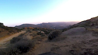
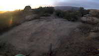
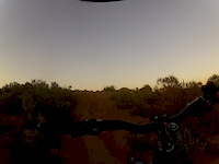
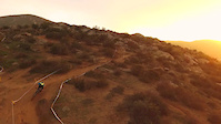
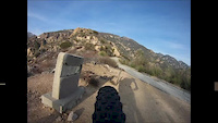
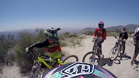
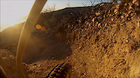
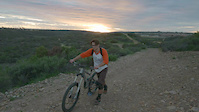
Videos of Idyllwild - Pine Cove Mountain Bike
trail: Sunset
2:22 |
126 |
May 30, 2016
trail: Sunset
4:55 |
170 |
May 15, 2016
trail: Sunset
2:18 |
24 |
Mar 29, 2016
trail: Sunset
0:28 |
207 |
Jan 24, 2016
trail: Sunset
7:37 |
60 |
Jan 14, 2016
trail: Hellrazor
3:30 |
1299 |
Aug 25, 2015
trail: Sunset
0:20 |
81 |
Feb 12, 2015
trail: Sunset
0:43 |
111 |
Feb 5, 2015
Current Trail Warnings
| status | trail | date | condition | user | info |
|---|---|---|---|---|---|
| Project X | May 23, 2026 @ 8:20pm (America/Los_Angeles) May 23, 2026 | Dry | spunj3 | It looks really different than it did... | |
| Grotto Overlook | May 22, 2026 @ 12:57am (America/Los_Angeles) May 22, 2026 | Dry | hgjkdshkjw | Impassable due to overgrowth | |
| North Face | May 22, 2026 @ 12:56am (America/Los_Angeles) May 22, 2026 | Dry | hgjkdshkjw | Impassable due to fallen trees and thick... |
Recent Trail Reports
| status | trail | date | condition | info | user |
|---|---|---|---|---|---|
| Neepa Flow | May 27, 2026 @ 9:25am (America/Los_Angeles) May 27, 2026 | Variable | sh33mon | ||
| Thomas Mountain Bike Trail | May 27, 2026 @ 7:01pm (America/Los_Angeles) May 27, 2026 | Dry | birdsandtrees | ||
| Toptimator | May 22, 2026 @ 1:00am (America/Los_Angeles) May 22, 2026 | Ideal | hgjkdshkjw | ||
| Smokestack | May 22, 2026 @ 12:59am (America/Los_Angeles) May 22, 2026 | Ideal | hgjkdshkjw | ||
| Lower Tubs | May 22, 2026 @ 12:59am (America/Los_Angeles) May 22, 2026 | Dry | hgjkdshkjw | ||
| Black Bear | May 22, 2026 @ 12:58am (America/Los_Angeles) May 22, 2026 | Dry | hgjkdshkjw | ||
| Sutton's run | May 22, 2026 @ 12:54am (America/Los_Angeles) May 22, 2026 | Dry | hgjkdshkjw | ||
| Logpile | May 22, 2026 @ 12:54am (America/Los_Angeles) May 22, 2026 | Dry | hgjkdshkjw | ||
| Buena Vista | May 22, 2026 @ 12:53am (America/Los_Angeles) May 22, 2026 | Dry | hgjkdshkjw | ||
| Coffee Pot | May 22, 2026 @ 12:53am (America/Los_Angeles) May 22, 2026 | Dry | hgjkdshkjw |
Activity Feed
| username | action | type | title | date |
|---|---|---|---|---|
| aoLDoKy1 | wishlist | trail | activity #96563048 | Jun 8, 2026 @ 2:07pm Jun 8, 2026 |
| Rishindo | comment | trail | activity #96341301 | Jun 5, 2026 @ 9:02pm Jun 5, 2026 |
| Rishindo | ridden | trail | activity #96341238 and 6 more | Jun 5, 2026 @ 9:00pm Jun 5, 2026 |
| k5davey | wishlist | trail | activity #96033351 | Jun 1, 2026 @ 12:11pm Jun 1, 2026 |
| nk2011 | add | photo | activity #95813395 and 1 more | May 29, 2026 @ 5:32pm May 29, 2026 |
Recent Comments
| username | type | title | comment | date |
|---|---|---|---|---|
| trail | This is a great trail that is definitely worth... | Jun 5, 2026 @ 9:02pm Jun 5, 2026 | ||
| report | Trail has been cleared and is good to ride | May 27, 2026 @ 9:27am May 27, 2026 | ||
| trail | This would be a great trail if it weren't so... | Mar 22, 2026 @ 6:55pm Mar 22, 2026 | ||
| trail | Really nice, well-built trail. Maybe my... | Mar 22, 2026 @ 6:51pm Mar 22, 2026 | ||
| trail | Really well laid-out trail. Tons of fun, makes... | Mar 14, 2026 @ 6:52am Mar 14, 2026 |
Local Badges
-

Completionist0 awarded
Activity Type Stats
| activitytype | trails | distance | descent | descent distance | total vertical | rating | global rank | state rank | photos | reports | routes | ridelogs |
|---|---|---|---|---|---|---|---|---|---|---|---|---|
| Mountain Bike | 73 | 82 miles | 17,644 ft | 42 miles | 4,262 ft | #2,727 | #976 | 340 | 372 | 2 | 8,187 | |
| Horse | 7 | 47 miles | 12,851 ft | 29 miles | 7,326 ft | #1,134 | #719 | 34 | 1 | |||
| Hike | 116 | 187 miles | 48,179 ft | 98 miles | 9,364 ft | #339 | #161 | 16 | 378 | 1 | 1,880 | |
| Trail Running | 116 | 187 miles | 48,179 ft | 98 miles | 9,364 ft | #780 | #292 | 378 | 2 | 175 |
Frequently Asked Questions About Idyllwild - Pine Cove
▼
What are the best places to ride in Idyllwild - Pine Cove?
Idyllwild - Pine Cove has 4 areas to explore for mountain biking. The top rated areas are:
▼
What are the highest rated mountain biking trails in Idyllwild - Pine Cove?
The highest rated mountain biking trails in Idyllwild - Pine Cove are:
- Lower Tubs (4.3/5)
- Silver Crag (4.2/5)
- Thomas Mountain Bike Trail (4.1/5)
- Mystic Dubbing (4.1/5)
- Sutton's run (4.1/5)
▼
What is the best time of the year to ride in Idyllwild - Pine Cove?
Based on ride log data, the most popular months to ride in Idyllwild - Pine Cove are:
- May (123 activities)
- July (116 activities)
- August (104 activities)
▼
Where can I park to ride in Idyllwild - Pine Cove?
There are 14 parking locations listed in Idyllwild - Pine Cove. The most popular parking spots are: View all parking and trailhead locations on the map to plan your visit.
Activities
Trails
- Hard trails in Idyllwild - Pine Cove
- Easy trails in Idyllwild - Pine Cove
- Favorite trails in Idyllwild - Pine Cove
- Most ridden trails in Idyllwild - Pine Cove
- Singletrack in Idyllwild - Pine Cove
- Viewpoint trails in Idyllwild - Pine Cove
- Trails with technical features in Idyllwild - Pine Cove
- Race routes in Idyllwild - Pine Cove
Points of Interest
- Black Mountain Fire Lookout Sight
- San Jacinto Peak Summit
- Suicide Rock Summit
- Red Tahquitz Summit
- South Ridge Yellow Post #2 Camping
- South Ridge Yellow Post #1 Camping
- South Ridge Yellow Post #3 Camping
- Hurkey Creek Park Campground Camping
- Idyllwild Arts Academy Sight
- Boulder Campground Camping
- San Jacinto Peak (10,787 ft)
- Folly Peak (10,482 ft)
- Newton Drury Peak (10,177 ft)
- By brenthillier
 NSMBA TRAILFORKS & contributors
 - Admins: IVMTB
- #9528 - 18,208 views
- idyllwild - pine cove activity log | embed map of Idyllwild - Pine Cove mountain bike trails | idyllwild - pine cove mountain biking points of interest
Downloading of trail gps tracks in kml & gpx formats is enabled for Idyllwild - Pine Cove.
You must login to download files.