close
-
Layers w
- Weather Layers
- Pro
- Pro
- Pro
- Pro
- Pro
- Pro
- More Layers
- Pro
- Pro
- Pro
- Pro
-
Upgrade to

3D
Trail Conditions
- Unknown
- Snow Groomed
- Snow Packed
- Snow Covered
- Snow Cover Partial
- Freeze/thaw Cycle
- Icy
- Prevalent Mud
- Wet
- Variable
- Ideal
- Dry
- Very Dry
Trail Flow (Ridden Direction)
Trailforks scans users ridelogs to determine the most popular direction each trail is ridden. A good flowing trail network will have most trails flowing in a single direction according to their intension.
The colour categories are based on what percentage of riders are riding a trail in its intended direction.
The colour categories are based on what percentage of riders are riding a trail in its intended direction.
- > 96%
- > 90%
- > 80%
- > 70%
- > 50%
- < 50%
- bi-directional trail
- no data
Trail Last Ridden
Trailforks scans ridelogs to determine the last time a trail was ridden.
- < 2 days
- < 1 week
- < 2 weeks
- < 1 month
- < 6 months
- > 6 months
Trail Ridden Direction
The intended direction a trail should be ridden.
- Downhill Only
- Downhill Primary
- Both Directions
- Uphill Primary
- Uphill Only
- One Direction
Contribute Details
Colors indicate trail is missing specified detail.
- Description
- Photos
- Description & Photos
- Videos
Trail Popularity ?
Trailforks scans ridelogs to determine which trails are ridden the most in the last 9 months.
Trails are compared with nearby trails in the same city region with a possible 25 colour shades.
Think of this as a heatmap, more rides = more kinetic energy = warmer colors.
- most popular
- popular
- less popular
- not popular
ATV/ORV/OHV Filter
Max Vehicle Width
inches
US Cell Coverage
Legend

Radar Time
Activity Recordings
Trailforks uses anonymized public activity data.
?
Activity Recordings
Trailforks uses anonymized public activity data.
?
Personal Heatmap
▶
Activity Types
all
/
none
▶
Options
2
Date range
month
–
Winter Trails
Warning
A routing network for winter maps does not exist. Selecting trails using the winter trails layer has been disabled.
Missing Trails
Most Popular
Least Popular
Trails are colored based on popularity. The more popular a trail is, the more red. Less popular trails trend towards green.
Jump Magnitude Heatmap
Heatmap of where riders jump on trails. Zoom in to see individual jumps, click circles to view jump details.
BC Backroad Status
![map legend]()
Service Road Atlas is a free to use, community-driven service for viewing and creating reports on the numerous back-country service roads around B.C. and Alberta.

Slope Aspect
Direction the slope faces
Trails Deemphasized
Trails are shown in grey.
Only show trails with no bike usage.
Suggested Layers
Based on selected activity type
Save the current map location and zoom level as your default home location whenever this page is loaded.
SavePopular Trail Networks
view all areas »
No description for Île-de-France has been added yet!
Login or register to submit one.
This region uses the Uk/Euro style trail grading system.
Region Details
- 216
- 199
- 232
- 42
- 31
- 1
Stats
- Avg Trail Rating
- Trails (view details)
- 756
- Trails Mountain Bike
- 723
- Trails E-Bike
- 707
- Trails Horse
- 64
- Trails Hike
- 632
- Trails Trail Running
- 637
- Trails Dirtbike/Moto
- 4
- Trails Snowshoe
- 4
- Trails Downhill Ski
- 4
- Trails Backcountry Ski
- 4
- Trails Nordic Ski
- 4
- Total Distance
- 699 miles
- Total Descent
- 61,031 ft
- Total Vertical
- 605 ft
- Highest Trailhead
- 678 ft
- Reports
- 1,053
- Photos
- 548
- Ridden Counter
- 15,649
Articles
Visiting Paris for the Olympics? Escape the City On These 5 Hikes
Aug 2, 2024 from backpacker.com
Escape the Paris crowds on these quick escapes close to town.
Sub Regions
- Cesson (14)
- Brie Comte Robert (34)
- Plateau de Brie (31)
- Buthiers (1)
- Fontainebleau (46)
- Gagny (10)
- Forêt de Ferrières (13)
- Brie Comte Robert (34)
- Essone (156)
- Briis-Sous-Forges (4)
- Cheptainville (1)
- Mennecy (0)
- gif sur yvette (5)
- Limours (7)
- Milly-la-Forêt (27)
- Orsay (52)
- Rochefort En Yveline (3)
- Saint-Rémy-lès-Chevreuse (6)
- Saulx Les Chartreux (2)
- Sermaise (1)
- Soisy-sur-Seine (28)
- Forêt de Sénart (27)
- St Rémy Lès Chevreuse (2)
- Verrières-le-Buisson (6)
- Fôret de Verrières (7)
- Briis-Sous-Forges (4)
- Haut de Seine (172)
- Châtenay-Malabry (6)
- Chaville (6)
- CLAMART (16)
- Marnes-la-Coquette (9)
- Meudon (30)
- Fôret de Meudon (19)
- Rueil-Malmaison (1)
- Saint-Cloud (35)
- Sevres (3)
- Vaucresson (49)
- Ville-d'Avray (65)
- Châtenay-Malabry (6)
- Paris (58)
- Paris (57)
- Bois de Boulogne (40)
- Bois De Vincennes (0)
- Paris (57)
- Seine et Marne (114)
- Val d'Oise (133)
- Cergy (47)
- Forêt de l'hautil (44)
- Franconville (1)
- Forêt de Carnelle (0)
- Forêt de Montmorency (77)
- Cergy (47)
- Val de Marne (1)
- Bois de Chigny (1)
- Yvelines (91)
- Aubergenville (1)
- Bullion (11)
- Cernay-La-Ville (10)
- Chambourcy (2)
- Chateaufort (15)
- Chevreuse (7)
- Dampierre (7)
- Follainville (4)
- Jambville (4)
- Le Chesnay (1)
- Maurepas (1)
- Saint-Germain-en-Laye (7)
- Senlis (1)
- Versailles (2)
- Forêt Domaniale de Marly (4)
- Aubergenville (1)
Popular Île-de-France Mountain Biking Trails
• 100 ★ 4.0 • 2 miles • 50 ft • 107 •
Popular green difficulty paved path. This mountain bike primary trail can be used one direction and has a moderate overall physical rating with a 50 ft green climb. Trail visibility is always easy to follow. On average it takes 6 minutes to complete this trail.
• 90 ★ 0.0 • 2,264 ft • 23 ft • 95 •
Popular green difficulty family friendly paved path. This mountain bike primary trail can be used both directions and has a easy overall physical rating with a 23 ft green climb. Trail visibility is always easy to follow. On average it takes 1 minutes to complete this trail.
• 95 ★ 0.0 • 650 ft • 4 ft • 89 •
Popular green difficulty family friendly asphalt/tarmac road. This mountain bike primary trail can be used both directions and has a easy overall physical rating with a 4 ft green climb. Trail visibility is always easy to follow. On average it takes minutes to complete this trail.
• 100 ★ 0.0 • 558 ft • 10 ft • 81 •
Popular green difficulty family friendly asphalt/tarmac road. This multi-use trail can be used both directions and has a easy overall physical rating with a 10 ft green climb. Trail visibility is always easy to follow. On average it takes minutes to complete this trail.
• 80 ★ 0.0 • 1 mile • 76 ft • 80 •
Popular green difficulty family friendly asphalt/tarmac road. This multi-use trail can be used one direction and has a easy overall physical rating with a 76 ft green climb. Trail visibility is always easy to follow. On average it takes 4 minutes to complete this trail.
• 95 ★ 0.0 • 1,079 ft • 0 ft • 77 •
Popular green difficulty family friendly asphalt/tarmac road. This multi-use trail can be used both directions and has a easy overall physical rating with a 0 ft green climb. Trail visibility is always easy to follow. On average it takes minutes to complete this trail.
• 75 ★ 0.0 • 2,018 ft • 0 ft • 73 •
Popular green difficulty family friendly asphalt/tarmac road. This multi-use trail can be used one direction and has a easy overall physical rating with a 0 ft green climb. Trail visibility is always easy to follow. On average it takes 1 minutes to complete this trail.
• 75 ★ 0.0 • 3,451 ft • 6 ft • 62 •
Popular green difficulty family friendly asphalt/tarmac road. This multi-use trail can be used one direction and has a easy overall physical rating with a 6 ft green climb. Trail visibility is always easy to follow. On average it takes 1 minutes to complete this trail.
Île-de-France Mountain Bike Routes
★ 5.0 • 5 miles • 362 ft • 7 • Loop •
The first official MTB trail in the Fontainebleau forest! Created with the help of the French Mountain...
★ 5.0 • 20 miles • 1,441 ft • 4 • Loop •
A nice 30km ride in these beautiful parcs Can get a bit muddy, no main difficulty
12 miles • 365 ft • 1 •
Aller bosser de Beauplan Vers Massy en VTT, Gravel, a pied etc
25 miles • 2,795 ft • 6 • Loop •
Sortie Physique par Benoit de Véloxygene
★ 5.0 • 13 miles • 1,766 ft • 0 •
20km & 850m of climbing , 95% single track, some steep downhill, 20+ features along the way. If the trail...
31 miles • 2,050 ft • 2 • Loop •
Boucle partant de Clamart, passant par le parc de Versailles, avec plusieurs petits singles notamment sur...
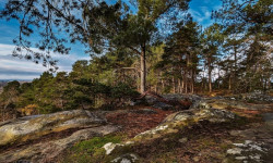
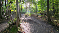
Photos of Île-de-France Mountain Bike
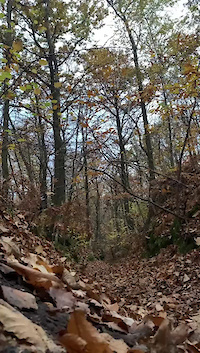
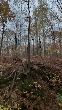
Videos of Île-de-France Mountain Bike
trail: L'Artaudière
0:13 |
50 |
Nov 23, 2024
trail: L'Artaudière
0:12 |
53 |
Nov 23, 2024
trail: Jujube
0:03 |
49 |
Oct 11, 2024
trail: Jujube
0:05 |
39 |
Jun 10, 2024
trail: Franckystein
0:09 |
81 |
Oct 24, 2023
trail: Jujube
0:10 |
60 |
Oct 23, 2023
trail: Franckystein
0:05 |
74 |
Oct 12, 2023

trail: Chemin du Canal
0:33 |
|
Jul 11, 2023
Current Trail Warnings
| status | trail | date | condition | user | info |
|---|---|---|---|---|---|
| Vieille Branche Saint-Cloud | Jun 15, 2026 @ 11:31pm (Europe/Paris) 2 days | Very Dry | ChambreNoire | ||
| White Door Saint-Cloud | Jun 15, 2026 @ 11:31pm (Europe/Paris) 2 days | Ideal | ChambreNoire | ||
| Charly's Saint-Cloud | Jun 15, 2026 @ 11:31pm (Europe/Paris) 2 days | Ideal | ChambreNoire |
Recent Trail Reports
| status | trail | date | condition | info | user |
|---|---|---|---|---|---|
| Branche Connector Saint-Cloud | Jun 15, 2026 @ 11:30pm (Europe/Paris) 2 days | Unknown | ChambreNoire | ||
| Chemin de La Brosse Saint-Cloud | Jun 15, 2026 @ 11:27pm (Europe/Paris) 2 days | Variable | ChambreNoire | ||
| La Brosse Saint-Cloud | Jun 15, 2026 @ 11:27pm (Europe/Paris) 2 days | Variable | ChambreNoire | ||
| Allée de Monsieur Saint-Cloud | Jun 15, 2026 @ 11:27pm (Europe/Paris) 2 days | Variable | ChambreNoire | ||
| Allée de la Rue de Marnes Saint-Cloud | Jun 15, 2026 @ 11:27pm (Europe/Paris) 2 days | Variable | ChambreNoire | ||
| Combleval Saint-Cloud | Jun 15, 2026 @ 11:27pm (Europe/Paris) 2 days | Variable | ChambreNoire | ||
| Brosse Connector Saint-Cloud | Jun 15, 2026 @ 11:27pm (Europe/Paris) 2 days | Variable | ChambreNoire | ||
| Veloroute du Canal de l'Ourcq Paris | Jun 7, 2026 @ 7:10am (Europe/Paris) Jun 6, 2026 | Ideal | renaissancerider | ||
| down to fond Fanette Orsay | May 26, 2026 @ 12:29pm (Europe/Paris) May 26, 2026 | Dry | farmergilles | ||
| War Pigs Yvelines | May 22, 2026 @ 9:33am (Europe/Paris) May 22, 2026 | Ideal | fvtt |
Activity Feed
| username | action | type | title | date |
|---|---|---|---|---|
| ChambreNoire | add | report | activity #97065853 | Jun 15, 2026 @ 2:31pm 2 days |
| ChambreNoire | add | report | activity #97065724 and 10 more | Jun 15, 2026 @ 2:29pm 2 days |
| renaissancerider | add | report | activity #96451369 | Jun 7, 2026 @ 5:49am Jun 7, 2026 |
| FranciscoZHAJdi | wishlist | trail | activity #96306716 | Jun 5, 2026 @ 10:26am Jun 5, 2026 |
| FranciscoZHAJdi | vote | trail | activity #96303891 | Jun 5, 2026 @ 9:47am Jun 5, 2026 |
Recent Comments
| username | type | title | comment | date |
|---|---|---|---|---|
| trail | Ce sentier est plutôt classé, rouge que bleu | Dec 27, 2025 @ 1:49am Dec 27, 2025 | ||
| trail | La descente finale peut se faire soit par la... | Sep 18, 2025 @ 11:38pm Sep 18, 2025 | ||
| report | Conditions top | Sep 18, 2025 @ 11:37pm Sep 18, 2025 | ||
| report | Roulante uniquement en partie haute | Nov 15, 2023 @ 8:12am Nov 15, 2023 | ||
| trail | Chemin qui n'existe plus | Nov 15, 2023 @ 7:54am Nov 15, 2023 |
Local Badges
-

Descent 100k Badge0 awarded -
Descent 100k Badge0 awarded -
Descent 100k Badge0 awarded -
Descent 100k Badge0 awarded -
Descent 100k Badge0 awarded -

Descent 10k Badge6 awarded
Bike & Skill Parks
| name | type | city | rating |
|---|---|---|---|
| Bikepark de Sénart | skill park | Soisy-sur-Seine | |
| pumptrack Vélizy-Villacoublais | skill park | Vélizy-Villacoublais | |
| Trial des Carrières | skill park | Cergy | |
| Trial des Oziers | skill park | Cergy | |
| Terrain de cross de Quinsaines | skill park |
Activity Type Stats
| activitytype | trails | distance | descent | descent distance | total vertical | rating | global rank | state rank | photos | reports | routes | ridelogs |
|---|---|---|---|---|---|---|---|---|---|---|---|---|
| Mountain Bike | 723 | 650 miles | 55,883 ft | 288 miles | 604 ft | 545 | 1,052 | 59 | 85,136 | |||
| E-Bike | 707 | 641 miles | 55,121 ft | 283 miles | 604 ft | 3 | 988 | 34 | 13,073 | |||
| Horse | 64 | 75 miles | 2,398 ft | 30 miles | 518 ft | 147 | 1 | |||||
| Hike | 632 | 592 miles | 53,625 ft | 261 miles | 594 ft | 1,005 | 9 | 2,573 | ||||
| Trail Running | 637 | 591 miles | 54,367 ft | 262 miles | 594 ft | 1,009 | 8 | 6,388 | ||||
| Dirtbike/Moto | 4 | 2 miles | 66 ft | 3,862 ft | 59 ft | 144 | 3 | |||||
| Snowshoe | 4 | 2 miles | 66 ft | 3,862 ft | 59 ft | 2 | ||||||
| Downhill Ski | 4 | 2 miles | 66 ft | 3,862 ft | 59 ft | 16 | ||||||
| Backcountry Ski | 4 | 2 miles | 66 ft | 3,862 ft | 59 ft | 9 | ||||||
| Nordic Ski | 4 | 2 miles | 66 ft | 3,862 ft | 59 ft | 5 |
Activities
Trails
- By hpman83
 TRAILFORKS TFFRANCE & contributors
 - Admins: TFFRANCE, elyari, freerider48, provencemb
- #7454 - 16,141 views
- Île-de-france activity log | embed map of Île-de-France mountain bike trails | Île-de-france mountain biking points of interest polygons
Downloading of trail gps tracks in kml & gpx formats is enabled for Île-de-France.
You must login to download files.